Chicago, IL
Weather Forecast Office
Low pressure moved across north central Illinois during the afternoon of April 7th, tracking along a frontal boundary that had stalled out near the I-80 corridor. To the south of this stationary front, unseasonably mild and moist conditions prevailed, which helped provide the fuel necessary for thunderstorms to develop along a cold front trailing south from the low pressure system.
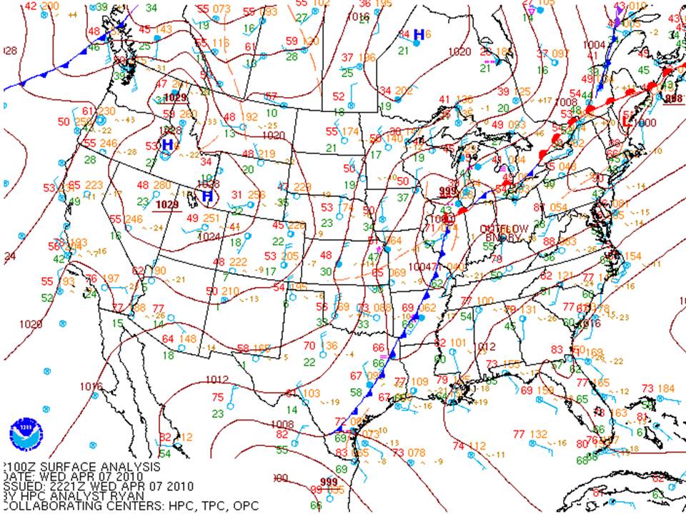
By early afternoon, it had become apparent that the combination of the mild and moist air mass along with strong winds aloft were creating conditions favorable for the development of severe thunderstorms. The Storm Prediction Center issued a Tornado Watch for much of central and southern Illinois south of the warm front.
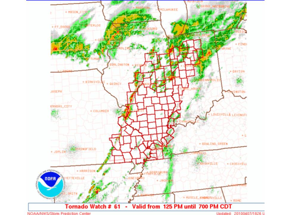
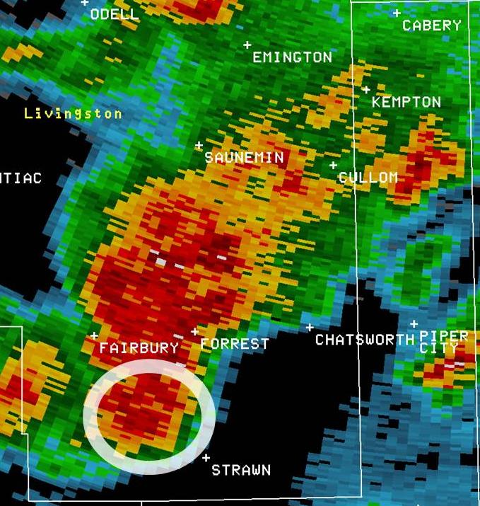
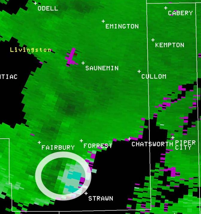
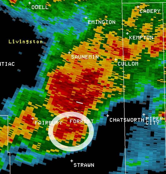
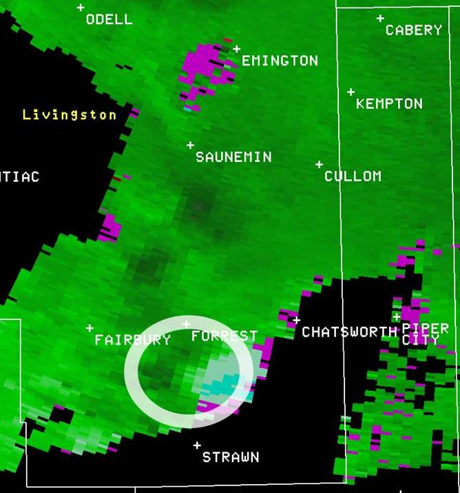
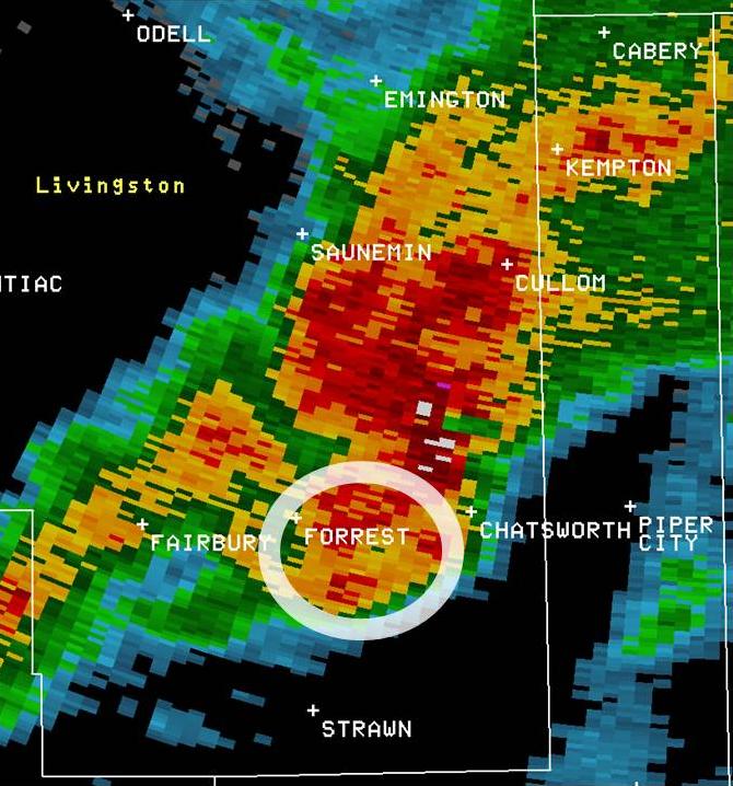
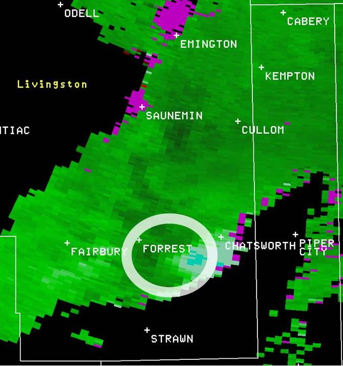
Numerous thunderstorms developed across the watch box with a few of the storms taking on supercellular characteristics with rotating updrafts. Despite the rotating updrafts, relatively few severe weather reports were received. The one exception was with a storm that moved into Livingston County at around 3 PM, when a trained spotter observed a funnel cloud and potential tornado. Here is a look at some of the radar images from around the time of the funnel cloud being sighted:
|
|
|
|
|
|
|
|
|
Doppler radar imagery of the supercell thunderstorm moving across southeast Livingston County Wednesday afternoon. Images on the left are of the radar reflectivity, while images on the right are of radar velocity. The white circles in each picture depict the location of the low-level rotation.
Hazards
Enhanced Hazardous Weather Outlook
Hazardous Weather Outlook
National Briefing
Storm Spotter Training and Seminars
Outlooks
Watch/Warning/Advisory Criteria
Snow Squall Warnings
Local Forecasts
Marine
Aviation
Fire
Text Products
Great Lakes Marine Portal
Lake Michigan Beach Forecast
El Nino
Snow and Ice Probabilities
US Dept of Commerce
National Oceanic and Atmospheric Administration
National Weather Service
Chicago, IL
250 George J Michas Dr.
Romeoville, IL 60446
815-834-1435 8am-8pm
Comments? Questions? Please Contact Us.