Chicago, IL
Weather Forecast Office
Ring-of-Fire Storms and Floods
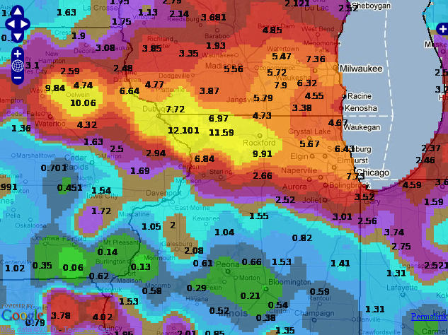
Map of 72 hour precipitation ending on July 25
Meteorological Setup:
A large sub-tropical ridge developed early in the week across Texas and drifted east towards the Southeastern United States. (Fig. 1) As the 500hPa ridge drifted east, a series of weak low pressure systems traversed the Central Plains northeast into the Upper Midwest. A by-product of the 500hPa positioning on 22Jul2010, was a steady feed of Gulf of America moisture to the Northwest of the ridge. (Fig. 2)
Strong convective activity is commonly found when subtropical ridges occur, especially during the warm seasons. Galarneau and Bosart (2006) coined the term "ridge rollers" for convective systems
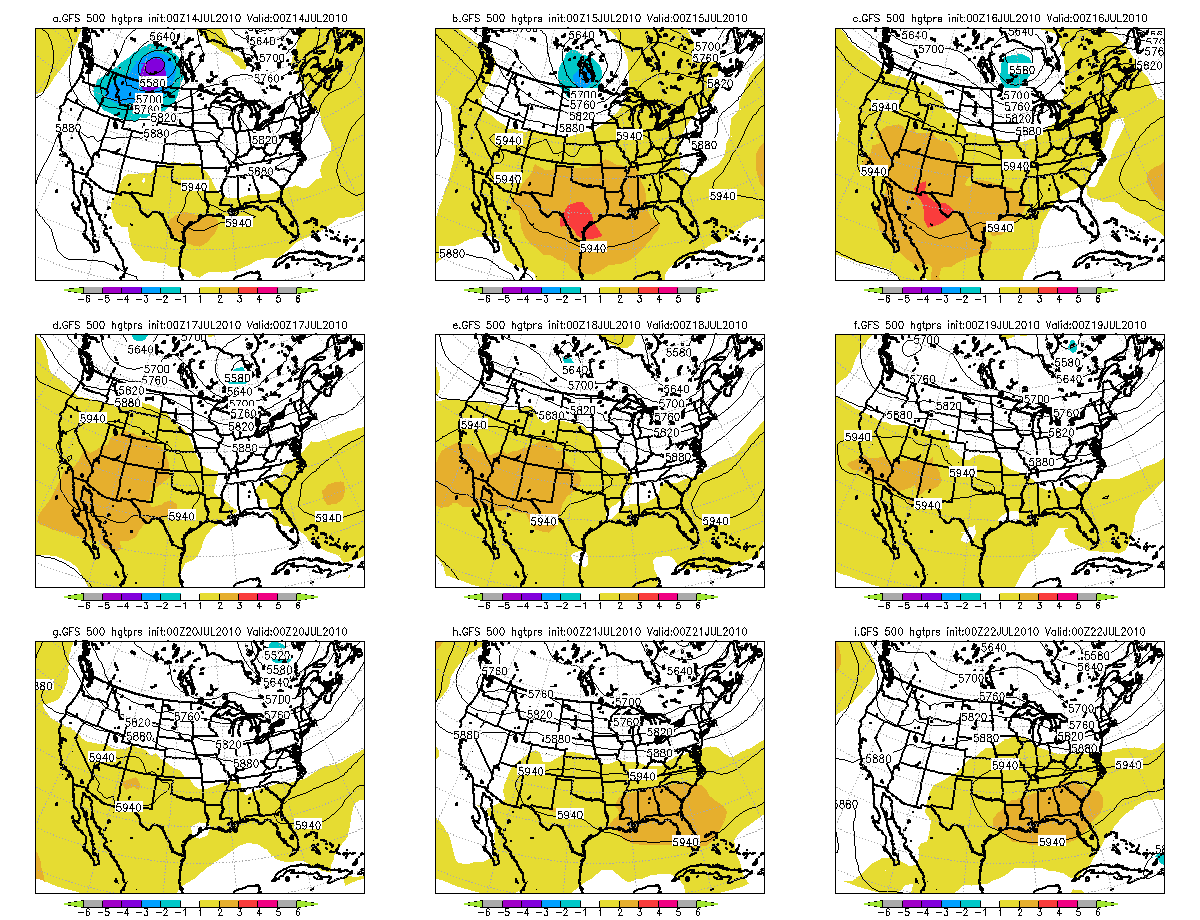
Figure 1. 500hPa-ridge across the Southwest United States becoming centered across the Southeast United States 22July 2010.
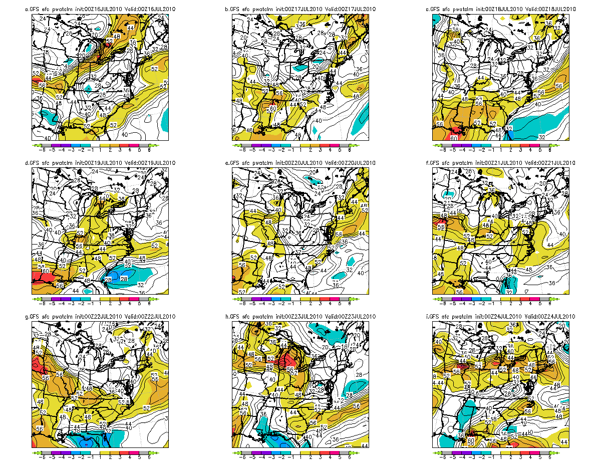
Figure 2. GFS Precipitable water anomalies.
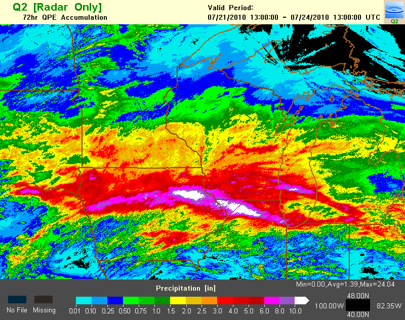
Figure 3. Multi-sensor estimated rainfall for the period of 21-24 July 2010.
Hazards
Enhanced Hazardous Weather Outlook
Hazardous Weather Outlook
National Briefing
Storm Spotter Training and Seminars
Outlooks
Watch/Warning/Advisory Criteria
Snow Squall Warnings
Local Forecasts
Marine
Aviation
Fire
Text Products
Great Lakes Marine Portal
Lake Michigan Beach Forecast
El Nino
Snow and Ice Probabilities
US Dept of Commerce
National Oceanic and Atmospheric Administration
National Weather Service
Chicago, IL
250 George J Michas Dr.
Romeoville, IL 60446
815-834-1435 8am-8pm
Comments? Questions? Please Contact Us.

