Very Localized Snow Accumulations on December 12th
Somewhat unusual weather conditions developed on the morning of the 12th resulting in very localized light snow accumulations despite very warm temperatures aloft (850mb or 5000ft temperatures near +9C).
Low level clouds developed during the morning with bases only a few hundred feet off the surface and tops around 1500 to 2000 feet.
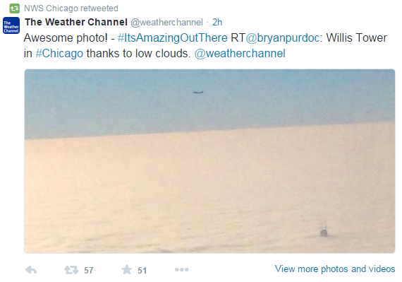
Figure 1: Tweet showing the top of the Willis Tower poking above the low and shallow clouds.
Forecast soundings from the morning of the 12th (Figure 2) initialized well picking up the saturated conditions in the lowest levels of the atmosphere, with much drier air just aloft.
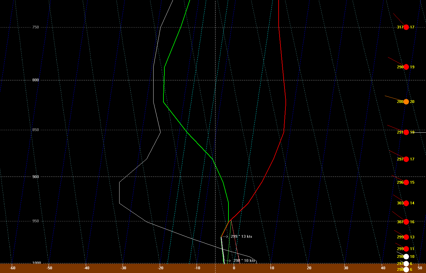
Figure 2: Red line shows a vertical temperature profile while the green line shows dew points. Where these two lines come together, conditions are saturated resulting in cloud cover.
Weak ascent was in place during the morning (white line farther left indicated stronger upward vertical motion — a key ingredient for precipitation). This ascent originated from mid-level warm air advection. The forecast was for light freezing drizzle to develop. Temperatures were below freezing within the cloud layer, so you might ask “Why drizzle instead of snow?” The answer is a bit complicated and involves microphysical processes that we won’t go too much into, but for ice crystals to develop and form into snow, temperatures typically need to be less than -10C within the saturated layer, otherwise droplets will remain liquid in a state that we refer to as “supercooled.” This sounding shows the coolest temperatures only around -5C which indicated that any precip would most likely reach the surface in a supercooled liquid state, then freeze on contact. Indeed, there were reports of freezing drizzle and slick roads across the region the morning of the 12th.
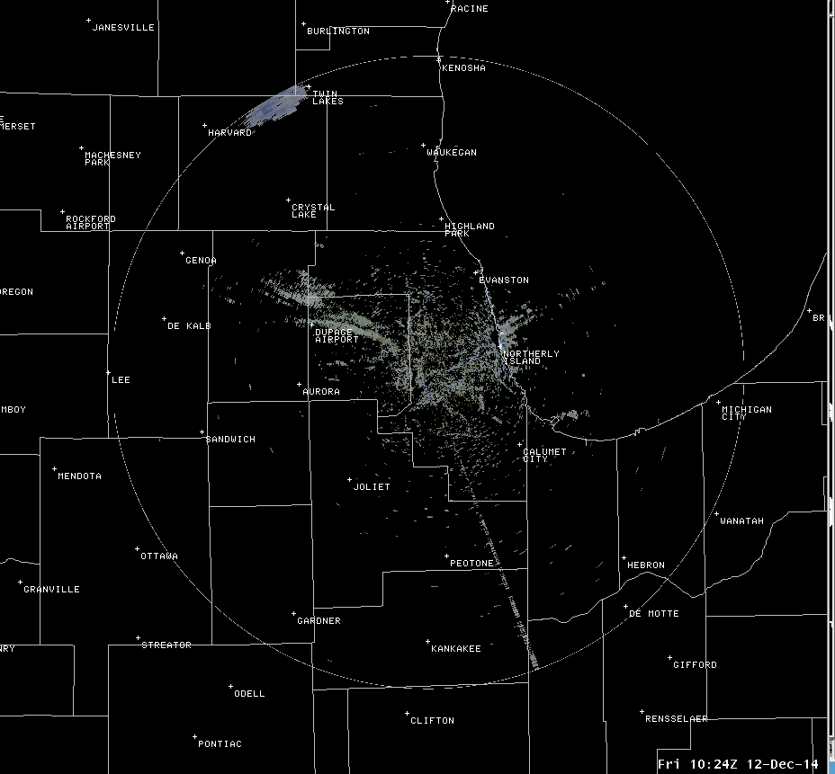
Figure 3: A radar loop from December 12th showing plumes of snow developing across the area.
The unusual conditions began developing around 500 AM or so when weak radar returns (Figure 3) started appearing in wind-parallel plumes across the area. As winds aloft turned from northwest to more westerly through the radar loop, notice the orientation of the plumes changed but the source seemed to remain the same points. While conjecture on our part, we speculate that some of these plumes originated from smoke stacks which lofted particulates into the saturated layer of air allowing for heterogeneous ice nucleation to occur (in other words for ice crystals to form) in temperatures warmer than -10C. Growth of these ice crystals through aggregation (merging of crystals) and riming (supercooled liquid freezing onto the ice crystal after contact) allowed for snowflakes to grow in size.
Again, these plumes were very localized in nature but snow growth was large enough that some areas reported accumulating snowfall, including, for example, around an inch of snow in portions of Lockport (Figures 4 & 5).
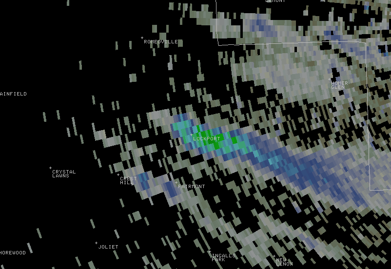
Figure 4: Zoomed in radar imagery near Lockport showing localized heavier snowfall.
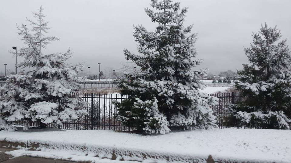
Figure 5: Photo of snow taken in Lockport (photo courtesy of Annette Frushour via Facebook)

