Overview
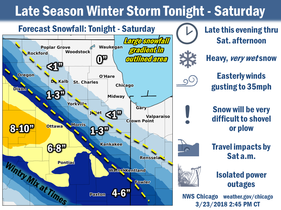
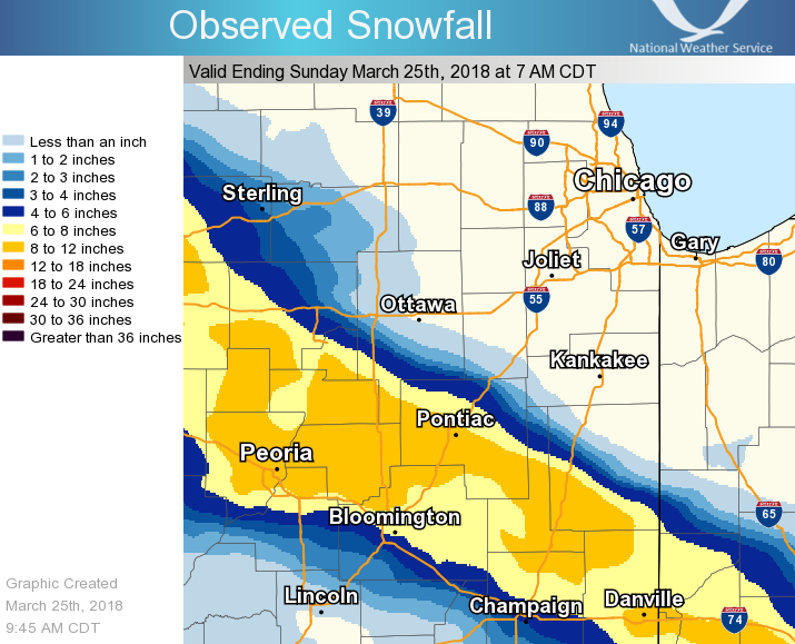 Total snowfall from the evening of Friday, March 23rd through the evening of Saturday, March 24th. |
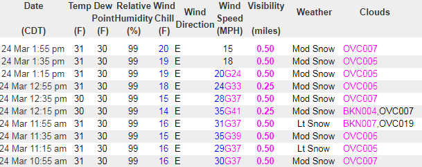
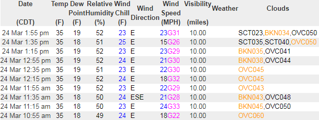
Comparison between observations at Pontiac (heavy snow) and Kankakee (no snow) during the late morning and early afternoon of March 24th. The Kankakee observation is ~40mi ENE of Pontiac. The very dry air is evident in the dew point/relative humidity at Kankakee. |
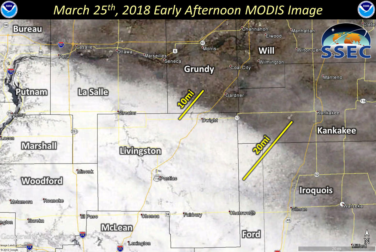
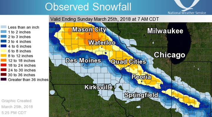
March 25th early afternoon image from the Space Science and Engineering Center Terra Satellite. |
Observed Snowfall
|
Select Snowfall Amounts
Location (County)            Amount
Dana (La Salle)              12.0 in
Flanagan (Livingston)        11.0 in
Chatsworth (Livingston)      8.5 in
Loda (Iroquois)              8.0 in
Fairbury (Livingston)        7.8 in
Paxton (Ford)                7.5 in
Streator (La Salle)          6.4 in
Pontiac   (Livingston)       6.0 in
Long Point  (Livingston)     5.6 in
Campus  (Livingston)         4.5 in
Lostant (La Salle)           4.0 in
Dwight  (Livingston)         3.0 in
Harmon (Lee)                 3.0 in
Peru (La Salle)              2.0 in
|
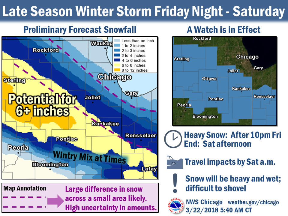
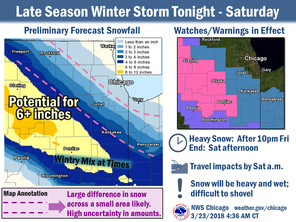
Forecast Graphics
 |
 |
 |
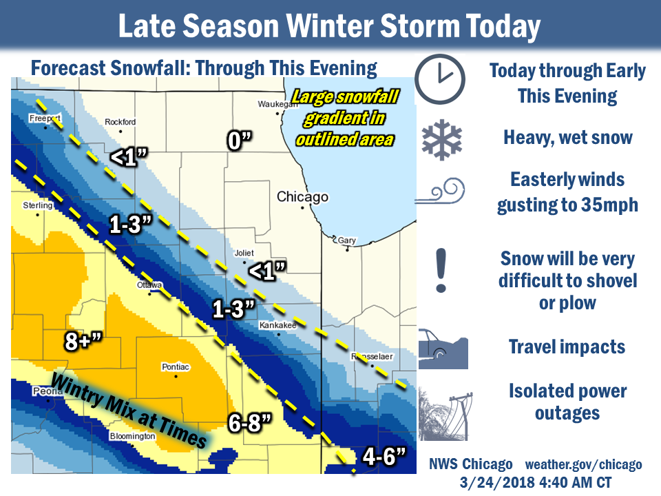 |
| Thursday morning, March 22nd. | Friday morning, March 23rd. | Friday afternoon, March 23rd. | Saturday morning, March 24th. |
 |
Media use of NWS Web News Stories is encouraged! Additional recaps can be found on the NWS Chicago Science & Past Events Page. |
|