Chicago, IL
Weather Forecast Office
Overview
|
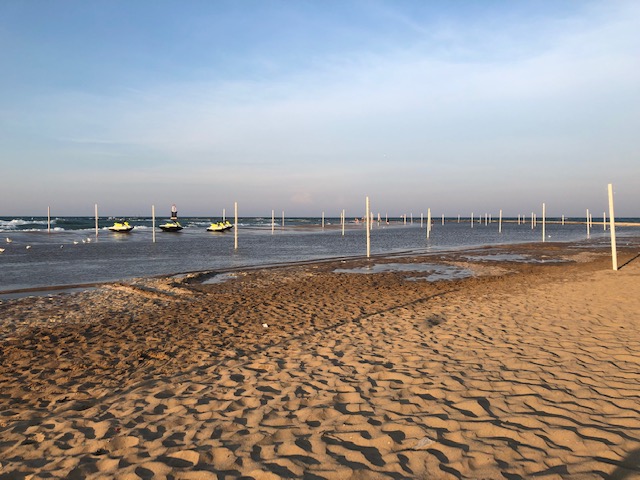
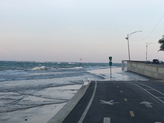
Unusually high Lake Michigan water levels, near record in fact, set the stage for minor flooding impacts with a prolonged, breezy northerly winds on Independence Day weekend 2019. North-northeast winds were regularly gusting 15-25 kt, and while not as strong as usual for flooding events, the wave action on top of high levels resulted in the minor flooding. This was minor but because it was summer and beaches were active, this episode had impacts more so than typical season for lakeshore flood advisory events (autumn, winter, and spring). This included flooding along Chicago area beaches and parts of the city's bike path. A Lakeshore Flood Advisory was issued beforehand, along with a Beach Hazards Statement for rip currents, by NWS Chicago. |
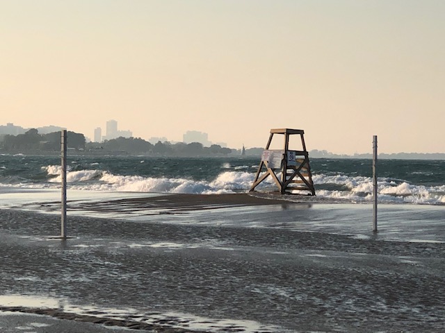 Flooding along the Chicago shore on July 6, 2019. |
Photos
 |
 |
 |
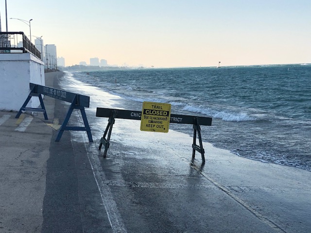 |
| Chicago shore minor flooding. | Volleyball net posts flooded in Chicago. | Chicago bike path closed. | Chicago bike patch closed. |
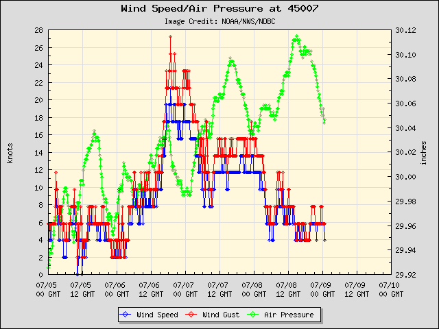
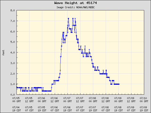
Winds & Waves
 |
.png) |
.png) |
| Southern Lake MI open water buoy winds | Wilmette, IL buoy winds | Michigan City, IN buoy winds |
 |
|
.png) |
| Southern Lake MI open water buoy winds | Wilmette, IL buoy winds | Michigan City, IN buoy winds |
 |
Media use of NWS Web News Stories is encouraged! Please acknowledge the NWS as the source of any news information accessed from this site. Additional recaps can be found on the NWS Chicago Past Events Page |
|
Hazards
Enhanced Hazardous Weather Outlook
Hazardous Weather Outlook
National Briefing
Storm Spotter Training and Seminars
Outlooks
Watch/Warning/Advisory Criteria
Snow Squall Warnings
Local Forecasts
Marine
Aviation
Fire
Text Products
Great Lakes Marine Portal
Lake Michigan Beach Forecast
El Nino
Snow and Ice Probabilities
US Dept of Commerce
National Oceanic and Atmospheric Administration
National Weather Service
Chicago, IL
250 George J Michas Dr.
Romeoville, IL 60446
815-834-1435 8am-8pm
Comments? Questions? Please Contact Us.

