Chicago, IL
Weather Forecast Office
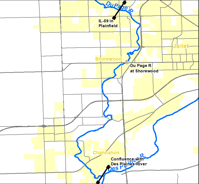
Effective December 7, 2021, flood impact categories will change for the DuPage River at Shorewood, Illinois. These changes are necessary due to the removal of Hammel Woods Dam near the gauge in Shorewood. These changes have been collaborated with the Will County Emergency Management Agency and the Village of Shorewood.
Click here for the service change notice issued November 2, announcing these changes.
DuPage River at Shorewood
Action Stage Minor Flood Stage Moderate Flood Stage Change from 8.0 feet to 7.5 feet Major Flood Stage
River forecasts for this location will be issued when the water level has reached, or is expected to reach, action stage. These changes are needed due to the removal of Hammel Woods Dam in Shorewood. Dam removal changed the behavior of the river at the gauge location such that the river is now at lower stages when passing the same amount of water. The changes to river behavior are most significant at low stages and at locations just upstream of the dam's previous location. Because changes to the DuPage River in the vicinity of the gauge are not fully certain, it is possible that additional changes to flood impact categories may occur in the future as the river moves toward its new equilibrium. |
|
This gauge represents the river reach from near IL-59 in Plainfield to the confluence with the Des Plaines River. |
Hazards
Enhanced Hazardous Weather Outlook
Hazardous Weather Outlook
National Briefing
Skywarn
Outlooks
Watch/Warning/Advisory Criteria
Snow Squall Warnings
Local Forecasts
Marine
Aviation
Fire
Text Products
Great Lakes Marine Portal
Lake Michigan Beach Forecast
El Nino
Snow and Ice Probabilities
Past Weather
Stormdata
Holiday Climate Data
Climate Plots
Weather Event Write-Ups
Education
Jetstream
Play Time for Kids
Student Opportunities
US Dept of Commerce
National Oceanic and Atmospheric Administration
National Weather Service
Chicago, IL
250 George J Michas Dr.
Romeoville, IL 60446
815-834-1435 8am-8pm
Comments? Questions? Please Contact Us.