
Hazardous heat will continue across the Southern Plains, Gulf Coast and Desert Southwest through the weekend. Additional heat will build into the Great Basin and Northern Plains this weekend. A stalled front is expected to bring periods of heavy to excessive rainfall and flooding from the Tennessee Valley to the Southeast U.S on Friday. Read More >
Severe Weather on the South Plains June 12, 2005 |
||
 |
|
 |
|
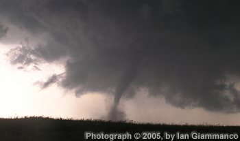
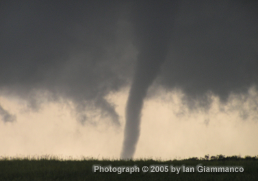
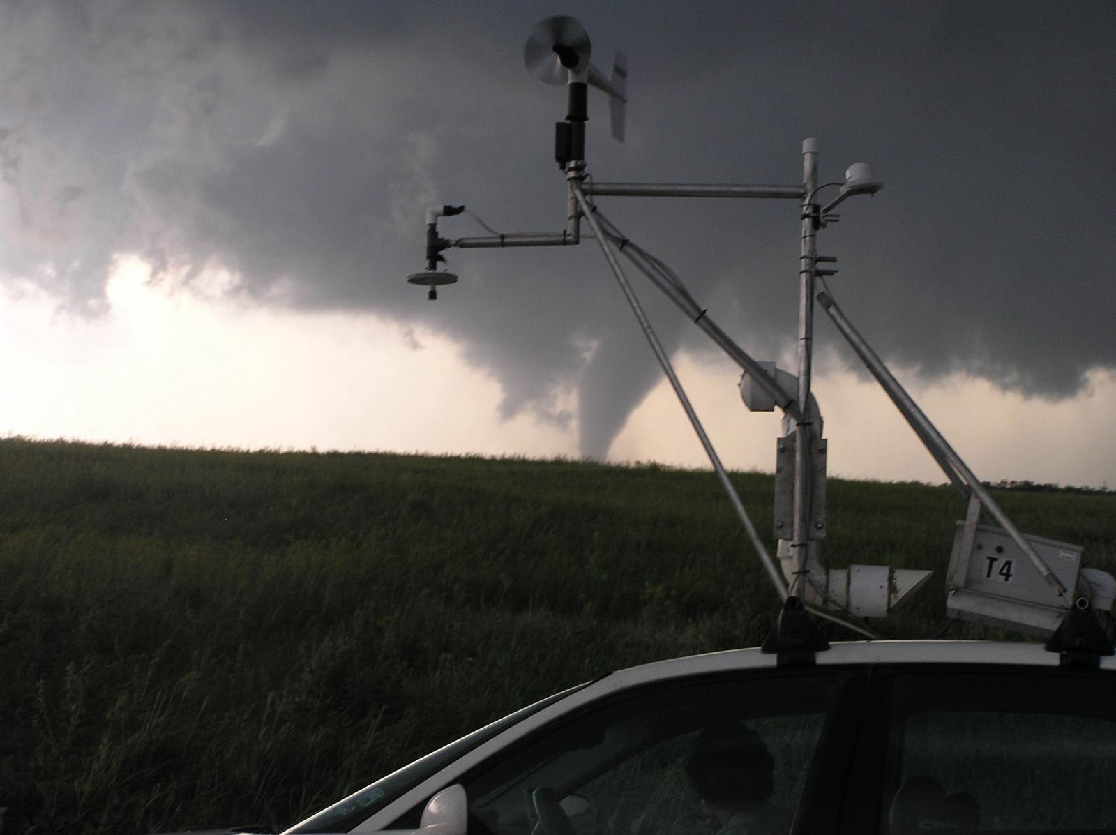
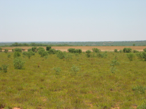
Although one strong thunderstorm briefly developed east of Lubbock, in Crosby County, during the early afternoon of June 12, 2005, the main event waited until mid-afternoon to get going. By mid-afternoon, an upper-level disturbance, working in tandem with a tightening dryline across the eastern South Plains, was sufficient to promote the development of a broken line of north-northeast to south-southwest oriented storms. These storms, located in a very unstable and strongly sheared environment, quickly began to rotate. The first tornado reports came in with a storm located over eastern Crosby and northwest Dickens Counties, where brief touchdowns were observed. Then, a storm further south, across northwest Kent County, morphed into the storm of greatest concern. This storm produced classic tornado radar signatures, including a well developed hook echo on the low-level reflectivity, and a very strong rotation signature in the velocity fields. At the same time, Skywarn spotters, research teams, media crews and amateur storm chasers witnessed several tornadoes and numerous reports were received from this storm, including some reports of a very large circulation at times. Fortunately, though, the tornadoes passed through rural region of Kent County. Some of the tornado pictures we've received are shown below.
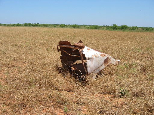
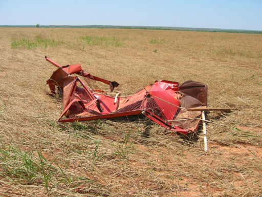
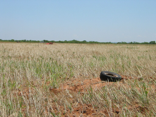
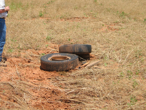
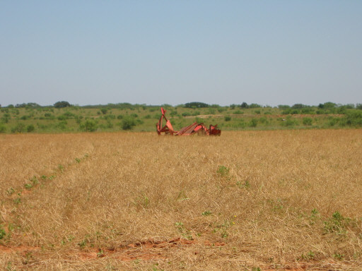
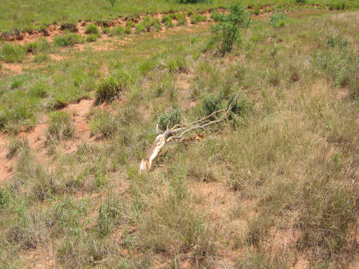
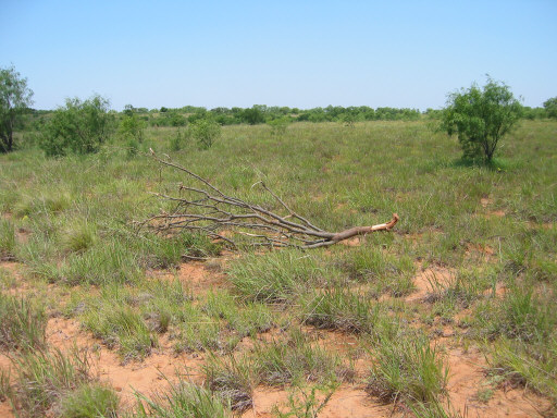
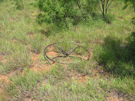
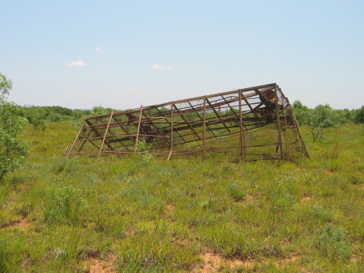
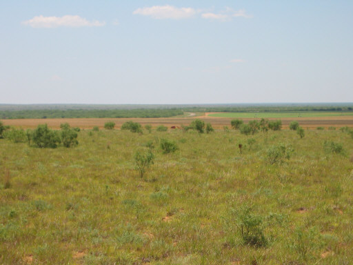
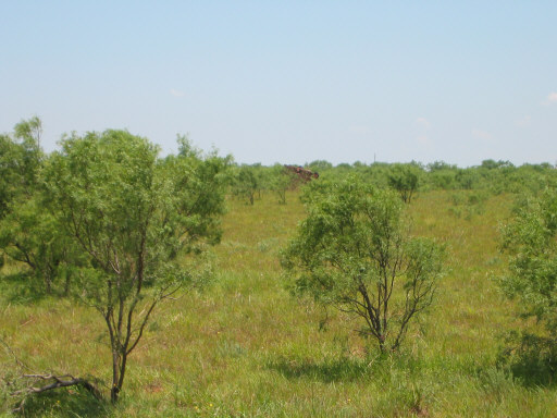
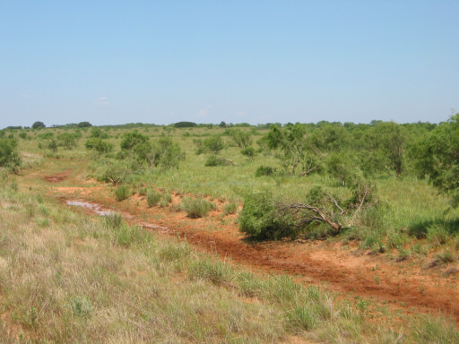
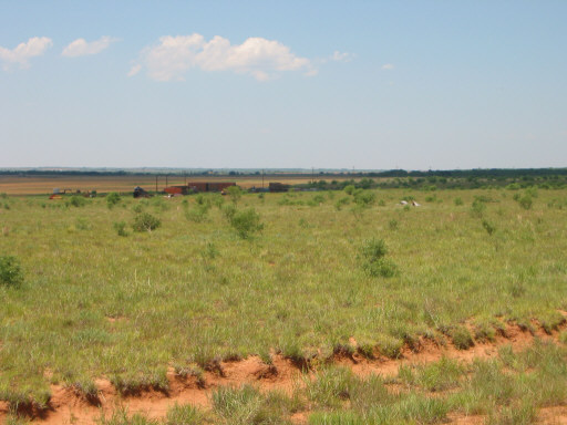
Pictures of damage from tornadoes that struck Kent County (northwest of Jayton) on June 12, 2005. Click on the images for a larger view. (Photographs taken by Brian LaMarre, Warning Coordination Meteorologist, WFO Lubbock, TX)
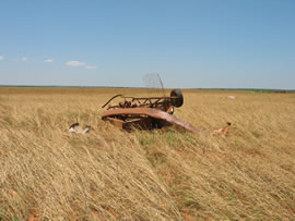
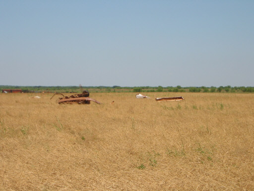
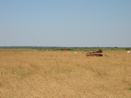
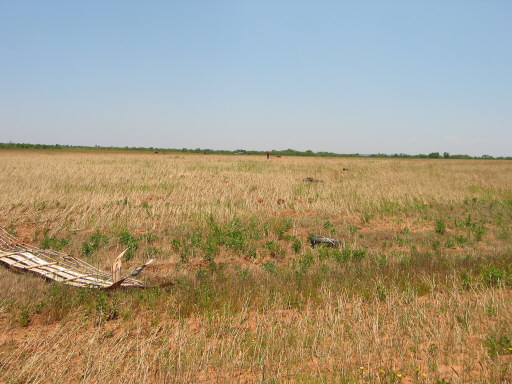
Pictures of damage from tornadoes that struck Kent County (northwest of Jayton) on June 12, 2005. Click on the images for a larger view. (Photographs taken by Brian LaMarre, Warning Coordination Meteorologist, WFO Lubbock, TX) However, there was an area of impact to the northwest of Jayton that we were able to find some damage. This area was bounded by a triangle including FM2320, FM1228 and CR 112. Traveling on CR112 north from FM2320, there was a damage path characterized by tree damage across the zone. The path was oriented west/southwest to east/northeast in this area and was maximized along this axis just to the east of FM1228 in this area. There was a very large circulation pattern, with a 0.6 to 0.7 of a mile wide stretch measured. This large circulation pattern phased well with chaser reports and video accounts of a large tornado.
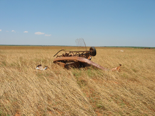
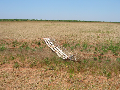
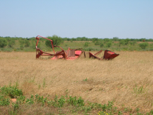
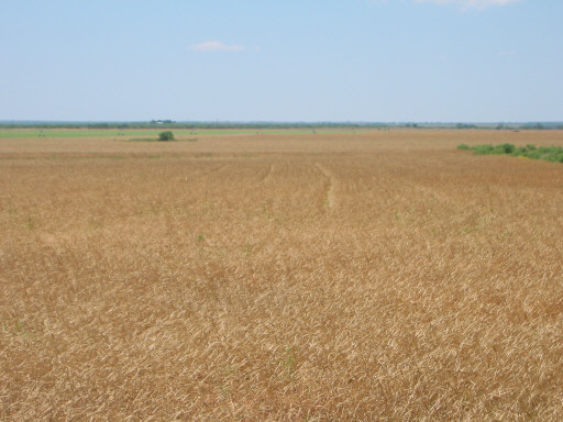
Pictures of damage from tornadoes that struck Kent County (northwest of Jayton) on June 12, 2005. Click on the images for a larger view. (Photographs taken by Brian LaMarre, Warning Coordination Meteorologist, WFO Lubbock, TX) In walking through the tall brush and wheat field, a circulatory pattern was evident in the wheat field with all of the wheat laying down to the south. Along this quadrant of the circulation, large farm equipment (tractors, cotton trailers, etc) were tossed and mangled. Additionally, an 80,000lb box car was shaken by the tornado and associated strong wind but was not moved from its location. However, the contents inside the box car were moved around. The farm vehicles were tossed briefly, a few times, as there were scar marks and impact marks in the field as they were blown to the south. One tractor had the front-end snapped off after the 2nd impact with the ground (as it was likely too heavy to remain airborne for too long and was dragged and rolled by the tornadic circulation).
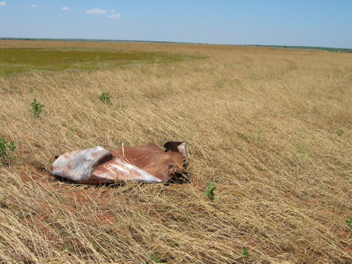
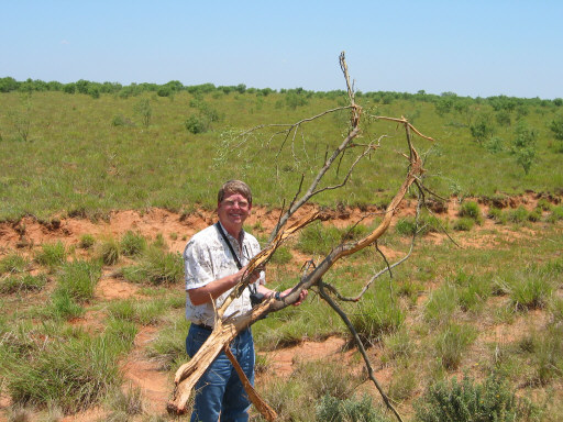
Pictures of damage from tornadoes that struck Kent County (northwest of Jayton) on June 12, 2005. Click on the images for a larger view. (Photographs taken by Brian LaMarre, Warning Coordination Meteorologist, WFO Lubbock, TX) On the east side of the circulation, there were tree branches (not grown in that immediate area) that were stripped of their bark. A cotton trailer (lighter than the other equipment) was lifted from where it was apparently sitting for a long time (with brush growing underneath) and was tossed to the north and mangled upon impact. The equipment was tossed approximately 3/10 of a mile within this circulation. Additionally, it was evident from other tree damage that the circulation was multi-vortex., with the greater damage (mentioned above) having occurred on the immediate outer edge of the circulation where the winds would be strongest. Mini-vortices, or suction-vortices, likely occurred, contributing to the tree damage inside the broad 0.6 to 0.7 mile wide circulation (similar to turbulence seen inside a water eddy when you watch water passing a rock in a stream and see the larger eddy or vortex spin around).
Pictures of damage from tornadoes that struck Kent County (northwest of Jayton) on June 12, 2005. Click on the images for a larger view. (Photographs taken by Brian LaMarre, Warning Coordination Meteorologist, WFO Lubbock, TX) Moreover, there was a Doppler On Wheels (DOW) in the area, that sampled winds above the surface of up to 80 meters per second (up to 179 mph). However, we do not yet know at which elevation the DOW was sampling these winds. Nonetheless, the Fujita scale is not based on measured winds and is based purely on damage resulting from the tornado. Thus, based on the damage, this area will likely be rated F-2
Pictures of damage from tornadoes that struck Kent County (northwest of Jayton) on June 12, 2005. Click on the images for a larger view. (Photographs taken by Brian LaMarre, Warning Coordination Meteorologist, WFO Lubbock, TX) Research and scientific studies are exploring a different scale that could account for real-time measurements, but we just don't have that implemented at this time. Official stats on all events are contained in the official Storm Data publication which isn't compiled until 60 days after the month in question ends.
|
||||||||||||||||||||||||||||
|
Note: The below information contains preliminary reports as they were received throughout the severe weather event. Some reports may show multiple reports of tornadoes. This can occur as various sources witness the same tornado from different locations at different times. The official account of tornado occurrences across the area during the event will be compiled once all the information has been gathered and reviewed in detail. However, all reports are important to the National Weather Service and a sample of them can be seen below. PRELIMINARY LOCAL STORM REPORTS (CDT):
PRELIMINARY LOCAL STORM REPORT...SUMMARY
NATIONAL WEATHER SERVICE LUBBOCK TX
948 PM CDT SUN JUN 12 2005

..TIME...   ...EVENT...      ...CITY LOCATION...     ...LAT.LON...
..DATE...   ....MAG....      ..COUNTY LOCATION..ST.. ...SOURCE....
            ..REMARKS..

0454 PM     HAIL             WHITE RIVER LAKE        33.48N 101.10W
06/12/2005  1.00 INCH        CROSBY             TX   PUBLIC

            REPORTED AT WHITE RIVER LAKE MARINA

0509 PM     TORNADO          10 E CROSBYTON          33.64N 101.06W
06/12/2005                   CROSBY             TX   STORM CHASER

            ON THE GROUND FOR 3 MINUTES

0510 PM     TORNADO          5 NNW MCADOO            33.80N 101.04W
06/12/2005                   DICKENS            TX   PUBLIC

            3 BRIEF TOUCHDOWNS

0519 PM     HAIL             ROARING SPRINGS         33.90N 100.86W
06/12/2005  0.88 INCH        MOTLEY             TX   TRAINED SPOTTER

0522 PM     HAIL             MCADOO                  33.73N 101.01W
06/12/2005  1.00 INCH        DICKENS            TX   TRAINED SPOTTER

0541 PM     TORNADO          17 NW CLAIREMONT        33.34N 100.96W
06/12/2005                   KENT               TX   TRAINED SPOTTER

0609 PM     TORNADO          8 NW CLAIREMONT         33.25N 100.85W
06/12/2005                   KENT               TX   TRAINED SPOTTER

            4 NW OF SALT CREEK PLANT. LARGE TORNADO FROM 605-609 PM.

0617 PM     TORNADO          10 W JAYTON             33.25N 100.75W
06/12/2005                   KENT               TX   LAW ENFORCEMENT

0625 PM     HAIL             10 W JAYTON             33.25N 100.75W
06/12/2005  2.50 INCH        KENT               TX   LAW ENFORCEMENT

0638 PM     TORNADO          5 NW JAYTON             33.30N 100.64W
06/12/2005                   KENT               TX   NWS EMPLOYEE

            A LARGE TORNADO ON THE GROUND FROM 638 TO 648 PM

0705 PM     TORNADO          8 SSE JAYTON            33.14N 100.52W
06/12/2005                   KENT               TX   BROADCAST MEDIA

            BRIEF TOUCHDOWN

0739 PM     HAIL             8 SW ASPERMONT          33.06N 100.32W
06/12/2005  0.88 INCH        STONEWALL          TX   LAW ENFORCEMENT
|
||||||||||||||||||||||||||||


