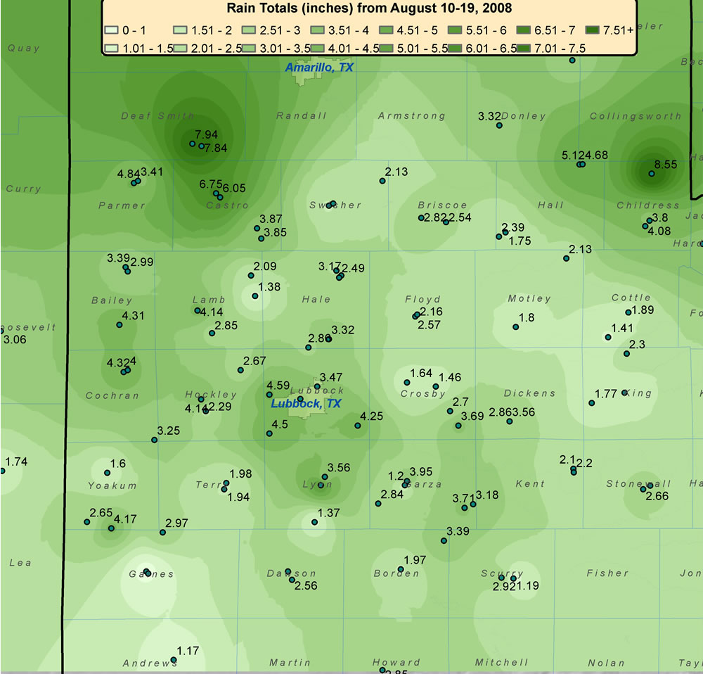
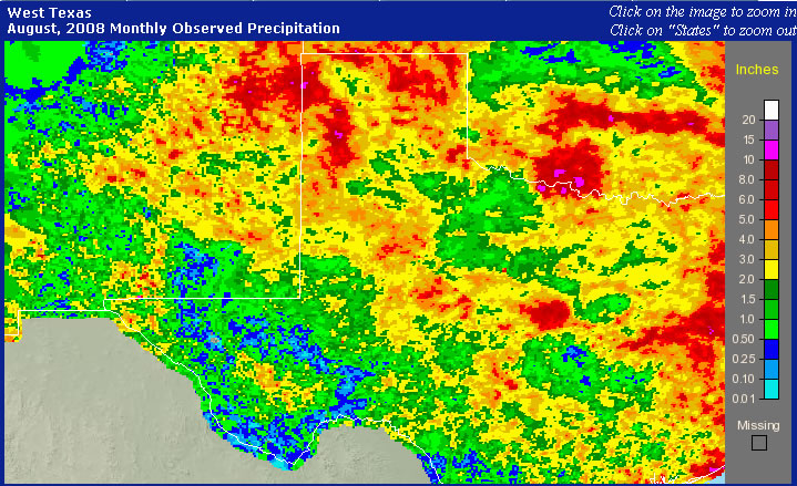
The middle of August brought another round of rain to West Texas. This, after seeing area- wide rainfall in the middle of July, and an active second half of June. The shower and thunderstorm activity in August was thanks, in part, to a northwest flow regime (similar to in June), which supported generally evening and overnight storms that moved in from the higher terrain of New Mexico and southeast Colorado. Additionally, the activity was enhanced by a very slow moving and atypically strong upper level storm system (for August) that dropped through the central Rockies and eventually emerged over the Texas Panhandle. When the above factors combined with abundant Gulf moisture streaming in on deep easterly upslope winds, the result was many rounds of efficient rainfall producing showers and thunderstorms. To read a more detailed public information statement about the rains CLICK HERE. Below is a map that displays measured rainfall that fell over the region between August 10th and the morning hours of the August 19th, 2008.
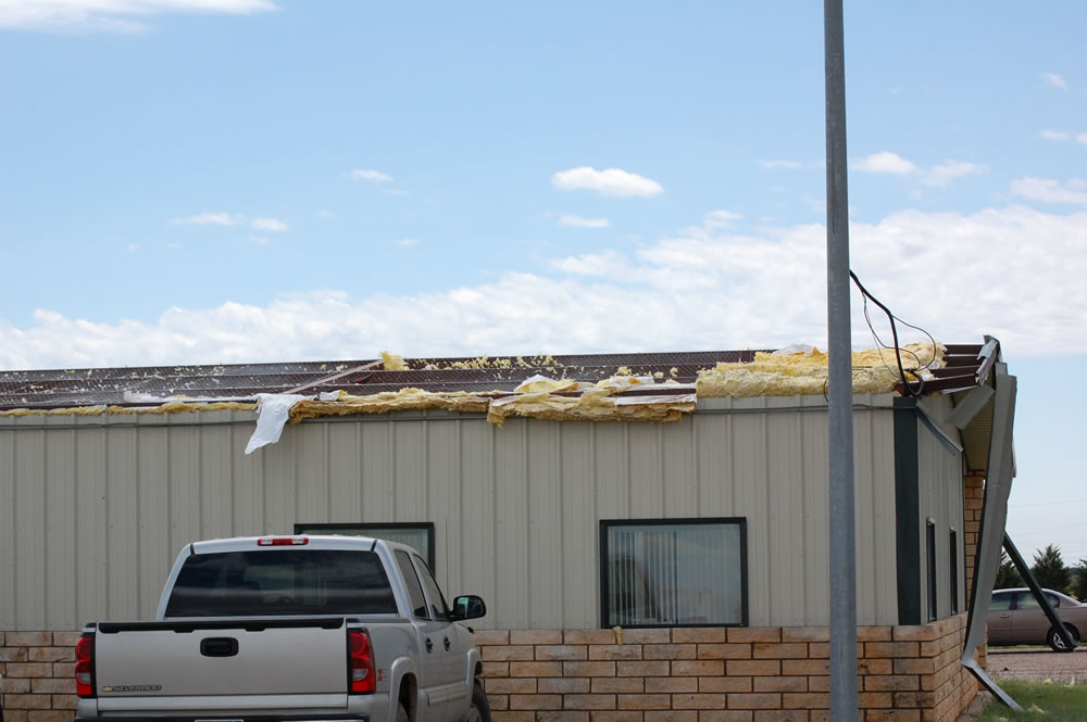
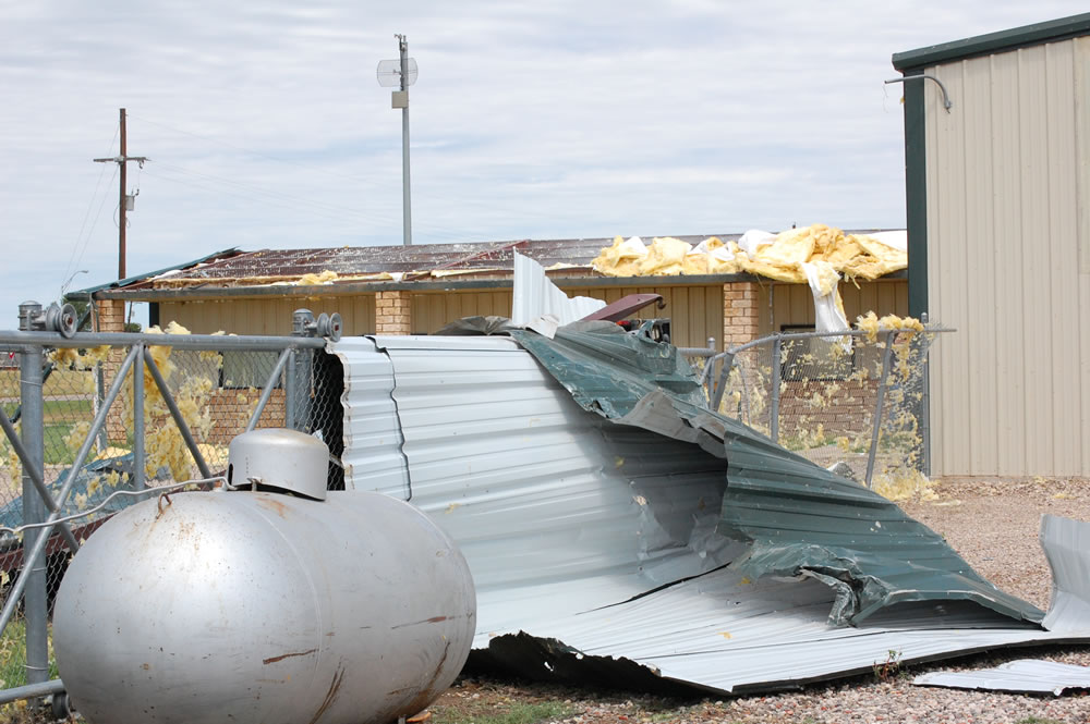
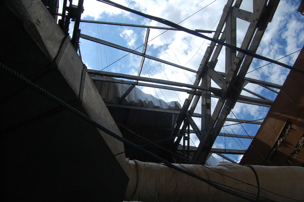
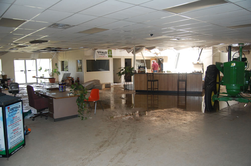
All the rainfall did cause some problems, including flooding of low lying and poor drainage areas at various locations and times. Also, some of the rain was accompanied by severe weather. Severe weather was reported to the National Weather Service in Lubbock on the 11th, 13th, 14th, and 18th of August. To see the preliminary storm reports over this period see the below table. The most widespread severe weather of the period occurred from the late afternoon through the evening hours of Thursday the 14th. A complex of thunderstorms organized over the southern Texas Panhandle and northeast New Mexico during the late afternoon hours, then plunged southeast, bringing winds of 60 to 65 mph to much of the southern Texas Panhandle, South Plains and Rolling Plains. The winds knock down a number of power lines in Seth Ward, Memphis and Lubbock. The storms also produce roof damage just north of Abernathy, which when coupled with rain lead to water damage too (see photos below).
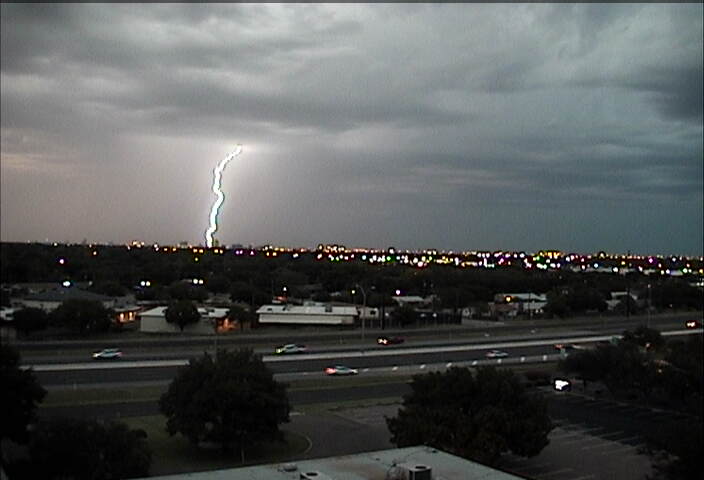
Other extreme weather highlights included a very proficient lightning storm early Saturday (16 August) that knocked out power for many in Lubbock, a wind gust measured to 73 mph by the West Texas Mesonet site located 1 mile northeast of Amherst on Wednesday (18 August), and golf-ball sized hail observed at McAdoo on Monday (18 August). Below is an image of what it looked like as the strong winds came through Lubbock on the 14th.
The image below shows the estimated rainfall fall for the month of August (updated through the 18th) across of all of West Texas and New Mexico. The data in the image below includes both rain gauge and radar-derived rainfall. In general, you can see the same rainfall pattern across the South Plains and Rolling Plains but also of interest is the abundant rainfall which fell across the western and northern Texas Panhandle for the second month in a row (see July rains). This has again helped to raise the level at the Lake Meredith Reservoir near Amarillo slightly. To view more detailed hydrological data in the Amarillo area CLICK HERE, or in the Lubbock area CLICK HERE.
|
|||||||||||||||||||
|
|
|||||||||||||||||||


