A cold Canadian air mass pushed through the South Plains late Tuesday (10 March), dropping temperatures well below normal after a prolonged stretch of very warm weather. This cold air remained entrenched across the region through the remainder of the week. Eventually, warm and moist air began advance over the cold air near the ground and produced widespread rain and freezing rain showers by Friday morning (13 March). Thankfully, with temperatures around or just below freezing, most roadways stayed wet and did not ice over.
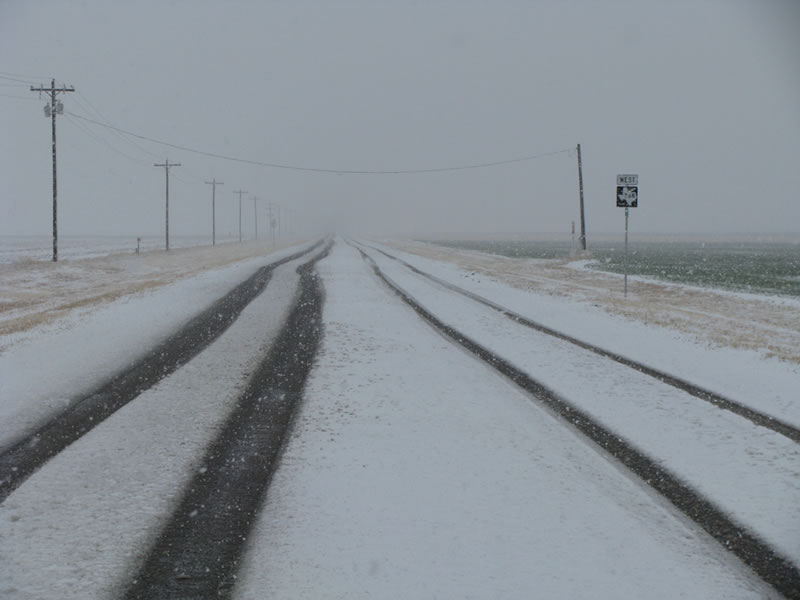
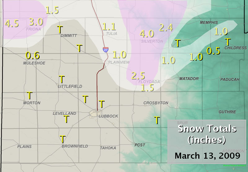
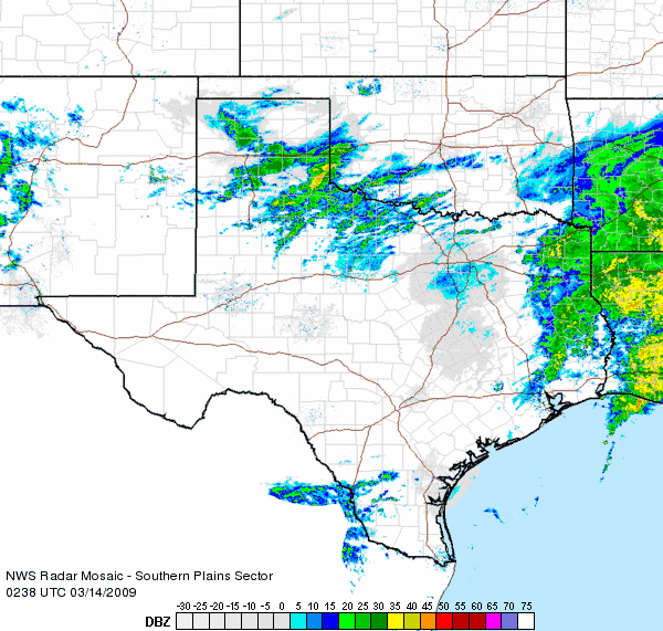
By late Friday morning, an upper level storm system began to approach from the west. This storm brought colder air aloft with it, and as it drew closer it began changing the rain over to sleet and snow across the southwest Texas Panhandle and northwest South Plains. The changeover to snow worked its way eastward across the Caprock during the afternoon hours, and then off the Caprock during the evening hours. All the precipitation fell with temperatures at or just above or just below the freezing mark at ground level. The storm system and precipitation shifted east of the area by the early morning hours Saturday. The above map shows the reported snowfall totals from the entire event.
The quick hitting storm brought some good moisture to West Texas, with anywhere from about a tenth to one half of an inch of melted liquid precipitation reported. The biggest winners were generally across the southern Texas Panhandle where the heavier snow fell, as well as from the central South Plains eastward into the Rolling Plains where the heavier rain showers occurred. Below is a radar animation taken toward the end of event, as the heaviest precipitation was shifting toward the southeast Texas Panhandle, Rolling Plains and southwest Oklahoma.
|
|||||||||||||||

