
Scattered thunderstorms with severe gusts, hail and a tornado risk are possible near a cold front from the Ohio Valley to the Mid-Atlantic tonight. Tropical Storm Bertha is expected to bring tropical storm conditions to portions of the Gulf Coast from the panhandle of Florida into Louisiana through Wednesday. Read More >
After a relatively dry stretch from late winter into early spring, mid-April brought a brief respite. Unlike the previous couple of storm systems that tracked to the north of the area and brought widespread strong winds and blowing dust, this mid-April system moved a little farther south and progressed at a slower rate. This more southern and slower track allowed greater amounts of moisture to return to the region, and resulted in widespread shower and thunderstorm development as lift from the approaching storm interacted with the increasing moisture. Many locations recorded a third of an inch to an inch of total precipitation, mostly falling from Saturday afternoon through early Sunday morning. However, many locations did see some lighter amounts of precipitation fall on Easter afternoon, as the upper level storm moved directly overhead.
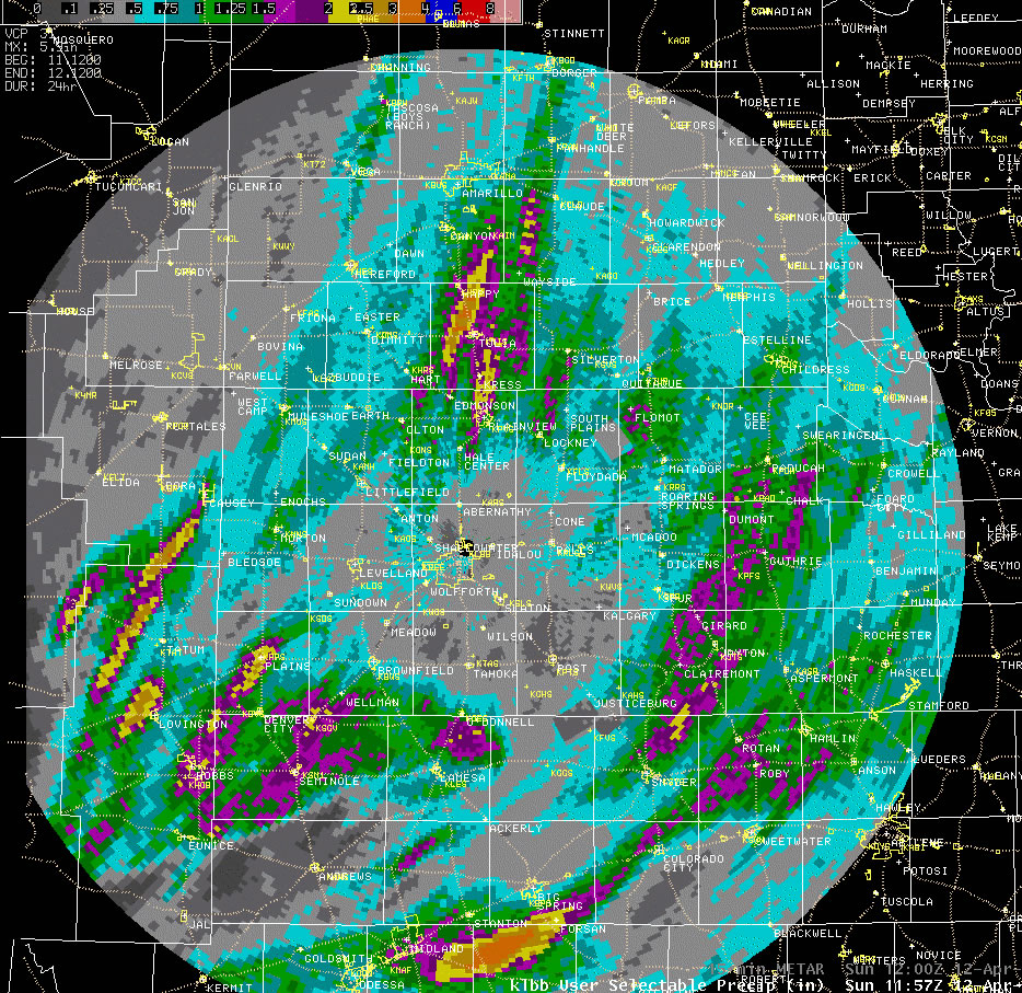
The above map depicts radar estimated rainfall from early Saturday morning through early Easter morning. Everyone received some rain, but locations encircling the central South Plains generally saw more than the central South Plains did. To see a more complete summary of rainfall totals for the event CLICK HERE. The showers and thunderstorms were generally on the mild side. However, the southwest South Plains did experience some more intense storms Saturday evening. One storm near Denver City produced one inch diameter hail and prompted a radar indicated tornado warning. This storm quickly weakened as it moved northeast into cooler and more stable air. A second line of storms then moved in from eastern New Mexico and produced a measured wind gust to 60 mph near Denver City less than an hour later. This storm also weakened, with more intense storms generally remaining across the Permian Basin through the remainder of the evening hours. To view some of the preliminary storm reports CLICK HERE.
|
|||||
 |
|||||
|
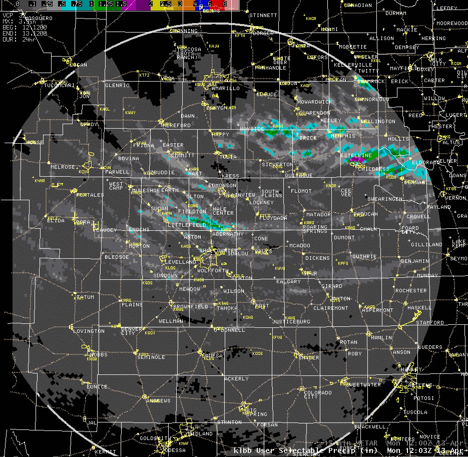
Radar estimated rainfall from 7 am Sunday (12 April) to 7 am Monday (13 April). Though the amounts are not precise, they do depict regions of higher and lower precipitation. Click on the image for a larger view. |
|||||
|
The above map depicts radar estimated rainfall from early Easter morning through early Monday morning. After a brief reprieve from the precipitation on Easter morning, showers and thunderstorms redeveloped during the afternoon as the cold core upper level storm system moved over the relatively warm and sunny South Plains. This thunderstorm activity did not produce the quantity of rainfall as the previous night's activity, thanks in part to the relatively small size of the individual storms and their relatively fast movement, but may storms did generate small hail. One storm near Childress even became severe and produced nickel-sized hail before moving off to the east. All of the activity eventually diminished during the evening hours as the sun set, the lower atmosphere cooled and the upper level storm moved east of the area. |

