National Weather Service United States Department of Commerce


Storms Bring Tornadoes, Hail and Wind - 29 April 2009
The image depicts the more significant severe weather reports that occurred during the afternoon and evening of April 29th. Locations are approximate and reports preliminary. Please see the local storm reports for more details. Click on the image for a larger view.

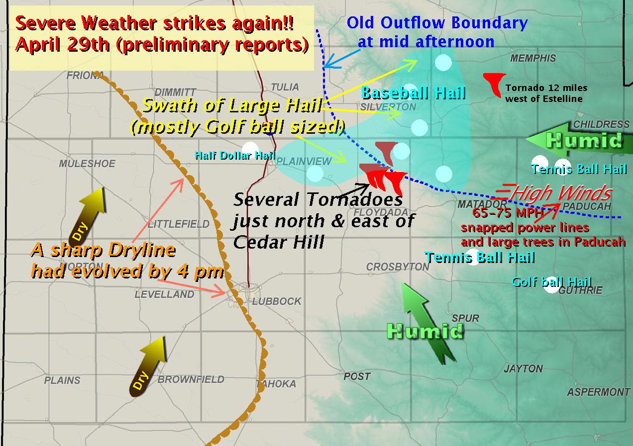
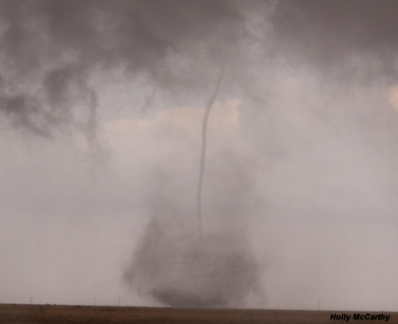
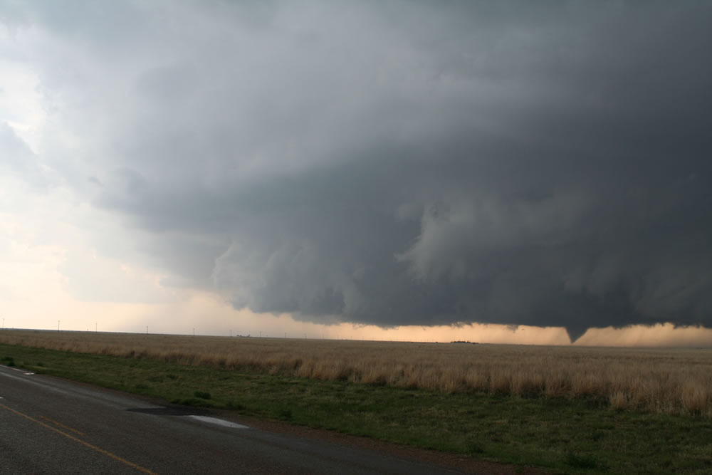
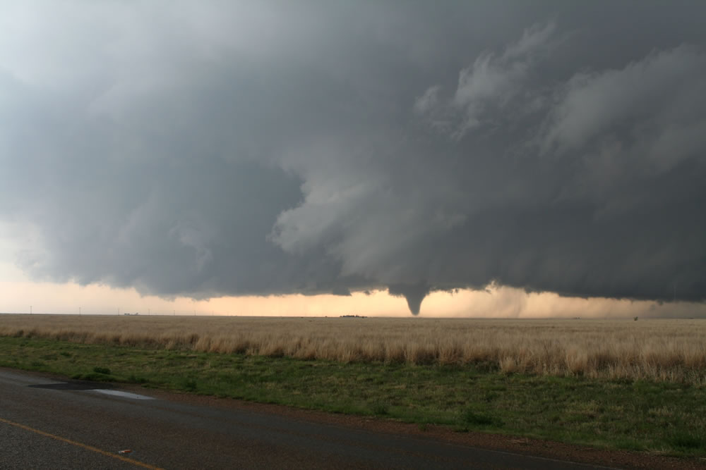
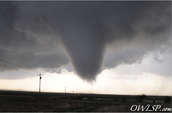
Abundant amounts of low-level moisture and instability combined with modest wind shear and a residual outflow boundary to produce a number of supercell thunderstorms to the far southern Panhandle, and northern portions of the South Plains and Rolling Plains.

Thunderstorm initiation actually began early in the afternoon across the southern Rolling Plains. But the activity quickly shifted to the north by late afternoon as thunderstorms developed near an outflow boundary from previous storms the day before. Due to the very unstable atmosphere, these storms quickly became severe and the first tornado of the day was spotted west of Estelline in Hall County around 4:20 pm. By 5 pm, a large storm had developed over Hale county west of Plainview. This storm moved to the east and produced several tornadoes across Floyd county as it interacted with the outflow boundary. At this time (around 6 pm), many storm spotters and chasers obtained photos and video of the tornadoes - at one point at least two tornadoes were observed at the same time. The last tornadoes were reported just before 7 pm, and as the storm continued east into across Motley and into Cottle County it interacted with other storms moving northeast out of Dickens County and lost the tight tornadic circulation. Nevertheless, the storm remained severe - producing large hail and damaging winds of at least 75 mph as it went across Cottle County. This resulted in widespread wind damage in  Paducah.

Click HERE to view the local storm reports from the event.


Image of a tornado taken near Cedar Hill on April 29th
Close-up photograph of one of the tornadoes near Cedar Hill. Photo taken by KLBK-TV Meteorologist Holly McCarthy (Courtesy Matt Laubhan). Click on the image for a larger view.


NWS meteorologist Jason Jordan took these photos of the tornadoes that touched down near Cedar Hill in northeast Floyd County (click on the images to enlarge).
 
Image of the Lubbock Operations Area during the April 29th Storms
Here are two pictures taken of the severe weather operations at the Lubbock office during the event (click on the images to enlarge).
 
Picture taken by Wesley Luginbyhl from near Cedar Hill (click on the image to enlarge). The image was taken at 6:13 pm, with the tornado located approximately 2 1/2 miles west of Cedar Hill.
Pictures taken by Wesley Luginbyhl from near Cedar Hill (click on the image to enlarge). The image was taken at 6:19 pm looking south-southwest from 1 mile east of Cedar Hill..
Above are two pictures taken by Wesley Luginbyhl from near Cedar Hill (click on the images to enlarge). The left image was taken at 6:13 pm, with the tornado located approximately 2 1/2 miles west of Cedar Hill. The right image was taken at 6:19 pm looking south-southwest from 1 mile east of Cedar Hill.