
Numerous severe thunderstorms are expected across a broad region from the Ohio Valley to the Mid-Atlantic and Northeast States today into tonight. Swaths of damaging wind gusts are expected and some tornadoes are possible. Bertha is expected to bring tropical storm conditions to portions of the Gulf Coast from the Florida Panhandle westward to southeastern Louisiana later today and Wednesday. Read More >
|
Storms bring a little rain to the southern Texas Panhandle & Rolling Plains |
|
 |
|
|
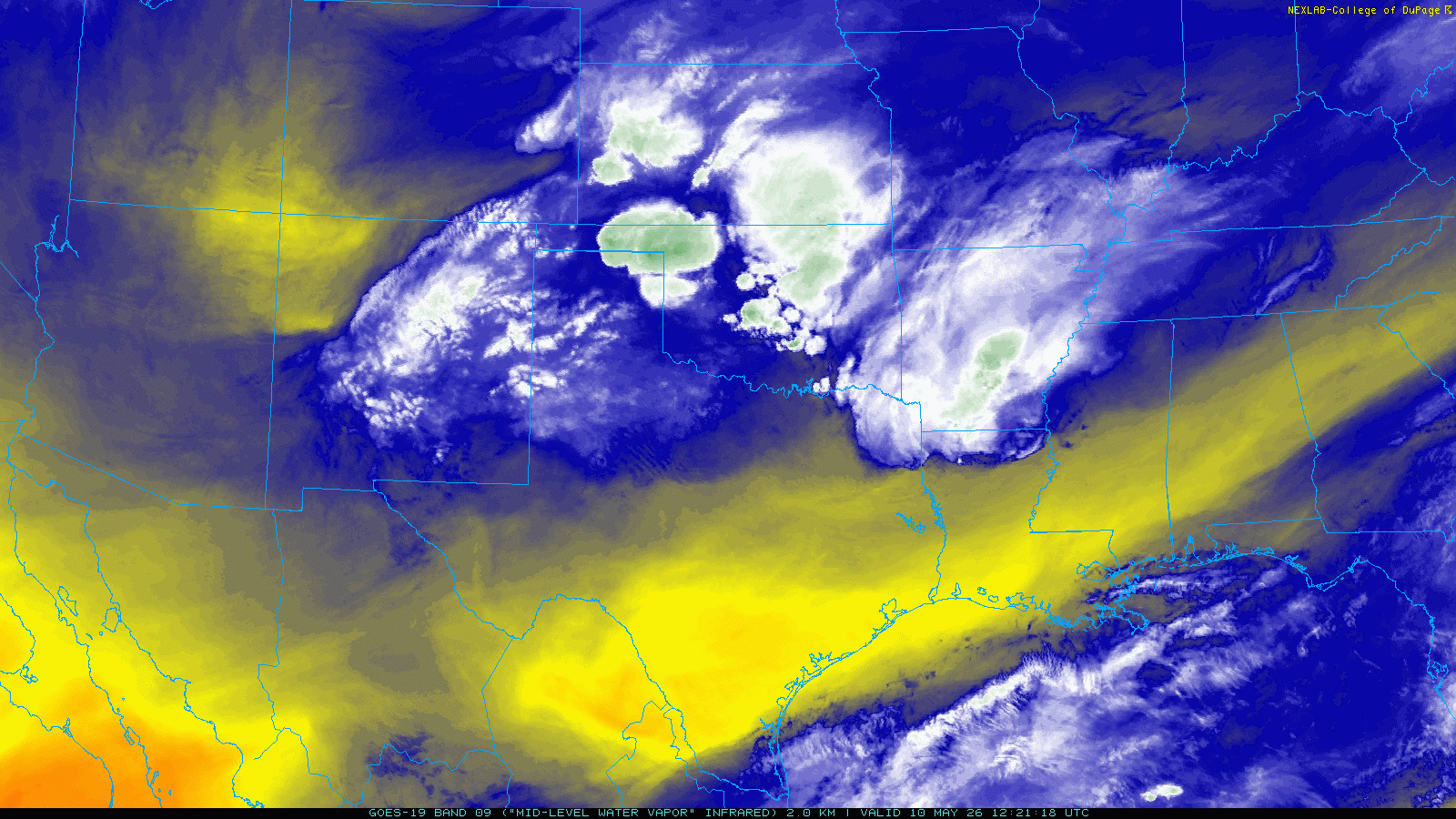
Mid-level water vapor loop valid from 7:21 am to 5:01 pm on Sunday (10 May 2026). |
|
|
Sunday, May 10th, brought a taste of spring weather to West Texas. The day began on the mild and moist side, but the warming was interrupted by a cold front that plunged southward through the South and Rolling Plains through the morning and early afternoon. Behind the front, gusty northeasterly winds carried in cooler air, with temperatures flatlining and even falling slowly through the afternoon hours as plenty of clouds prevailed. |
|
 |
|
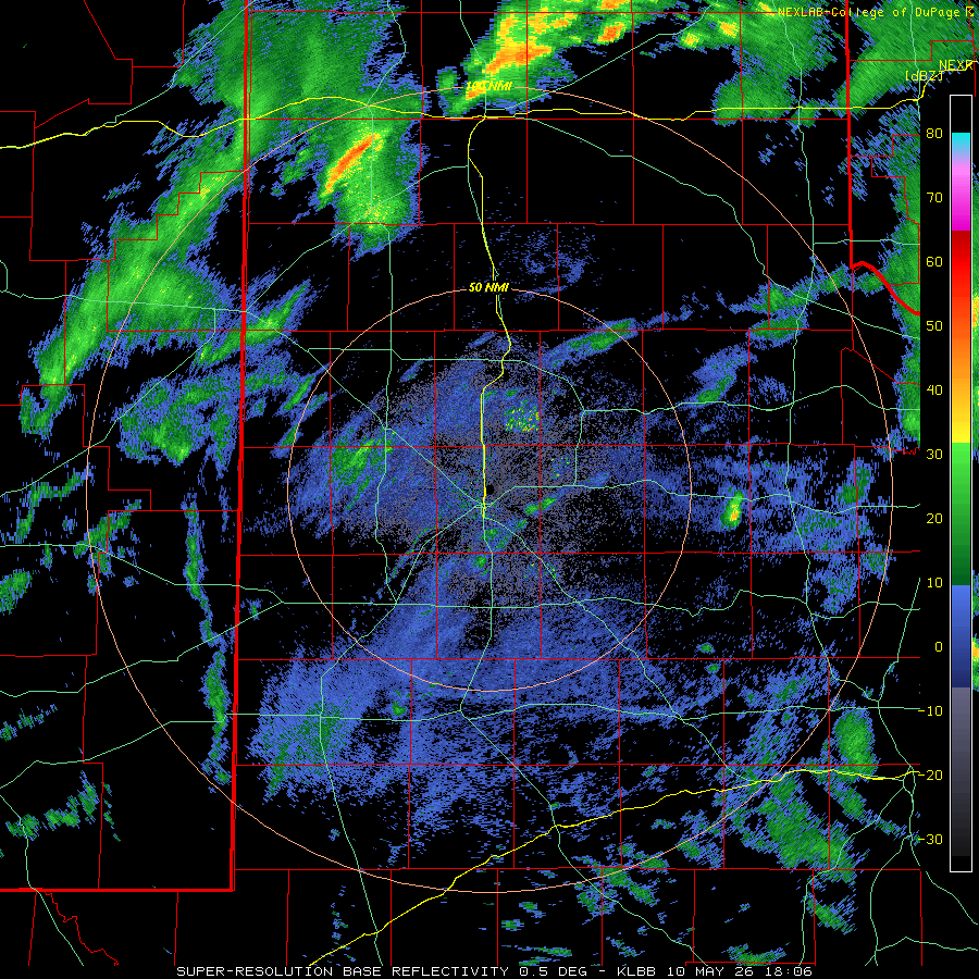
| Lubbock WSR-88D radar animation valid from 1:06 pm to 8:37 pm on Sunday (10 May 2026). | |
| Despite the passage of the front, low-level moisture levels remained high enough that, when aided by mid-level moisture and an approaching disturbance, widespread showers and scattered thunderstorms blossomed over portions of the region Sunday afternoon. The bulk of the activity favored the southern Texas Panhandle and the Rolling Plains, with lesser coverage over the adjacent South Plains. | |
 |
|
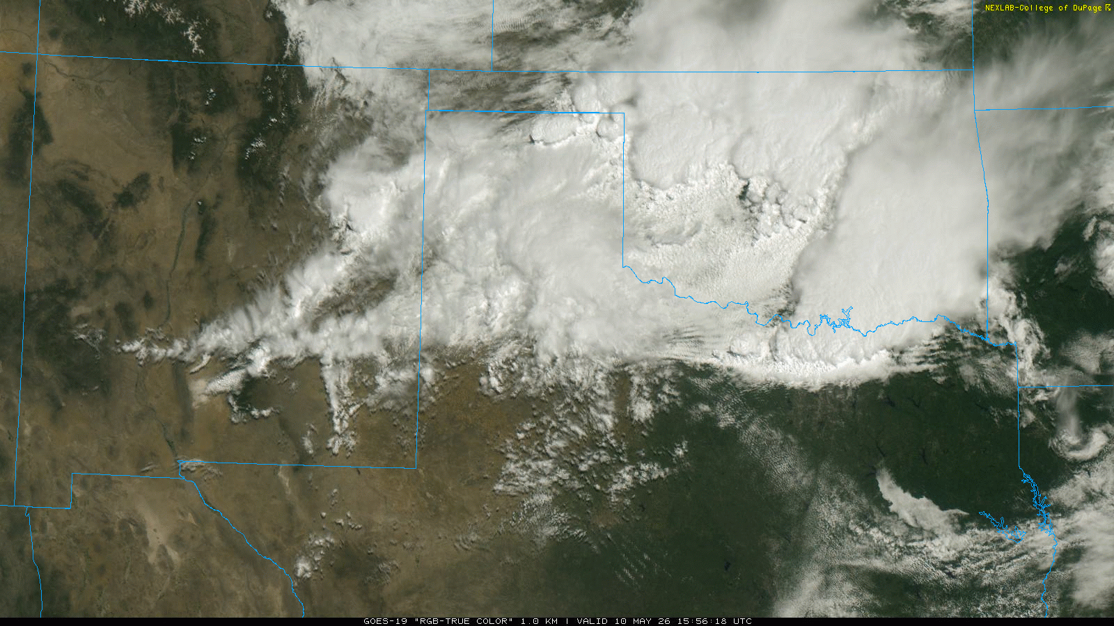
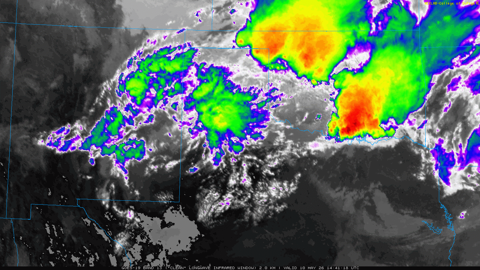
| RGB-True Color satellite animation valid from 10:56 am to 5:06 pm on Sunday (10 May 2026). An infrared satellite animation, valid from 9:41 am to 5:11 pm on Sunday, can be VIEWED HERE. | |
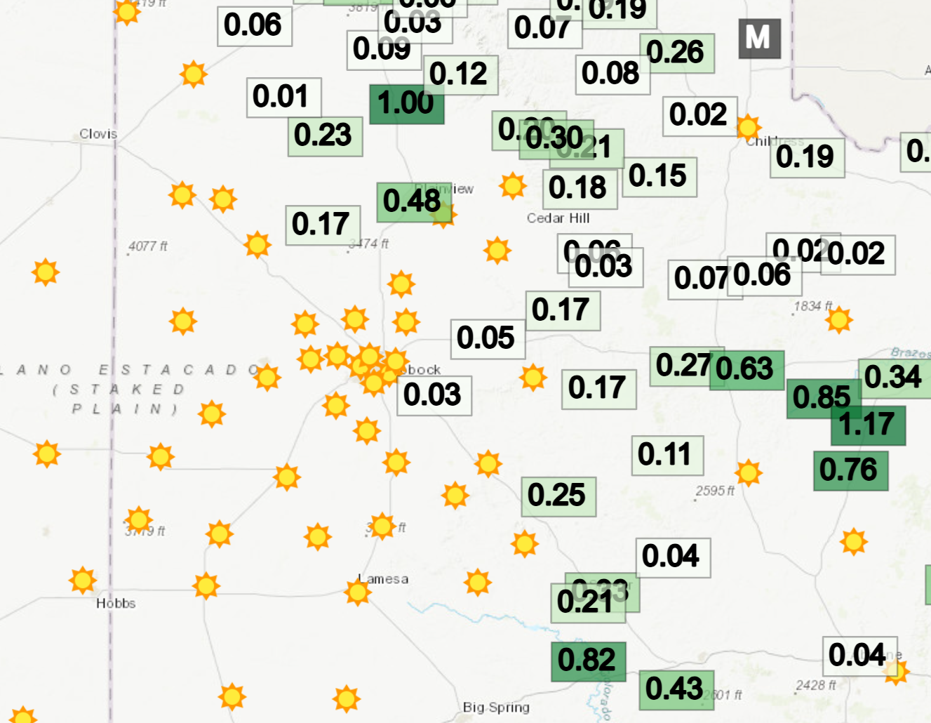
| Where the most intense thunderstorms tracked, they brought brief bursts of heavy rain and even a few pockets of hail. Those lucky enough to get squarely underneath a thunderstorm received a quick 1/2 to over 1 inch of rain. Locations in and near Tulia, the northwest side of Plainview and southeast of Guthrie were a few of the biggest rainfall winners. Officially, Lubbock recorded a trace of rainfall. | |
 |
|
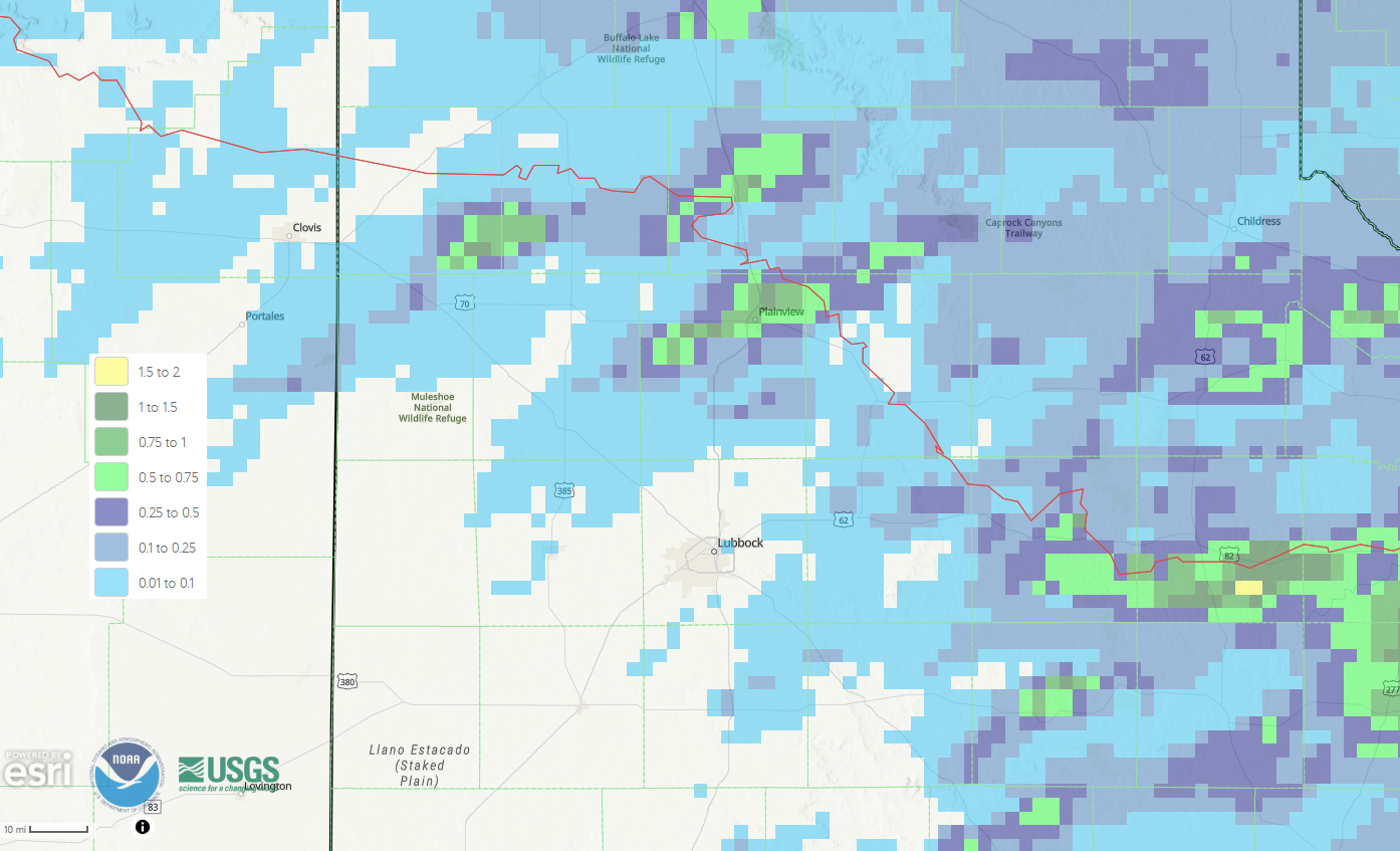
| Radar-estimated and bias-corrected 24-hour rainfall ending at 7 am on Monday (11 May 2026). 24-hour rain totals measured by the West Texas Mesonet (WTM), ending at 5:20 pm on Sunday (10 May 2026), can be FOUND HERE. | |
| Where hail fell, it was generally small, though larger hail likely accompanied a couple of more intense storms, one over rural portions of southeast Dickens into southwest King County and another from near Lake Alan Henry into southwestern Kent County. The latter storm did produce a hailstone around the size of a golf ball near Lake Alan Henry. | |
 |
|
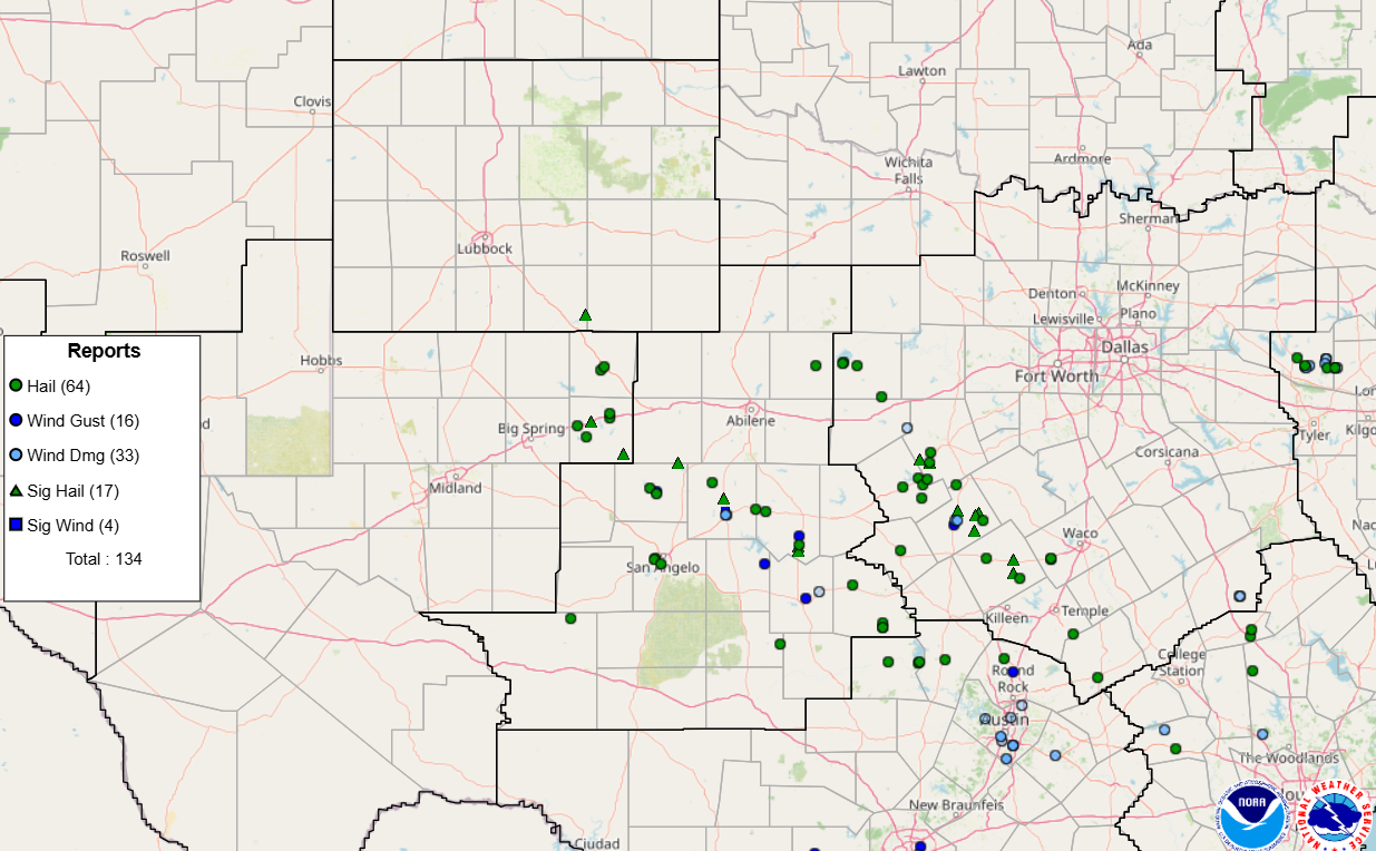
| Plotted storm reports received by the Storm Prediction Center (SPC) on Sunday (10 May 2026). | |
| Farther south, where greater moisture and instability was available ahead of the cold front, intense thunderstorms formed and brought swaths of damaging winds and large hail from the Big Country into the Hill Country of Central Texas. | |

