|
Memorial Day Weekend Thunderstorms & Rain |
|||
 |
|||
|
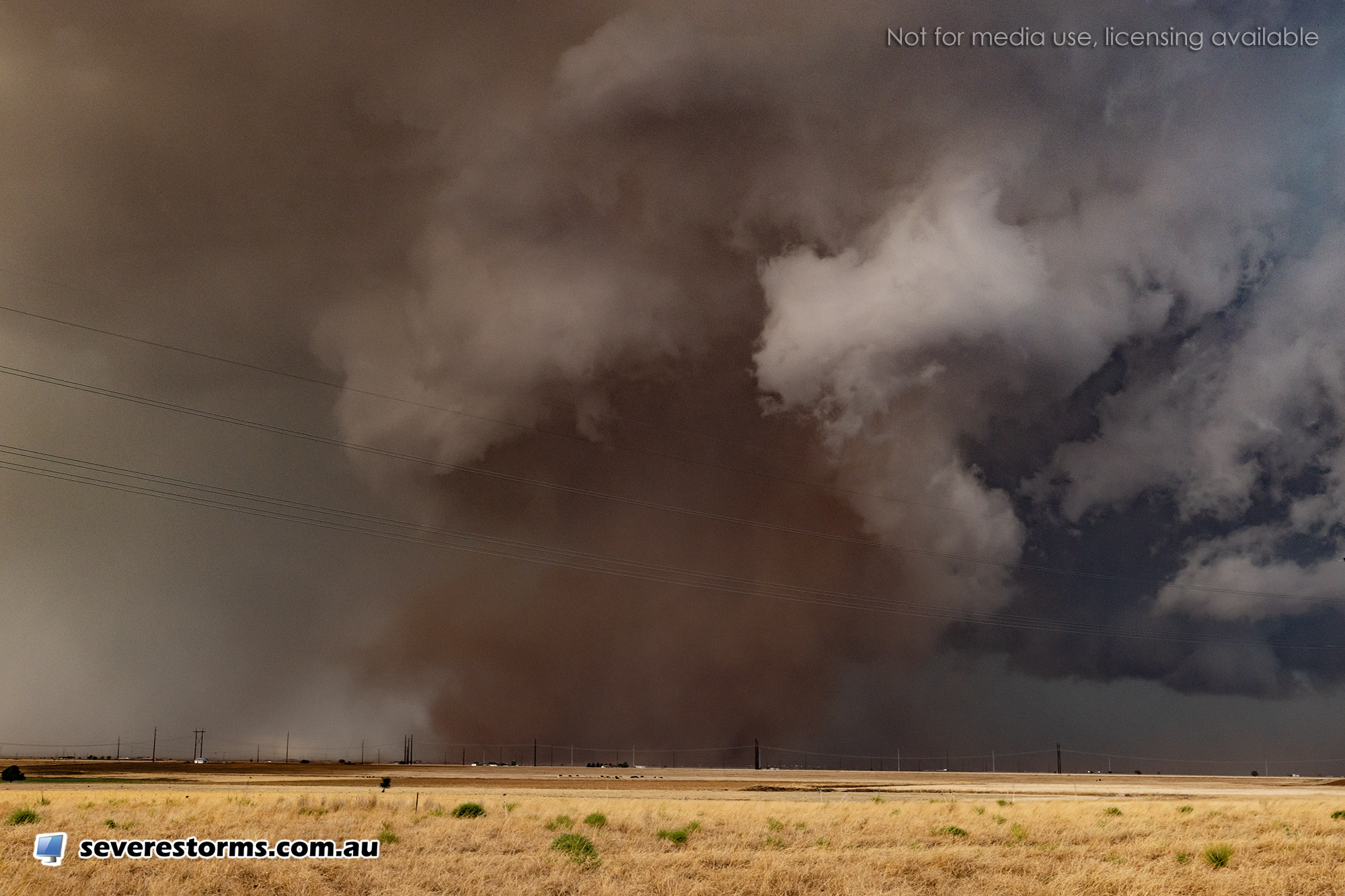
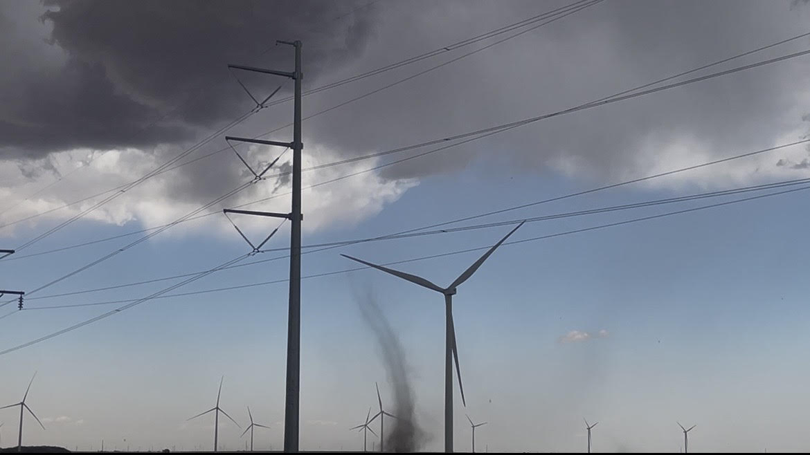
Dusty tornado that occurred northwest of Abernathy on Friday evening (22 May 2026). The picture is courtesy of Daniel Shaw. |
|||
|
The Memorial Holiday Weekend brought the return of thunderstorms, and much-needed rainfall, to West Texas. The holiday stretch started off with a bang on Friday afternoon (May 22nd) as scattered thunderstorms developed across the southwest Texas Panhandle and western and central South Plains. The initial activity formed where temperatures peaked well into the 80s and lower 90s, though moisture was on the lean side. |
|||
 |
|||
| "RGB-True Color" satellite loop valid from 2:16 pm to 6:26 pm on Friday (22 May 2026). | |||
| As the storms moved eastward, aided by numerous outflow boundaries and increasing moisture and instability, they expanded in coverage and intensity. In addition, horizonal wind shear maximized along the various boundaries aided in the development of several landspout-type tornadoes. Landspout tornadoes are akin to dust devils (and waterspouts), forming where weakly rotating air is lifted and stretched. Landspouts are generally on the weaker side, and rarely pose a significant risk of damage, but are highly visible and photogenic, as is shown below. | |||
 |
|||
| Landspout tornado observed southwest of Post on Friday afternoon (22 May 2026). The image is courtesy of Sarah Arthurs. | |||
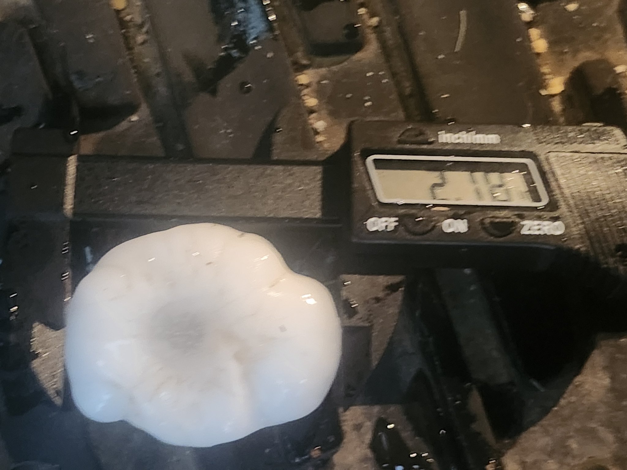
| A few of the more robust thunderstorms generated large hail, as big as tennis balls southwest of Aiken and to golf ball size in and around Slaton. The merging of thunderstorms and outflow boundaries over Hale County produced the most intense storm of the day, which tossed hail, torrential rain and even generated a tornado (or hybrid tornado) northwest of Abernathy. | |||
 |
|||
| Large hail that fell near Petersburg on Friday evening (22 May 2026). The picture is courtesy of Randy Jennings. | |||
| The thunderstorm activity eventually morphed into a line of storms as it made its way off the Caprock Friday evening. When all was said and done, many locations along and east of the Highway 84 Corridor saw a little rain, with isolated pockets of heavy rain, totaling 1/2 to 1+ inches. | |||
 |
|||
| Lubbock WSR-88D radar animation valid from 2:05 pm to 11:40 pm on Friday (22 May 2026). | |||
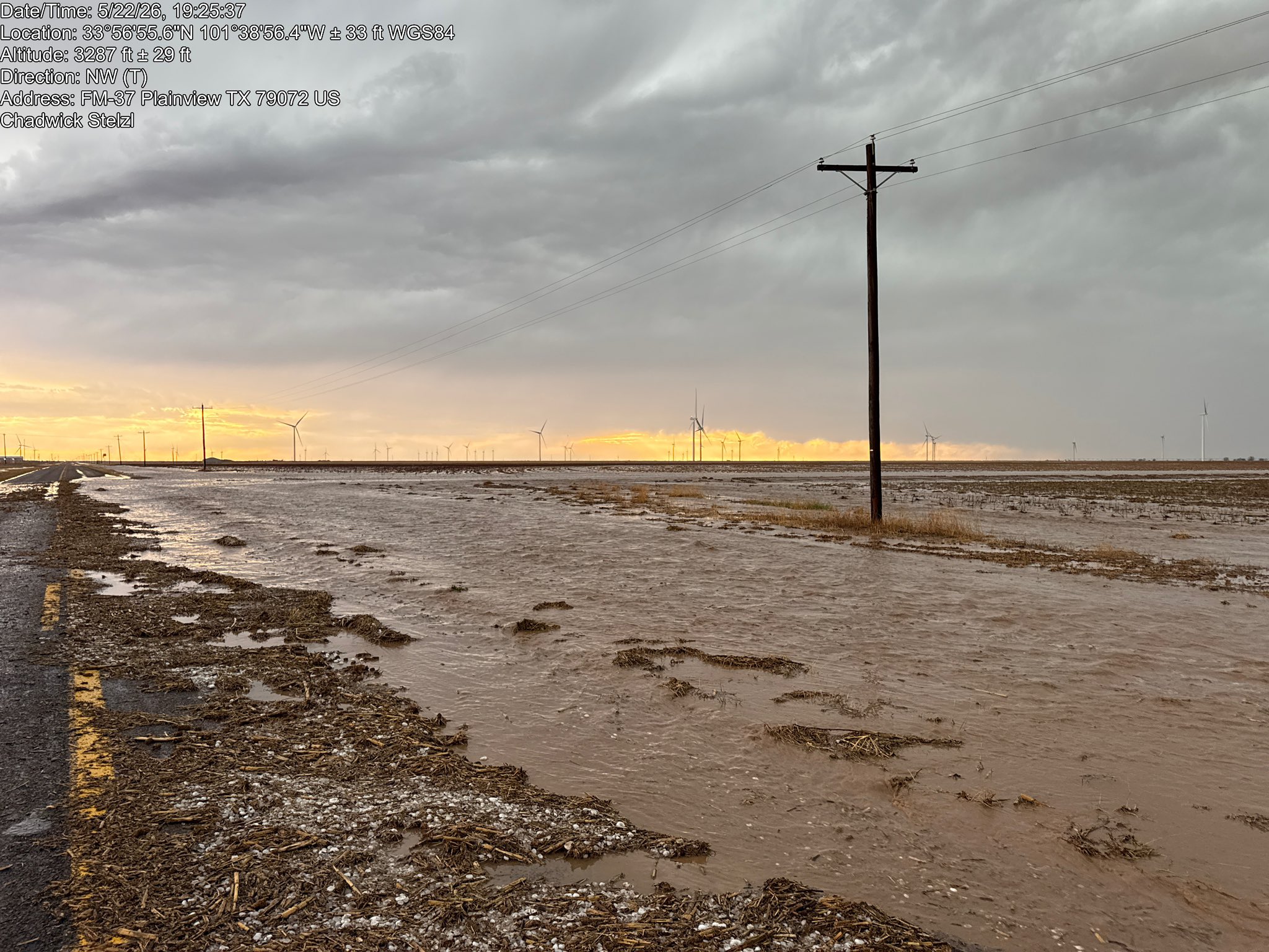
| Where the heaviest rain fell, including across the southeast portion of Hale County, the intense rain resulted in rapid runoff and flooding of fields and roadways. | |||
 |
|||
| Flooding along FM 37 northwest of Petersburg Friday evening (22 May 2026). The image is courtesy of Chadwick Steizi. | |||
| The next day, Saturday (May 23rd), brought another round of storms to the South Plains region, though this event occurred later in the day, mostly from mid-evening well into the overnight hours. | |||
 |
|||
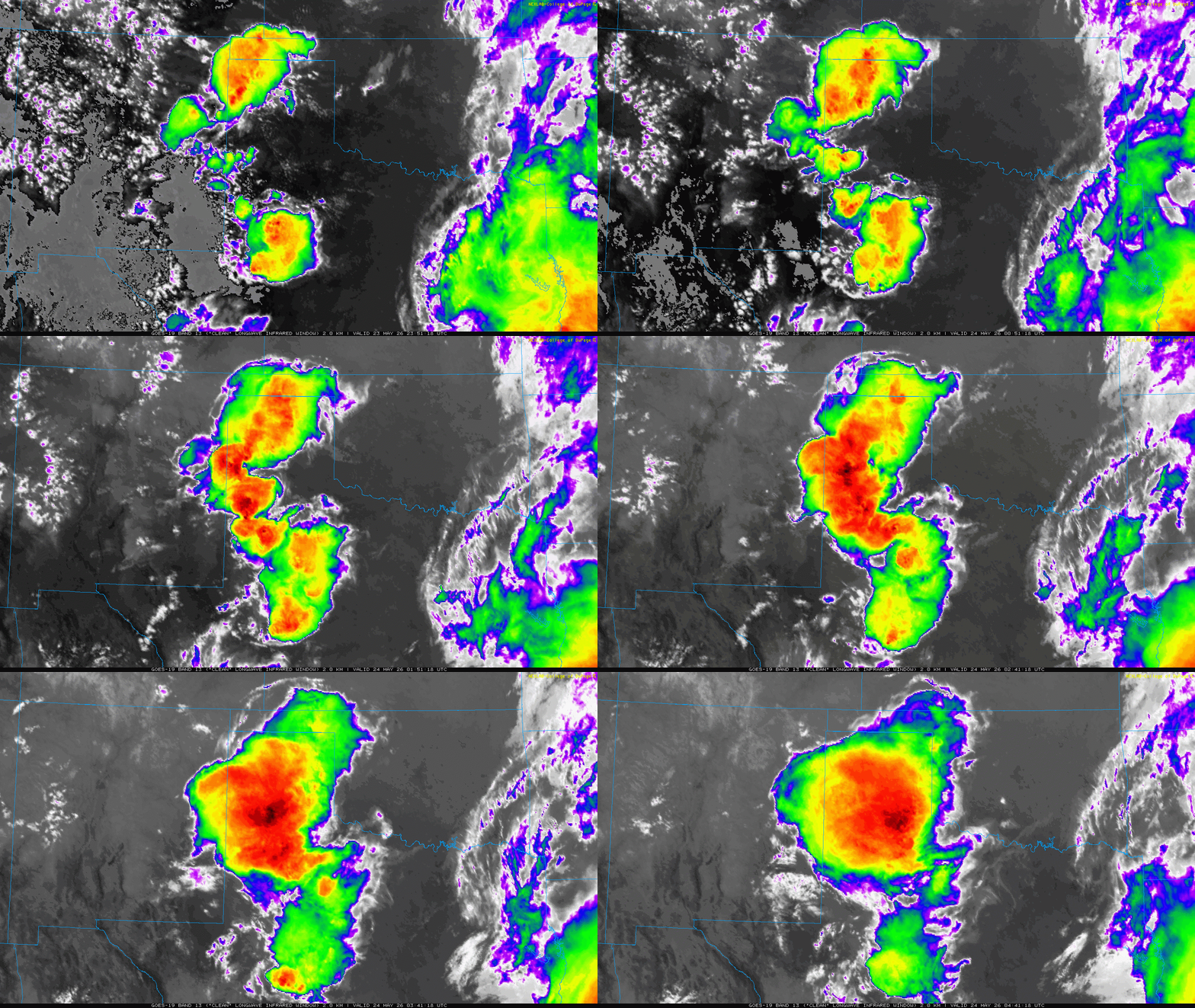
| Infrared satellite loop valid from 6:57 pm to 11:41 pm on Saturday (23 May 2026). An "RGB-True Color" satellite animation, valid from 4:36 pm to 7:41 pm on Saturday, can be VIEWED HERE. | |||
| The activity was aided by a subtle mid-level disturbance approaching out of the southern Rockies. Scattered thunderstorms first developed over the western South Plains and northern Permian Basin. This activity generated several outflow boundaries that raced off in various directions, triggering new development as it interacted with improving moisture and modest instability. | |||
 |
|||
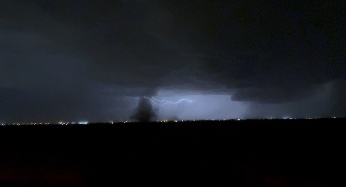
| Landspout tornado near Shallowater Saturday evening (23 May 2026). The image is courtesy of Ethan Myers. | |||
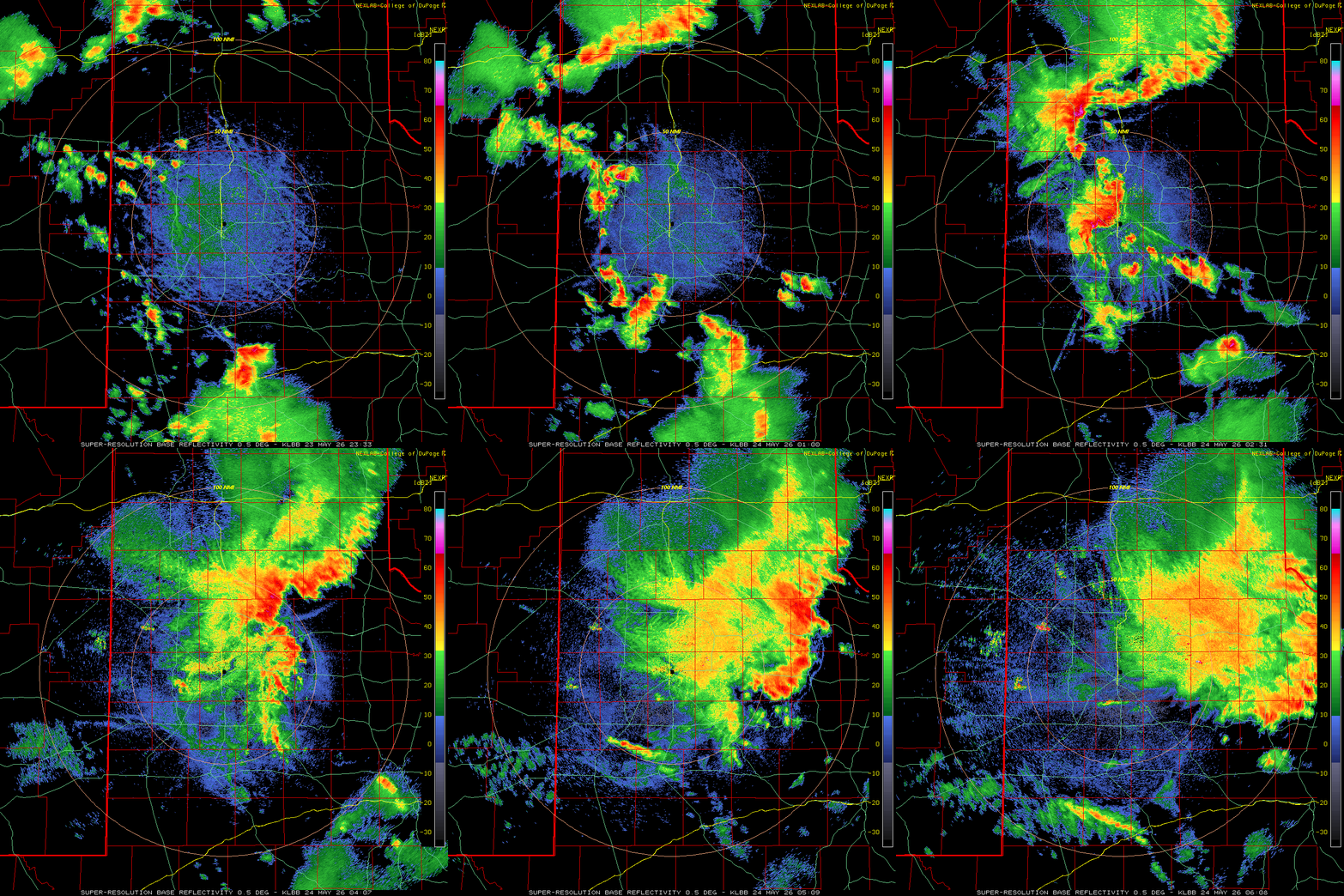
| Similar to the previous evening, lift along the various boundaries resulted in the formation of at least three landspout-type tornadoes Saturday evening. The South Plains' activity eventually merged with a complex of thunderstorms diving southeastward out of the Texas Panhandle, forming into an intense cluster that accelerated through the Rolling Plains late Saturday night. | |||
 |
|||
|
|||
|
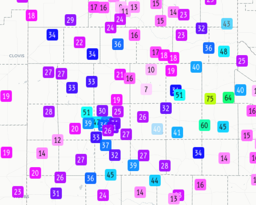
The most intense cores dropped pockets of hail, as large as 2 inch in diameter a few miles west of Tahoka, while quarter-sized hail was observed in Estelline. As the thunderstorms grew upscale and accelerated, they generated strong to severe wind gusts over portions of the central Rolling Plains. A peak wind gust of 75 mph was recorded by the Paducah 10SW West Texas Mesonet (WTM) site, while the Hackberry 2SSE WTM measured a gust to 64 mph at 12:19 am early Sunday morning (May 24th). |
|||
 |
|||
| Peak wind gusts (mph) measured by the West Texas Mesonet between 11:40 pm on Saturday and 12:40 am on Saturday (23-24 May 2026). | |||
| More welcome than the wind and hail was the widespread rain that fell over much of the region. Several locations saw a quick 1 to 2+ inches of rain, with the bulk of the heavy rain falling in a swath across the central South Plains (grazing the north side of Lubbock) as well as much of the southern Texas Panhandle and northern Rolling Plains. The Estelline 3SSE WTM site was the big winner, measuring 2.11 inches of rain Saturday night. | |||
 |
|||
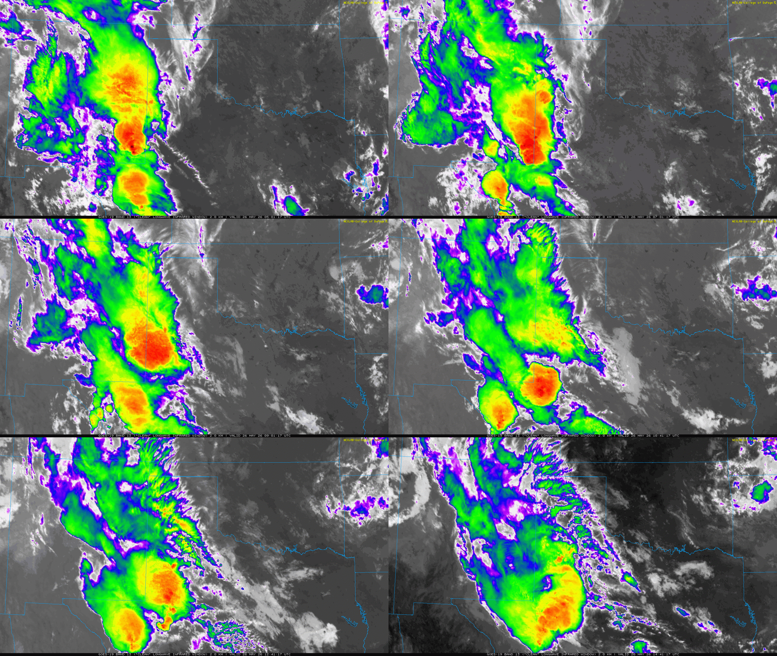
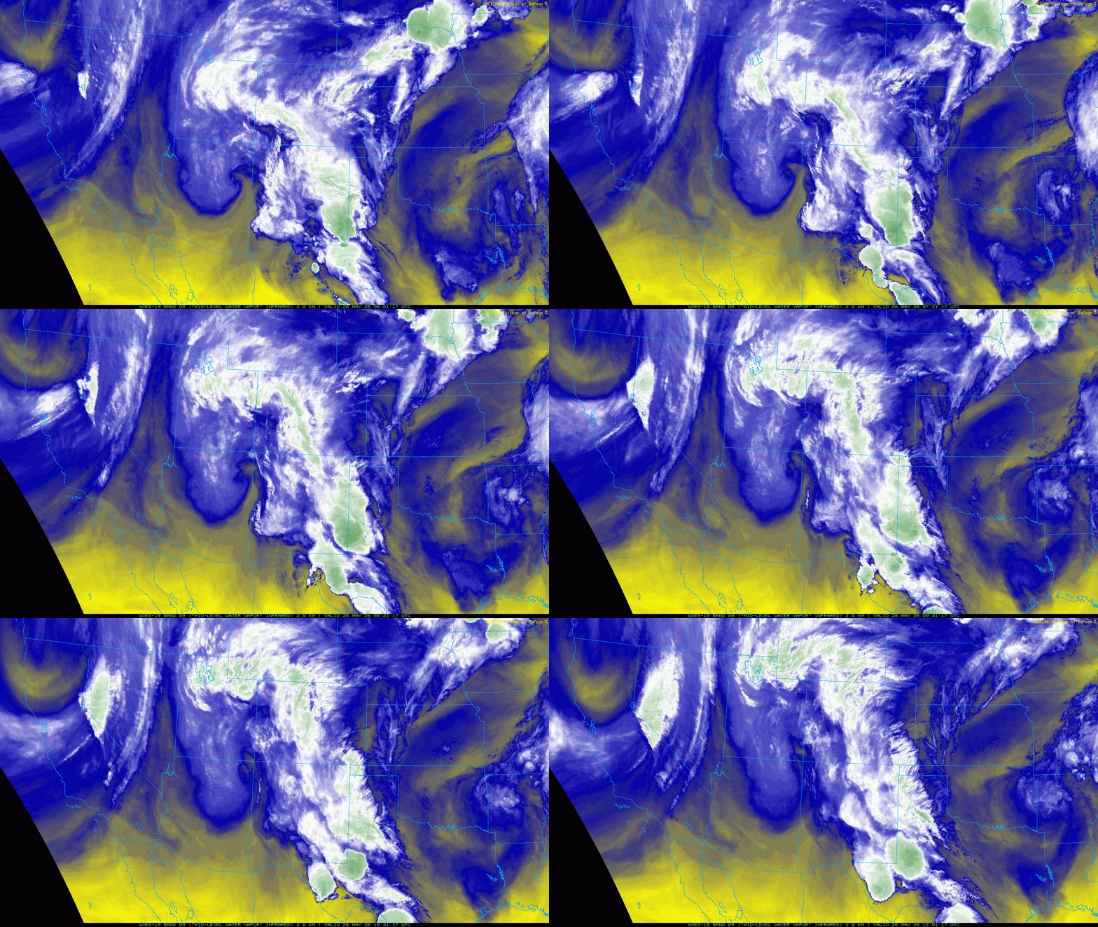
| Water vapor satellite loop valid from 1:01 am to 7:01 am on Tuesday (26 May 2026). A infrared satellite animation, valid from 12:01 am to 9:41 am on Tuesday, can be FOUND HERE. | |||
|
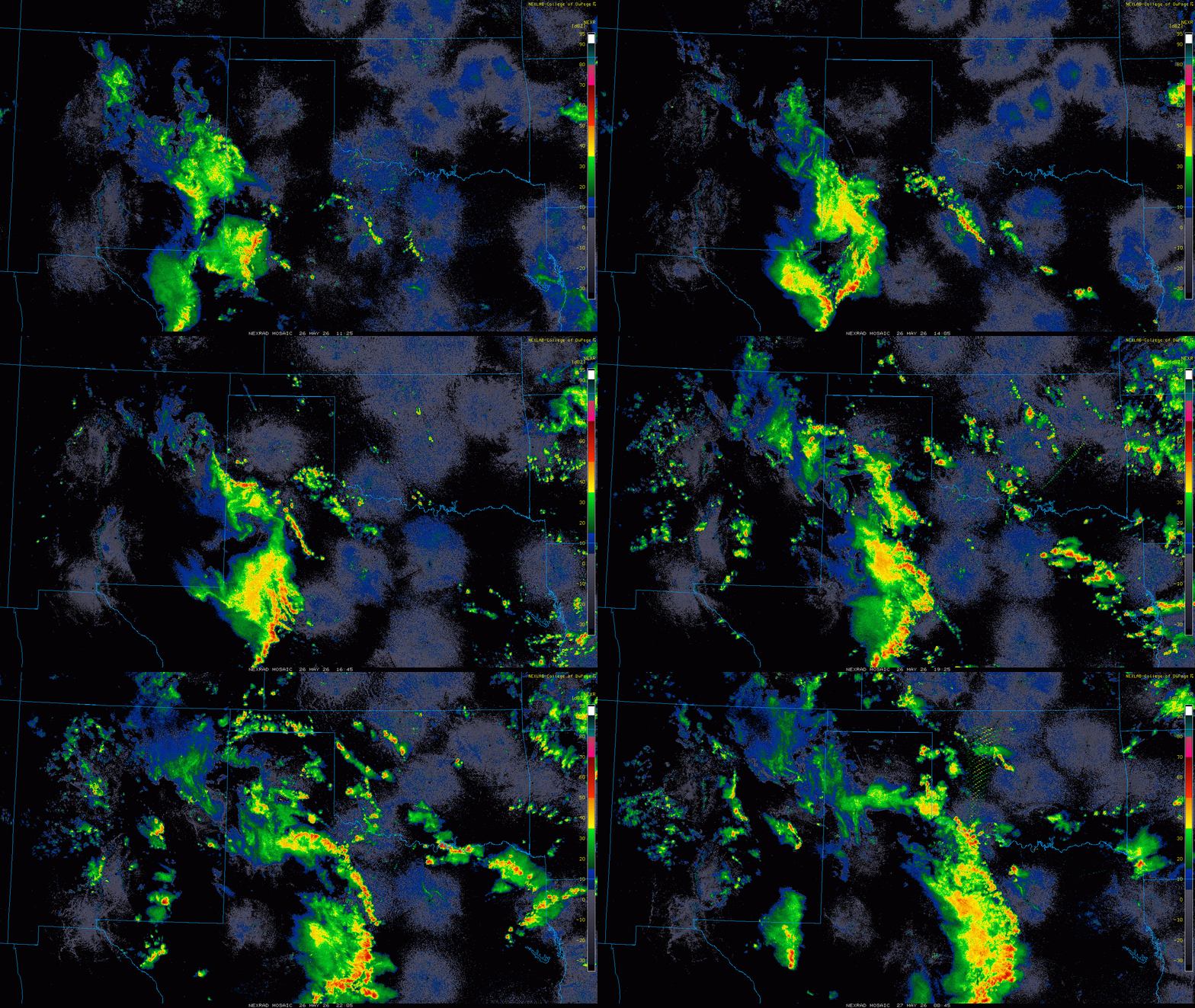
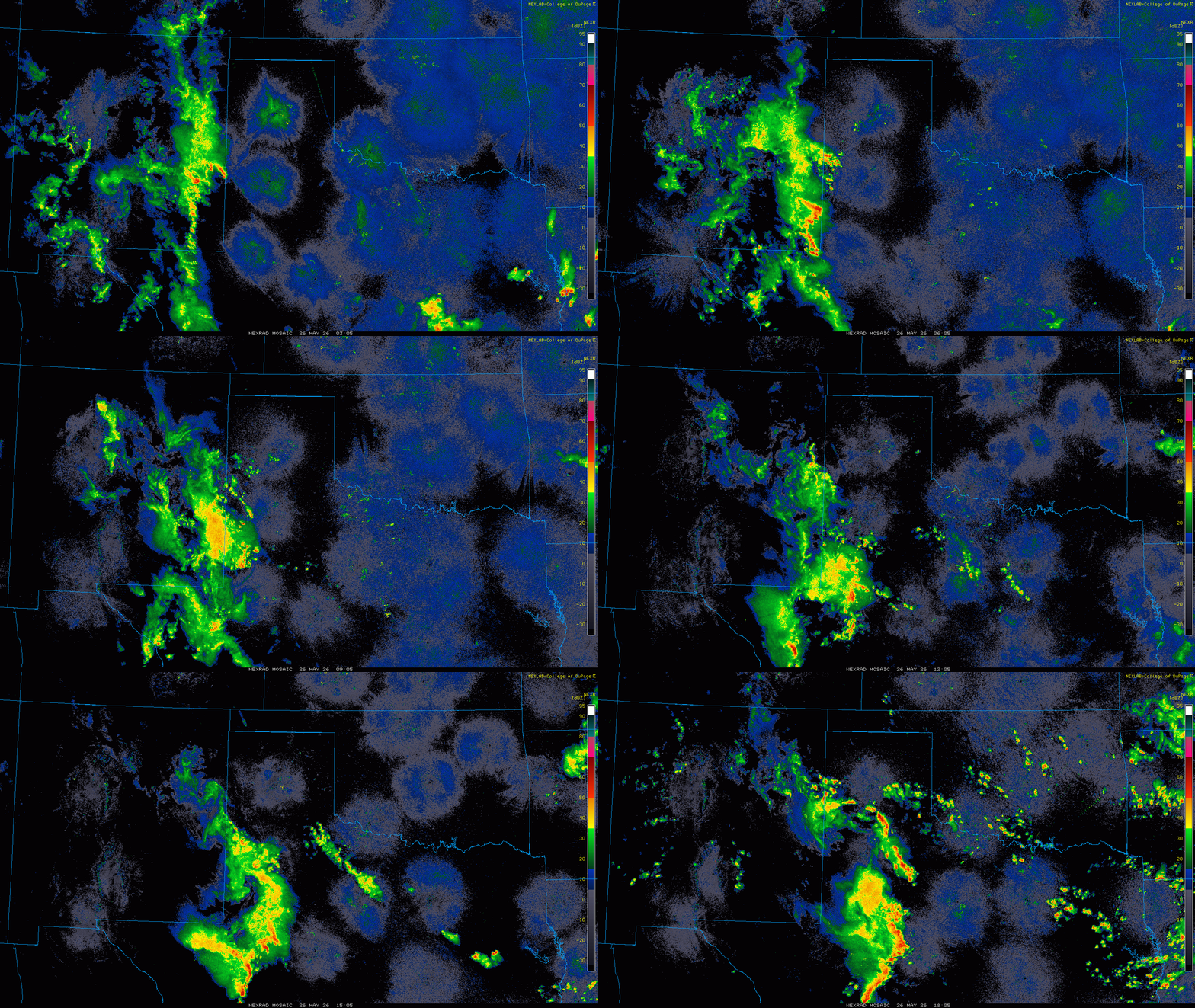
After a bit of a lull Sunday and Monday, with only spotty rainfall over the western South Plains, more widespread showers and thunderstorms overspread the region from west-to-east late Monday night (May 25th) into Tuesday (May 26th). This round of rain/storms occurred in response to a moisture-rich storm system lifting through the southern and central Rockies. |
|||
 |
|||
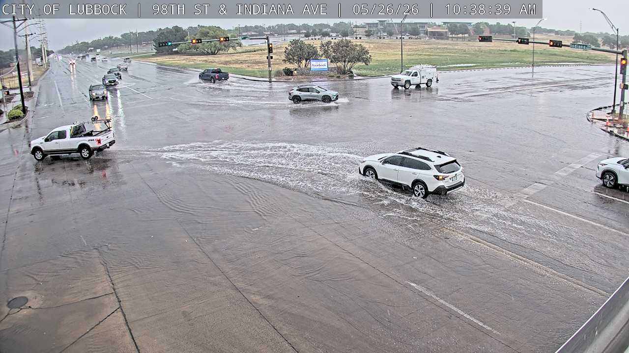
| Minor street flooding at the intersection of 98th Street and Indiana Avenue, in Lubbock, Tuesday morning (26 May 2026). The image is courtesy of the city of Lubbock. | |||
| The moist atmosphere supported widespread rain and locally heavy downpours on Tuesday. Where temperatures warmed to near 80 degrees and instability was maximized, bands of strong to briefly severe thunderstorms developed and moved from south-to-north across the south-central Texas Panhandle and Rolling Plains. One storm generated a wind gust to 77 mph as it moved across the Vigo Park WTM, while also dropping a quick 1.06 inches of rain. Another storm produced a 62 mph wind gust as it moved across the Jayton WTM. | |||
 |
|||
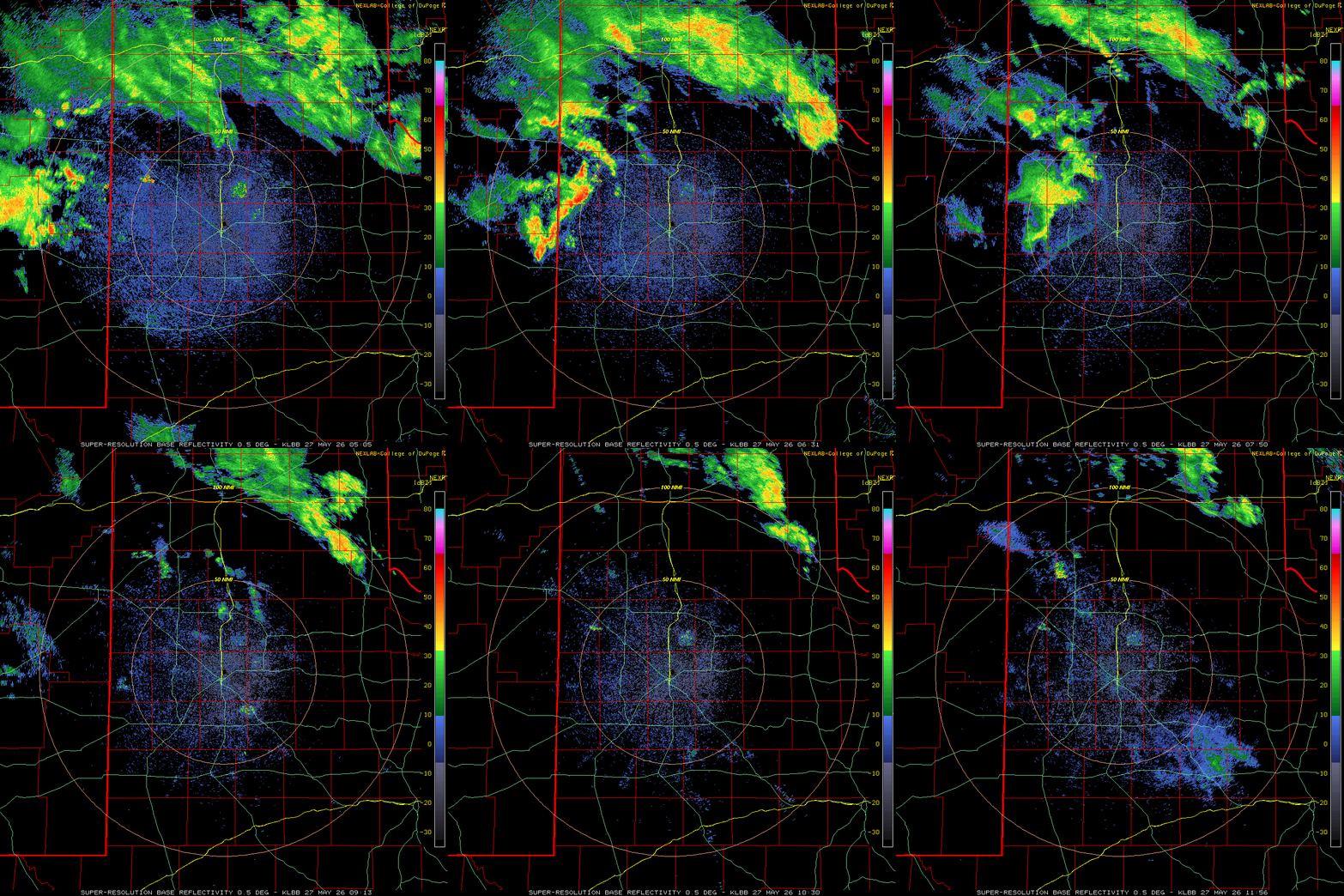
| Regional radar loop valid from 10:05 pm on Monday to 1:05 pm on Tuesday (25-26 May 2026).Another regional animation, valid from 6:25 am to 7:45 pm on Tuesday can be VIEWED HERE. Additional Lubbock WSR-88D radar loops can be found at: 12:35 am to 1:26 pm on Tuesday; 4:58 am to 8:02 pm on Tuesday; and 12:09 am to 6:56 am on Wednesday (27 May 2026). | |||
| Light rain lingered over portions of the region through the late afternoon and early evening hours before shifting off to the north and east Tuesday evening. One final batch of thunderstorms then moved out of eastern New Mexico and into the western South Plains after midnight early Wednesday (May 27th), but quickly diminished over the central South Plains by 3 to 4 am. | |||
 |
|||
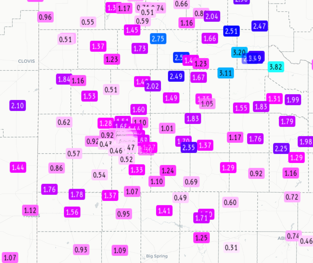
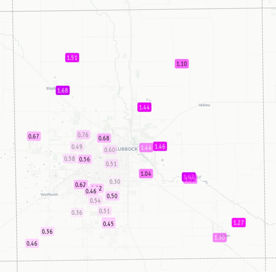
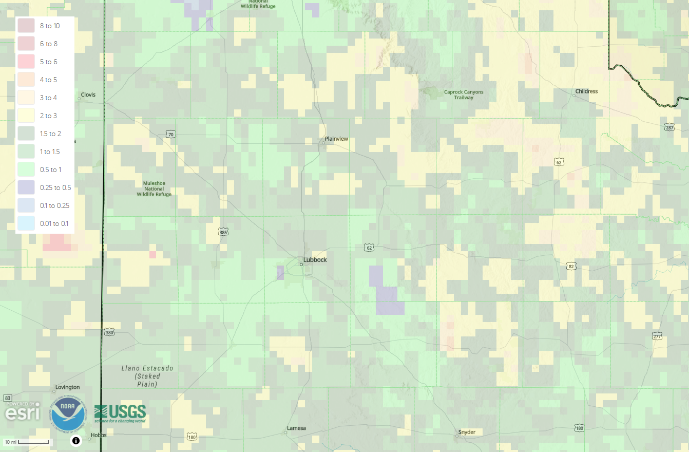
| 6-day radar-estimated and bias-corrected rainfall ending at 7 am on Wednesday (27 May 2026). Measured 5-day rainfall totals from the National Weather Service (NWS) and West Texas Mesonet (WTM), ending at 1 pm on Wednesday, can be VIEWED HERE, with a zoomed in view of Lubbock County HERE. | |||
|
Altogether, the rounds of late-May showers and thunderstorms provided widespread beneficial rainfall to the region. Many locations recorded 1 to 2+ inches of rain, with over 3 inches measured at a few spots across the southeast Texas Panhandle. The southwestern half of the city of Lubbock was in a relative minimum, though even here most locations saw close to half inch. Officially, the Lubbock Airport measured 1.73 inches over the extended Memorial Day briefing, boosting the running annual total to 3.70 inches. Well to the northeast, Childress officially recorded 1.50 inches over this same stretch, lifting their 2026 year-to-date total to 5.58 inches. A list of the preliminary storm reports collected over this active holiday weekend can be found below. |
|||
Preliminary Local Storm Report...Summary
National Weather Service Lubbock TX
436 AM CDT Sat May 23 2026

..TIME...   ...EVENT...      ...CITY LOCATION...     ...LAT.LON...
..DATE...   ....MAG....      ..COUNTY LOCATION..ST.. ...SOURCE....
            ..REMARKS..

0335 PM     Tstm Wnd Gst     2 S Brownfield          33.15N 102.27W
05/22/2026  M58 MPH          Terry              TX   Mesonet


0857 PM     Tstm Wnd Gst     3 N Roaring Springs     33.94N 100.85W
05/22/2026  M58 MPH          Motley             TX   Mesonet


0425 PM     Landspout        5 WSW Grassland         33.12N 101.67W
05/22/2026                   Lynn               TX   Public

            Report of small funnel halfway up to cloud.

0509 PM     Hail             1 WSW Slaton            33.43N 101.66W
05/22/2026  E1.00 Inch       Lubbock            TX   CO-OP Observer

            Isolated quarter size hail, but mostly dime
            and smaller.

0515 PM     Hail             2 NW Slaton             33.47N 101.66W
05/22/2026  M0.88 Inch       Lubbock            TX   Public


0520 PM     Hail             1 WNW Slaton            33.45N 101.66W
05/22/2026  E1.75 Inch       Lubbock            TX   Public

            Media viewer sent in hail picture.

0550 PM     Hail             3 SE Lubbock Int. Airpo 33.62N 101.77W
05/22/2026  E1.00 Inch       Lubbock            TX   Public

            Report from mPING: Quarter (1.00 in.).

0534 PM     Landspout        3 W Spade               33.93N 102.21W
05/22/2026                   Lamb               TX   Public

            Spotter report of a landspout.

0542 PM     Landspout        3 N Earth               34.27N 102.41W
05/22/2026                   Lamb               TX   Public

            Spotter network report of a landspout.

0456 PM     Hail             4 SE Plainview          34.14N 101.70W
05/22/2026  E0.75 Inch       Hale               TX   Public

            Report from mPING: Dime (0.75 in.).

0502 PM     Landspout        3 SE Plainview          34.16N 101.70W
05/22/2026                   Hale               TX   Storm Chaser

            Multiple reports on X from chasers of
            landspouts.

0534 PM     Hail             6 SW Aiken              34.09N 101.61W
05/22/2026  M0.75 Inch       Hale               TX   Public

            Report from mPING: Dime (0.75 in.).

0543 PM     Hail             10 SW Aiken             34.02N 101.62W
05/22/2026  E1.00 Inch       Hale               TX   Public

            Report from mPING: Quarter (1.00 in.).

0545 PM     Hail             10 SW Aiken             34.02N 101.63W
05/22/2026  M1.00 Inch       Hale               TX   Public

            Report from mPING: Quarter (1.00 in.).

0548 PM     Hail             10 SW Aiken             34.02N 101.63W
05/22/2026  E1.75 Inch       Hale               TX   Emergency Mngr


0556 PM     Hail             8 SSW Aiken             34.04N 101.60W
05/22/2026  E1.75 Inch       Hale               TX   Public

            Picture reported on social.

0556 PM     Hail             6 N Petersburg          33.95N 101.59W
05/22/2026  E1.50 Inch       Hale               TX   Public

            Report from mPING: Ping Pong Ball (1.50
            in.).

0600 PM     Hail             10 SW Aiken             34.02N 101.60W
05/22/2026  M2.25 Inch       Hale               TX   Public

            Report from mPING: Hen Egg+ (2.25 in.).

0609 PM     Landspout        Edmonson                34.28N 101.90W
05/22/2026                   Hale               TX   Broadcast Media

            Media report of landspout near Edmonson.

0610 PM     Hail             10 SW Aiken             34.02N 101.60W
05/22/2026  E2.50 Inch       Hale               TX   Public

            Report from mPING: Tennis Ball (2.50 in.).

0626 PM     Tornado          6 NNW Abernathy         33.93N 101.87W
05/22/2026                   Hale               TX   Storm Chaser

            Multiple reports of a dusty tornado.

0653 PM     Hail             9 N Petersburg          34.00N 101.59W
05/22/2026  M1.25 Inch       Hale               TX   Public

            Report from mPING: Half Dollar (1.25 in.).

0654 PM     Flood            Hale Center             34.06N 101.84W
05/22/2026                   Hale               TX   Broadcast Media

            Report of foot of water over I-27. Cars
            driving slowly through water.

0657 PM     Hail             6 NNW Petersburg        33.95N 101.65W
05/22/2026  M2.00 Inch       Hale               TX   Storm Chaser

            Measured 2.18 inch hail. Time is estimated
            based on radar.

0705 PM     Hail             8 NW Petersburg         33.95N 101.70W
05/22/2026  E1.50 Inch       Hale               TX   Public

            Report from mPING: Ping Pong Ball (1.50
            in.).

0725 PM     Flash Flood      9 NW Petersburg         33.98N 101.70W
05/22/2026                   Hale               TX   Public

            Rushing water along and on the road FM 37.

0609 PM     Landspout        3 NE Hart               34.42N 102.07W
05/22/2026                   Castro             TX   Public

            Spotter report of a landspout.

0832 PM     Tstm Wnd Gst     7 ESE Silverton         34.45N 101.19W
05/22/2026  M62 MPH          Briscoe            TX   Mesonet


0527 PM     Landspout        6 S Lazbuddie           34.31N 102.62W
05/22/2026                   Bailey             TX   Public

            Corrects previous landspout report from 6 S
            Lazbuddie. Spotter report of a landspout.



 Follow us on X
 Follow us on Facebook
 Follow us on YouTube
 LUB RSS Feed