
Dangerous heat will expand from the Gulf Coast into the Southern Plains and Desert Southwest through week's end. Additional extreme heat impacting the Pacific Northwest will shift to the northern Plains by the weekend. Tropical Storm Bertha is expected to continue to impact portions of the northern Gulf Coast from the western Florida Panhandle to southeastern Louisiana through tonight. Read More >
|
Torrential rain inundates portions of the southern South Plains |
|
 |
|
|
Stormy skies on Sunday evening (31 May 2026) over South Lubbock. The picture is courtesy of Erin Shaw. |
|
|
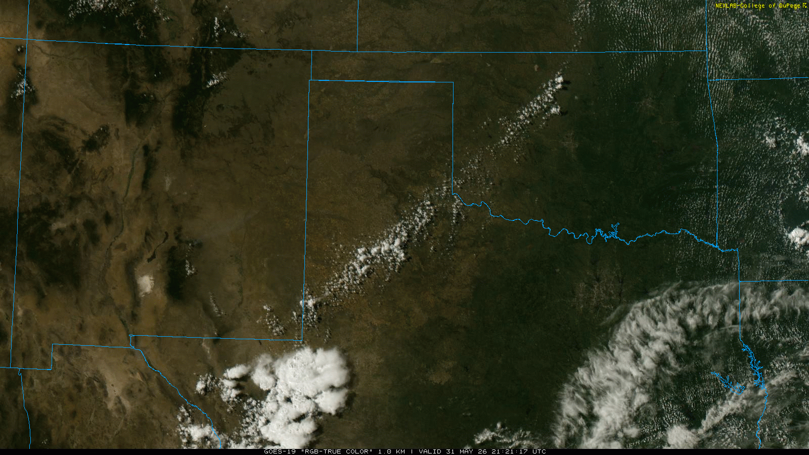
The final day of May turned active as hot temperatures, peaking in the upper 90s and lower triple digits, teamed up with a dryline. As temperatures approached 100 degrees thunderstorms erupted along the dryline, which stretched from northeast-to-southwest from the northern Rolling Plains into the southern South Plains, around 4 pm Sunday afternoon. |
|
 |
|
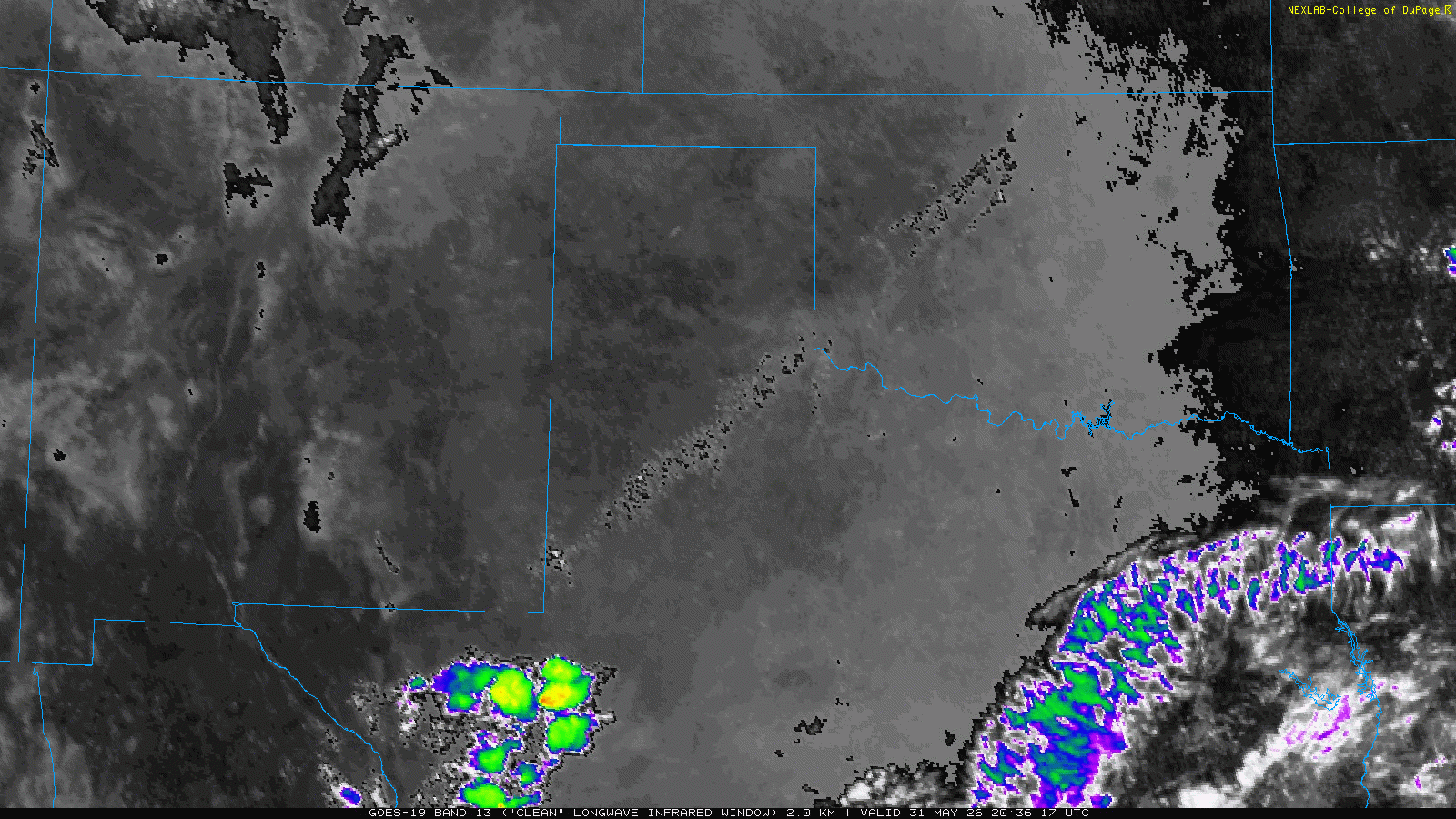
| "RGB-True Color" satellite loop valid from 4:21 pm to 7:56 pm on Sunday (31 May 2026). An infrared satellite animation, valid from 3:46 pm to 9:36 pm, can be VIEWED HERE. | |
| The thunderstorms gradually grew upscale into a broken, slow-moving line that persisted over the central Rolling Plains and the southeast and south-central South Plains well into Sunday evening. Temperatures tumbled into the 60s and 70s as rain-cooled air poured out of the storms. Torrential rain, coupled with the slow-moving storms, resulted in swaths of intense rainfall. | |
 |
|
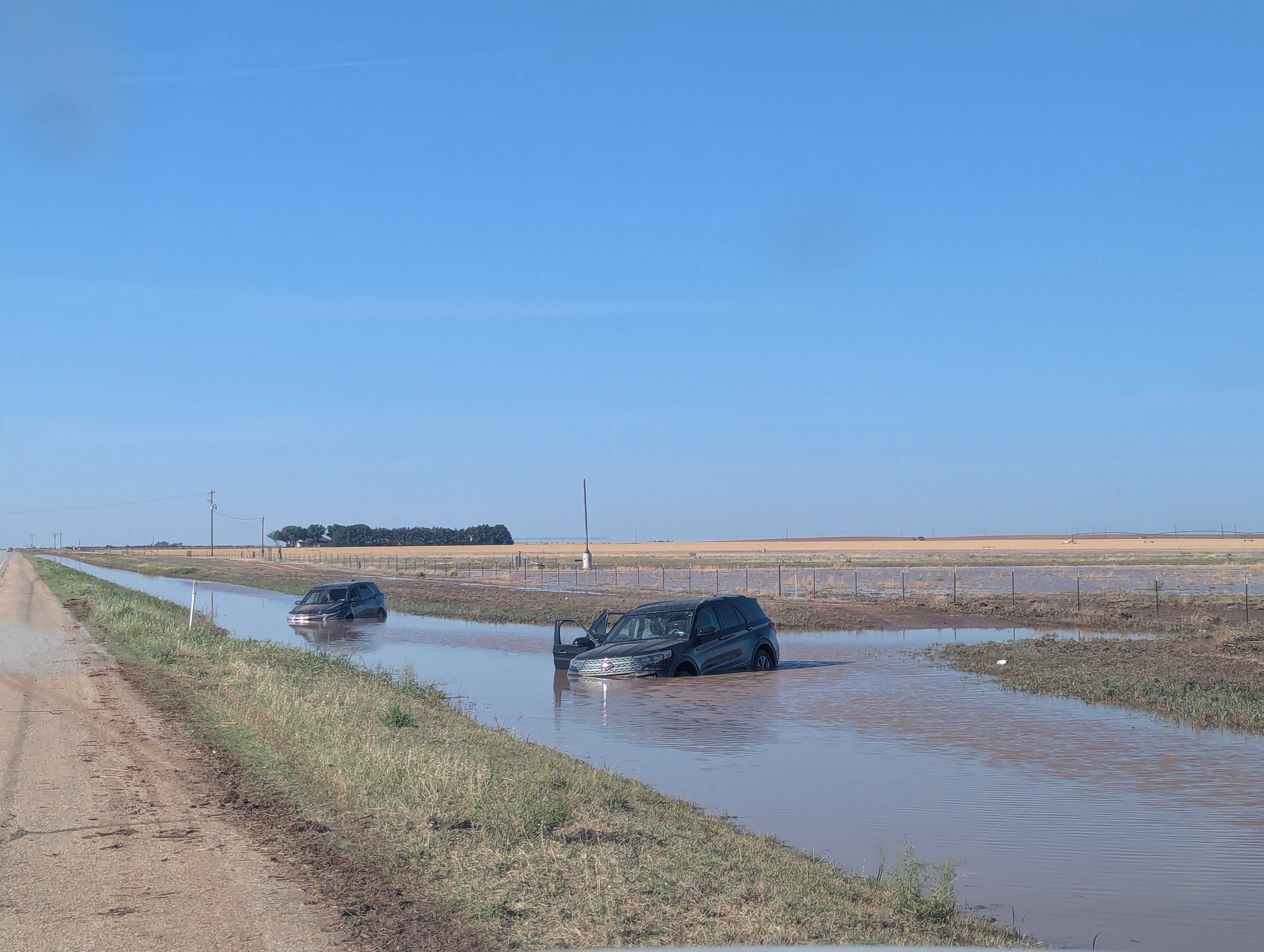
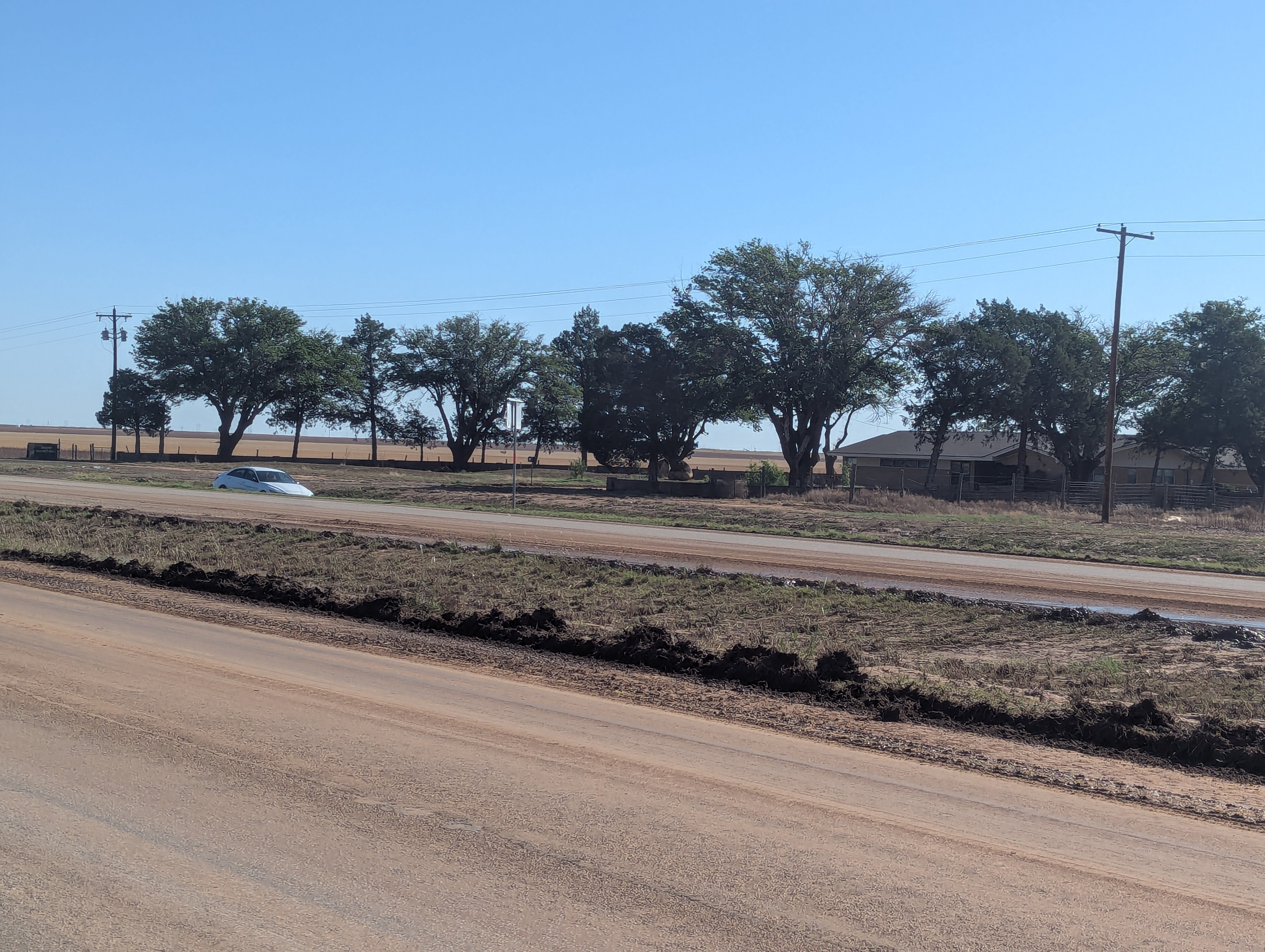
| Flooded out vehicles along Highway 87 several miles north of Tahoka on Monday morning (1 June 2026). | |
| Excessive runoff from the prolonged heavy rain flooded fields and inundated low-lying roadways. Where the heaviest rain fell, a couple of stretches of Highway 87 north of Tahoka, as well as portions of Highway 380 west of Post were overtopped by water and mud. Unfortunately, these dangerous conditions led to a number of vehicles leaving the roadway and being stranded along Highway 87 in Lynn County. | |
 |
|
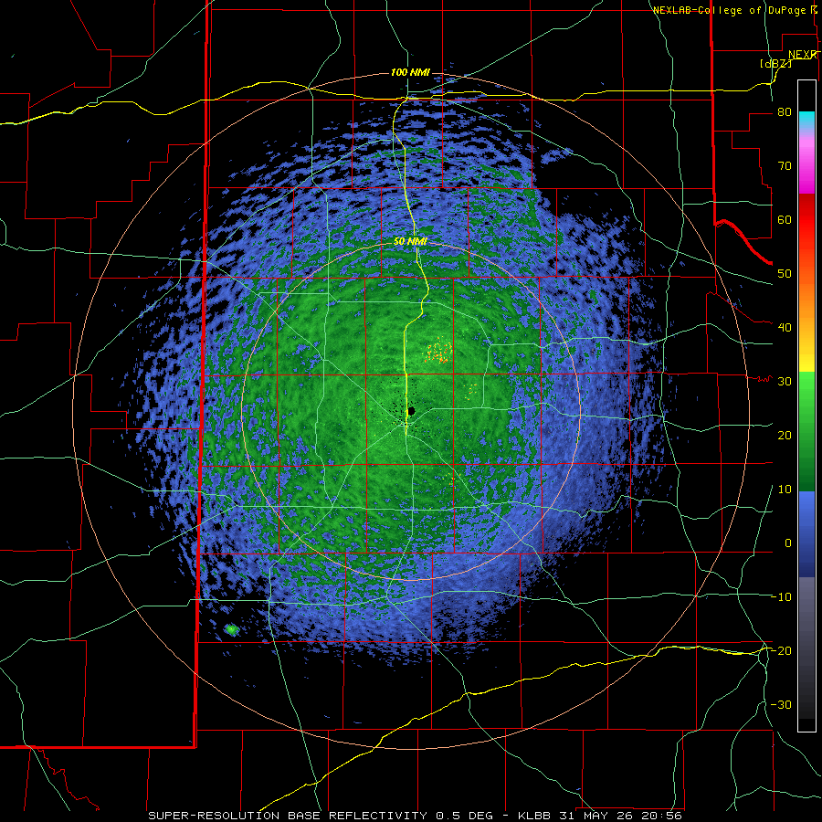
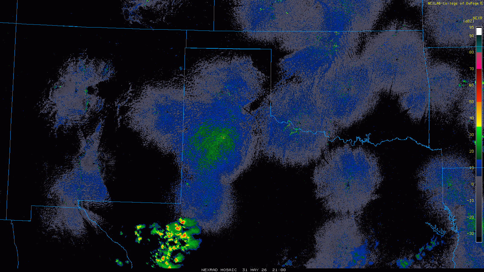
| Lubbock WSR-88D radar animation valid from 3:56 pm to 10:34 pm on Sunday (31 May 2026). A regional radar animation, valid from 4 pm on Sunday to 1:30 am on Monday (1 June 2026), can be FOUND HERE. | |
| One the positive side, the thunderstorm activity brought much-need rain to a good chunk of the southeast half of the South Plains into the central Rolling Plains. Interacting outflow boundaries even triggered additional thunderstorm development over the central South Plains, including in and around Lubbock, Sunday evening. | |
 |
 |
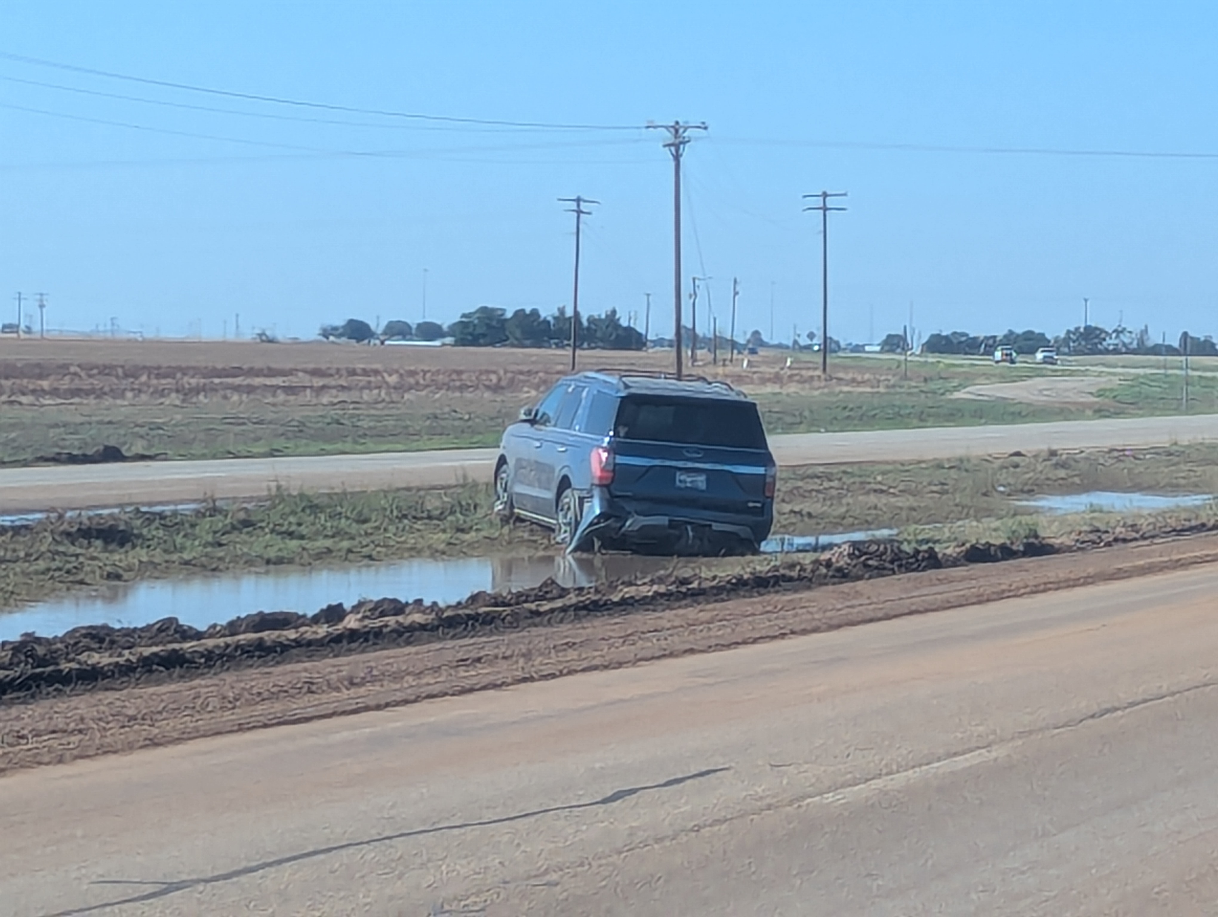
| Flooded out vehicles along Highway 87 several miles north of Tahoka on Monday morning (1 June 2026). | |
| In addition to rain, the thunderstorms were particularly electrical, generating frequent lightning and crashing thunder. The strongest cores even generated brief bouts of hail and severe-caliber wind gusts. Quarter size hail was observed in White River Lake, while peak wind gusts of 66 mph and 59 mph were measured by the Hackberry and Post West Texas Mesonet (WTM) sites, respectively. | |
 |
|
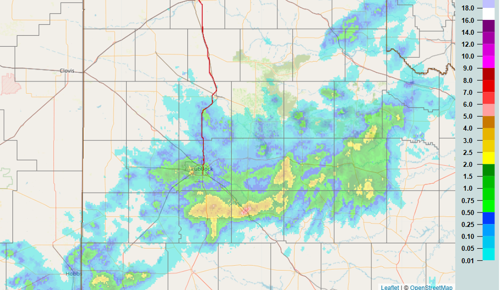
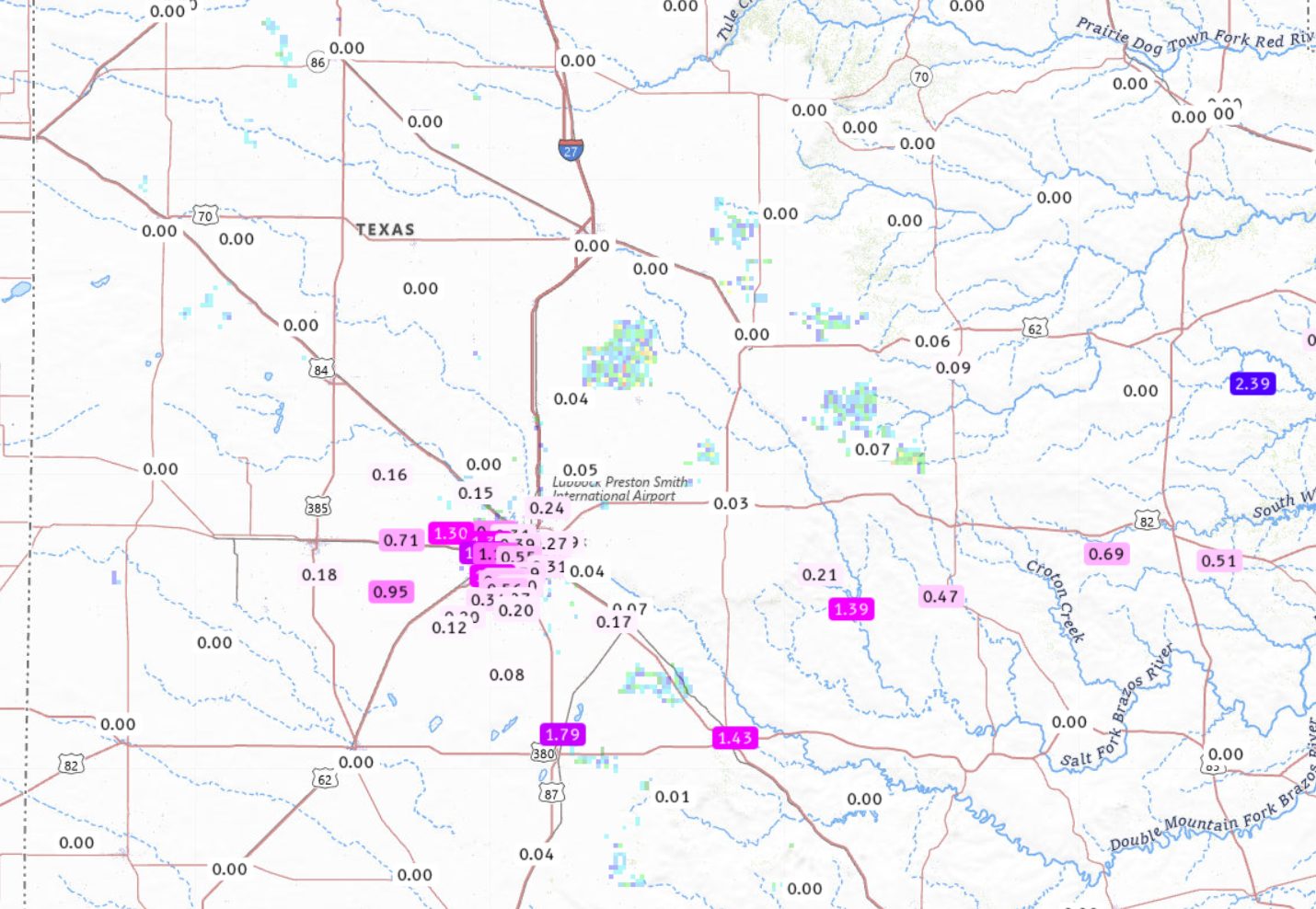
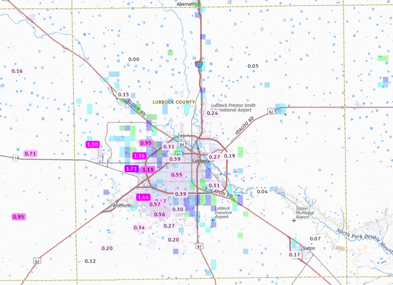
| 24-hour radar-estimated and bias-corrected rainfall ending at 7 am on Monday (1 June 2026). Measured 24-hour rainfall totals from the National Weather Service (NWS) and West Texas Mesonet (WTM), ending at 7:20 am on Monday, can be VIEWED HERE, with a zoomed in view of Lubbock County HERE. | |
| The heaviest rain, likely from 2 to 4+ inches, fell in a swath from north of Tahoka to north and northeast of Post. Even outside the heaviest rain, healthy totals 0.5 to 1+ inches fell across the western parts of Lubbock as well as from White River Lake eastward into much of King County. Officially, the Lubbock Airport only recorded 0.22 inches, while Childress missed out completely. | |
 |
|
| Stormy skies on Sunday evening (31 May 2026) over South Lubbock. The picture is courtesy of Erin Shaw. | |
|
Not to be overlooked, the stormy skies made for a colorful and ominous sunset in Lubbock. A list of the preliminary storm reports collected on the final day of May be found below. |
|
Preliminary Local Storm Report...Summary
National Weather Service Lubbock TX
135 AM CDT Mon Jun 1 2026

..TIME...   ...EVENT...      ...CITY LOCATION...     ...LAT.LON...
..DATE...   ....MAG....      ..COUNTY LOCATION..ST.. ...SOURCE....
            ..REMARKS..

0644 PM     Hail             White River Lake        33.48N 101.10W
05/31/2026  E1.00 Inch       Crosby             TX   Broadcast Media


0648 PM     Tstm Wnd Gst     1 NE Post               33.20N 101.37W
05/31/2026  M59 MPH          Garza              TX   Mesonet


0747 PM     Tstm Wnd Gst     2 SSE Hackberry         33.90N 100.13W
05/31/2026  M66 MPH          Cottle             TX   Mesonet


0900 PM     Flash Flood      3 NW Graham             33.18N 101.50W
05/31/2026                   Garza              TX   Law Enforcement

            Sheriffs office reports flooding on US-380
            about 1 mile west of FM399.

0915 PM     Flash Flood      4 N Tahoka              33.23N 101.81W
05/31/2026                   Lynn               TX   Emergency Mngr

            EM reports flooding on US-87 near CR19. Road
            is being closed.

0955 PM     Non-Tstm Wnd Gst 2 NE Slaton             33.46N 101.62W
05/31/2026  M69 MPH          Lubbock            TX   Mesonet

            Series of severe wind gusts from 58 to 69
            mph during the period from 953 PM to 1000 PM
            likely a result of a developing wake low.

1025 PM     Tstm Wnd Gst     Reese Center            33.61N 102.05W
05/31/2026  M58 MPH          Lubbock            TX   Mesonet


1030 PM     Flash Flood      3 ESE Reese Center      33.58N 101.97W
05/31/2026                   Lubbock            TX   Public

            6 inches of water over the road in low-lying
            area on 21st & Upland.

1051 PM     Non-Tstm Wnd Gst 2 NE Slaton             33.46N 101.62W
05/31/2026  M58 MPH          Lubbock            TX   Mesonet

            Gust from wake low.

1120 PM     Flash Flood      5 ENE Reese Center      33.61N 101.94W
05/31/2026                   Lubbock            TX   NWS Employee

            Flooding on roadway at Frankford & Erskine.
            2 cars stalled.

1142 PM     Non-Tstm Wnd Gst 10 SW Paducah           33.89N 100.40W
05/31/2026  M72 MPH          Cottle             TX   Mesonet

            Series of severe wind gusts ranging from 58
            to 72 mph during the period from 1133 PM to
            1142 PM likely a result of a wake low.

