
Scattered thunderstorms with severe gusts, hail and a tornado risk are possible near a cold front from the Ohio Valley to the Mid-Atlantic tonight. Tropical Storm Bertha is expected to bring tropical storm conditions to portions of the Gulf Coast from the panhandle of Florida into Louisiana through Wednesday. Read More >
|
A Wild Weather Weekend: 13-14 June 2009 |
|||||||||
| Severe Weather raked portions of the South Plains and Rolling Plains Saturday and Sunday, June 13th and 14th. Some of the thunderstorms produced large hail, damaging wind gusts, and a few tornadoes. | |||||||||
|
|
|||||||||
|
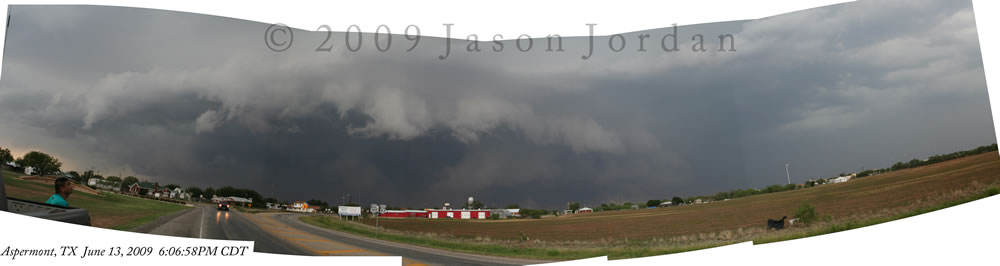
A panaramic image of the thunderstorm bearing down on Aspermont on the 13th of June. Click on the picture to view a larger version.
|
|||||||||
|
On Saturday, the intial storms formed across Floyd County in the afternoon; then expanded and moved east across the far southeast Panhandle and the Rolling Plains. On this day instability was particularly high, and this allowed thunderstorms that developed to quickly become severe. One especially severe storm produced large hail, severe straight-line wind gusts, funnel clouds and at least one tornado as it tracked across King and Stonewall Counties into Haskell County (Haskell is part of the warning area of the NWS San Angelo office). A tractor-trailer was overturned by severe thunderstorm outflow winds just north of Aspermont on U.S. 83 while a weather station of the West Texas Mesonet three miles northeast of Aspermont recorded a 100 mph wind gust in association with a tornado. NWS meteorogist Jason Jordan took the above picture of the storm just before it hit Aspermont.
In addition, another very strong storm produced hail to baseball size and larger in Quitaque, with many other locations experiencing large hail and strong wind gusts. To view a summary of the local storm reports from the 13th please click HERE. |
|||||||||
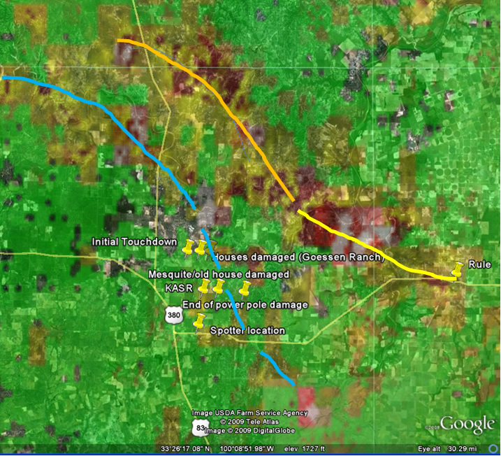
| The following image shows mesocyclone rotation tracks derived from area radar data in Stonewall/Haskell County areas. Also overlayed is points of surveyed damage that was determined to correspond to EF (Enhanced Fujita) -1 scale damage (85-110 mph). | |||||||||
 |
|||||||||
| Radar image of mesocylone tracks and damage reports from the Aspermont area on 13 June 2009. Click on the image for a larger view. | |||||||||
| The Texas Tech University/West Texas Mesonet have also put together a summary of data from this event - including damage photographs from northeast of Aspermont and West Texas Mesonet station observations. To view this report please click HERE. | |||||||||
|
|
|||||||||
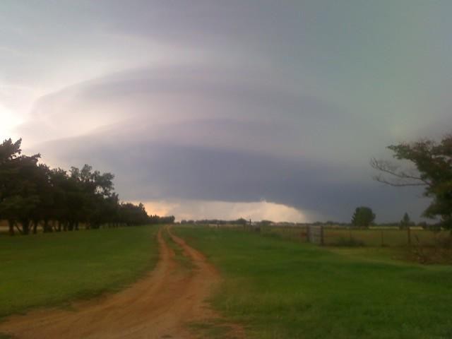
| On Sunday, thunderstorms produced another round of severe weather across much of the area. This time, some severe storms were located farther west, impacting the area from near Brownfield, to southern Lubbock, to near Idalou. However, storms also again affected portions of the Rolling Plains. Below is a picture of a severe storm as it moved through Cottle County. This storm produced large hail as well as reports of a rotating wall cloud and even a report or two of funnel clouds, but no known tornado touchdowns. To view the local storm reports from the 14th please click HERE. | |||||||||
|
|
|||||||||
| Picture of a rotating storm as it approached Paducah late on the afternoon of 14 June 2009. The picture was taken by Steven Beck. Click on the image for a larger view. | |||||||||
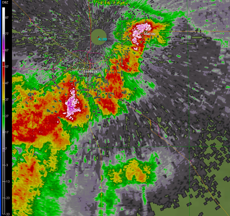
| The following picture shows how the storms looked from the Lubbock radar (at the airport) near the time when large hail and damaging wind where reported in south Lubbock and Idalou. | |||||||||
|
|||||||||
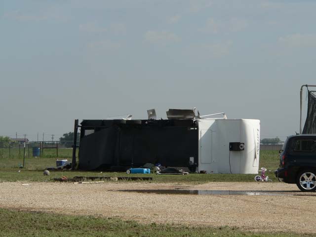
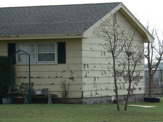
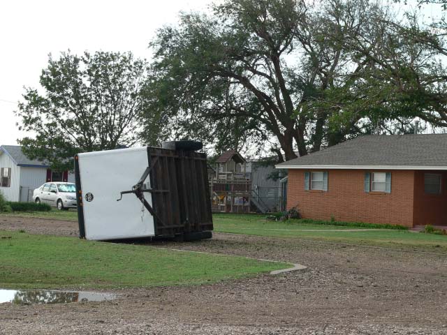
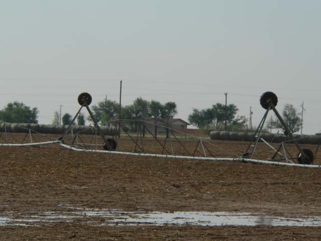
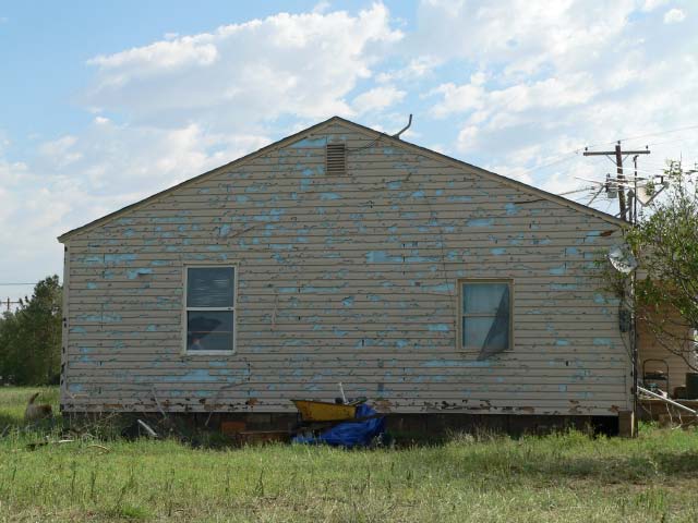
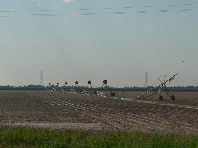
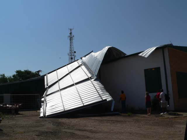
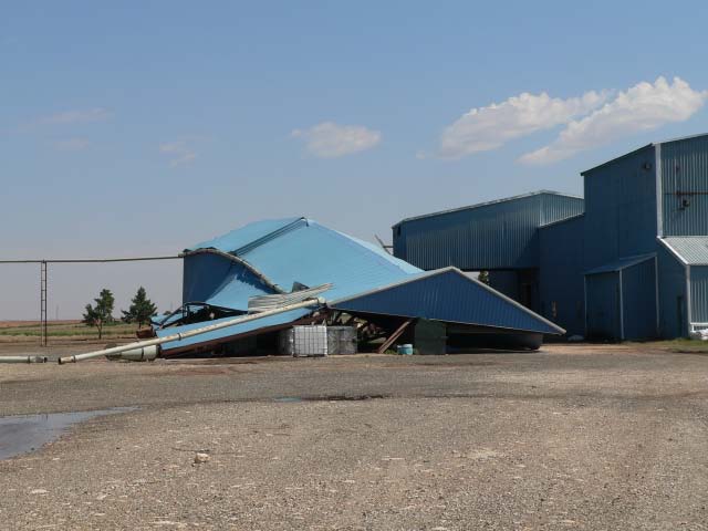
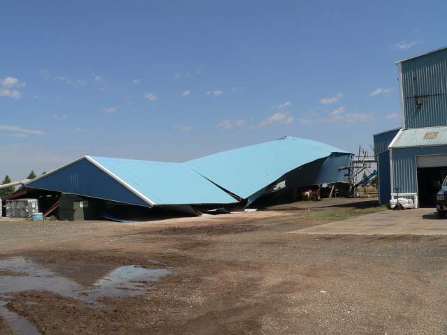
| The Lubbock National Weather Service conducted a damage survey in the Idalou and Brownfield areas Monday morning (15 June). Below are images documenting the damage caused by the winds and hail that impacted the area on the north and west side of Idalou. The strong winds and hail combined to damage a number of buildings on the south facing side, including knocking out windows. The winds also rolled a couple of trailers and a couple of center pivots. | |||||||||
|
|||||||||
|
Images of damage that occurred on the north and west side of Idalou. Pictures were taken the morning of Monday, 15 June 2009. The damage occurred the previous evening as a thunderstorm moved through with strong winds and hail. Click on the images for a larger view.
|
|||||||||
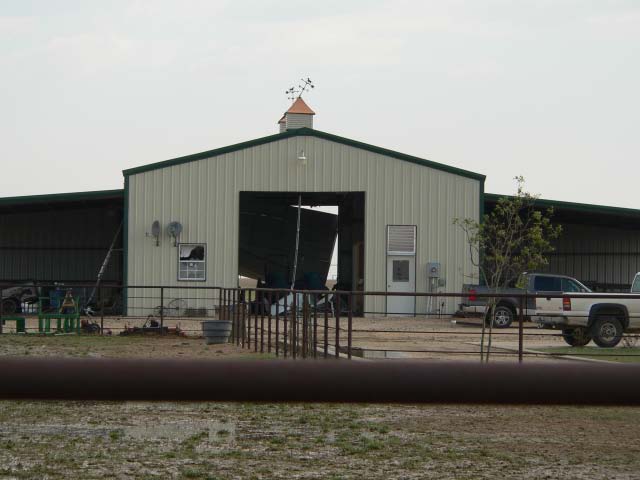
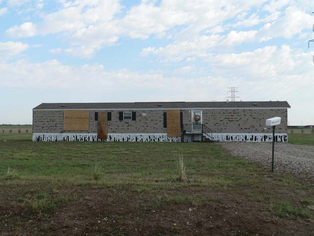
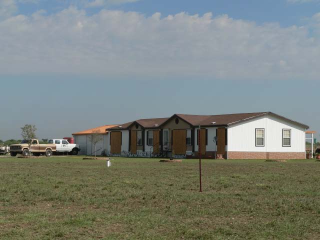
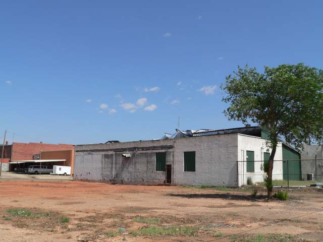
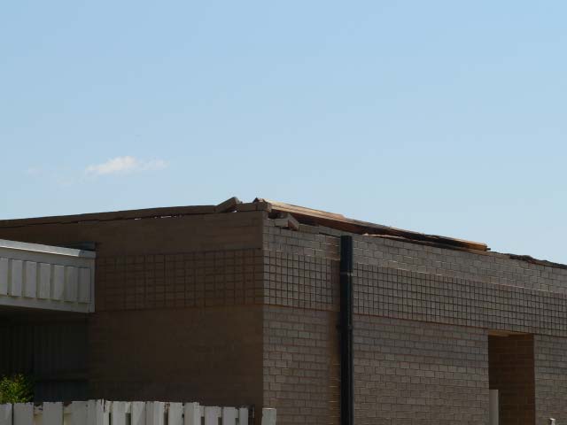
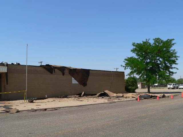
| The strong winds also produced isolated structural damage in the Brownfield area. Below are images of damage caused by the strong winds in and around the Brownfield area. | |||||||||
|
|||||||||
|
Images of damage that occurred in and to the east of Brownfield. Pictures were taken the morning of Monday, 15 June 2009. The damage occurred the previous evening as a thunderstorm moved through with strong winds. Click on the images for a larger view.
|
|||||||||


