
Dangerous heat will expand from the Gulf Coast into the Southern Plains and Desert Southwest through week's end. Additional extreme heat impacting the Pacific Northwest will shift to the northern Plains by the weekend. Tropical Storm Bertha is expected to continue to impact portions of the northwestern Gulf Coast from south central Louisiana to the upper Texas coast today. Read More >
|
Windstorm and Blowing Dust hits the South Plains |
||||
 |
||||
|
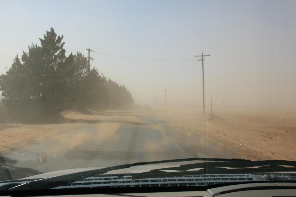
Photograph of dirt blowing across a road causing low visibility near Brownfield (photo courtesy Bill Hopkins).
|
||||
|
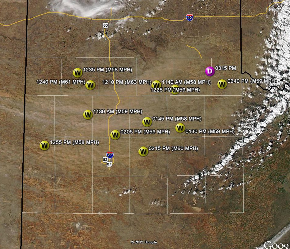
A powerful storm system crossed the Southern Plains Monday afternoon, and produced high winds and blowing dust over much of West Texas. Wind gusts as high as 63 mph were reported. Visibilities in the blowing dust dropped under a mile at times at the Lubbock airport and less than 100 feet along some roadways passing nearby open fields. The winds and blowing dust caused several high-profile vehicles to blow over across the area and one multi-vehicle accident was likely due to the storm. To view the preliminary storm reports for this event CLICK HERE. The high resolution satellite image below shows the dust plumes that were generated by the very high winds on Monday. The primary dust plume partially obscured portions of Palo Duro Canyon in the Panhandle. Other streamers arched from eastern New Mexico across the South Plains into the Rolling Plains south of Childress. |
||||
 |
||||
| MODIS visible satellite image captured Monday afternoon on the 20th shows the plumes of blowing dust arcing from near the Texas and New Mexico border across the southern Texas Panhandle and northern South Plains. Severe wind gust reports (W) from the West Texas Mesonet and an accident caused by blowing dust (D) are also shown. Click on the image for a larger view. | ||||
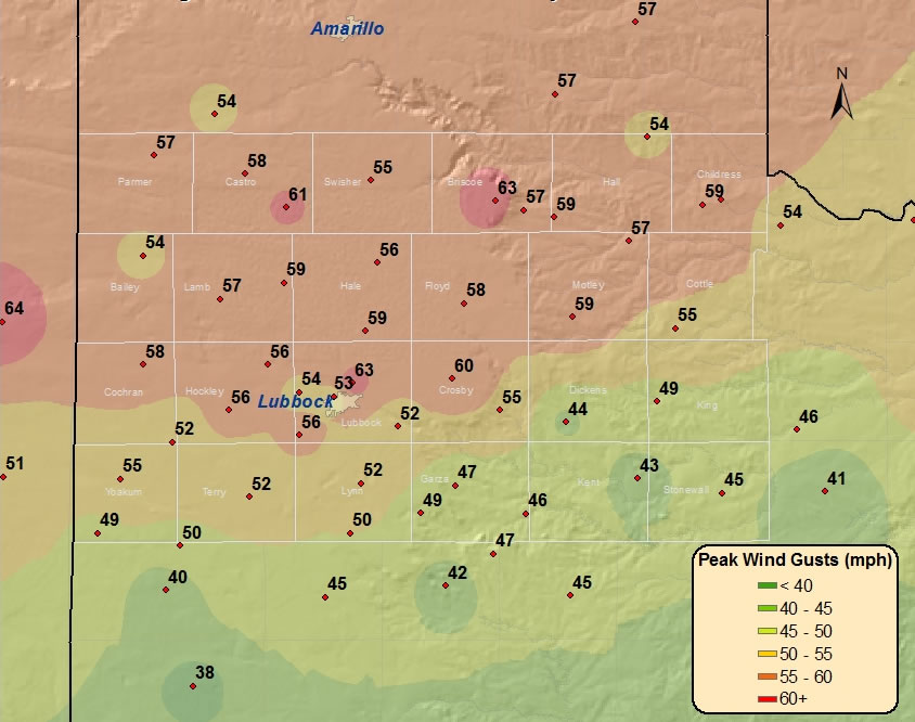
| The below map displays the highest wind gusts that were recorded across the area on Monday, 20 February 2012. The strongest winds were generally confined to the southern Texas Panhandle, central and northern South Plains, and northern Rolling Plains, though the entire region did experience windy conditions. Officially, the highest wind gusts at the Lubbock and Childress Airports were 63 mph and 59 mph, respectively. | ||||
|
|
||||
| Plot of the maximum wind gusts (mph) observed across the region on 20 February 2012. The data is courtesy of the West Texas Mesonet and the National Weather Service. Click on the image for a larger view. | ||||
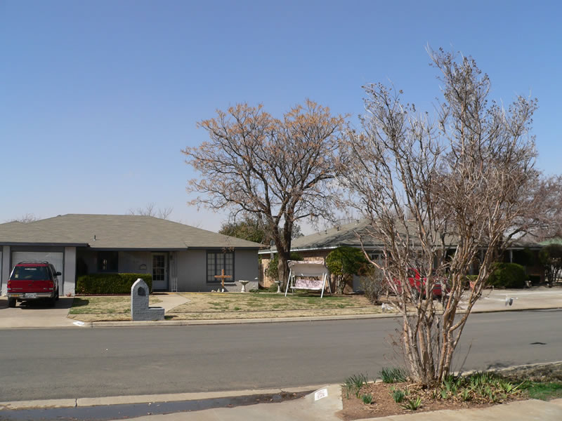
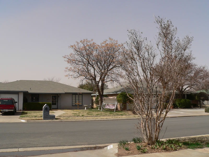
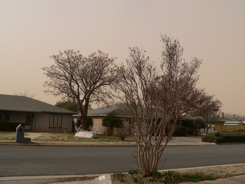
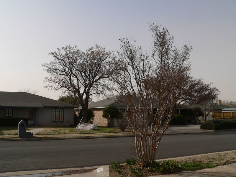
| Below are a series of pictures taken from south Lubbock through the afternoon hours on the February 20th. Although the visibility in this part of town never dropped too low, the browning of the sky is apparent, with some improvement noted by late in the afternoon. | ||||
|
||||

