
Dangerous heat will expand from the Gulf Coast into the Southern Plains and Desert Southwest through week's end. Additional extreme heat impacting the Pacific Northwest will shift to the northern Plains by the weekend. Tropical Storm Bertha is expected to continue to impact portions of the northern Gulf Coast from the western Florida Panhandle to southeastern Louisiana through tonight. Read More >
|
Snow and cold temperatures pay a visit to West Texas: |
|||
|
|
|||
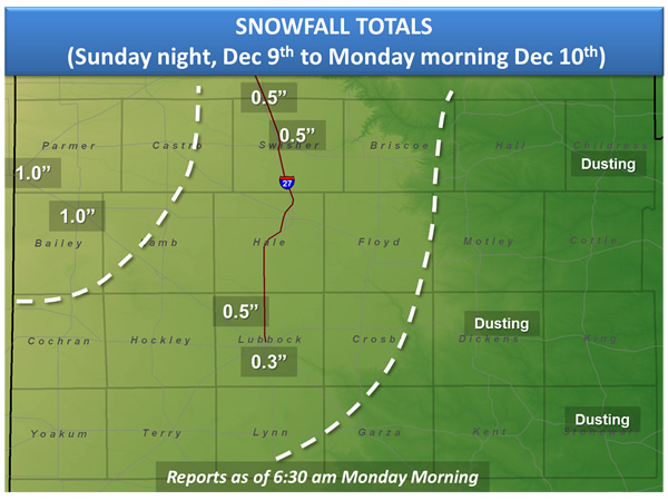
| Snowfall totals reported to the National Weather Service in Lubbock | |||
|
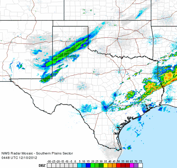
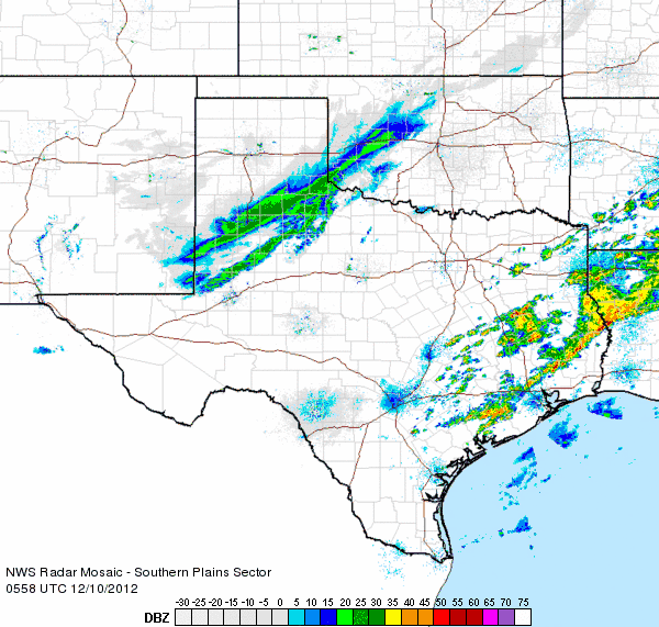
A strong cold front swept through the South Plains regions early Sunday, bringing much colder temperatures and blustery northerly winds. Then, Sunday evening, an upper-level storm system moved out of the southern Rockies and across eastern New Mexico and West Texas. Despite very dry air moving in following the cold front, a thin band of snow developed and moved quickly across the area overnight, bringing a brief shot of moderate to heavy snow. Many locations on the Caprock received between a tenth of an inch to one inch of snow in less than an hour, with lighter amounts in the Rolling Plains. In addition to the snow, temperatures were very cold. When combined with the brisk winds, the wind chill readings were between 5 below to 5 above across much of the far southern Texas Panhandle and northern South Plains early Monday morning. The images below are loops of the Lubbock radar which show the thin snow band moving across the area between about 10:50 pm and 1 am. |
|||
|
|
|||
| Regional radar animation valid from 10:48 pm to 11:58 pm CST on Sunday, 9 December 2012. | |||
|
|
|||
| Regional radar animation valid from 11:58 pm to 1:08 am CST on Monday, 10 December 2012. | |||
| The following images are some wintery weather scenes across the area. If you have any pictures you would like us to use, please send them to sr-lub.webmaster@noaa.gov | |||
  |
|||
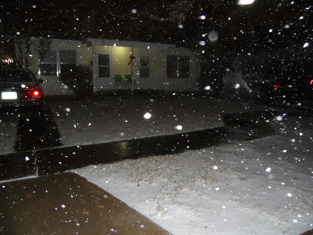
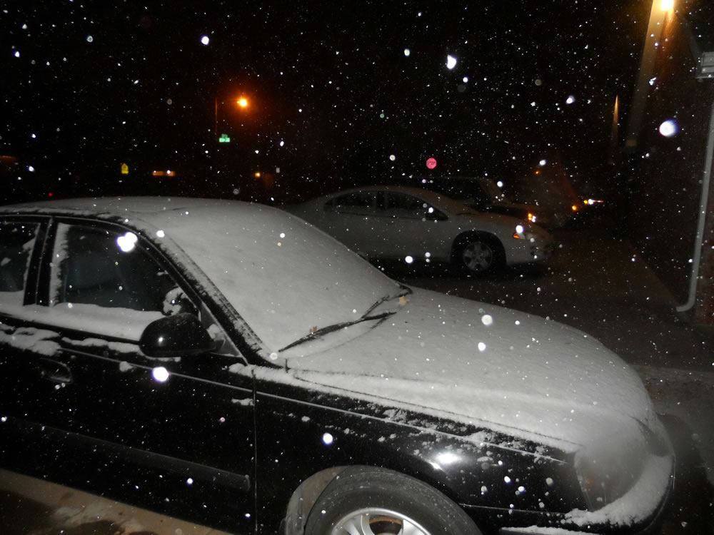
| Two pictures taken from near Texas Tech University in Lubbock late Sunday night as the snow band passed over Lubbock. Photos are courtesy Jenn Daniel. Click on the images for a larger view. | |||
  |
|||
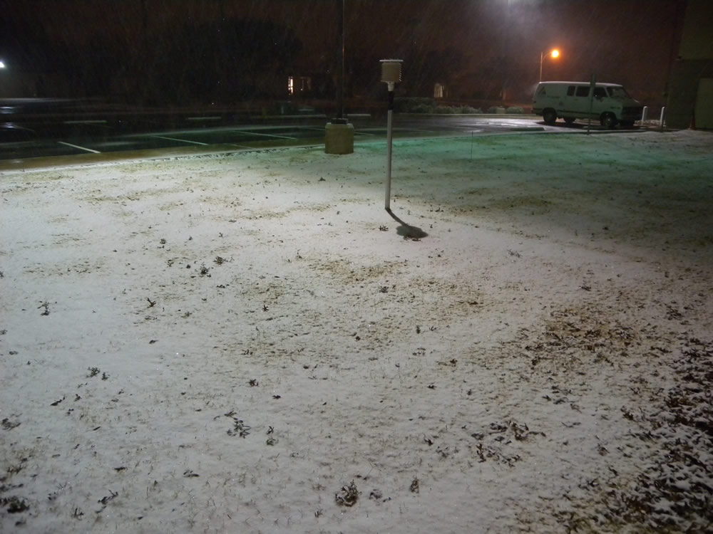
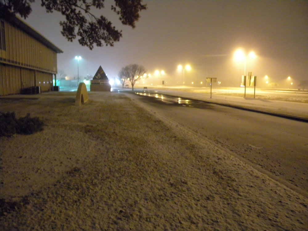
| Two pictures taken from the National Weather Service office at the Science Spectrum in south Lubbock. Click on the images for a larger view. | |||
|
|
|||
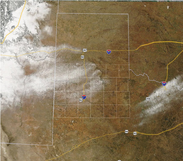
| MODIS satellite image of the snow field across eastern New Mexico and West Texas (another band of snow in north Texas can also be seen). Image taken approximately 4 pm CST, Monday December 10th. | |||

