
Numerous severe thunderstorms are expected across a broad region from the Ohio Valley to the Mid-Atlantic and Northeast States today into tonight. Swaths of damaging wind gusts are expected and some tornadoes are possible. Bertha is expected to bring tropical storm conditions to portions of the Gulf Coast from the Florida Panhandle westward to southeastern Louisiana later today and Wednesday. Read More >
|
Another Round of Wind & Dust |
||
|
|
||
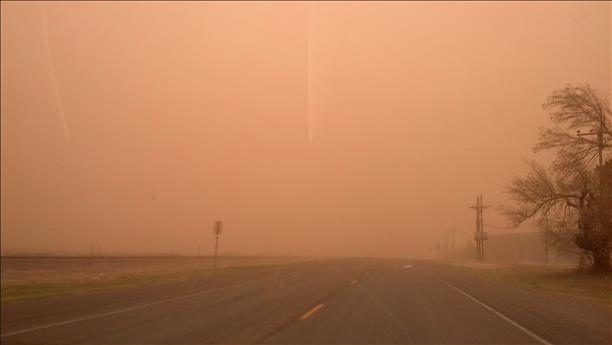
| Picture captured near Shallowater during the late afternoon hours on 23 March 2013. The image is courtesy of KLBK. | ||
|
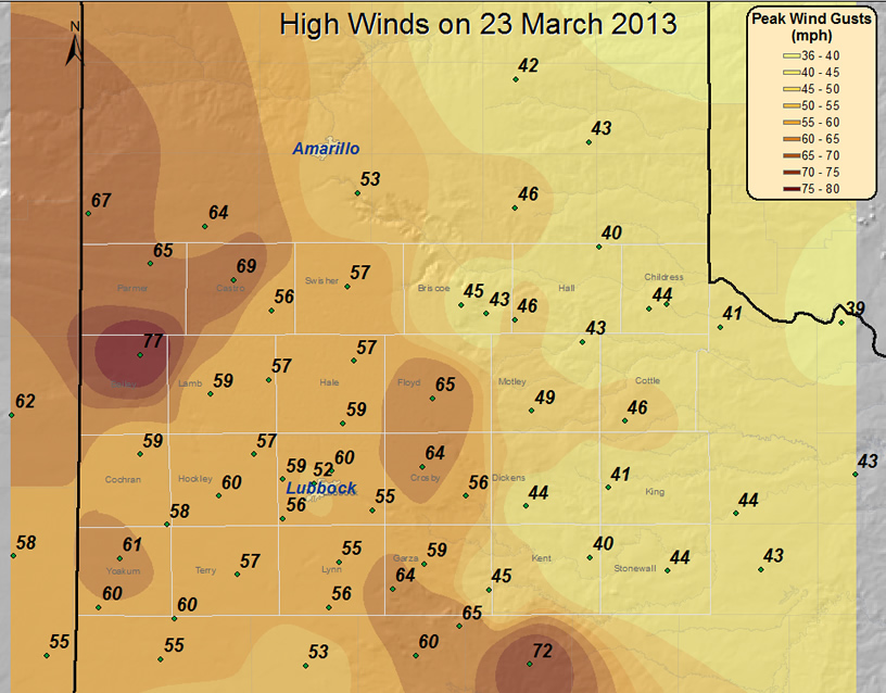
Late Saturday afternoon and evening brought a round of strong winds and blowing dust to the South Plains region, with the most extreme conditions affecting areas on the Caprock. Wind gusts of 55 to 65 mph were common both from the west, ahead of a cold front, and from the northwest and north, immediately behind the cold front (see the below map). The intense winds lofted copious amounts of dust and resulted in a brief period of brownout conditions for many spots on the Caprock. |
||
|
|
||
| Peak winds measured during the afternoon and evening hours of 23 March 2013. Wind data is courtesy of the West Texas Mesonet and the National Weather Service. Click on the image for a larger view. | ||
|
In addition, ahead of the front, the strong and warm westerly winds combined with very dry air to create a high fire danger. These conditions fanned a wildfire that destroyed three buildings and temporarily resulted in the closure of Highway 114 in eastern Hockley County, east of Smyer. Thankfully, behind the front, moisture levels increased and firefighters were able to contain the fire. |
||
|
|
||
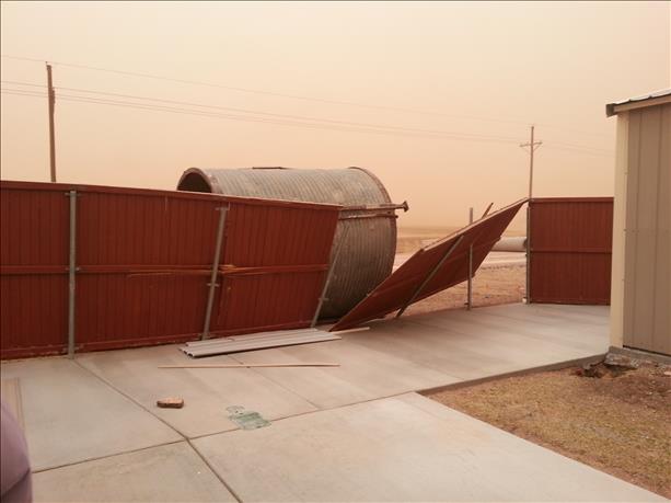
| Pictures of damage caused by the winds from around Lubbock. Images are courtesy of KLBK. Click on the images for a larger view. | ||
|
The storm system that brought the active weather to West Texas was a potent upper-level trough that dove out of the Rockies and into the southern High Plains during the late afternoon and evening hours on the 23rd. This system produced snow in the northern Texas Panhandle and points north, but it moved too far north to bring any meaningful precipitation to the South Plains and Rolling Plains. Instead, strong wind fields and a powerful cold front were all the South Plains could muster from this system. After a round of strong to severe winds and brown skies, winds were slow to decrease Saturday evening as Canadian air filtered in from the north. Temperatures turned much colder, with lows by Sunday morning only in the teens and 20s. These temperatures, combined with still breezy winds, resulted in wind chill readings in the single digits and teens early Sunday morning. |
||
|
|
||
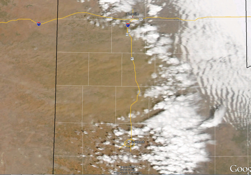
| MODIS visible satellite image taken around 3 pm on 23 March 2013. Click on the image for a larger view. | ||
|
The above satellite picture shows what the wind and dust storm looked like from space. Note several well-defined plumes of dust originating from eastern New Mexico and points very near the TX/NM state line. These dust plumes initially spread east, but then were whisked southward as the cold front moved in from the north. The below map shows plots of the wind and dust storm reports that the National Weather Service collected from the event. In addition, the chilly low temperatures recorded the following morning are available. The preliminary storm reports for this wind and dust event can be FOUND HERE. |
||
|
|
|||
|
Toggle Storm Reports
|
Toggle Peak Wind
Gust (mph) |
Toggle Peak Sustained
Wind Speeds (mph) |
Lows on 3/24/2013
|
|
Data courtesy of the West Texas Mesonet |
|||

