 |
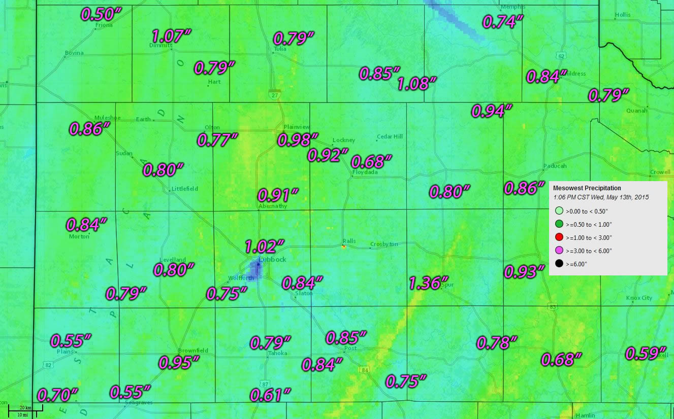 |
| Twenty-four hour rainfall totals ending at 1 pm on Wednesday, 13 May 2015. The data is courtesy of the West Texas Mesonet and the National Weather Service. The background map is radar-estimated rainfall. |
| |
| A quick-moving upper level disturbance acting upon bountiful moisture generated a swath of widespread rain early Wednesday. This rain shield moved from southwest to northeast across the South Plains region and provided several hours of steady light to moderate rain through the morning hours. A few locations even experienced a couple of rumbles of thunder. |
| |
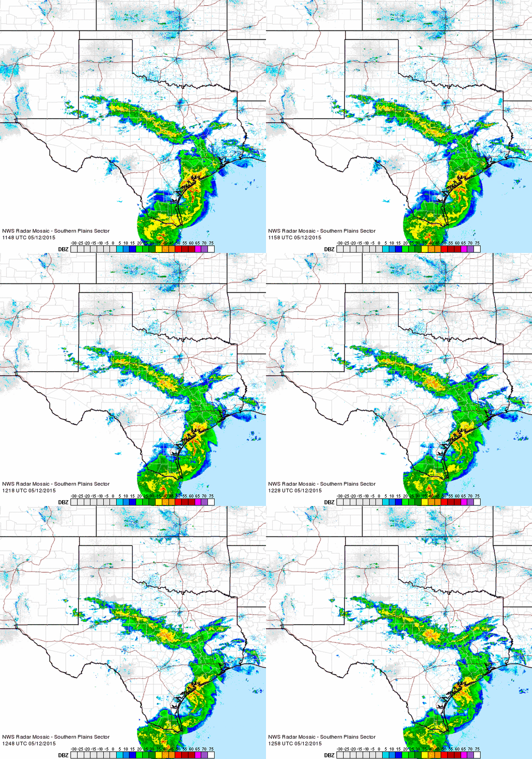 |
| Regional radar animation valid from 6:18 to 7:28 am on Wednesday, 13 May 2015. |
| |
| The widespread rain shifted north and east of the area by early afternoon, but not before dropping widespread three quarter to one inch amounts. A few spots, including the Lubbock Airport even recorded slightly over an inch. The 1.02 inches of rain that fell at Lubbock brought the official tally for the year up to 9.70 inches, which is 5. 02 inches above the average. In contrast, last year at this time only 0.90 inches had fallen to this point in the year. |
| |
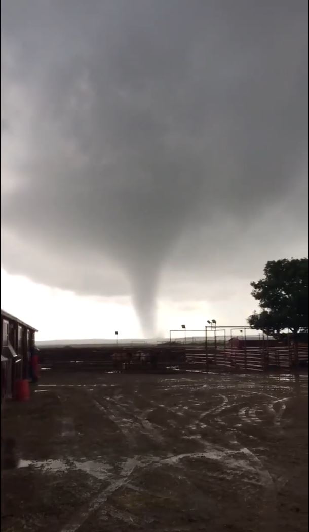 |
| Tornado observed near 6666 Ranch in Guthrie, Texas, around 6 pm on 13 May 2015. The image was captured from video taken by Sadie Tarver and relayed by KCBD. |
| |
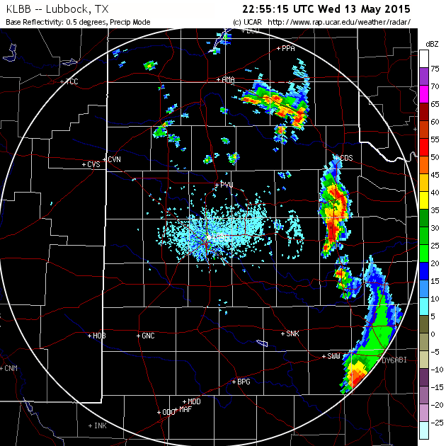
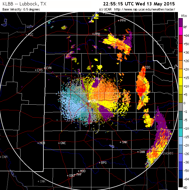
| After the main shield of rain shifted east, there was enough sunshine and heating that another round of isolated to scattered thunderstorms developed during the late afternoon and evening hours. This activity moved across the southern Texas Panhandle and Rolling Plains bringing rain and lightning. In general, this activity was not severe, but one storm organized enough to produce a brief tornado near Guthrie during the early evening hours. Thankfully, the tornado remained over open land before dissipating. |
| |
|
|
| Lubbock WSR-88D radar reflectivity (left) and velocity (right) data around the time of the tornado near Guthrie. |
| |



 Follow us on X
 Follow us on Facebook
 Follow us on YouTube
 LUB RSS Feed


