|
Mid-October brings severe storms and heavy rain |
|
 |
|
|
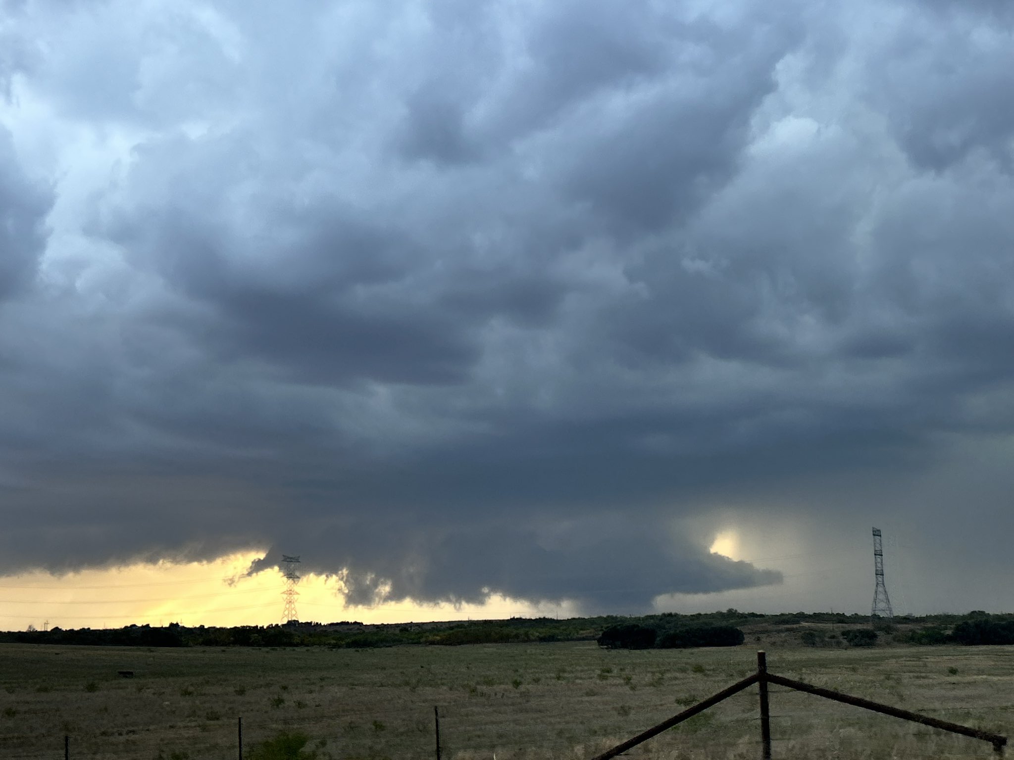
Low-hanging wall cloud associated with a supercell storm near Dickens Tuesday evening (13 October 2026). The image is courtesy of Jacob (@Jigsaw9051Wx) on X. |
|
|
Warm temperatures (upper 80s to mid-90s) and unusually moist conditions (dewpoints in the 60s and lower 70s) for mid-October fueled a bout of strong to severe thunderstorms late Tuesday afternoon into Tuesday evening (13 October). |
|
 |
|
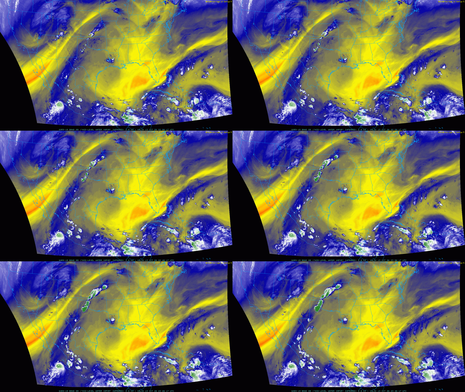
| Water vapor satellite loop valid from 5:06 pm to 6:46 pm on Tuesday (13 October 2026). | |
| The moisture included a mid-upper level tap from Hurricane Simon, while it was still churning off the west coast of Mexico. The tropical fed joined forces with very humid air flowing northwestward off the Gulf at lower levels. The warm and moist conditions resulted in strong instability across West Texas by late Tuesday afternoon. | |
 |
|
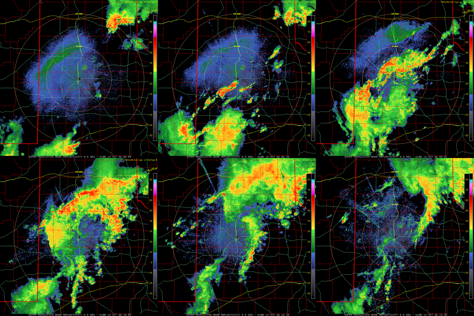
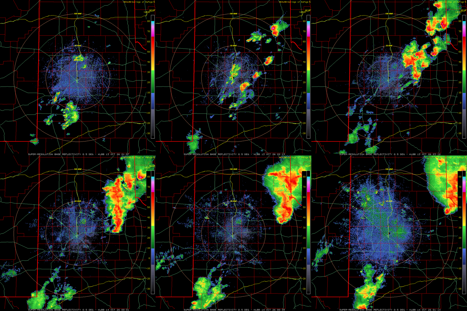
| Lubbock WSR-88D radar animation valid from 4:07 pm to 8:14 pm on Tuesday (13 October 2026). An additional radar animation, valid from 1:59 am to 8:35 am on Wednesday (14 October), can be FOUND HERE. | |
| Sufficient forcing along a surface trough and diffuse dryline provided the trigger for scattered thunderstorm development late Tuesday afternoon. Several cells quickly became strong to severe as they exploited the instability. In addition, moderate vertical wind shear found overhead, between a storm system emerging from the Great Basin and a ridge over the lower Mississippi River Valley, caused some of the storms to gain organization and rotate. | |
 |
|
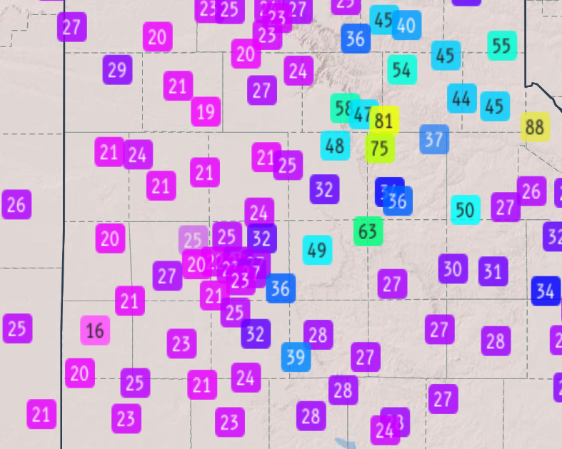
| Peak wind gusts measured by the West Texas Mesonet (WTM) on 13 October 2026. | |
| The most intense activity generated hail as large as baseballs near Matador, while a number of locations experience wind gusts in excess of 60 mph. A peak gust of 81 mph was measured by the West Texas Mesonet (WTM) site near Turkey, where trees were blown down. The wind was accompanied by golf ball size hail and torrential rainfall that flooded some roadways. | |
 |
|
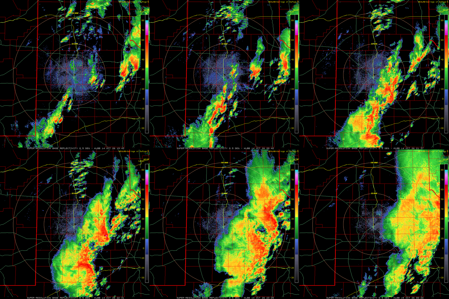
| Lubbock WSR-88D radar animation valid from 2:43 pm to 7:28 pm on Wednesday (14 October 2026). | |
| After a brief lull late Tuesday evening, another round of showers and thunderstorms redeveloped and spread northward across much of the South Plains region early Wednesday morning (14 October). This activity was not severe, but it did generate plenty of lightning and thunder and brief periods of torrential rainfall. As the morning rain faded, another round of more intense thunderstorms formed in the warmer and more unstable air that was present over the Rolling Plains, enhanced by an outflow-aided front sagging southward into the area. | |
 |
|
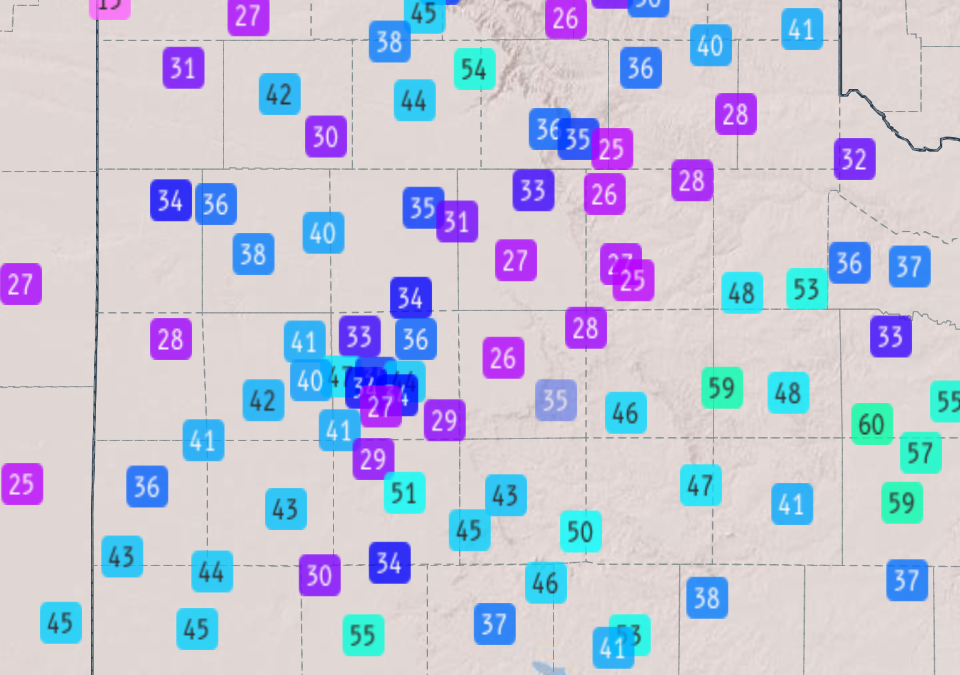
| Peak wind gusts measured by the West Texas Mesonet (WTM) on 14 October 2026. | |
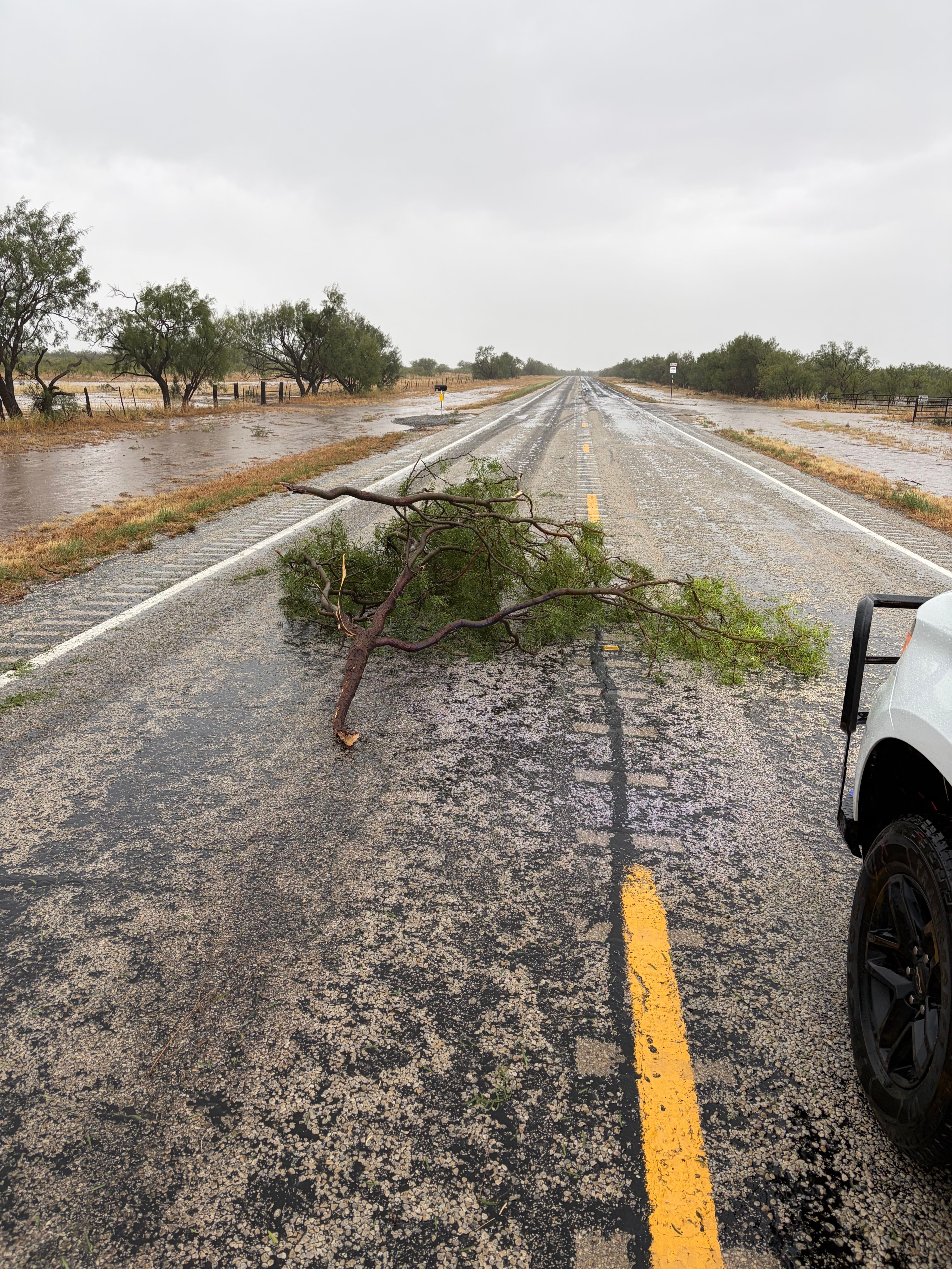
| Widespread heavy rain and scattered severe thunderstorms marched across the Rolling Plains Wednesday afternoon and evening. A peak wind gust of 59 mph was measured by the WTM site west of Guthrie, and roof and tree damage occurred west of Girard. | |
 |
|
| Tree branches down and roadside inundation near Girard on Wednesday evening (14 October 2026). The image is courtesy of Jeremy Carter. | |
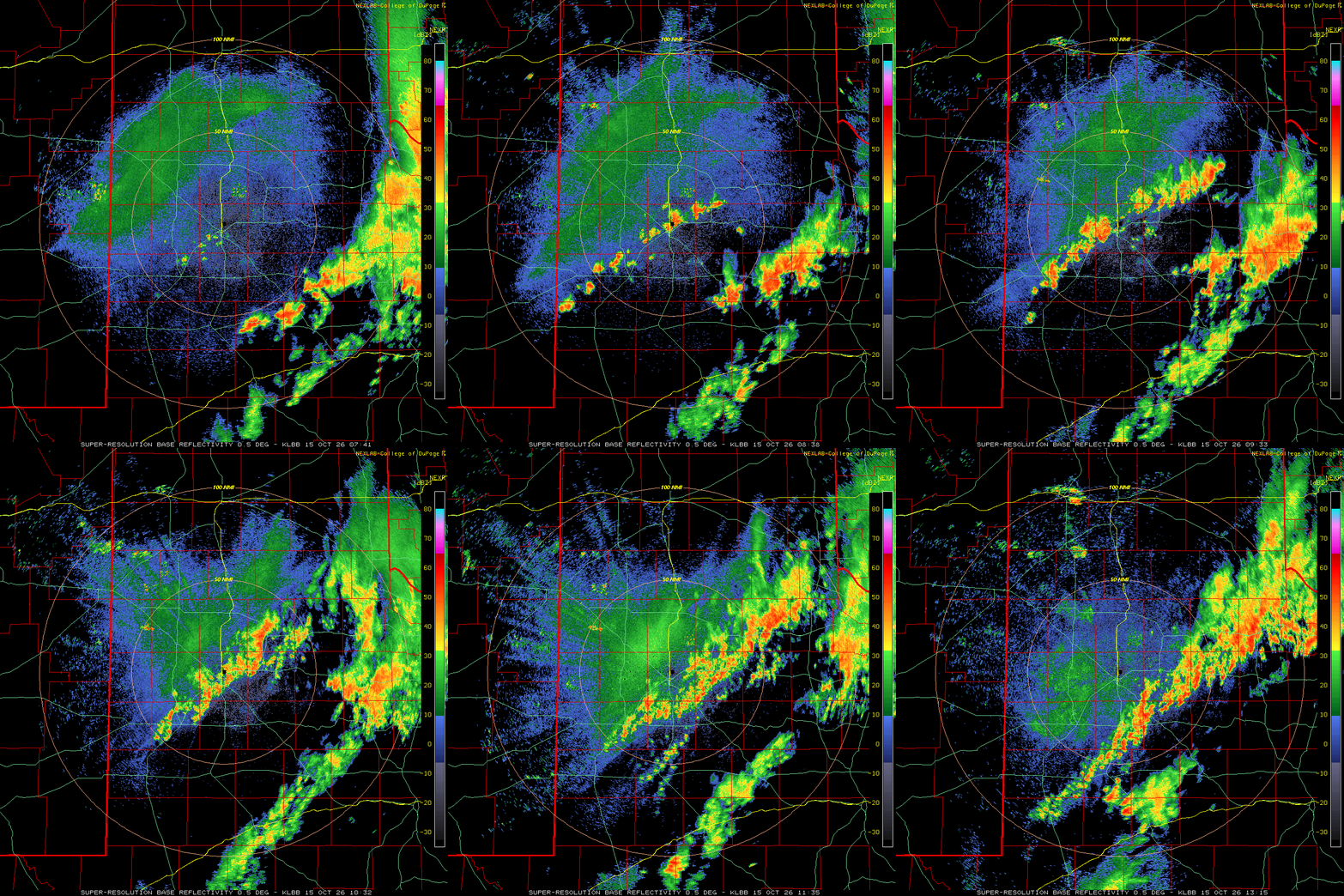
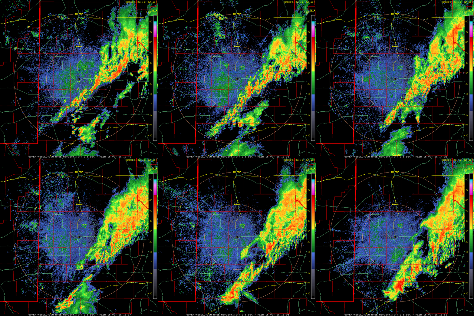
| More widespread was the torrential rain, and repeated rainfall that trained over parts of the Rolling Plains into Wednesday night. Even more showers and thunderstorms formed across the central and southwest South Plains early Thursday morning (15 October), again generating bouts of heavy rain. This final round of rain, heavy at times, gradually shifted east and moved over the already saturated Rolling Plains through the late morning and afternoon hours. | |
 |
|
| Lubbock WSR-88D radar animation valid from 7:40 am to 11:51 am on Wednesday (15 October 2026). An additional radar animation, valid from 2:41 am to 8:15 am on Wednesday (15 October), can be FOUND HERE. | |
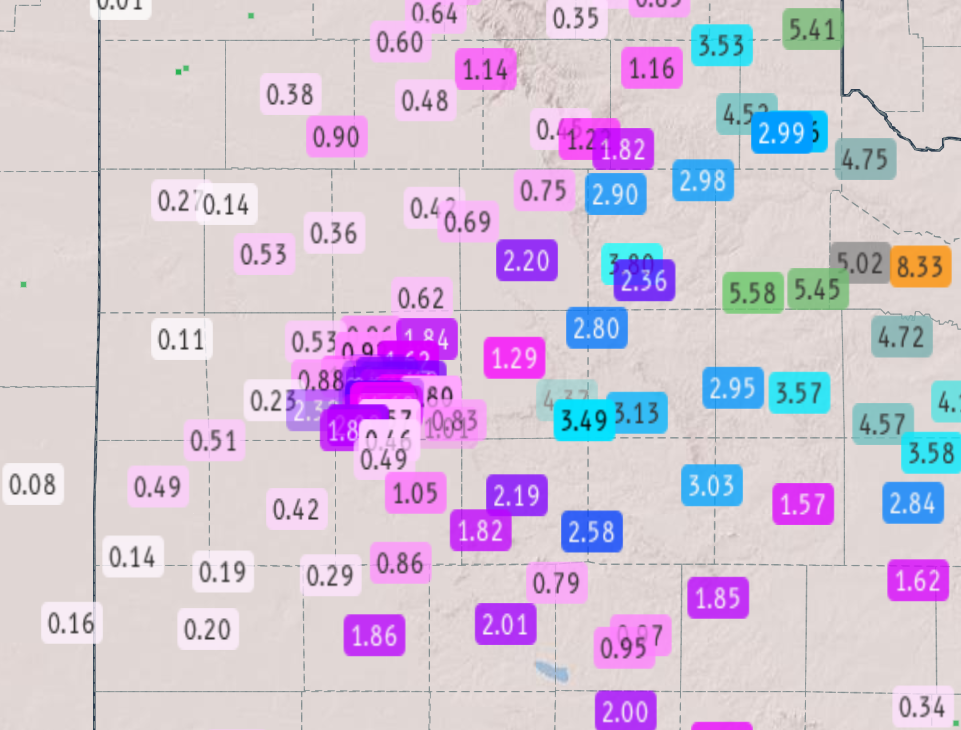
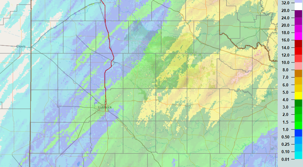
| Through midday Thursday, rain totals of 3 to 5+ inches were common over the central and northern Rolling Plains into the southeast Texas Panhandle. The heavy rain resulted in flooding of many roadways, with runoff filling the previously dry creeks and streams. | |
 |
|
| 3-day radar-estimated and bias-corrected rainfall ending at noon on Thursday (15 October 2026). Measured 3-day rainfall totals from West Texas Mesonet (WTM) over this same period can be VIEWED HERE. | |
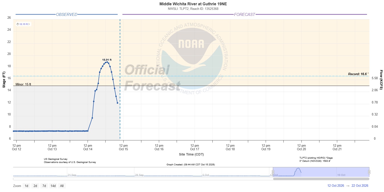
| Runoff from the heavy rain caused the Middle Wichita River at Guthrie 19NE to jump over 10 feet, cresting at 18.91 feet, exceeding the previous record of 16.6 feet. Elsewhere, smaller rises were noted along the Brazos River near Lubbock and the South Wichita River east of Guthrie. | |
 |
|
| Plot of the stage for the Middle Wichita River at Guthrie 19NE in mid-October 2026. | |
|
Rain totals weren't as high farther west, up on the Caprock, though swaths of 1 to 2+ inches occurred. The Lubbock Airport officially recorded 2.04 inches, fairly comparable to what was experienced across much of the City of Lubbock. A list of the preliminary storm reports collected over the active mid-October can be found below. |
|
Preliminary Local Storm Report...Summary
National Weather Service Lubbock TX
832 PM CDT Tue Oct 13 2026

..TIME...   ...EVENT...      ...CITY LOCATION...     ...LAT.LON...
..DATE...   ....MAG....      ..COUNTY LOCATION..ST.. ...SOURCE....
            ..REMARKS..

0504 PM     Hail             Memphis                 34.73N 100.54W
10/13/2026  E0.50 Inch       Hall               TX   Public

            Corrects previous hail report from Memphis.

0507 PM     Hail             1 S Matador             34.01N 100.82W
10/13/2026  E0.50 Inch       Motley             TX   Public

            Report from mPING: Half-inch (0.50 in.).

0508 PM     Hail             1 S Matador             34.01N 100.82W
10/13/2026  E1.75 Inch       Motley             TX   Public

            Report from mPING: Golf Ball (1.75 in.).

0508 PM     Hail             Matador                 34.01N 100.82W
10/13/2026  E1.75 Inch       Motley             TX   Emergency Mngr


0508 PM     Hail             1 S Matador             34.01N 100.82W
10/13/2026  E1.00 Inch       Motley             TX   Public

            Report from mPING: Quarter (1.00 in.).

0510 PM     Hail             1 NE Matador            34.02N 100.81W
10/13/2026  E2.75 Inch       Motley             TX   CO-OP Observer


0531 PM     Tstm Wnd Gst     3 NNW Mcadoo            33.77N 101.04W
10/13/2026  M63 MPH          Dickens            TX   Mesonet

            Measured by the TTU mesonet.

0555 PM     Tstm Wnd Gst     6 NW White River Lake   33.53N 101.17W
10/13/2026  M59 MPH          Crosby             TX   Mesonet

            Measured by the TTU mesonet.

0613 PM     Tstm Wnd Gst     2 E Flomot              34.23N 100.96W
10/13/2026  M75 MPH          Motley             TX   Mesonet

            Measured by the TTU mesonet.

0627 PM     Tstm Wnd Gst     2 WSW Turkey            34.38N 100.93W
10/13/2026  M81 MPH          Hall               TX   Mesonet

            Measured by the TTU mesonet.

0634 PM     Hail             Turkey                  34.39N 100.89W
10/13/2026  E1.00 Inch       Hall               TX   Fire Dept/Rescue


0704 PM     Hail             1 NE Childress          34.43N 100.20W
10/13/2026  E0.75 Inch       Childress          TX   Public

            Report from mPING: Dime (0.75 in.).

0739 PM     Tstm Wnd Gst     11 S Kirkland           34.24N 100.06W
10/13/2026  M61 MPH          Cottle             TX   NWS Employee



 Follow us on X
 Follow us on Facebook
 Follow us on YouTube
 LUB RSS Feed