|
Chilly mid-November showers and thunderstorms |
|
 |
|
|
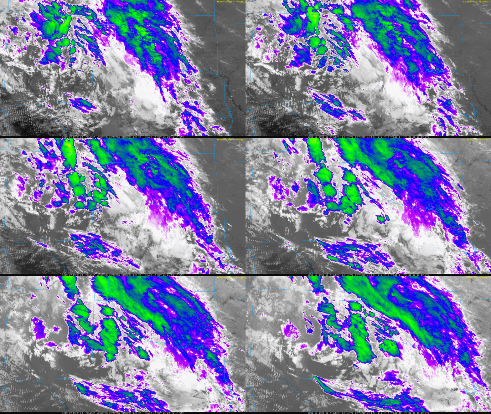
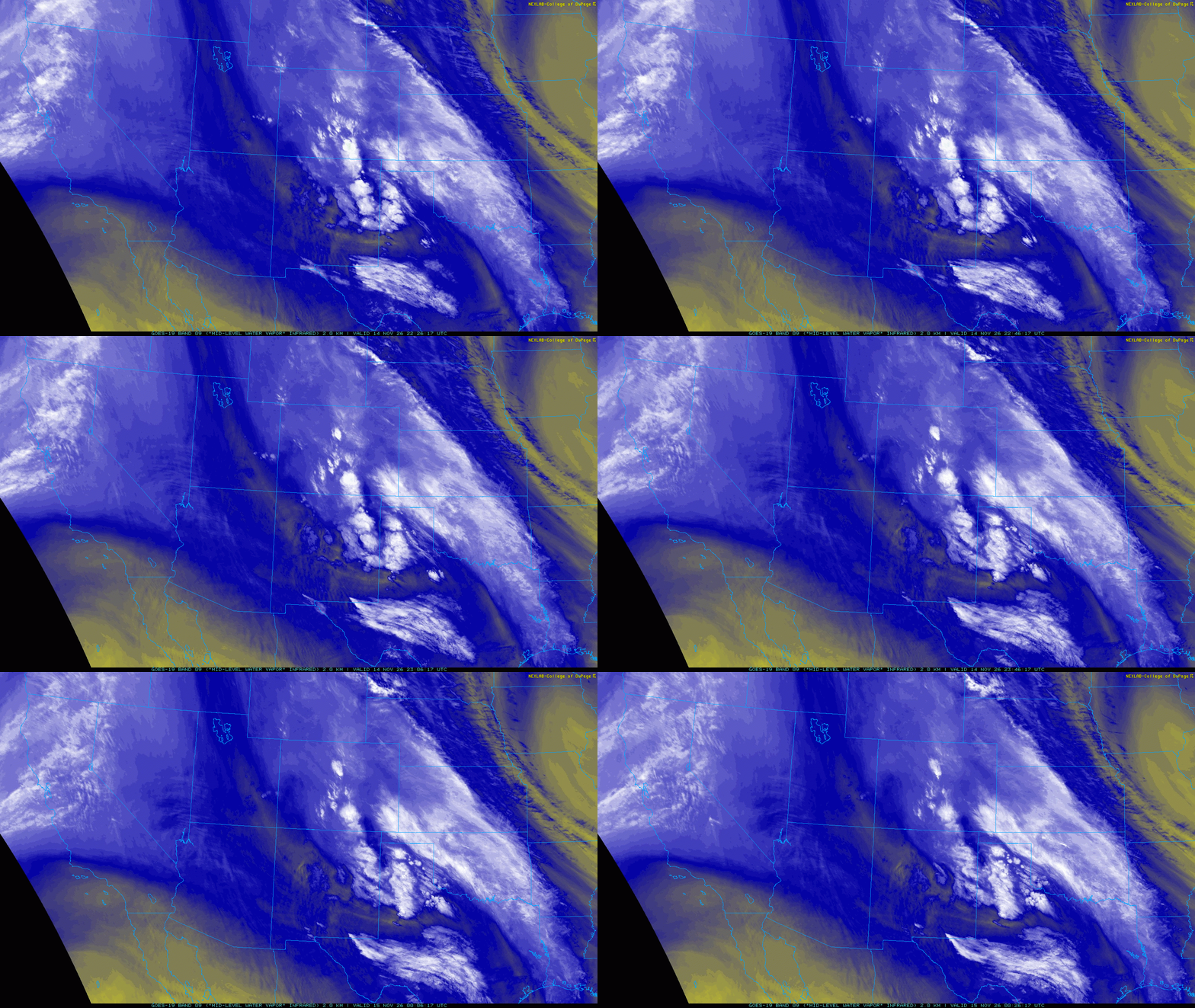
Regional water vapor satellite animation valid from 4:26 pm to 6:26 pm on Saturday (14 November 2026). An infrared satellite animation, valid from 2:16 pm to 6:36 pm on Saturday, can be VIEWED HERE. |
|
|
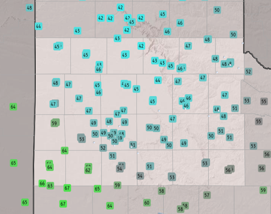
A backdoor cold front edged into northwest Texas on Friday and Friday night (November 13th). Cooler and increasing moist air followed as easterly and southeasterly breezes developed on Saturday (November 14th). Low clouds gradually filled in behind the front, with areas of fog and drizzle forming over the South Plains as moisture increased throughout the day. Where the clouds (and fog) held firm, temperatures remained stuck 40s and lower 50s throughout the day. |
|
 |
|
| Daytime high temperatures observed on Saturday (14 November 2026). The data are courtesy of the West Texas Mesonet (WTM) and NWS COOP observers. | |
|
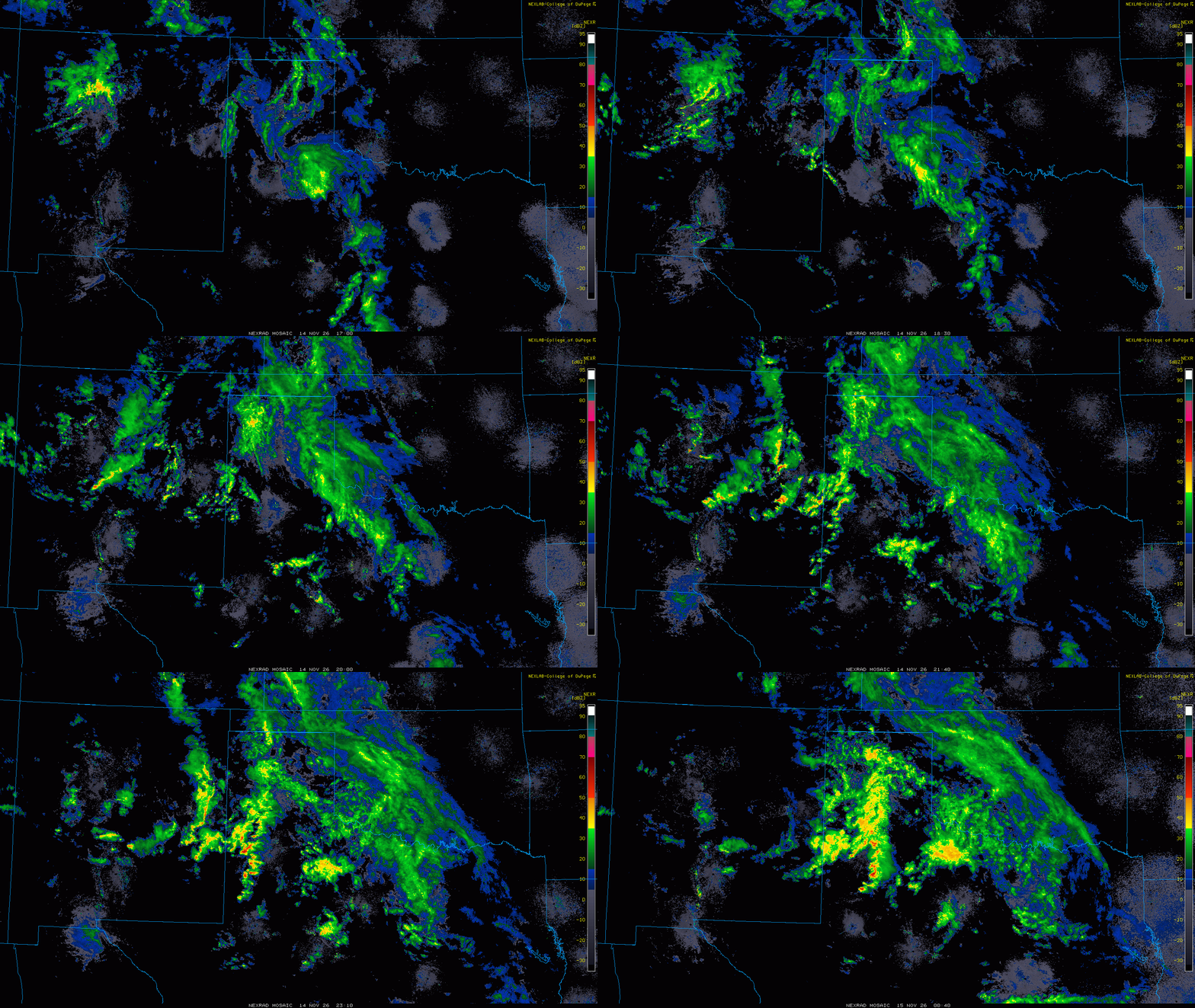
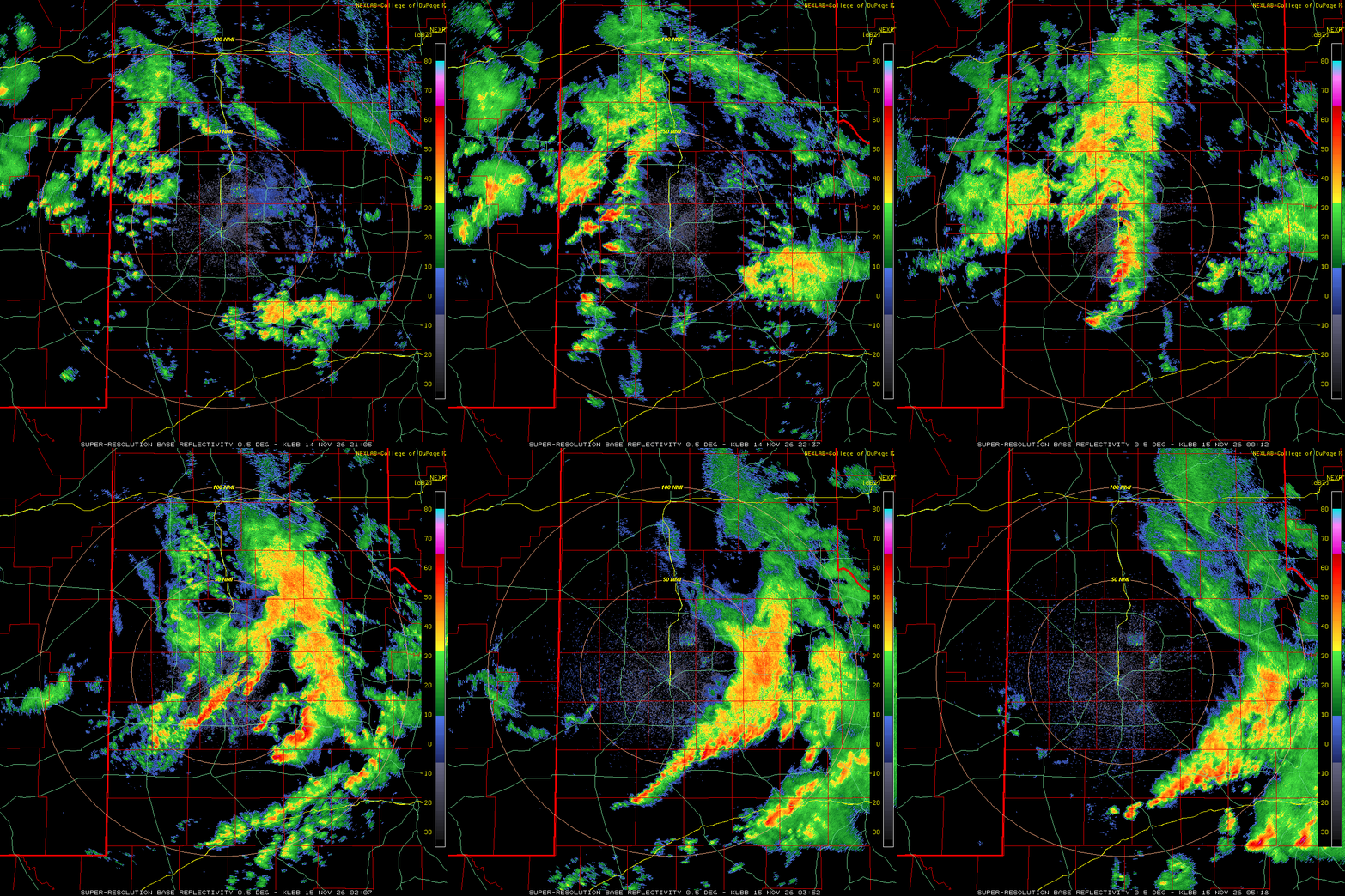
In addition to the cooler air, a disturbance aloft moving in from eastern New Mexico brought an area of early-day showers to the southwest South Plains. The showers faded as they spread farther east, but then regenerated as they moved off the Caprock late-morning and early afternoon. Many locations across the southeast Texas Panhandle and northern and central Rolling Plains received a quarter to half inch of rain as this activity passed over. |
|
 |
|
| Lubbock WSR-88D animation valid from 3:05 pm to 11:18 pm on Saturday (14 November 2026). An additional Lubbock radar animation, valid from 3:27 am to 6:32 pm on Saturday, can be VIEWED HERE. A regional radar animation, valid from 11:00 am to 6:40 pm on Saturday, can be FOUND HERE. | |
|
Eventually, pockets of sunshine developed over southeast New Mexico into the southwest South Plains. This allowed temperatures to warm into the 60s, which in combination with the increased moisture and an approaching mid-late disturbance, led to modest instability. As lift from another round of energy emerging from the southern Rockies overspread West Texas, showers and thunderstorms flourished by early Saturday evening. The showers and embedded storms spread from west-to-east over the South Plains, then into the Rolling Plains, through Saturday evening/night. The most intense cores generated pockets of hail, as large as 1.25 inches in diameter near Tahoka. One storm even produced a tornado east of Seminole around 6 pm. More widespread than the severe weather were brief bouts of moderate to heavy rainfall. |
|
 |
|
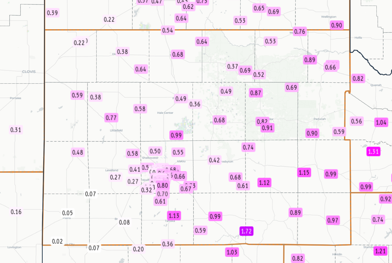
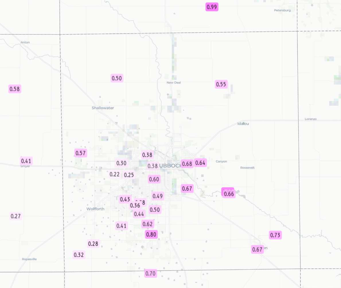
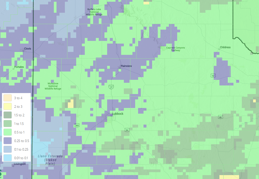
| Radar-estimated and bias-corrected 3-day rainfall ending at noon on Monday (16 November 2026). The measured 3-day rainfall over this same stretch can be VIEWED HERE. The data are courtesy of the West Texas Mesonet (WTM) and National Weather Service (NWS). A closeup of the Lubbock area can be FOUND HERE. | |
|
The entire South Plains region saw at least a little rain, with many locations receiving between a half inch and an inch. A few swaths, primarily from the southeast South Plains into the southern Rolling Plains, recorded over an inch. On the other side of the coin, rain totals near and under a tenth of an inch were common across the southwest South Plains. Officially, the Lubbock Airport measured 0.40 inches during this mid-November event, while Childress tallied 0.56 inches. |
|
Preliminary Local Storm Report
National Weather Service Lubbock TX
711 PM CST Sat Nov 14 2026

..TIME...   ...EVENT...      ...CITY LOCATION...     ...LAT.LON...
..DATE...   ....MAG....      ..COUNTY LOCATION..ST.. ...SOURCE....
            ..REMARKS..

0615 PM     Hail             Tahoka                  33.17N 101.80W
11/14/2026  E1.25 Inch       Lynn               TX   Emergency Manager

            Penny to half-dollar size.



 Follow us on X
 Follow us on Facebook
 Follow us on YouTube
 LUB RSS Feed