|
Widespread rain falls on the pumpkins |
|
 |
|
|
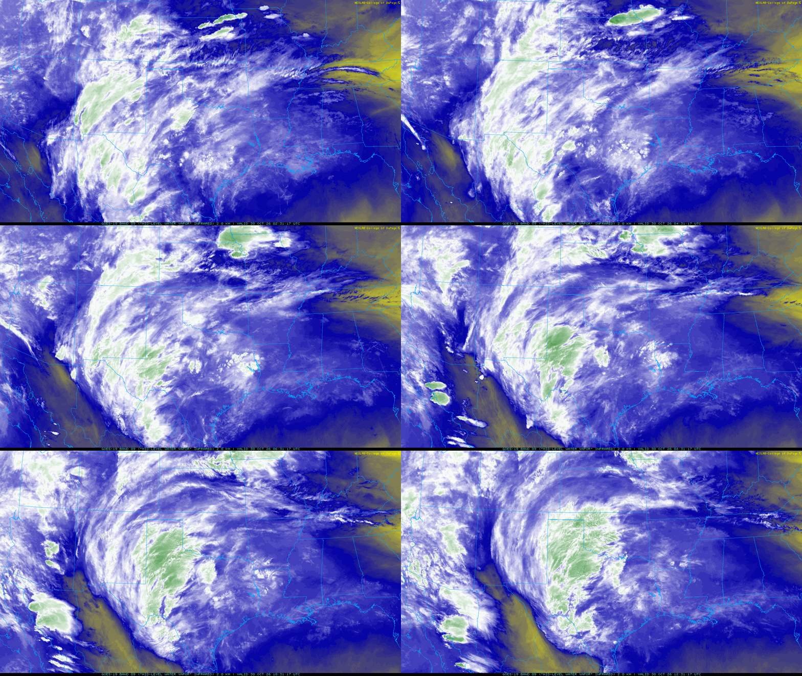
Regional water vapor satellite animation valid from 9:31 pm on Thursday to 7:31 am on Friday (29-30 October 2026). An infrared satellite animation, valid over the same period, can be VIEWED HERE. |
|
|
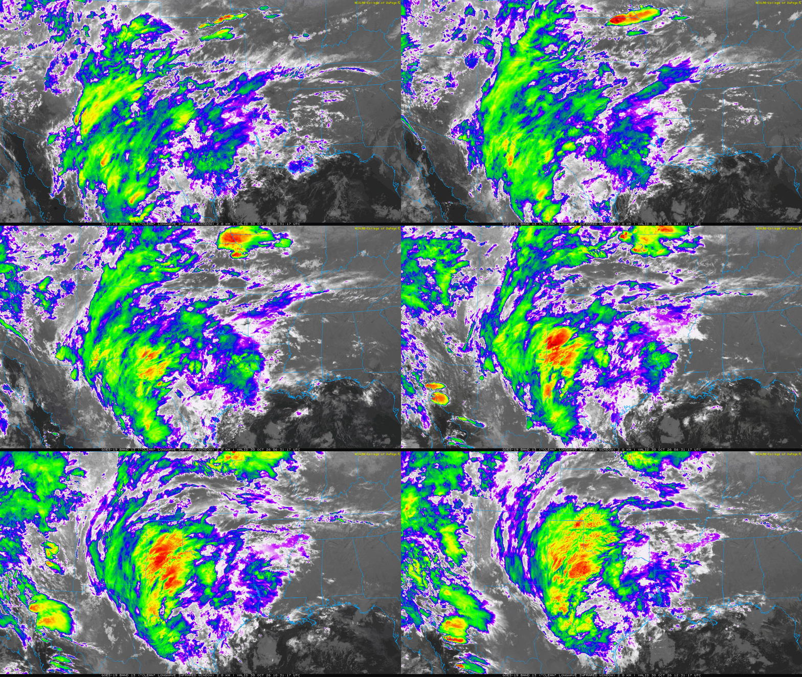
Late October brought yet another round of rain to the southern High Plains. Similar to previous rounds, this system was infused by tropical moisture from the eastern Pacific Ocean. The culprit this time was the remnant of Hurricane Vance. |
|
 |
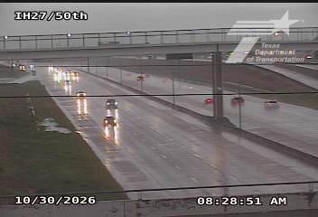 |
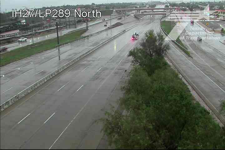
| Wet views of Interstate 27 in Lubbock on Friday morning (30 October 2026): (left) North Loop 289; (right) 50th Street. The images are courtesy of TXDOT. | |
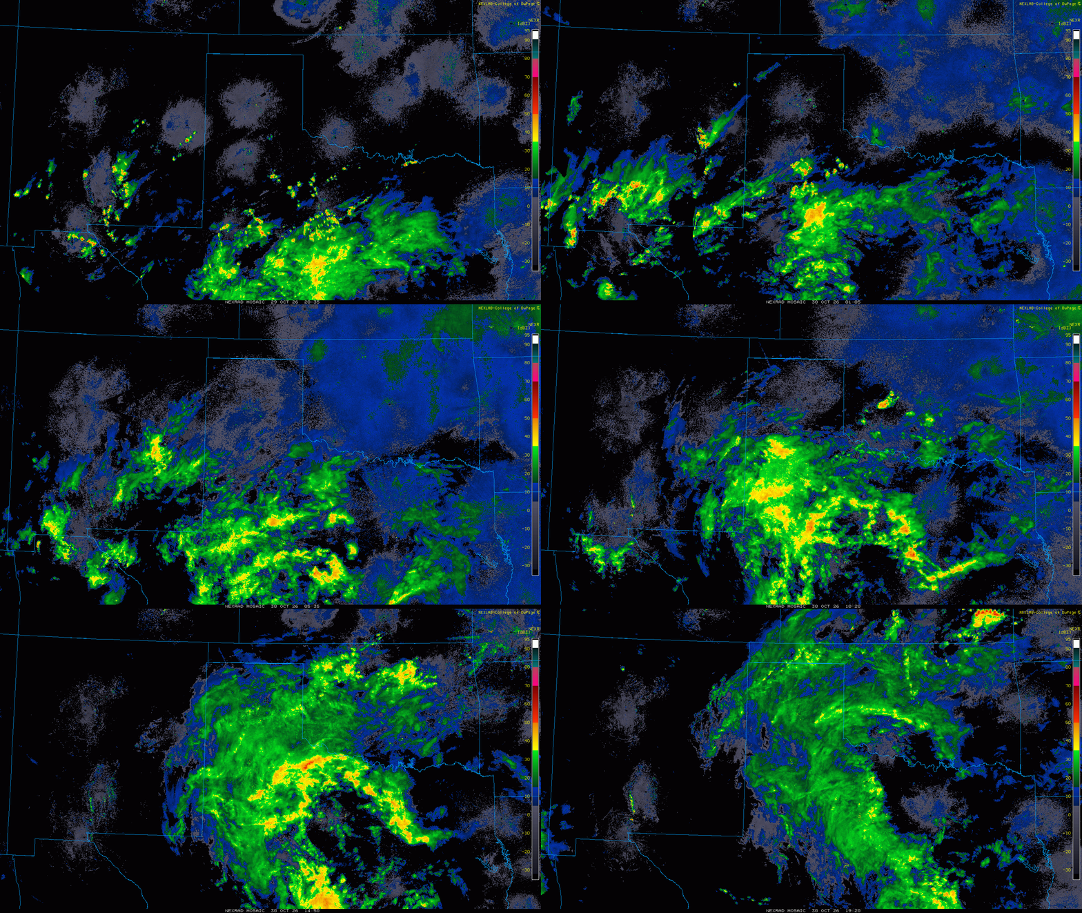
| Well ahead of the main surge of moisture and lift, scattered showers and even a few thunderstorms brought pockets of moderate to heavy rain to the southern South and Rolling Plains Thursday evening (29 October). Following a brief lull in the late evening, more widespread rain spread northward across the entire South Plains region early Friday morning (30 October). | |
 |
|
| Lubbock WSR-88D animation valid from 12:09 am to 2:12 pm on Friday (30 October 2026). A regional radar animation, valid from 4:35 pm on Thursday to 2:20 pm on Friday (29-30 October), can be FOUND HERE. | |
|
The rain, moderate at times, persisted all morning. Thereafter, the rain continued for most spots well into the afternoon, though it gradually diminished in intensity, before eventually coming to an end from west-to-east. |
|
 |
|
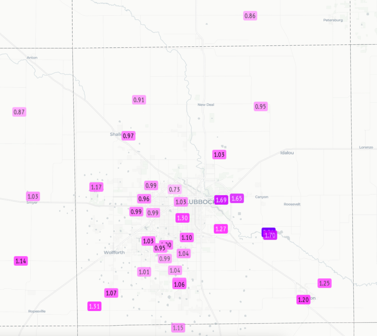
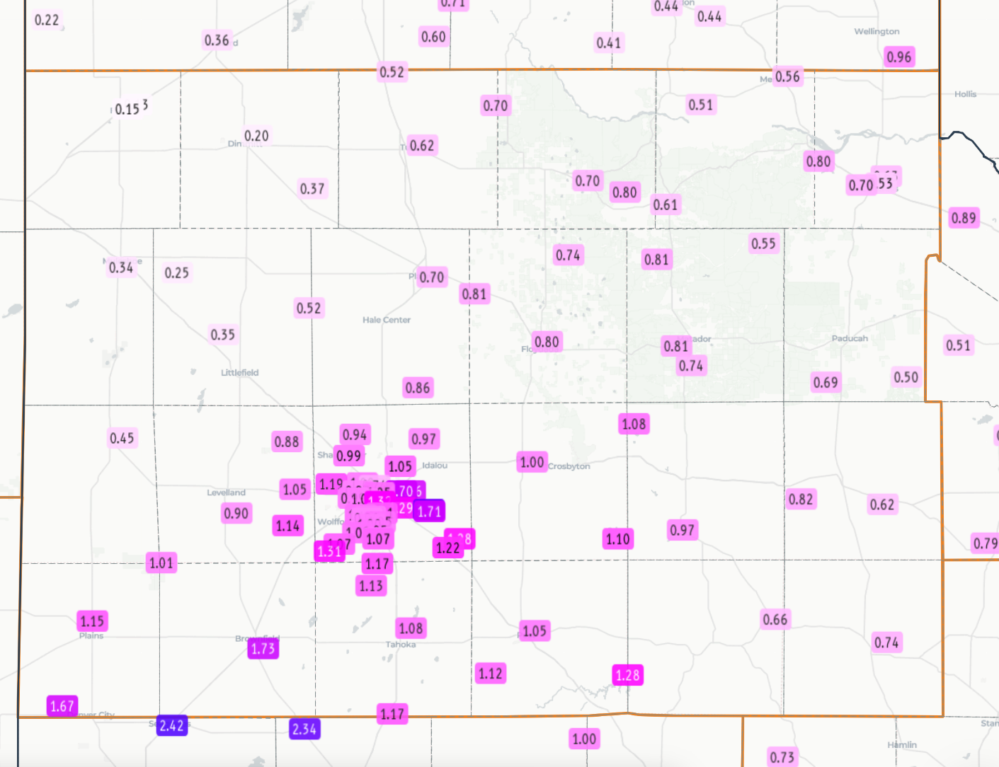
| Measured 24-hour rainfall ending at 2:30 pm on Friday (30 October 2026). The data are courtesy of the West Texas Mesonet (WTM) and National Weather Service (NWS). A closeup of the Lubbock area can be FOUND HERE. | |
|
Very limited instability kept thunder and heavy rain rates to a minimal. Even so, the prolonged rain event resulted in robust rain totals across a good portion of the region. Specifically, much of the southeastern half of the South Plains into the Rolling Plains and southeast Texas Panhandle saw rain total of 0.5 to 1.0+ inches. Rain totals in excess of an inch were common over much of the central and southern South Plains. The northwestern South Plains and southwest Texas Panhandle also received rain, though totals were lighter, generally from a couple tenths to a half inch. The cloudy and rainy weather brought no severe weather to the region, though typical ponding of water in low-lying and poor drainage areas did occur. |
|



 Follow us on X
 Follow us on Facebook
 Follow us on YouTube
 LUB RSS Feed