|
Tropical moisture enhances rain on the southern High Plains |
|
 |
|
|
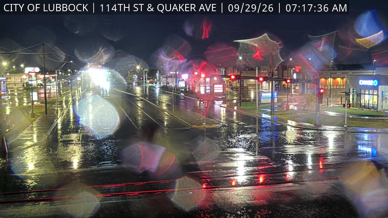
Wet roadways at the intersection of Quaker Avenue and 114th Street in southwestern Lubbock early Tuesday morning (29 September 2026). The image is courtesy of the City of Lubbock. |
|
|
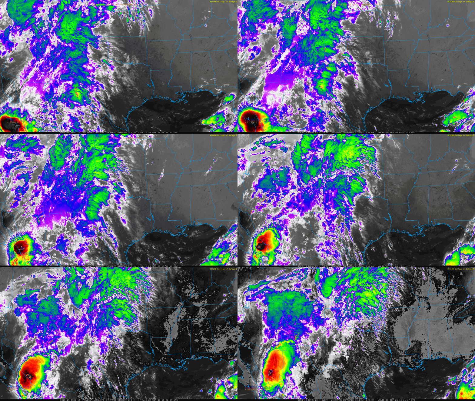
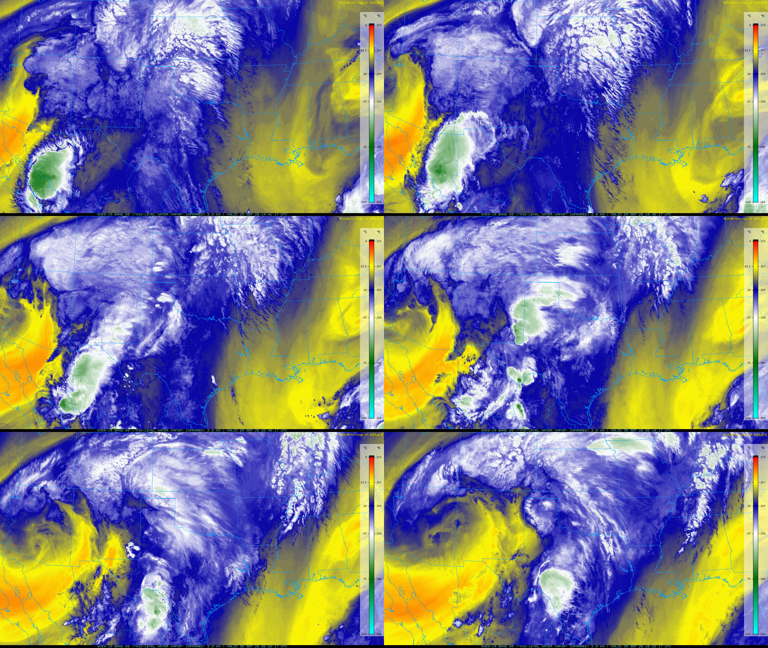
The unsettled latter half of September didn't let up at the end of the month. Instead, following a brief reprieve from the widespread rain September 24th-26th, yet another storm system moved into the Desert Southwest. In advance of the system, abundant Gulf moisture streamed in from the south while rich mid-upper level moisture flowed in from the southwest off the eastern Pacific. The monsoon moisture was further "enhanced" by the remnants of Hurricane Polo after making landfall on Baja California early Tuesday morning (September 29th). |
|
 |
|
| Lubbock WSR-88D animation valid from 6:54 pm on Monday to 7:05 am on Tuesday (28-29 September 2026). | |
| Well in advance of the system, isolated showers and thunderstorms developed over the Rolling Plains Monday evening (September 28th) as richer low-level moisture advanced into the region from the south. A broad area of moisture and lift then emerged from New Mexico early Tuesday (September 29th), supporting more widespread rain, with a few embedded thunderstorms, through the first half of the day. The heaviest thunderstorms targeted the central and southwestern South Plains, where a narrow swath saw as much as 1 to 1.5+ inches of rain. Unfortunately, the rain coverage and intensity faded as advanced northeastward, bringing little to no additional rain to much of the Rolling Plains Tuesday morning. | |
 |
|
| Regional water vapor satellite animation valid from 9:41 am on Tuesday to 5:26 am on Wednesday (29-30 September 2026). An infrared satellite animation, valid from 12:11 am to 1:16 pm on Tuesday (29 September), can be VIEWED HERE. | |
|
A relative lull in precipitation unfolded late Tuesday morning into the early afternoon, though breezy southerly winds continued to carry moisture into the region. As temperatures warmed into the upper 70s and lower 80s, scattered thunderstorms developed near a warm front across the southern Texas Panhandle and northwestern South Plains late Tuesday afternoon. Many of the individual cells began to rotate as they felt the influence of the relatively strong low-level wind shear in place. In addition to dropping brief bouts of heavy, one of the storms produced a documented tornado near Claude. Farther south, much of the South Plains and Rolling Plains remained dry Tuesday afternoon. |
|
 |
|
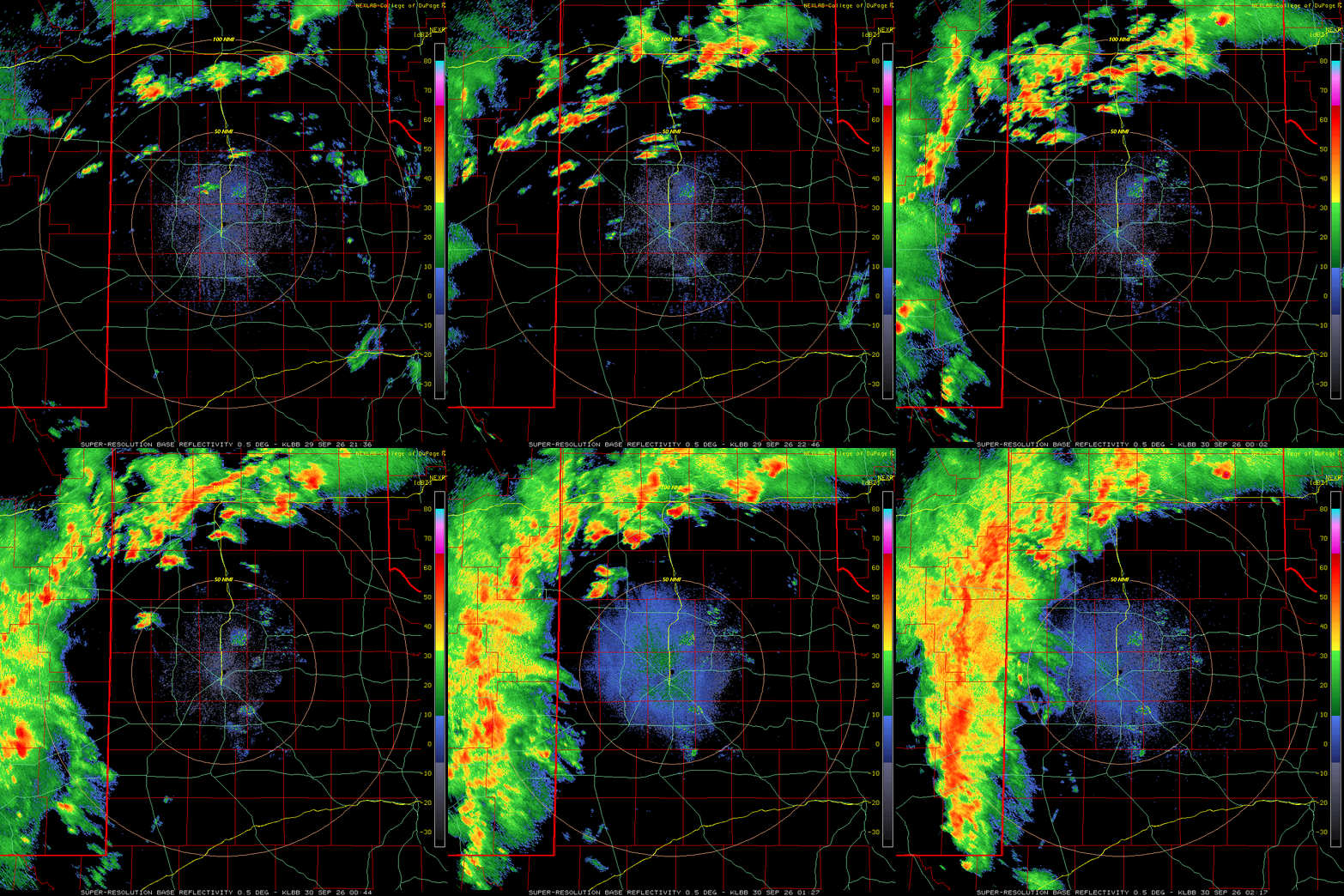
| Lubbock WSR-88D animation valid from 8:59 pm on Tuesday to 5:39 am on Wednesday (29-30 September 2026). An additional radar animation, valid from 4:36 pm to 9:17 pm on Tuesday, can be VIEWED HERE. A regional radar animation, valid from 12:10 am on Tuesday to 5:35 am on Wednesday, can be FOUND HERE. | |
|
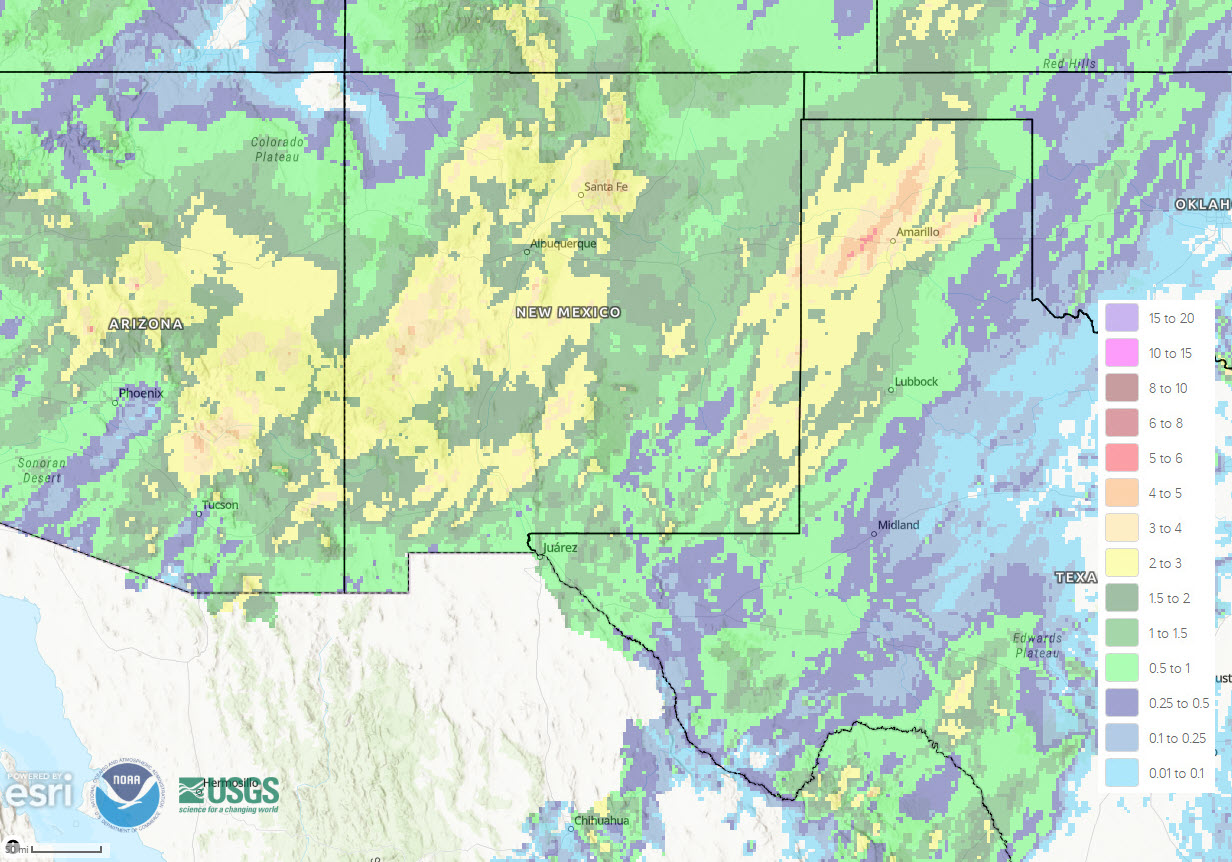
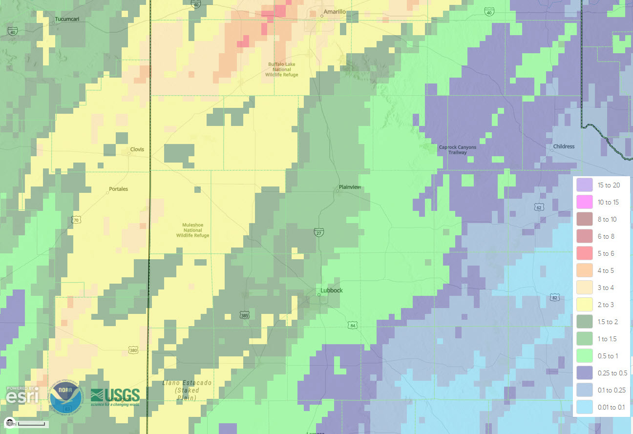
Even greater moisture and lift, including from Polo's remnants, then overspread the region late Tuesday. This led to a rapid increase in shower and thunderstorm activity that spread into the South Plains region from the west Tuesday evening. A broad shield of rain and embedded thunderstorms advanced eastward across the Caprock late Tuesday evening/night. One storm generated a wind gust to 65 mph at the West Texas Mesonet (WTM) site 6 miles west-northwest of Denver City just before 10:30 pm. However, the most widespread impact was the heavy rain that, similar to the previous week, targeted the southwest Texas Panhandle and western South Plains with an additional 2 to 3+ inches of rain. |
|
 |
|
| 3-day radar-estimated and bias-corrected rainfall (inches) ending at 7 am on Wednesday (30 September 2026). An expanded regional view of the 3-day radar-estimated rainfall can be FOUND HERE. | |
|
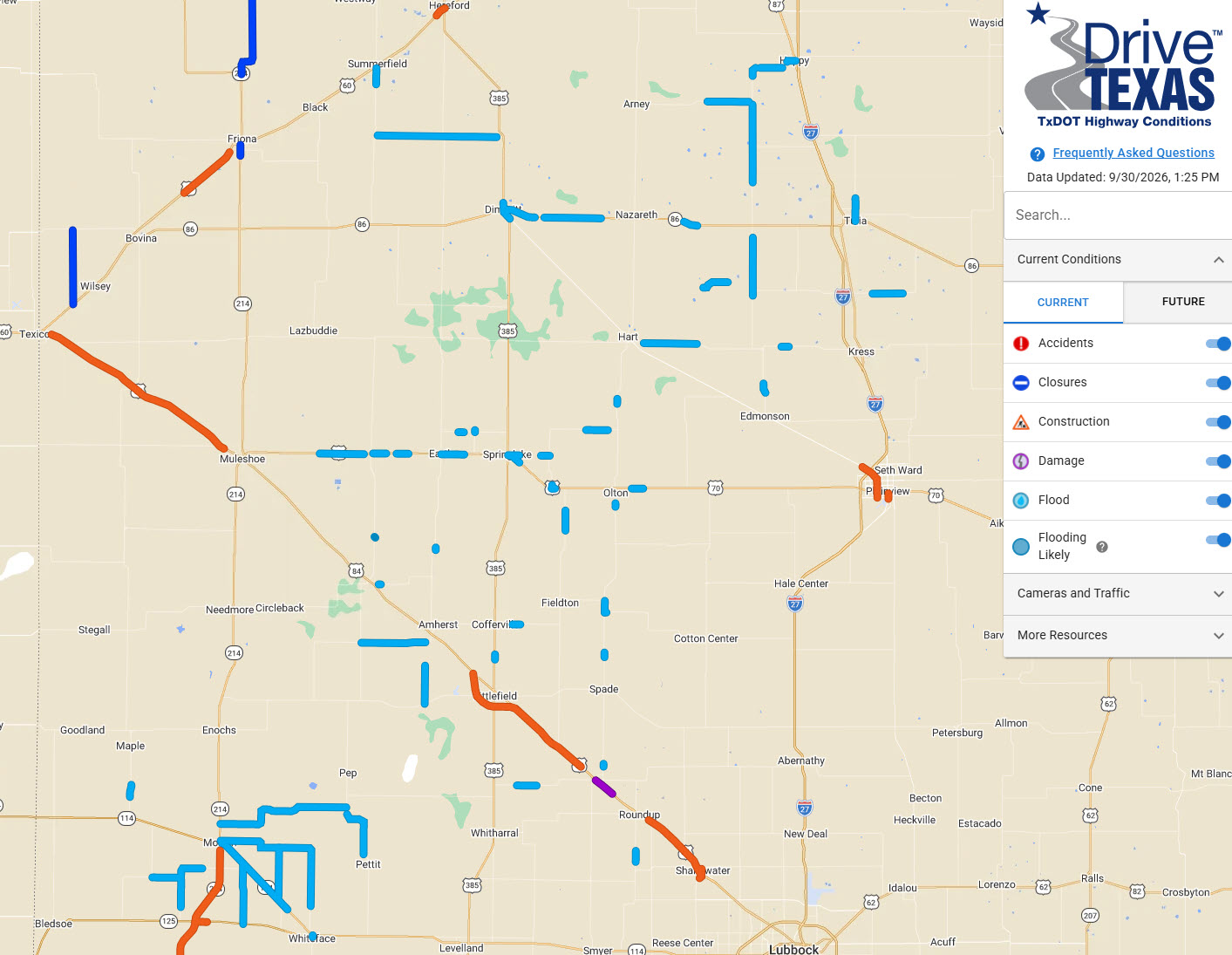
The heavy rain, falling on already saturated soils, led to excessive runoff that caused flash flooding and inundation of low-lying and poor drainage areas. The flooding led to the closure of several County and Farm-to-Market roads across Parmer and Castro County, while TXDOT documented water portions of many roads from the southwestern Texas Panhandle into the western South Plains. |
|
 |
|
| TXDOT road status captured at 1:30 pm on Wednesday (30 September 2026). The blue represents water on the roadways. | |
|
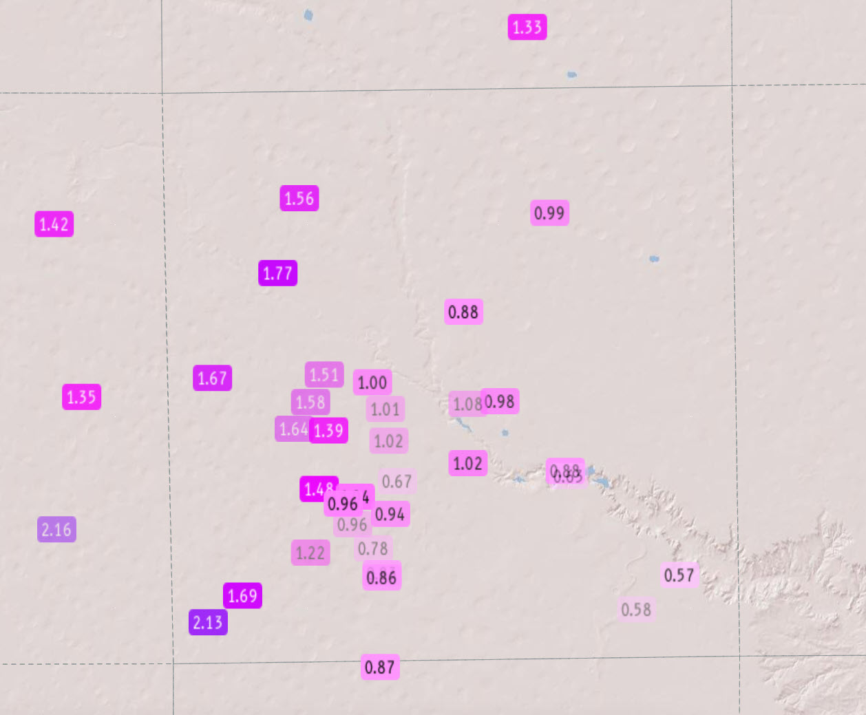
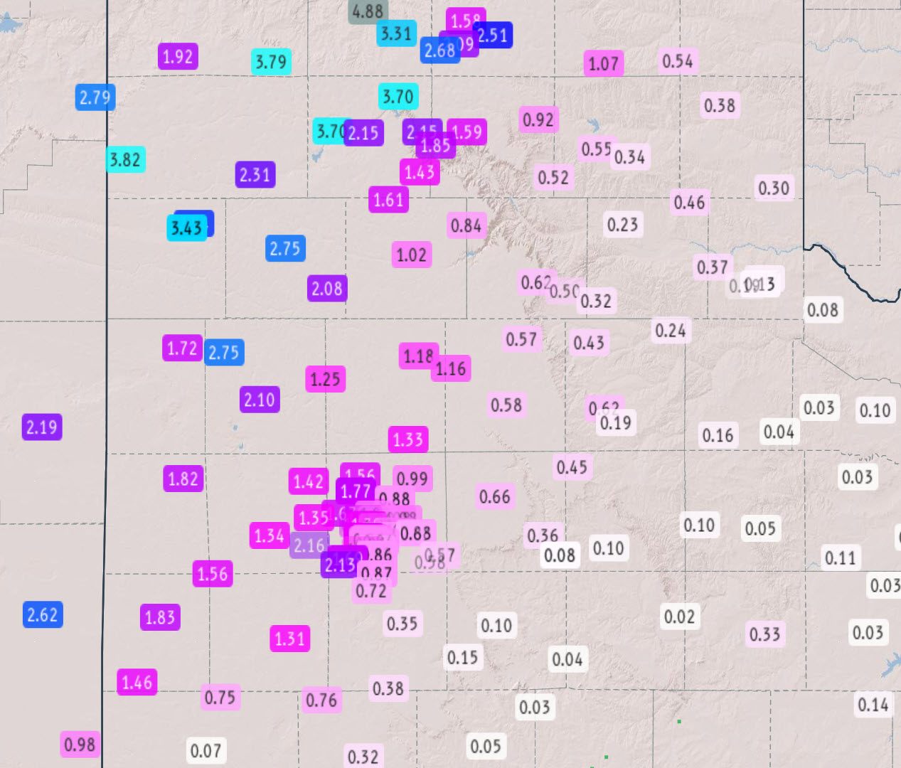
The rain continued eastward across the Rolling Plains and southeast Texas Panhandle early Wednesday morning (September 30th), though at a greatly diminished intensity. The rain then quickly ended, from southwest-to-northeast, as much drier air moved in aloft after daybreak. While locations on the Caprock experienced good to excessive amounts of rain over this 2-day event, locations off the Caprock didn't fare so well. Many locations in the Rolling Plains only tallied several hundredths to a couple tenths of an inch of rain from Monday through midday Wednesday (28-30 September). |
|
 |
|
| 3-day rainfall (inches), courtesy of the West Texas Mesonet (WTM) and National Weather Service (NWS), ending at 11:30 am on Wednesday (30 September 2026). A closeup of the Lubbock area can be FOUND HERE. | |
|
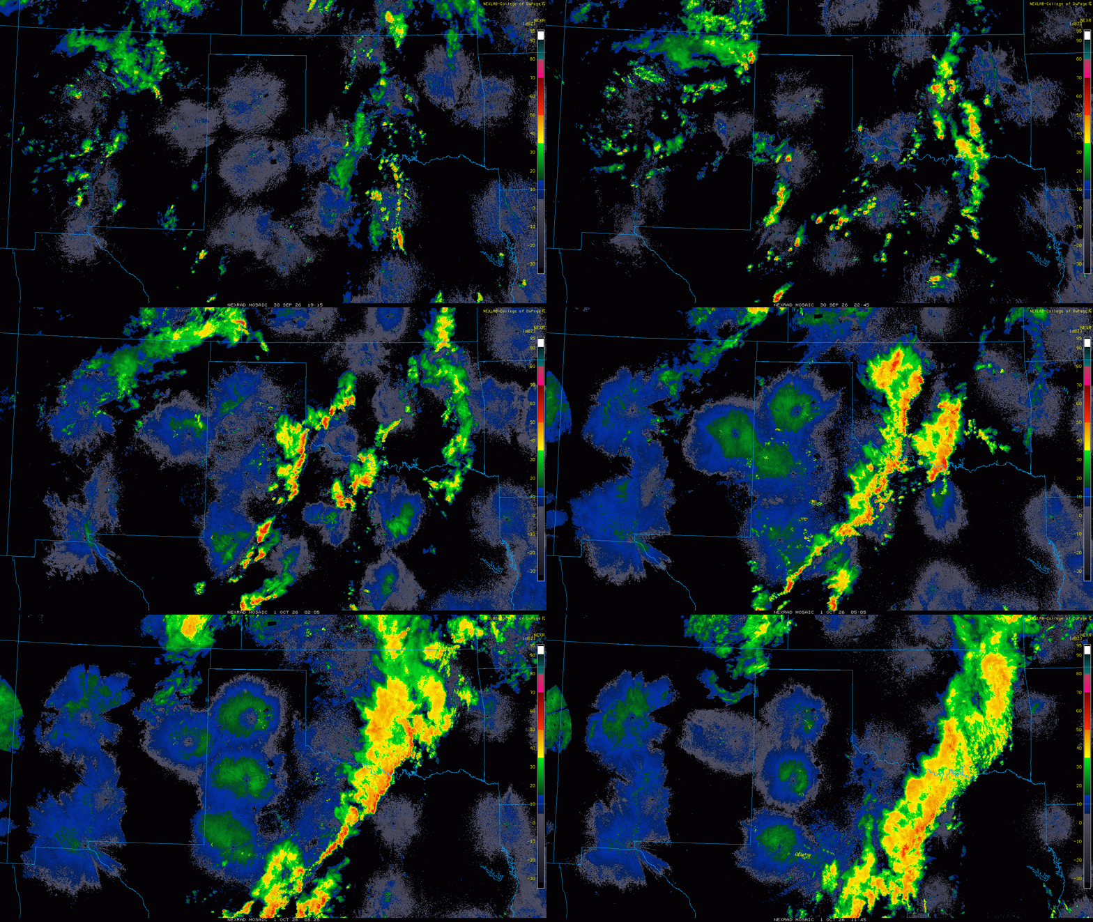
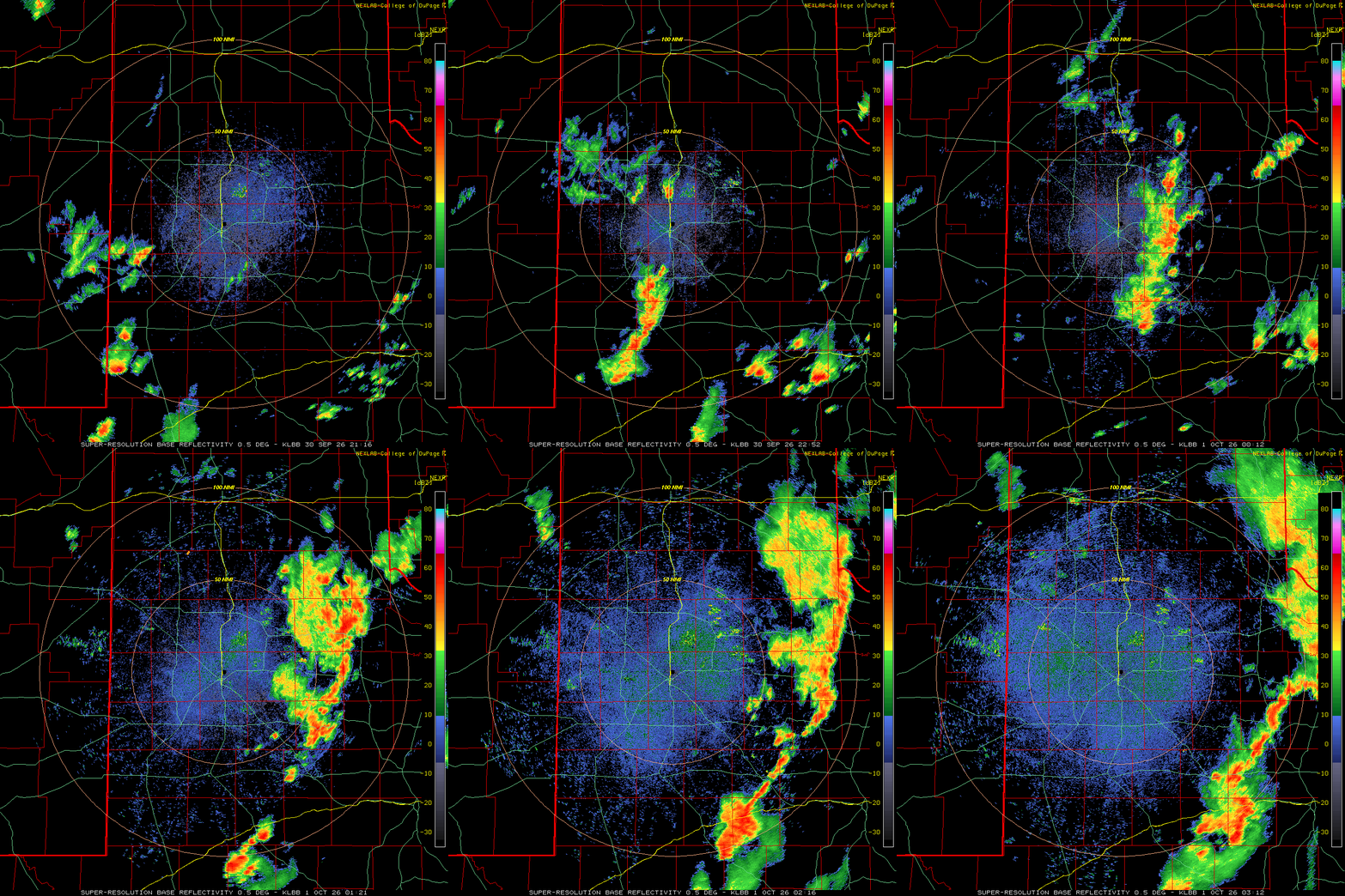
One final round of thunderstorms developed across the southwest South Plains Wednesday afternoon, then grew in coverage and intensity as it moved off the Caprock in the evening. Thankfully, this activity largely missed spots that received the heavier rain earlier and instead brought a little rain to much of the Rolling Plains and southeast Texas Panhandle, where they desperately needed it. |
|
 |
|
| Lubbock WSR-88D animation valid from 4:16 pm to 10:12 pm on Wednesday (30 September 2026). A regional radar animation, valid from 2:15 pm on Wednesday to 6:45 am on Thursday (30 September-1 October), can be FOUND HERE. | |
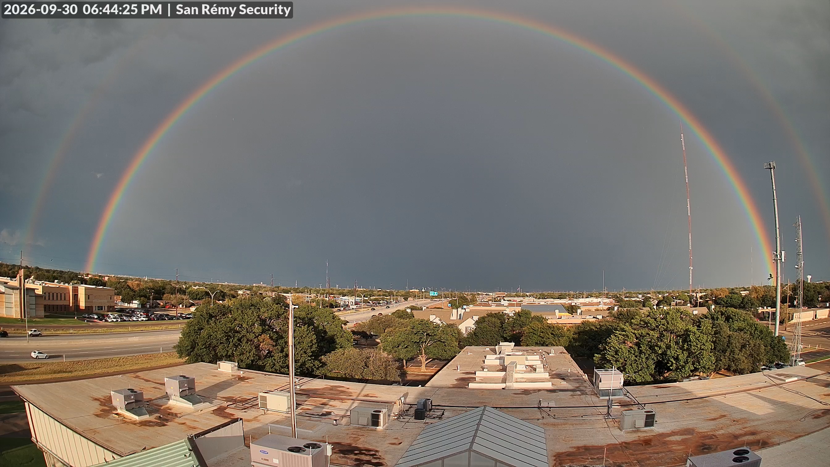
| Rain totals off the Caprock Wednesday evening weren't extreme, generally from around a 1/10 to 1/4 inch, but a few swaths did get a quick 1/2 to 1+ inches. The rain came with gusty winds, peaking at 60+ mph at the Estelline 4SSE and Paducah 10SW WTM sites. Lubbock largely missed out on this final bought of rain, but did witness a beautiful rainbow as the activity skirted by to the east. | |
 |
|
| Double rainbow viewed from south Lubbock Wednesday evening (30 September 2026). | |
|
Officially, the Lubbock Airport measured 0.84 inches over this 2-day stretch, which boosted the annual running total to 11.99 inches (though still over 3 inches below the average year-to-date precipitation). Farther east, Childress Airport officially measured 0.61 inches over this period, lifting their annual total to 12.92 inches (just under 7 inches below the average year-to-date precipitation). A list of the preliminary storm reports collected from September 29th to 30th can be found below. |
|
Preliminary Local Storm Report...Summary
National Weather Service Lubbock TX
1000 AM CDT Wed Sep 30 2026

..TIME...   ...EVENT...      ...CITY LOCATION...     ...LAT.LON...
..DATE...   ....MAG....      ..COUNTY LOCATION..ST.. ...SOURCE....
            ..REMARKS..

1024 PM     Tstm Wnd Gst     6 WNW Denver City       32.99N 102.94W
09/29/2026  M65 MPH          Yoakum             TX   Mesonet

            Additional severe gusts to 59 mph measured
            from 1022 to 1023 PM.

0925 PM     Flash Flood      3 ENE Friona            34.65N 102.67W
09/29/2026                   Parmer             TX   Public

            Right lanes closed due to high water along a
            portion of US-60 northeast of Friona.

0950 PM     Flash Flood      6 NNE Farwell           34.47N 102.99W
09/29/2026                   Parmer             TX   Dept of Highways

            FM 2396 is closed due to flooding.

1230 AM     Flash Flood      6 NNW Bovina            34.60N 102.92W
09/30/2026                   Parmer             TX   Law Enforcement

            Several county roads to the northeast of
            US-60 were reported as impassable due to
            flood waters.

0953 PM     Flash Flood      1 S Summerfield         34.72N 102.51W
09/29/2026                   Castro             TX   Dept of Highways

            Low water crossings are flooded on FM 1057
            south of Summerfield.

0545 AM     Flash Flood      3 S Summerfield         34.69N 102.51W
09/30/2026                   Castro             TX   Law Enforcement

            FM1057 was closed south of Summerfield and
            north of FM2397 due to flooding.

0820 PM     Tstm Wnd Gst     10 SW Paducah           33.89N 100.40W
09/30/2026  M64 MPH          Cottle             TX   Mesonet


0829 PM     Tstm Wnd Gst     4 SSE Estelline         34.50N 100.42W
09/30/2026  M60 MPH          Hall               TX   Mesonet



 Follow us on X
 Follow us on Facebook
 Follow us on YouTube
 LUB RSS Feed