|
Late September heavy rain for many on the Caprock |
|
 |
|
|
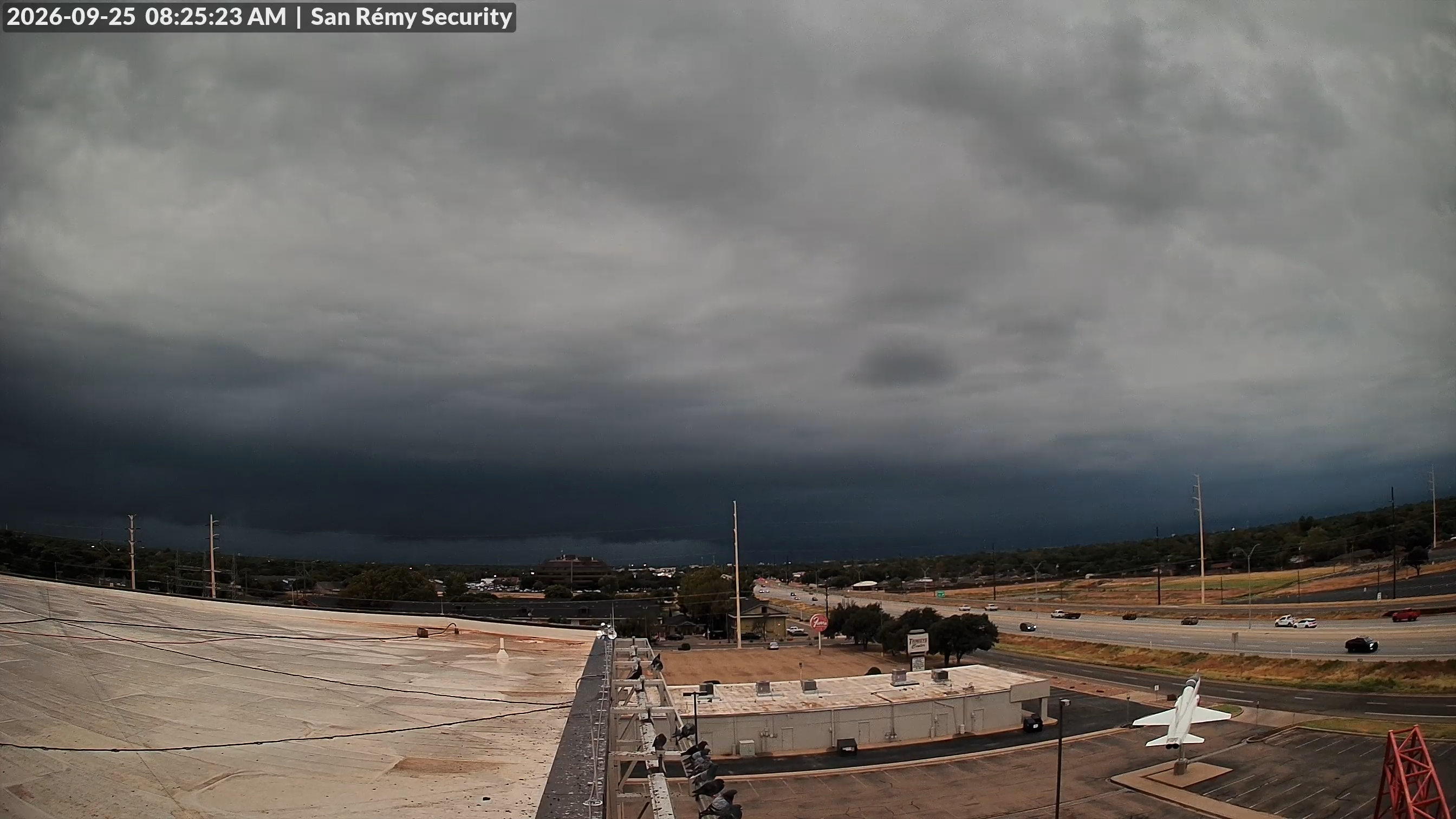
View from the south side of Lubbock immediately in advance of thunderstorms with heavy rain Friday morning (25 September 2026). |
|
|
The active stretch of September weather had another relative peak from the 24th to the 26th. Rounds of showers and thunderstorms occurred in advance of a storm system that lingered across the Desert Southwest through this period. Several embedded disturbances interacted with a rich stream of monsoon moisture to trigger the rounds of rainfall. |
|
 |
|
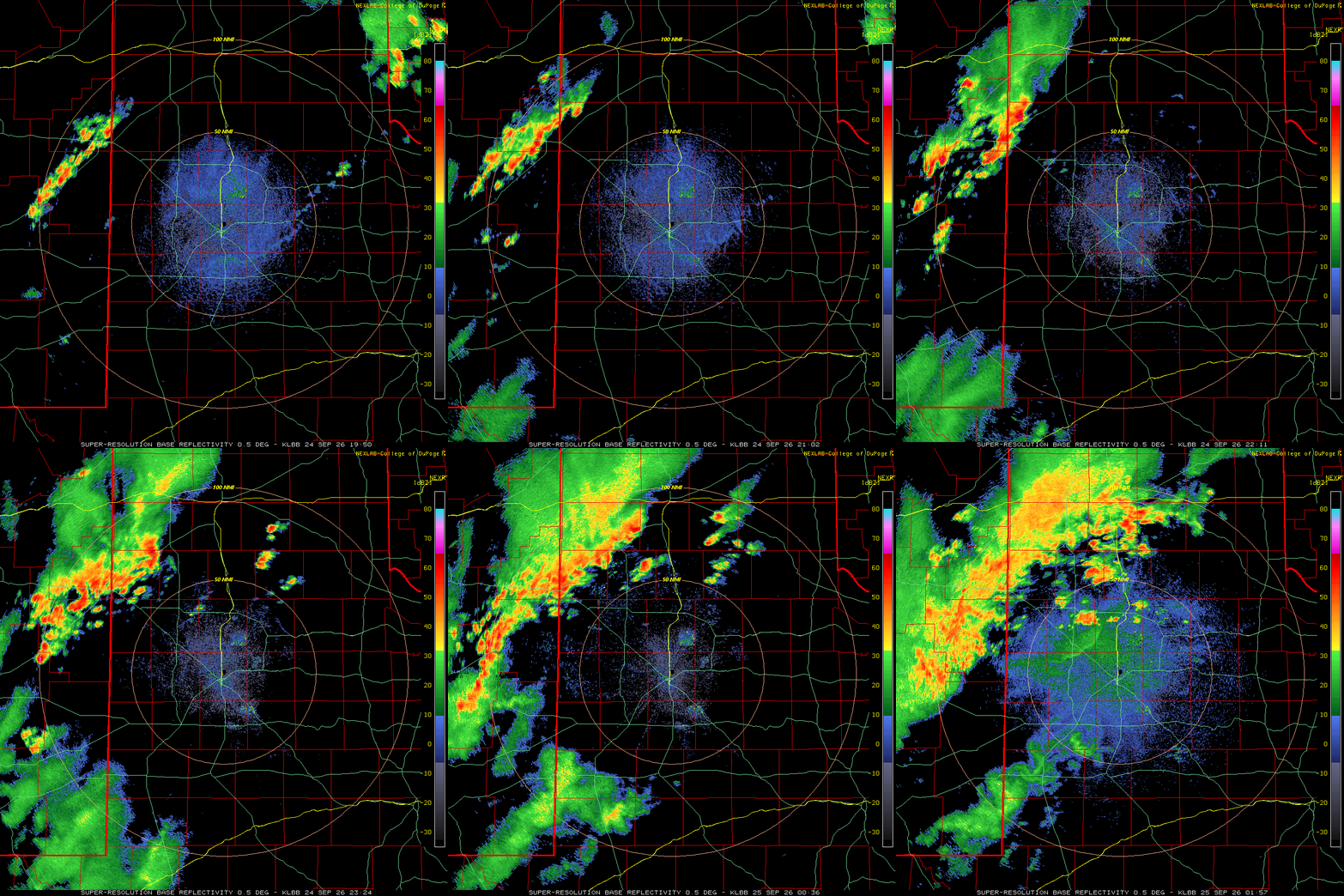
| Lubbock WSR-88D animation valid from 2:50 pm to 8:57 pm on Thursday (24 September 2026). An additional radar animation, valid from 8:36 am to 12:52 pm on Thursday (24 September), can be FOUND HERE. | |
| Early on, the best moisture and lift was farther west, where training showers and thunderstorms dumped torrential rain from eastern New Mexico into the southwestern Texas Panhandle on Thursday evening (September 24th). Many locations received a quick 2 to 3+ inches of rain along and near the Highway 60 Corridor from near Canyon through Hereford and Friona. Even heavier rain fell in eastern New Mexico, in and around Clovis and south-southwest from there, resulting in widespread flash flooding. | |
 |
|
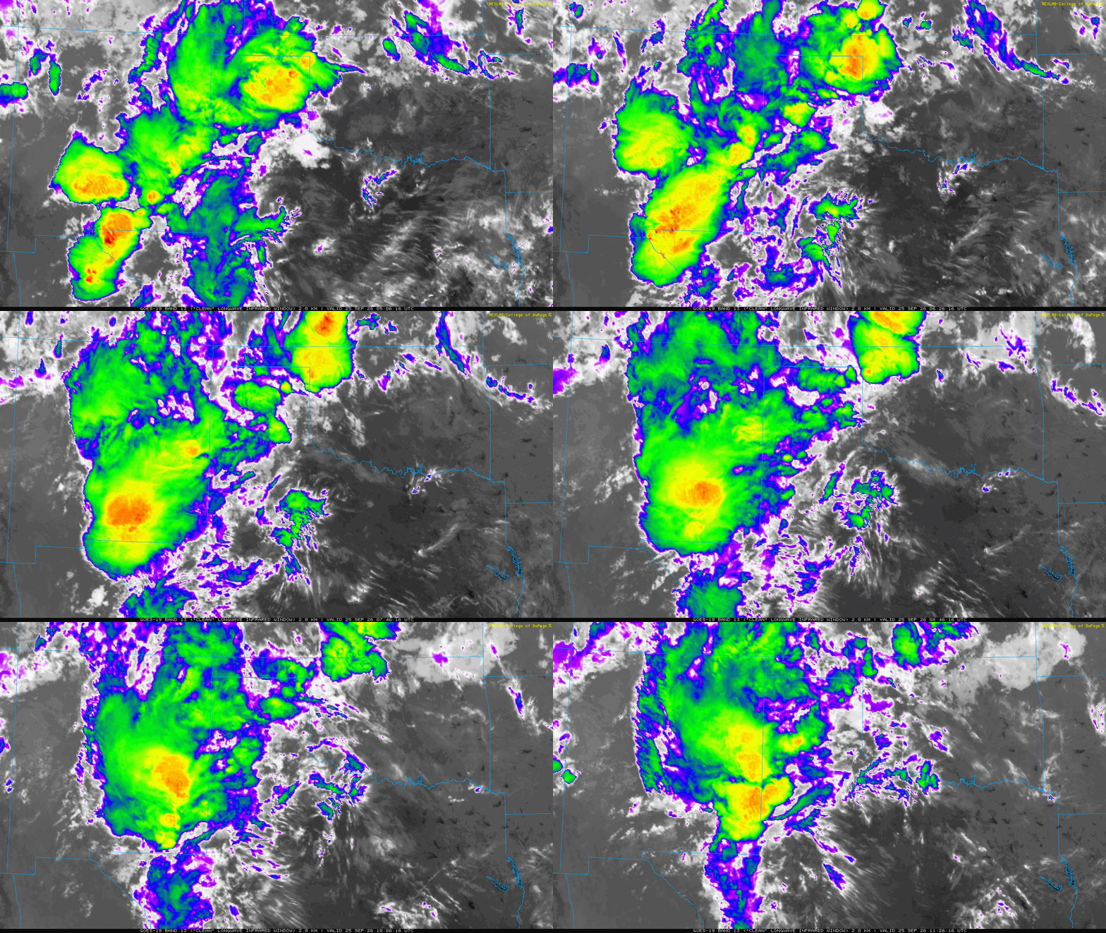
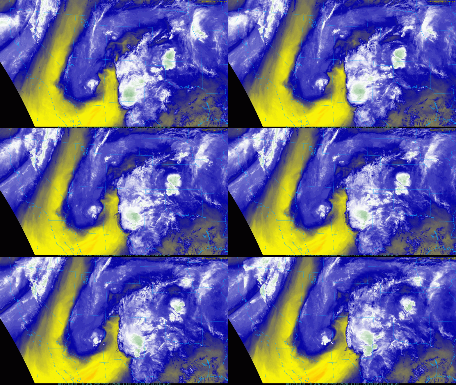
| Regional water vapor satellite animation valid from 3:06 am to 11:06 am on Friday (25 September 2026). An infrared satellite animation, valid from 12:06 am to 6:26 am on Friday, can be VIEWED HERE. | |
|
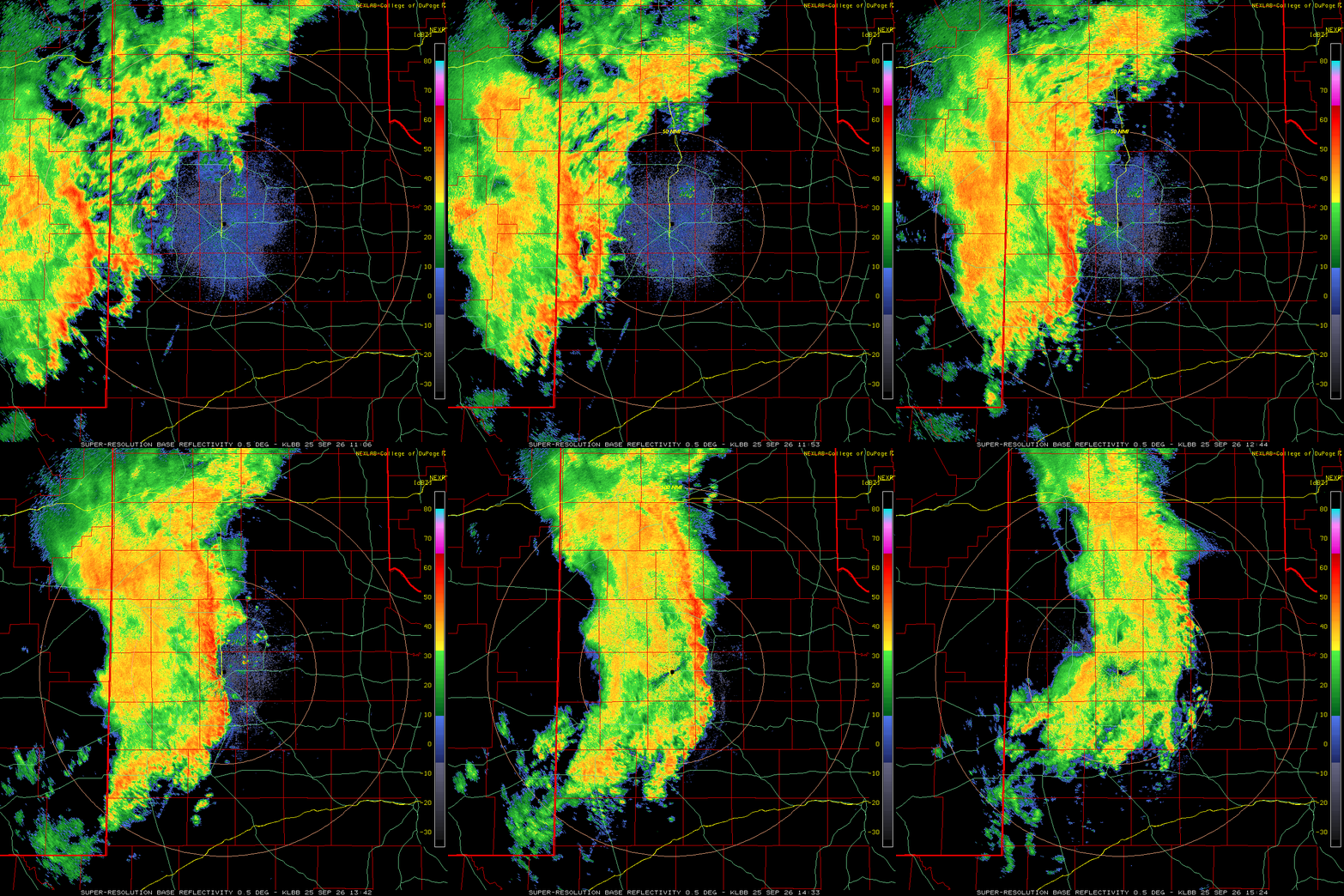
The rain expanded eastward into the south-central Texas Panhandle and western and central South Plains late Thursday night into early Friday morning (September 24th-25th). The shower and thunderstorm intensity increased Friday morning as a potent disturbance ejected from the southwestern trough. This led to a complex of thunderstorms tracking out of eastern New Mexico and across the South Plains around and after daybreak Friday. |
|
 |
|
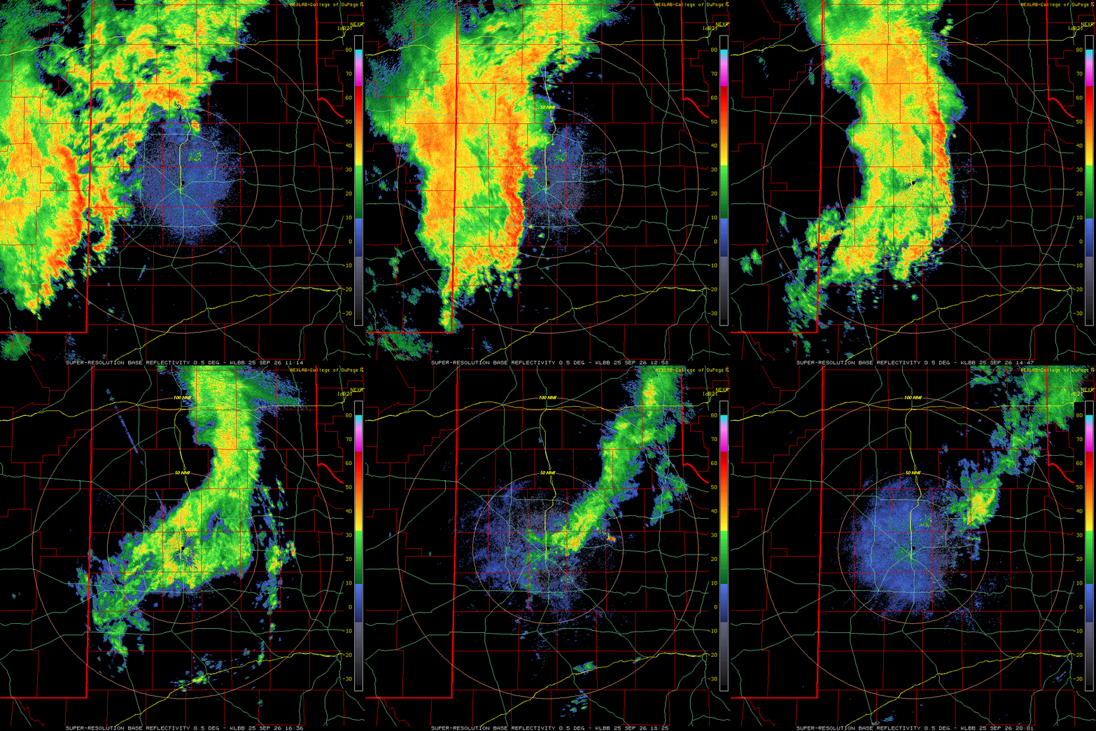
| Lubbock WSR-88D animation valid from 6:06 am to 10:24 am on Friday (25 September 2026). Additional radar animations can be found at: 4:25 pm on Thursday to 6:30 am Friday (24-25 September); and 6:14 am to 3:01 pm on Friday (25 September). | |
|
The leading edge of the thunderstorms brought brief torrential rain along with wind gusts of 40-50 mph. Light to moderate rain persisted after the initial line of storms for another couple hours over much of the Caprock. Unfortunately, the activity lost steam as it moved eastward, with much of the Rolling Plains missing out on the rain altogether. |
|
 |
|
| Dimmitt COOP Observer measuring a healthy rainfall on Friday morning (25 September 2026). The picture is courtesy of Russell Stringfield. The 24-hour rain total was 1.62 inches. | |
|
Following a lull in activity Friday afternoon and early evening, another round of thunderstorms developed in eastern New Mexico and spread into the western South Plains as the primary storm system began to eject from the southern Rockies. One storm became intense, producing a funnel cloud near Cannon AFB, before moving into northwestern Parmer County after 10 pm. Thankfully, no tornado or known damage occurred from this storm as it moved into Texas. |
|
 |
|
| Lubbock WSR-88D animation valid from 7:19 pm on Friday to 6:30 am on Saturday (25-26 September 2026). An additional radar animation, valid from 8:57 pm on Friday to 10:02 am on Saturday (25-26 September), can be FOUND HERE. | |
|
However, scattered non-severe thunderstorms continued all night across the southern Texas Panhandle and northern South/Rolling Plains, eventually exiting to the east of the region Saturday morning (September 26th). Brief heavy rain accompanied this overnight activity, though it generally moved fast enough to prevent any significant flooding concerns. A final round of scattered storms occurred along a surface trough over the Rolling Plains late Saturday afternoon into the evening. Although more limited in coverage than earlier rounds, this activity provided rain to a few spots in the Rolling Plains. |
|
 |
|
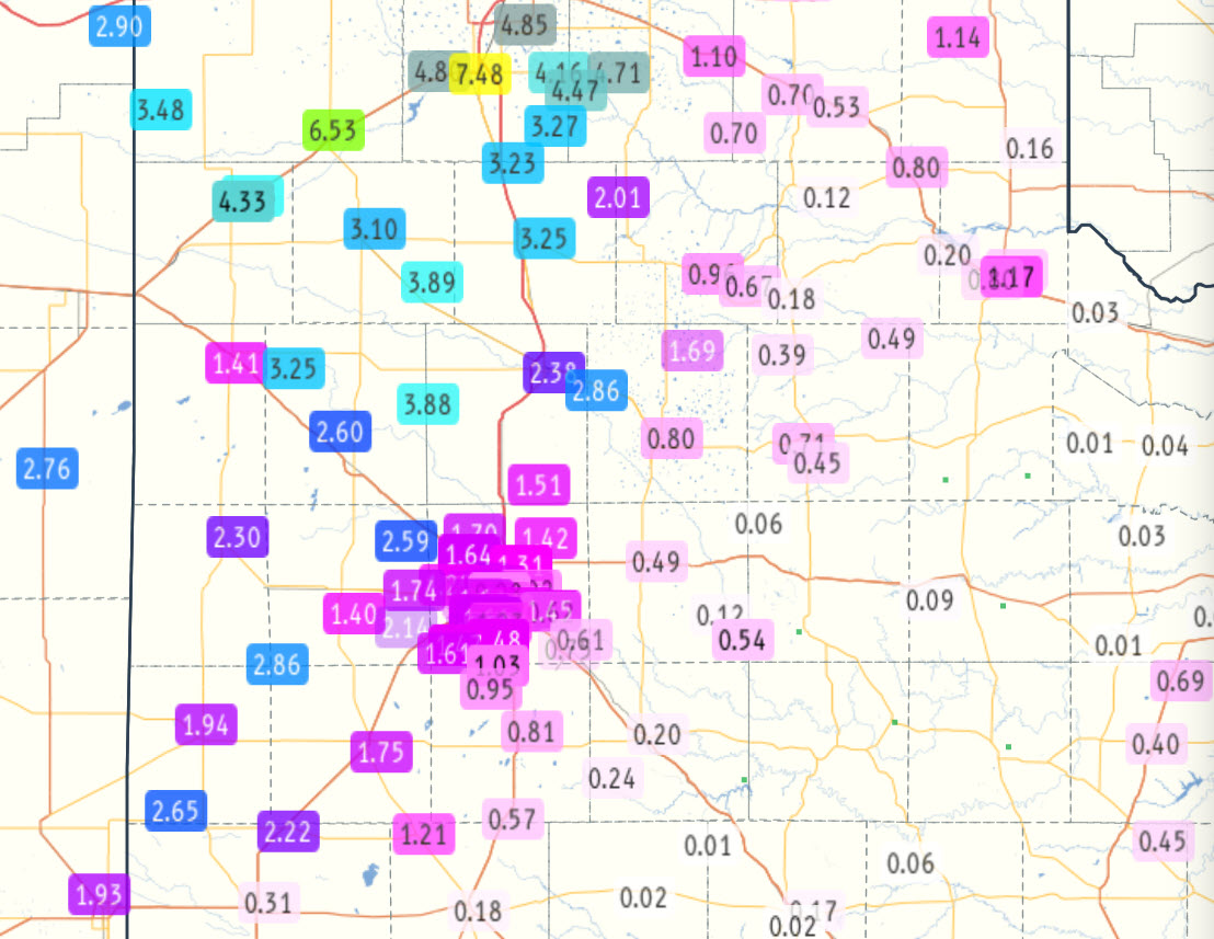
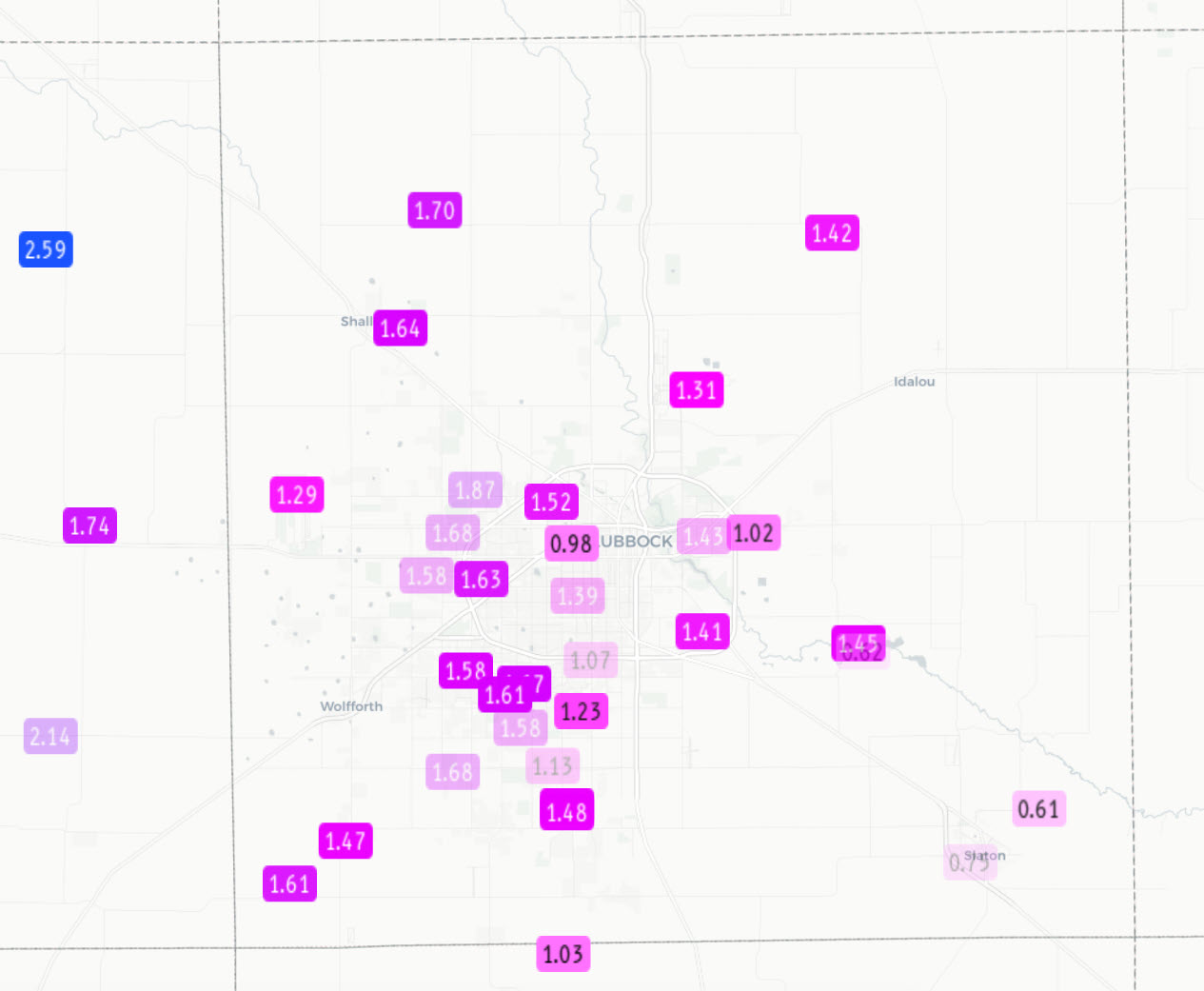
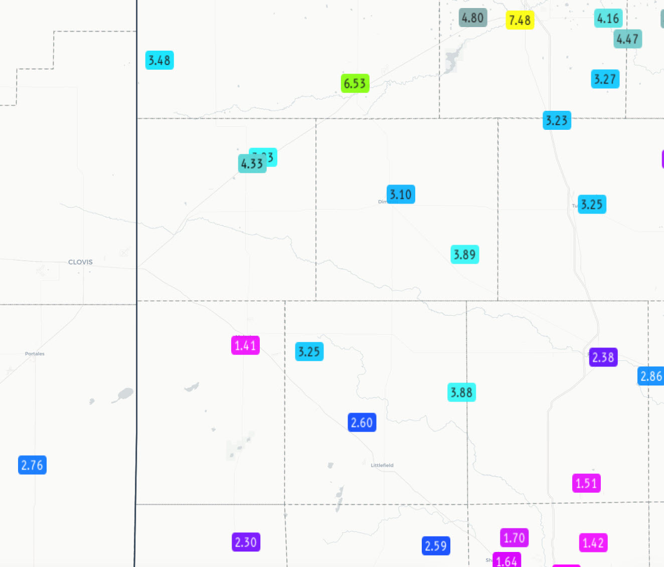
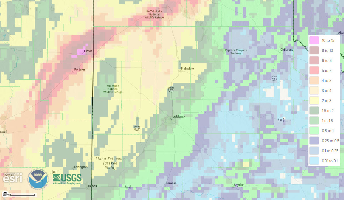
| 4-day radar-estimated and bias-corrected rainfall (inches) ending at 7 am on Sunday (27 September 2026). Measured rainfall, courtesy of the West Texas Mesonet (WTM) and National Weather Service (NWS) over this same stretch, can be VIEWED HERE A closeup of the Lubbock area can be FOUND HERE. A closeup of the southwest Texas Panhandle and northwest South Plains can be ACCESSED HERE. | |
|
By the conclusion of this multi-day event, most locations on the Caprock had picked up significant rainfall. The heaviest rain, around and above 2 inches, fell on much of the southwestern Texas Panhandle and northwestern half of the South Plains, while a swath of 3 to 5+ inches affected locations from around Amarillo through Friona and Clovis. Rain totals generally decreased with eastern extent, with spots in the Rolling Plains seeing little to no rain. Lubbock was located within the gradient, generally picking up 1 to 2 inches of rain. Officially, the Lubbock Airport measured 1.47 inches over this stretch, which boosted the annual running total to 11.15 inches (though still almost 4 inches below the average year-to-date precipitation). Farther east, Childress Airport officially measured 0.80 inches over this period, lifting their annual total to 12.31 inches (about 7 inches below the average year-to-date precipitation). A list of the preliminary storm reports collected from September 23rd to 26th can be found below. |
|
Preliminary Local Storm Report
National Weather Service Lubbock TX
106 PM CDT Thu Sep 24 2026

..TIME...   ...EVENT...      ...CITY LOCATION...     ...LAT.LON...
..DATE...   ....MAG....      ..COUNTY LOCATION..ST.. ...SOURCE....
            ..REMARKS..

1258 PM     Tstm Wnd Gst     Memphis                 34.73N 100.54W
09/24/2026  M60 MPH          Hall               TX   Mesonet



 Follow us on X
 Follow us on Facebook
 Follow us on YouTube
 LUB RSS Feed