
Scattered thunderstorms with severe gusts, hail and a tornado risk are possible near a cold front from the Ohio Valley to the Mid-Atlantic tonight. Tropical Storm Bertha is expected to bring tropical storm conditions to portions of the Gulf Coast from the panhandle of Florida into Louisiana through Wednesday. Read More >
|
National Weather Service Lubbock Significant Weather Events
May 13-14, 2016: Severe storms and locally heavy rainfall
|
|
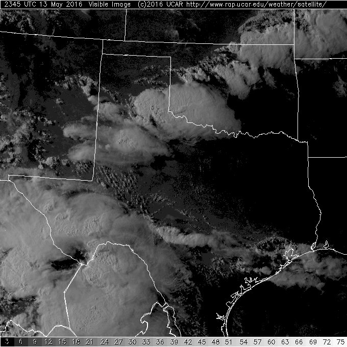
Scattered thunderstorms developed Friday afternoon along a surface trough running southwest to northeast from the western South Plains to the eastern Texas Panhandle. The storms eventually formed two southeastward-moving clusters, one clipping western and southern Lubbock County before moving across much of Lynn and Garza Counties, and the other passing through much of the Rolling Plains. As the storms exited the southern Rolling Plains late in the evening, additional storms formed along a westward moving outflow boundary across portions of Lubbock and Crosby Counties. Finally, a cold front moved into the region early Saturday morning the 14th and this helped intensify the storms already in progress across the central South Plains. The southern cluster produced severe wind gusts up to 65 mph from near Wolfforth to Tahoka and western Garza County. Golfball-sized hail was reported in northeast Childress County and wind damage was reported in Cottle and King Counties from the Rolling Plains storms. The satellite image below shows the two storm clusters in northwest Texas. |
|
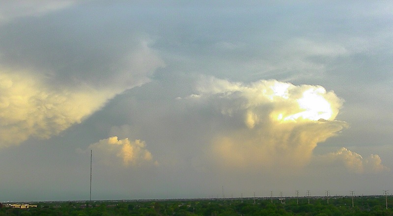
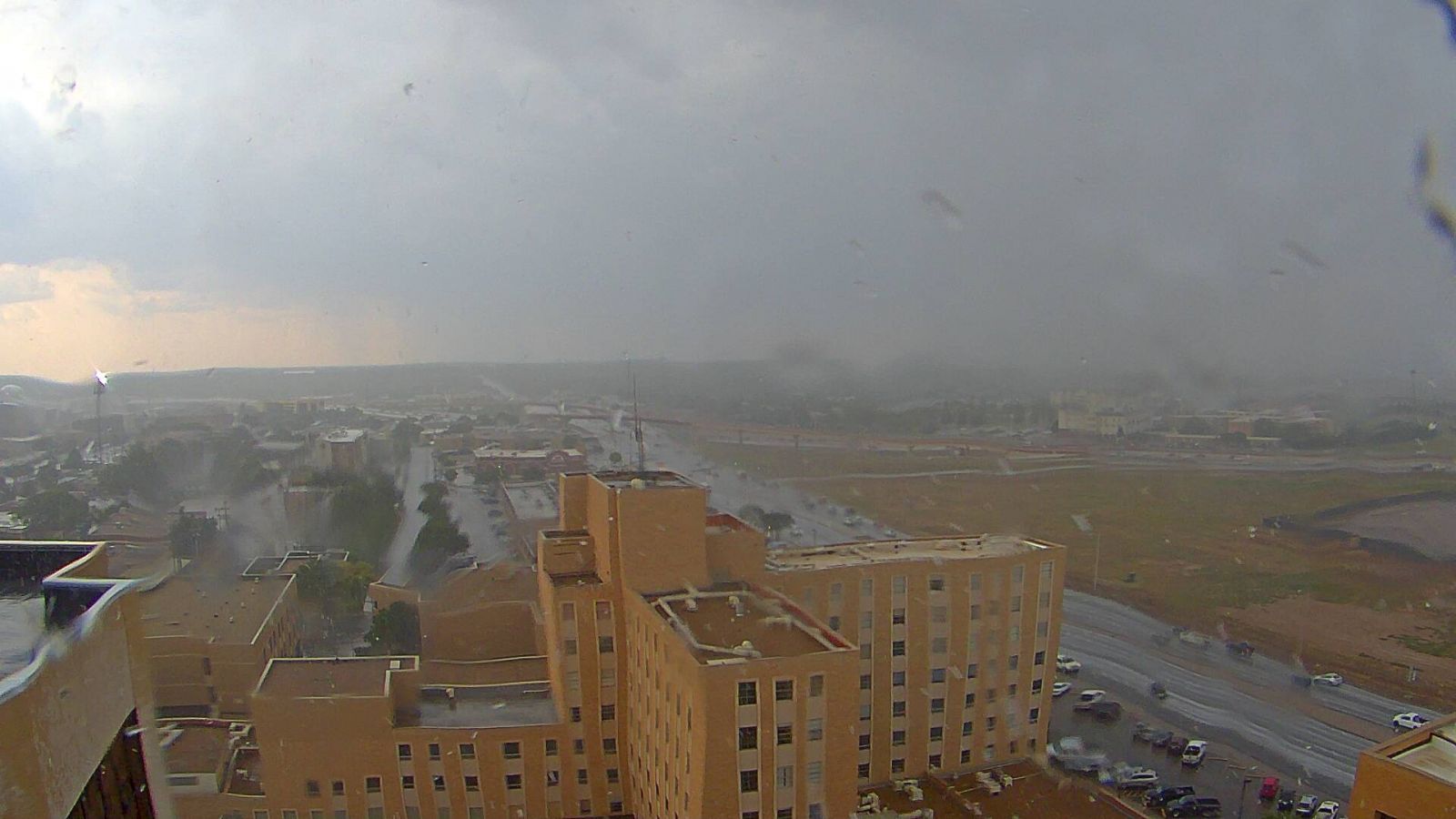
Other than the severe weather, the main impact from the storms were to bring much-needed rainfall to portions of the area. Lubbock County received quite a bit of rain from the second round of storms early Saturday morning. The Lubbock Airport ended up with 1.88 inches of rain on the 14th, which not only was a record for the date but also doubled the rainfall for the year! The image below shows the some of the rain which fell across western portions of Lubbock late Friday afternoon. |
|
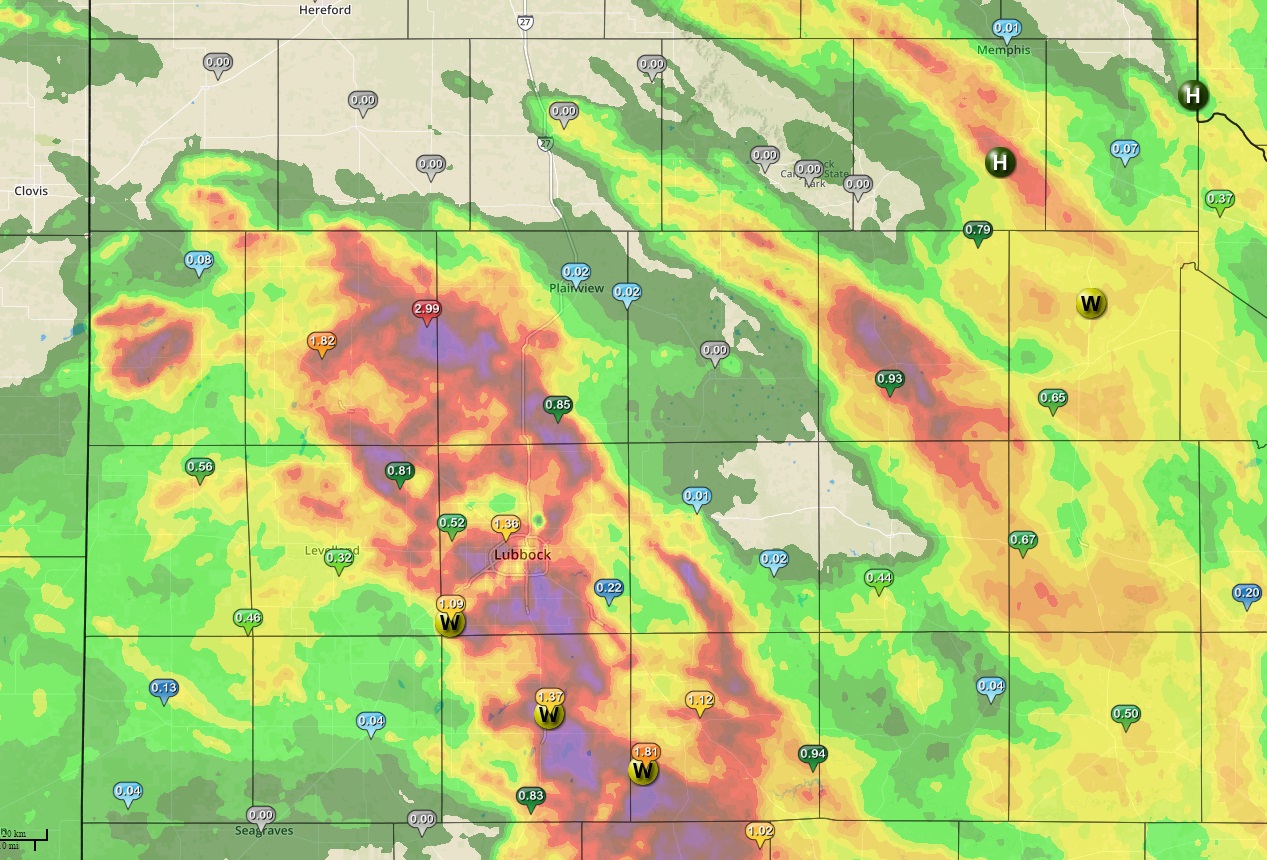
The map below shows the radar estimated rainfall across the area from the event. Individual reports from the West Texas Mesonet are plotted on the map. |
|
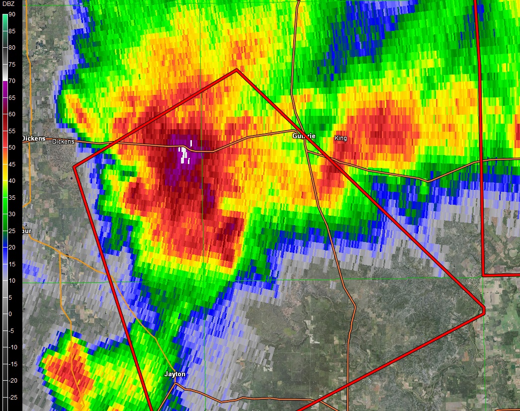
A radar image from shortly after 9 pm shows what was likely the most intense storm of the day - a supercell thunderstorm between Dickens and Guthrie heading southeast. |
|
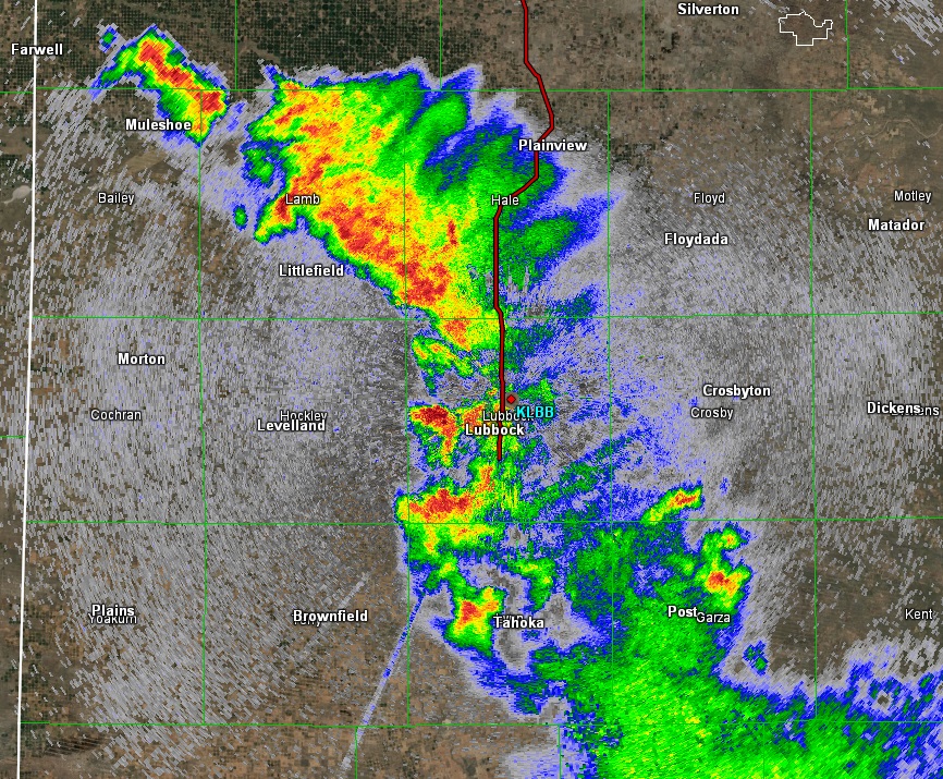
A radar image from 3 a.m. shows the early-morning storms that developed across the central South Plains. |
|

