
Dangerous and extreme heat will remain across portions of the central U.S. this week, persisting across the mid to lower Mississippi Valley, Gulf Coast, southern Plains and portions of Texas. A heat wave over the Southwest U.S. will peak this weekend. Heavy to excessive rainfall may produce flash flooding from the Delmarva Peninsula north into the Hudson Valley today and tonight. Read More >
Sunday afternoon and evening, September 17, 2017, brought a couple of rounds of thunderstorms to the northern South and Rolling Plains and southern Texas Panhandle. These storms had more instability and wind shear to work than what we had seen lately and this allowed a few of these storms to rotate and produce severe weather. The most intense storm of the day initially developed near the Texas and New Mexico state line before racing eastward across the northern South Plains. This storm produce large hail early-on, including golf ball to tennis ball size in Bula. Over time the storm began to produce damaging winds, peaking in magnitude as it traversed Petersburg, Cone and McAdoo.
 |
 |
|
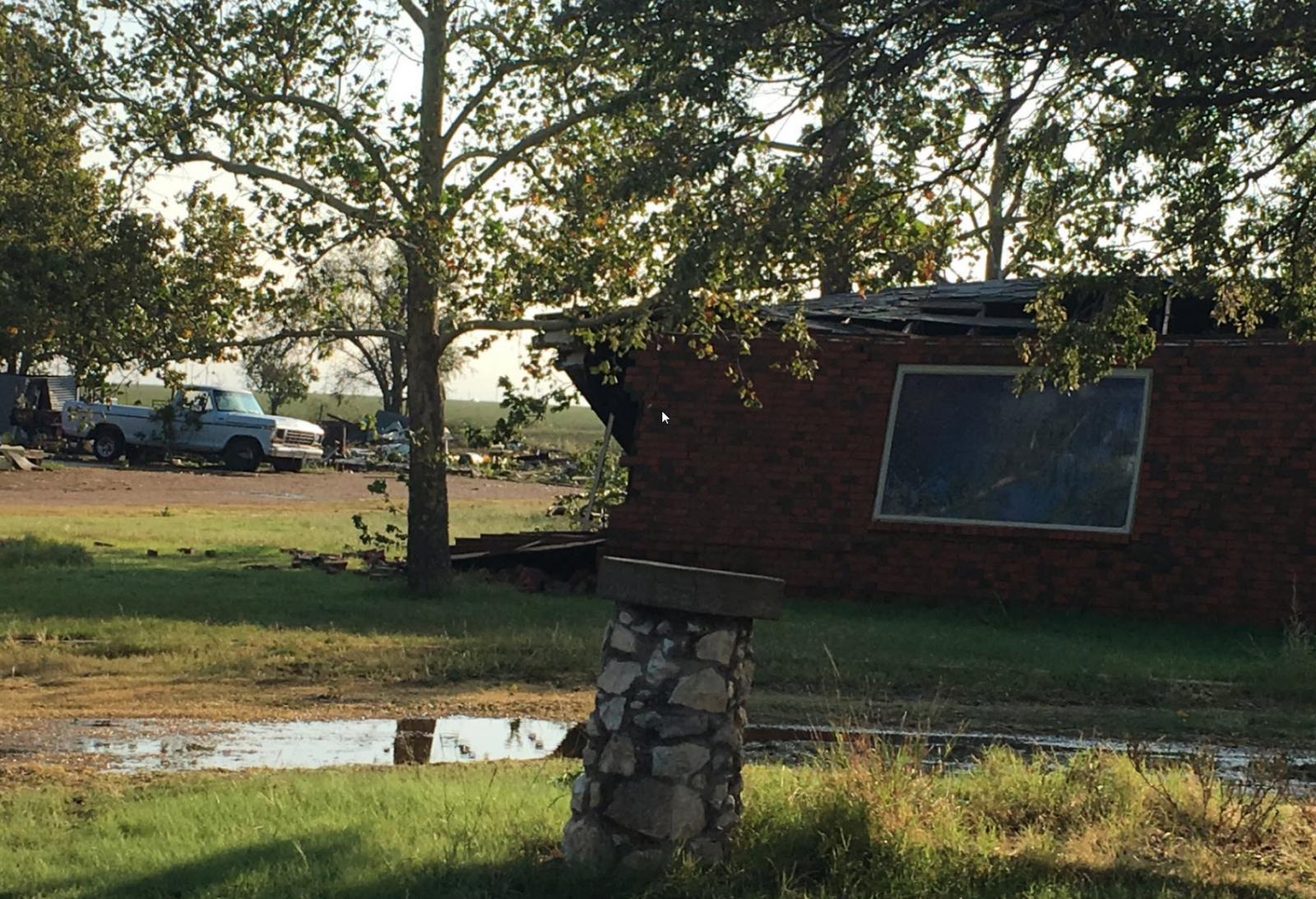
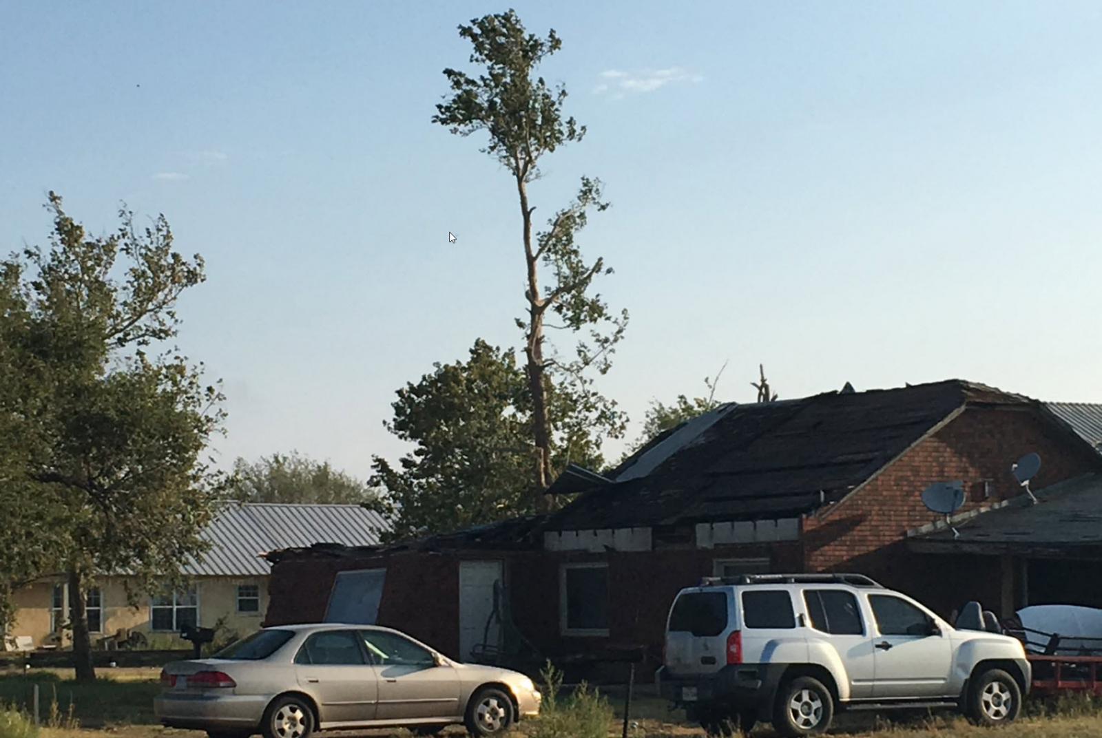
A couple of pictures of the damage incurred around Cone, Texas, on 17 September 2017.
|
|
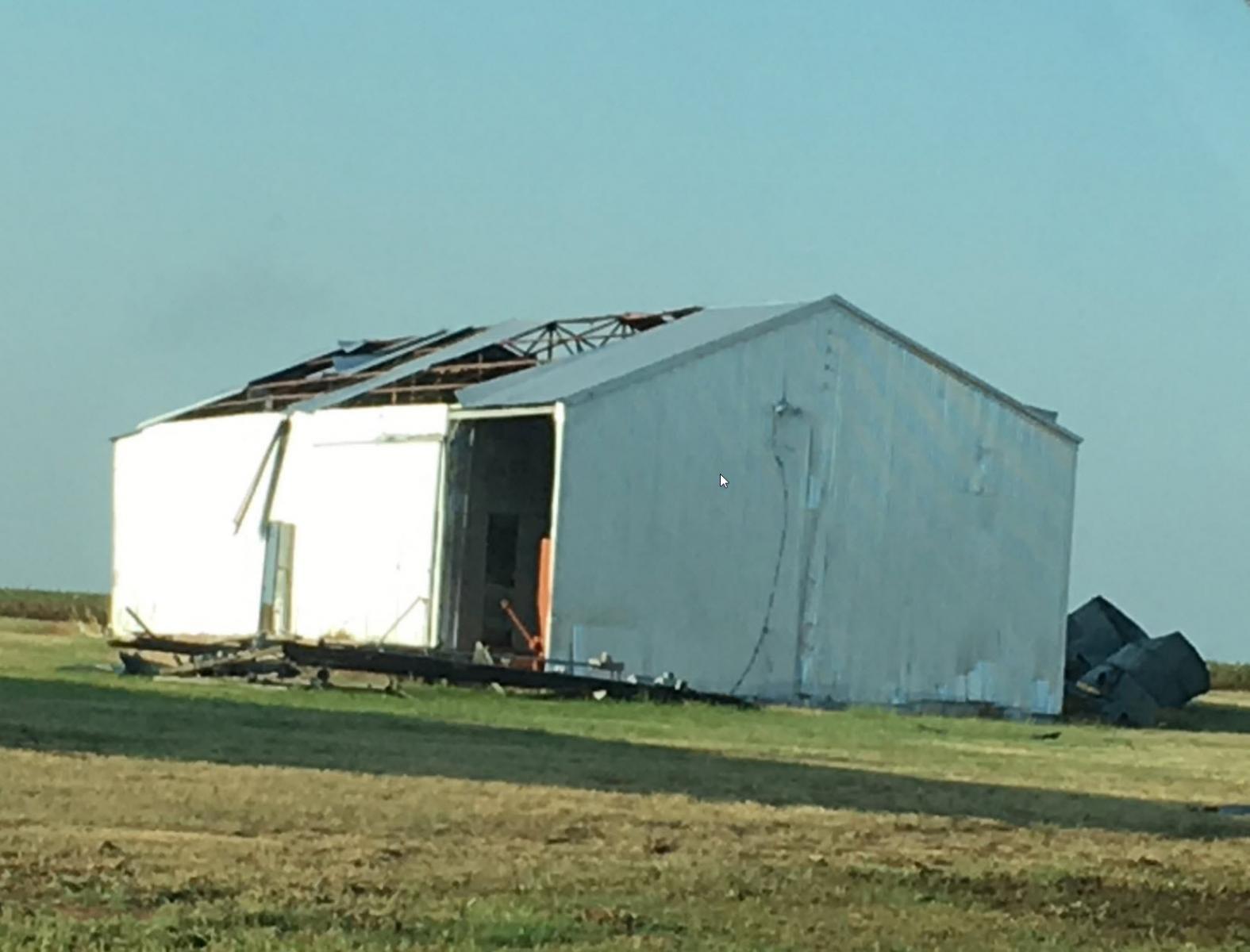
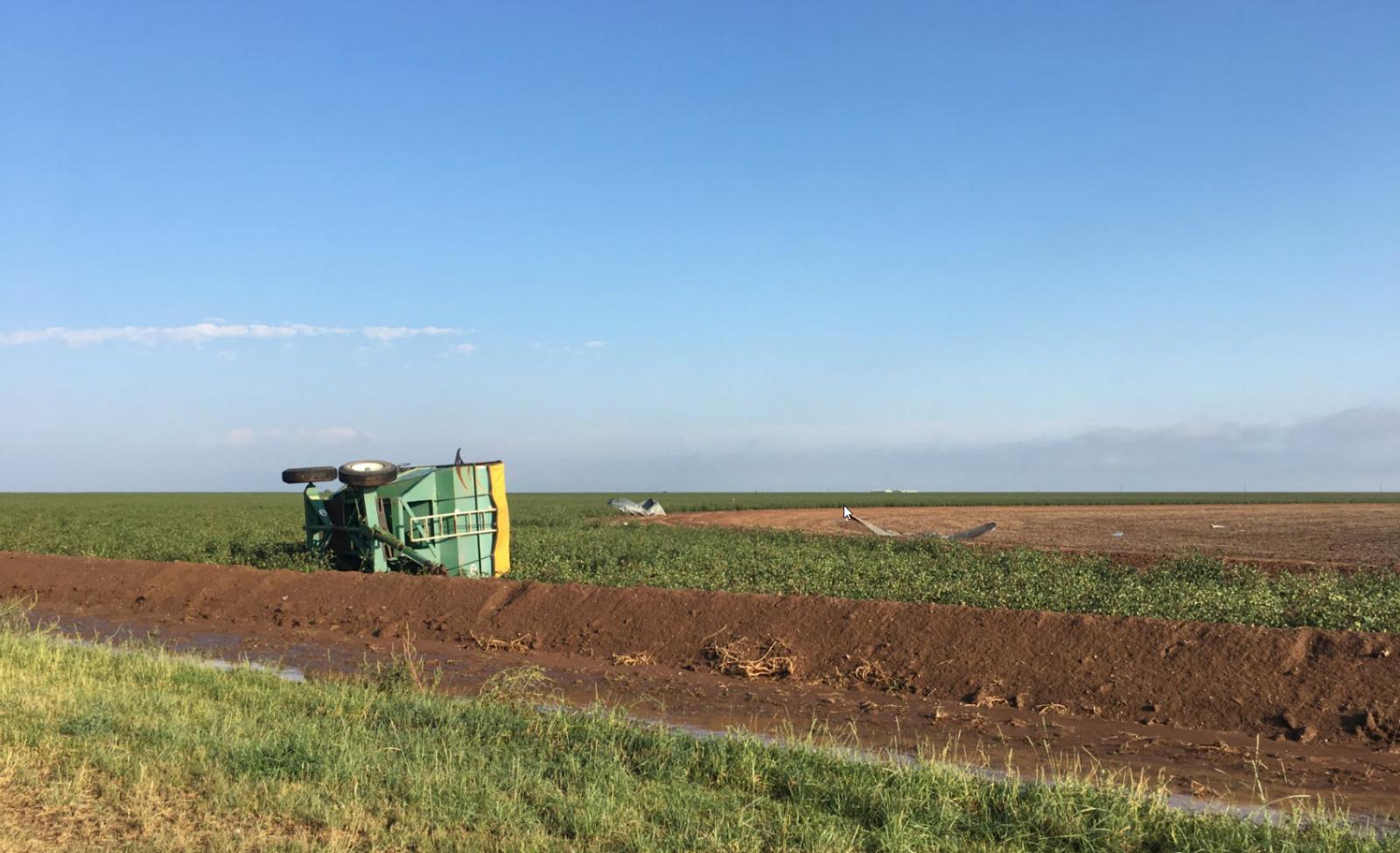
The community of Cone was particularly hard hit, receiving damage to homes, sheds, trees, power lines and farm equipment. A damage survey conducted by the National Weather Service determined that the most extreme damage was likely caused by winds in the 80 to 100 mph range.
 |
 |
|
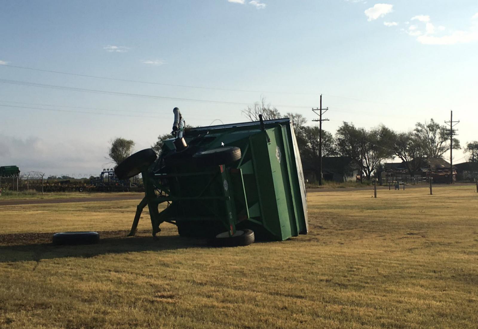
Farm equipment toppled near Cone, Texas.
|
|
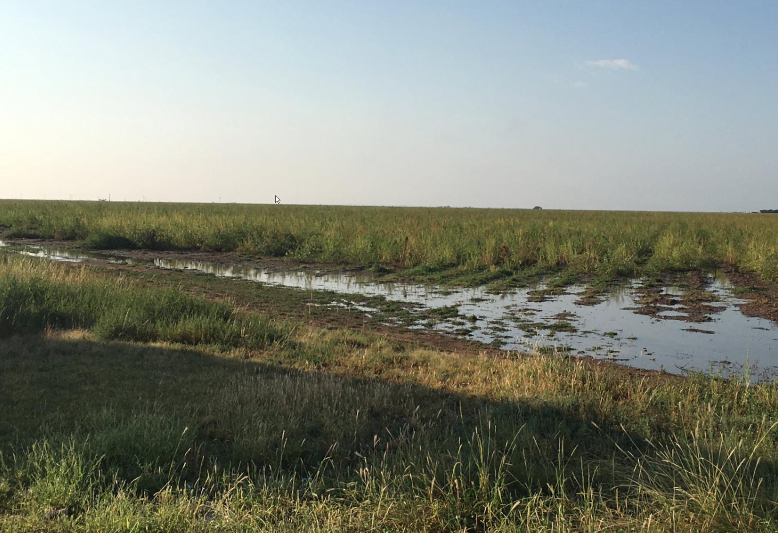
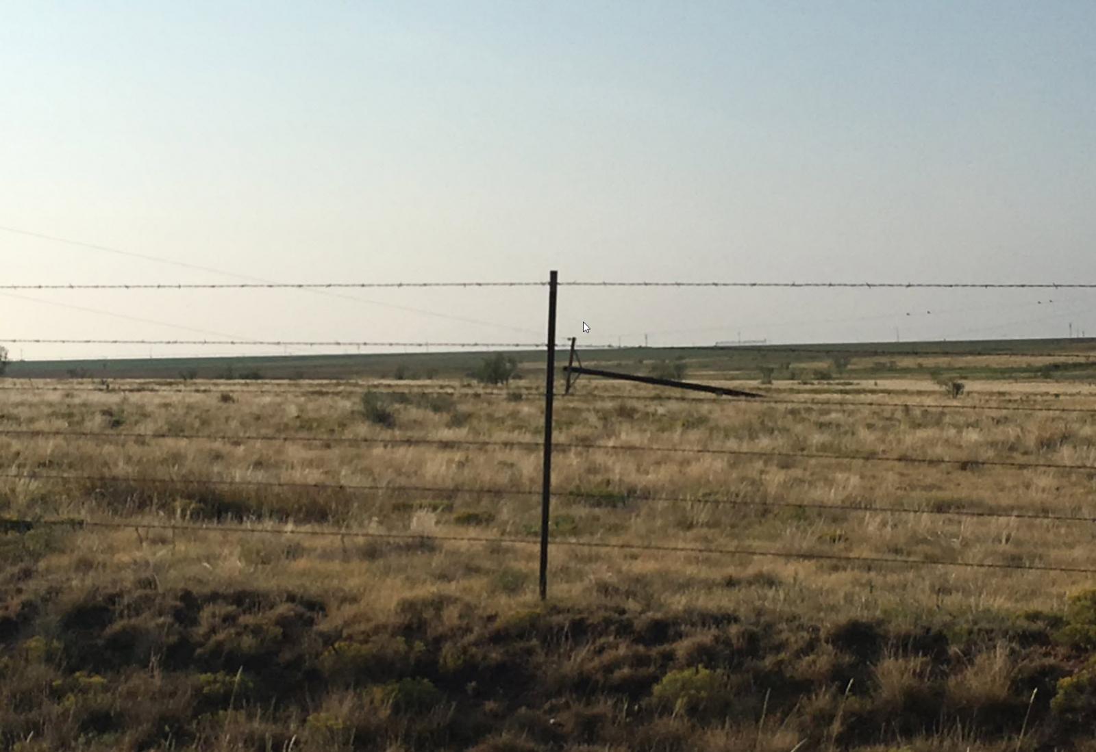
Unfortunately, in addition to damaging a number of structures and equipment the wind (and in spots hail too) stripped and/or flattened crops. Thankfully though, no injuries were reported.
 |
 |
|
Crop and power pole/line damage near Cone, Texas.
|
|
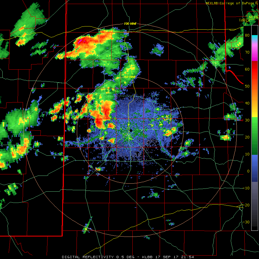
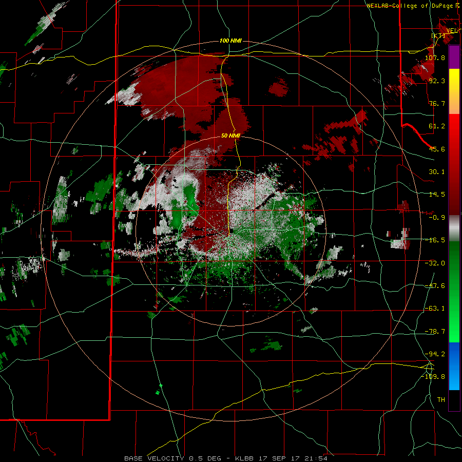
The below radar animation shows the progression of the thunderstorms Sunday afternoon and evening. The leading (eastern) complex of storms is the one that produced the widespread wind damage. A second round of thunderstorms followed nearly the same track. The trailing line of storms did also generate gusty winds, as high as 64 mph at the West Texas Mesonet site north of Floydada, though the coverage and intensity of winds was significantly lower than the initial round of thunderstorms.
 |
|
|
Lubbock radar reflectivity valid from 4:54 pm to 8:18 pm on 17 September 2017. An animation of the velocity data for this same time period can be VIEWED HERE.
|
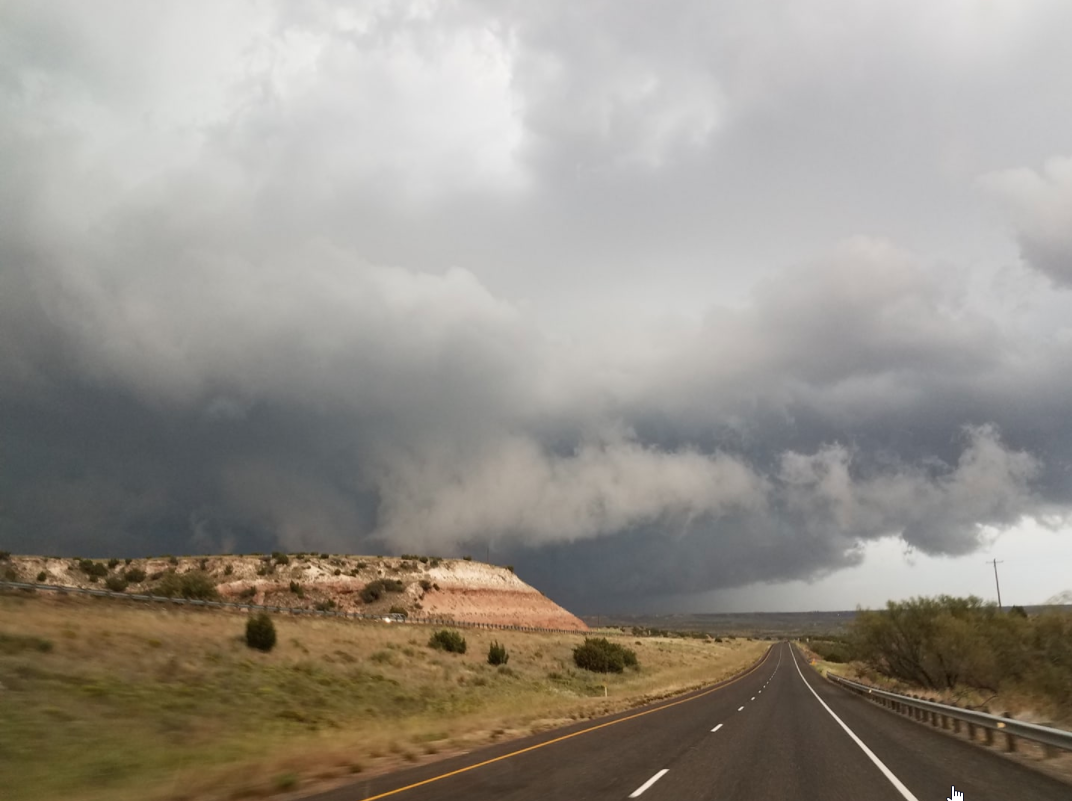
The passing thunderstorms did create an ominous and picturesque sight, especially when overlaid with the rugged terrain found along and off the Caprock.
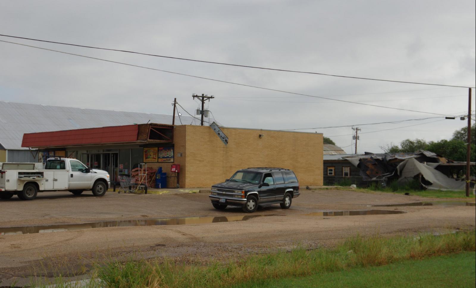
The severe winds inflicted damage to the Allsups in Petersburg, removing much of its roof and tossing it into the adjacent property to the east.
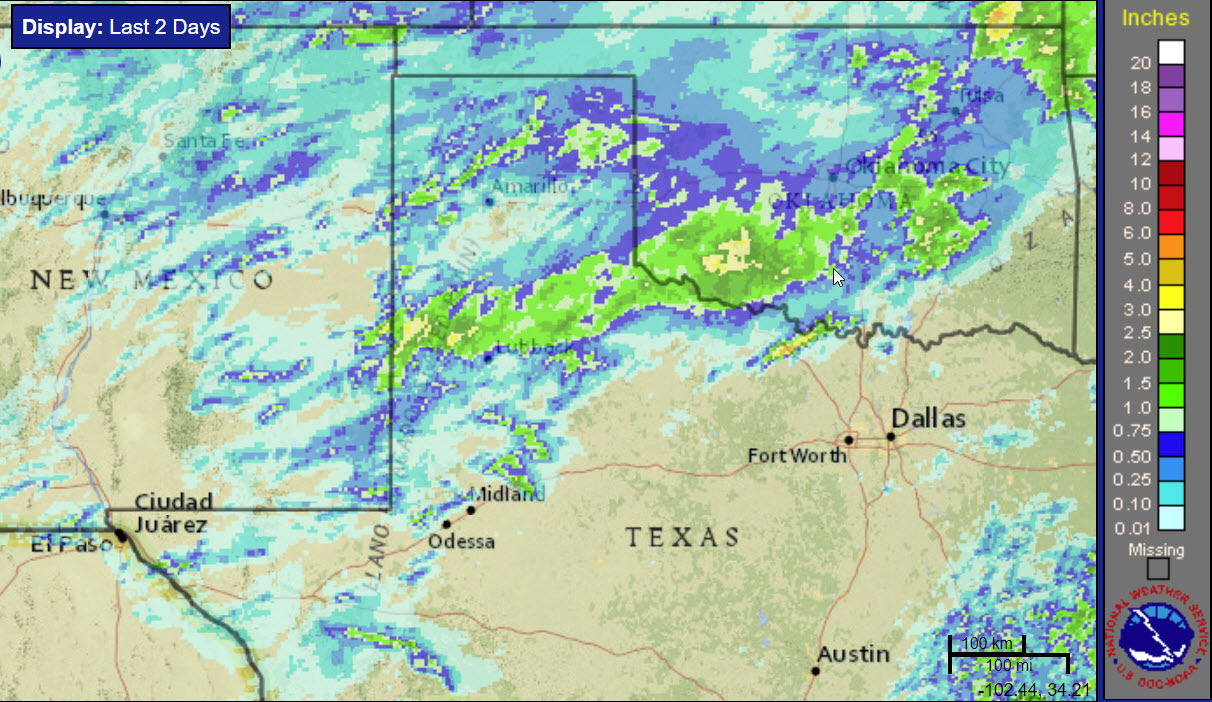
The storms were not limited to damaging winds and hail, they were also very efficient rain-producers. Torrential rains fell over short periods of time, including an impressive 0.60 inches of rain in only 5 minutes as one of the storms moved past Floydada. This undoubtedly caused street flooding, though the heavy rates didn't persist very long at any given location as the storms moved quickly east.
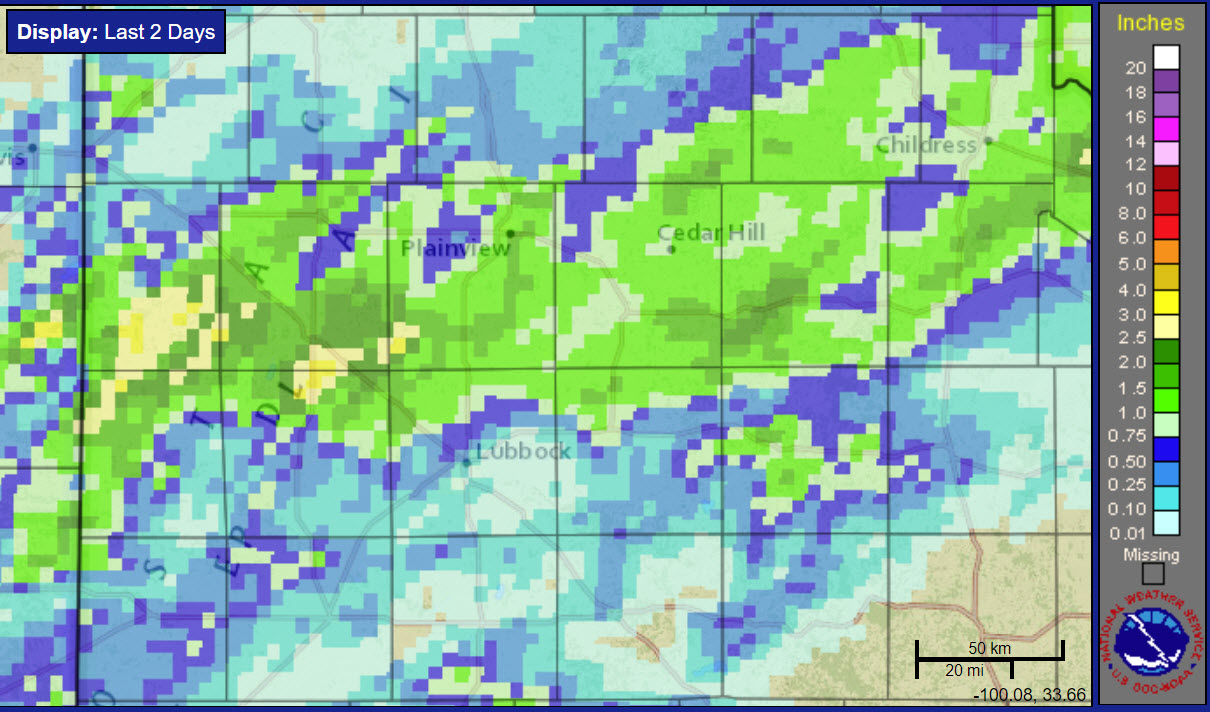
Locations from the Muleshoe Wildlife Refuge through Littlefield, Floydada, Matador and Turkey saw healthy rain totals, generally in the 1 to 2 inch range. A few spots across southern Bailey County into parts of Hockley and Lamb Counties may have even tallied amounts slightly above 2 inches. Officially Lubbock and Childress recorded 0.45 inches and 0.83 inches, respectively.
 |
 |
|
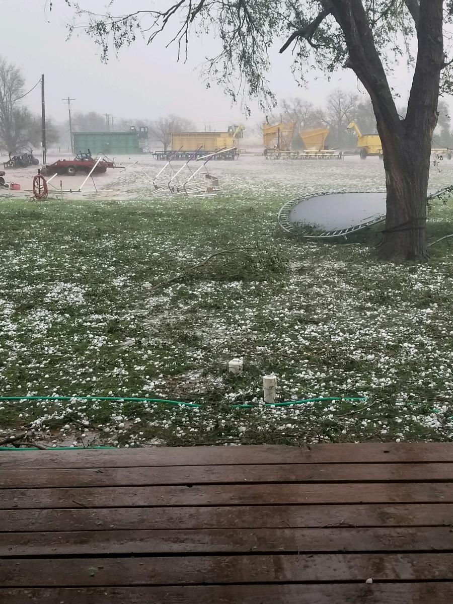
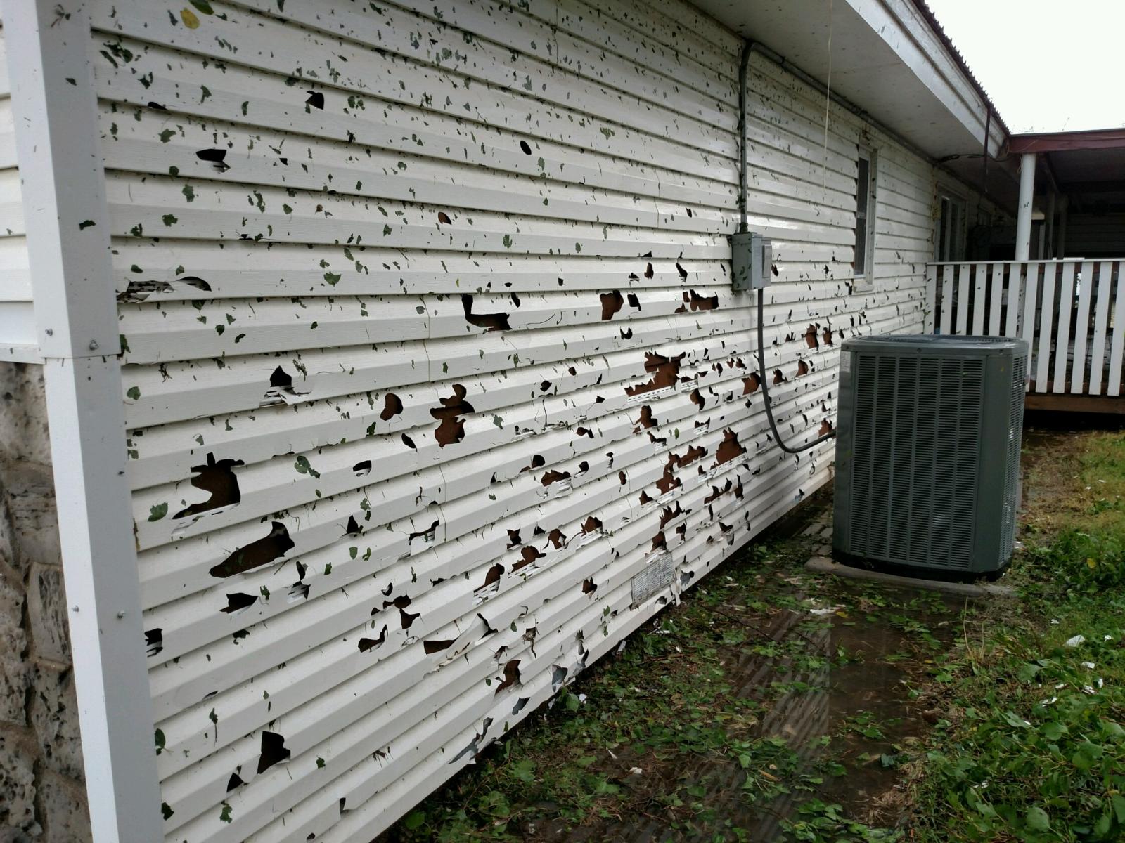
Large hail that fell in Bula, Texas, Sunday afternoon (left) and the damage the wind driven hail cause (right) on 17 September 2017. Pictures are courtesy of KCBD and Chase Cannon.
|
|
Above are a couple of pictures of large hail and the damage it inflicted when combined with strong winds in Bula late Sunday afternoon.
PUBLIC INFORMATION STATEMENT
NATIONAL WEATHER SERVICE LUBBOCK TX
1226 PM CDT Mon Sep 18 2017

...NWS Damage Survey for 9/17/2017 Thunderstorm Wind Event...

.Destructive Macroburst near Cone, TX...

Peak wind: 100 MPH
Path length: 15 miles
Path width: 2.5 miles
Fatalities: 0
Injuries: 0

Start date: 9/17/2017
Start time:  635 PM CDT
Start location: Petersburg, TX

End date: 9/17/2017
End time:  655 PM CDT
End location:  Cone, TX

.Event Summary...
A corridor of destructive thunderstorm winds moved east from
extreme southeast Hale County and across far northern Crosby
County Sunday evening, inflicting significant damage in and around
the community of Cone. Meteorologists from NWS Lubbock surveyed
the area in and around Cone and found damage consistent with
straight line winds in the 80 to 100 mph range. The heaviest
structural damage consisted of a collapsed brick wall to a single
residence home. The roof to an agricultural building was also
blown off by the strong winds. Other damage included broken
windows, fallen trees and downed tree limbs. Several dozen utility
poles were damaged or destroyed in the area, and some crops
sustained considerable damage. At least 10 center pivots were
damaged or destroyed.

Additional reports of wind damage were received in Petersburg and
McAdoo. In Petersburg, the roof to a gas station was completely
removed and landed on a nearby residence. Winds were estimated to
be near 80 mph in Petersburg.

Note:
The information in this statement is preliminary and subject to
change pending final review of the event and publication in NWS
Storm Data.

