
Dangerous heat will expand from the Gulf Coast into the Southern Plains and Desert Southwest through week's end. Additional extreme heat impacting the Pacific Northwest will shift to the northern Plains by the weekend. Tropical Storm Bertha is expected to continue to impact portions of the northern Gulf Coast from the western Florida Panhandle to southeastern Louisiana through tonight. Read More >
| Widespread rain, scattered severe storms and strong winds 15-19 March 2020 |
|||||||||||
 |
|||||||||||
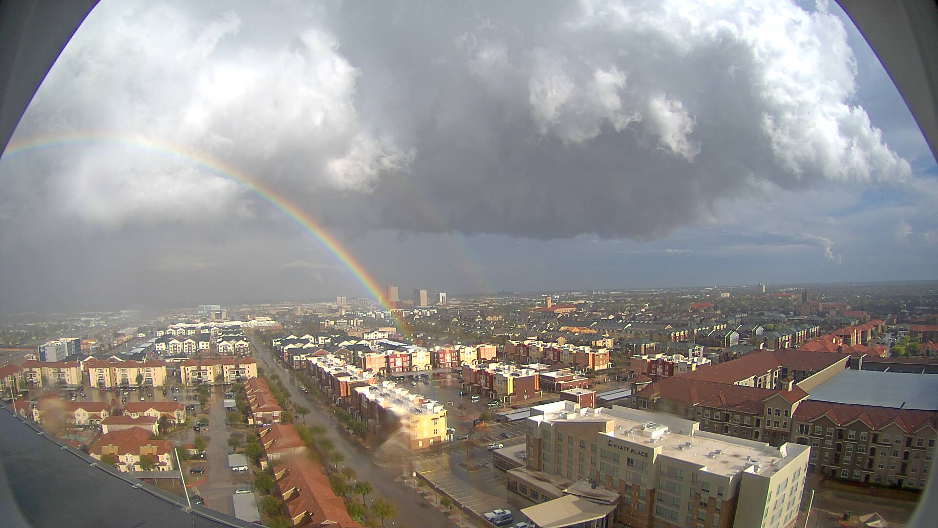
| Looking east from the Overton Hotel around 6 pm on Wednesday (18 March 2020). The image is courtesy of KAMC. | |||||||||||
|
Mid-March brought an unusually active stretch of weather to West Texas, punctuated by several rounds of showers and thunderstorms and then concluded with a day of dry westerly winds. The rounds of rainfall were spurred on by several passing upper level disturbances which interacted with abundant amounts of moisture. |
|||||||||||
 |
|||||||||||
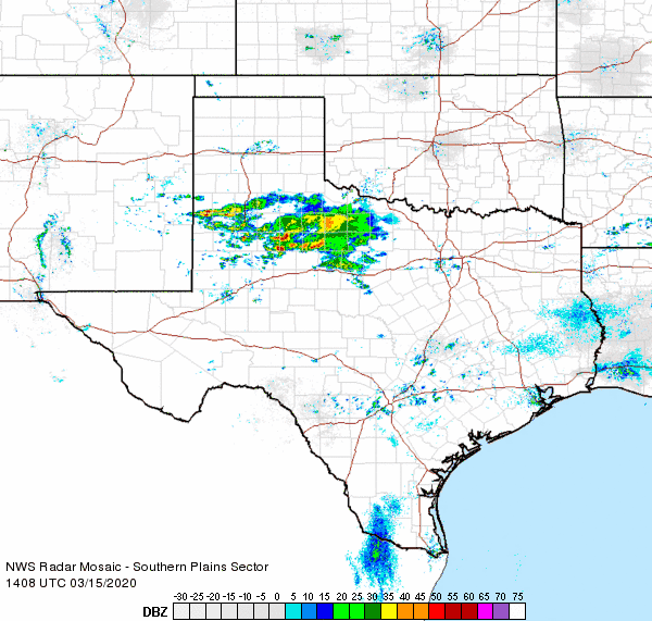
| Regional radar animation valid from 9:08 am to 10:18 am on 15 March 2020. | |||||||||||
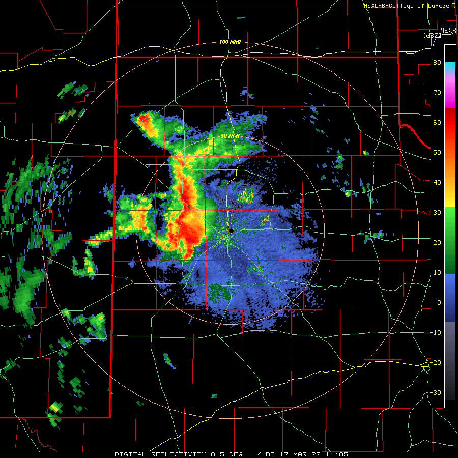
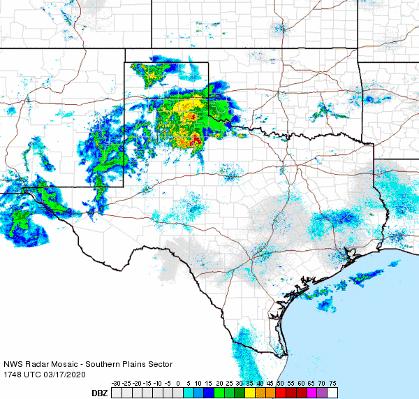
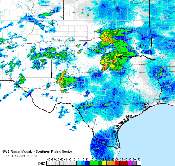
| The unsettled stretch kicked off with a round of early day showers and thunderstorms Sunday morning (15 March). The activity provided widespread rainfall, though totals were generally on the light side, ranging from several hundredths to a couple of tenths of an inch of rain. One stronger storm did drop heavier rain, from a half inch to over an inch over the southern Rolling Plains. | |||||||||||
 |
|||||||||||
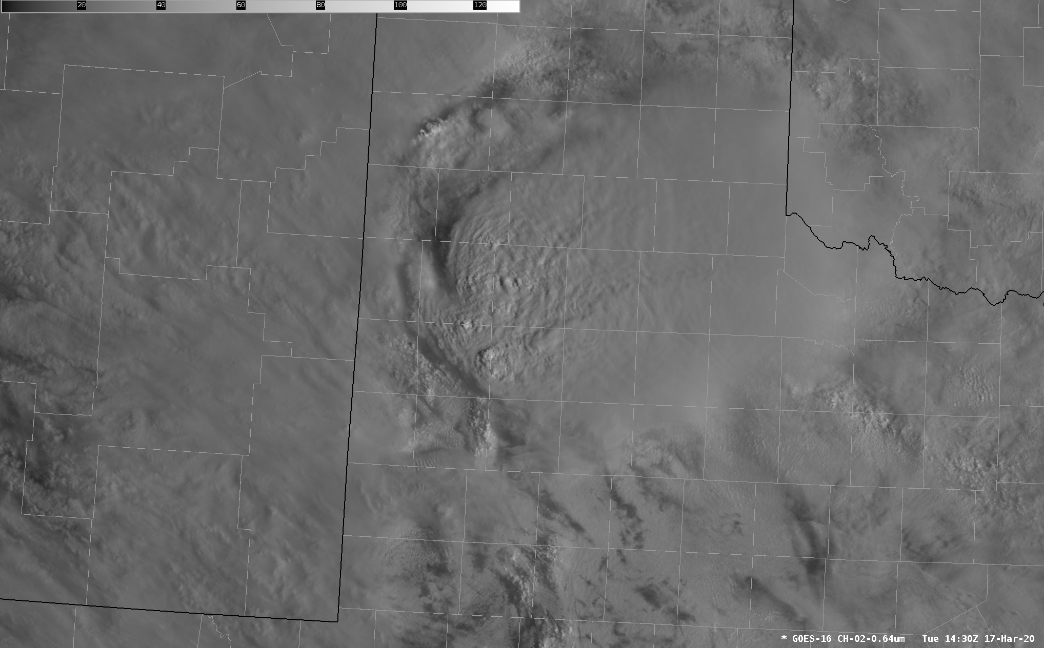
| Visible satellite image captured at 9:30 am on Tuesday (17 March 2020). Overshooting cloud tops can be seen across central South Plains, where the tallest/strongest thunderstorms were ongoing. | |||||||||||
|
|||||||||||
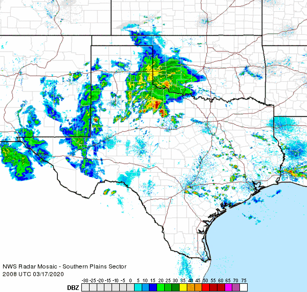
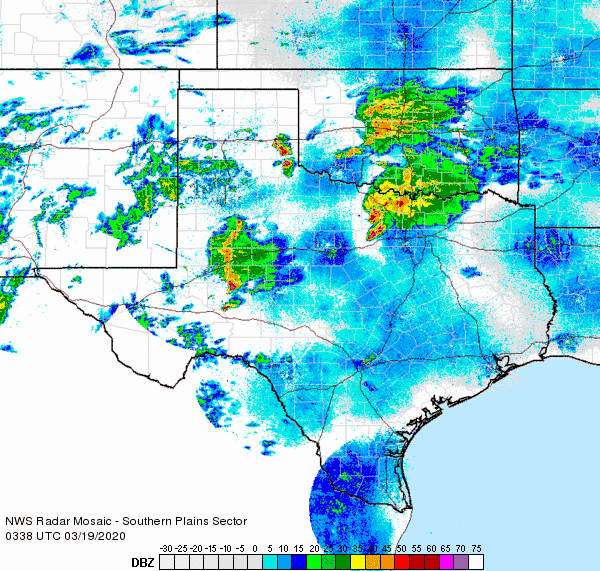
| In addition to producing hail, the early-day thunderstorms brought heavy downpours. Several more rounds of sub-severe showers and thunderstorms followed Tuesday afternoon and evening, bringing more rain to the South Plains region. The rain diminished Tuesday evening, leaving behind thick fog. | |||||||||||
 |
|||||||||||
| Supercell thunderstorms west of Lubbock on Wednesday evening (18 March 2020). The picture is courtesy of Tyler Hudson. | |||||||||||
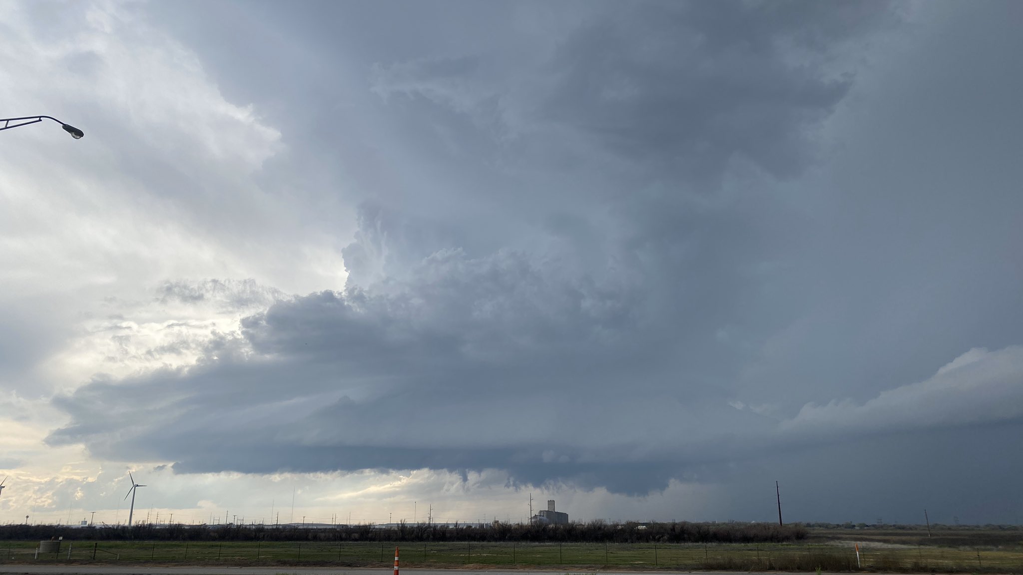
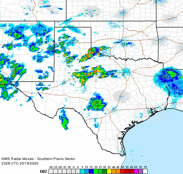
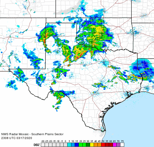
| The next day, Wednesday, March 18th, brought additional rounds of thunderstorms from late afternoon through the evening and overnight hours. Several of these storms became severe and generated large hail. On small but intense storm formed southwest of Lubbock and tracked northward, producing hail as large as 2.25 inches in diameter near Iola Avenue and 82nd Street. | |||||||||||
 |
|||||||||||
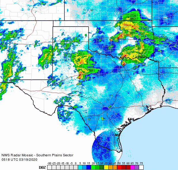
| Regional radar animation valid from 6:28 pm to 7:38 pm on 18 March 2020. Additional regional radar animation for the day can be found at: 3:38 pm to 4:48 pm; 9:48 pm to 10:58 pm; and 10:38 pm to 11:48 pm on 18 March 2020 and 12:18 am to 1:28 am on 19 March 2020. | |||||||||||
|
Scattered strong and severe storms also affected the southeast Texas Panhandle and Rolling Plains Wednesday evening. One of these storms produced golf ball size hail as it tracked northward along Highway 83 north of Childress. The storm also possessed a well-defined wall cloud, seen in the picture below. Thankfully, the wall cloud didn't produce any tornadoes. |
|||||||||||
.jpg) |
|||||||||||
| Severe thunderstorms and wall cloud passing by Childress on Wednesday evening (18 March 2020). | |||||||||||
| The storm intensity faded by mid-evening, though a couple of more rounds of sub-severe thunderstorms affected parts of the South Plains and Rolling Plains through early Thursday morning. | |||||||||||
 |
|||||||||||
| Large hail that fell on the west side of Lubbock on Wednesday evening (18 March). This picture was taken at Milwaukee and 82nd Street and shared on Twitter by Justin@FairTime81. | |||||||||||
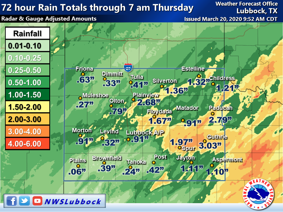
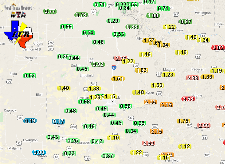
| By the time all was said and done, the entire region recorded welcome mid-March rains. Three-day rain totals of a quarter to three quarters of an inch were common, with 1 to 2+ inches of rain found from parts of the central and northern South Plains into the southeast Texas Panhandle and Rolling Plains. | |||||||||||
 |
|||||||||||
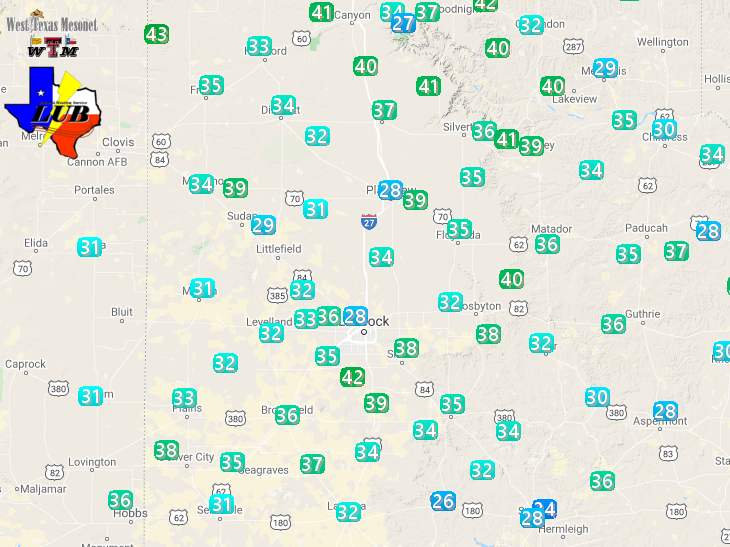
| 72-hour rain totals ending at 7 am on Thursday (19 March). The 6-day precipitation totals measured by the West Texas Mesonet ending on Thursday can also be VIEWED HERE. | |||||||||||
| Officially, Lubbock recorded 0.91 inches over the 3-day stretch, while 1.05 inches fell in Childress. These atypical mid-March rains further contributed to the relatively wet start to 2020. | |||||||||||
 |
|||||||||||
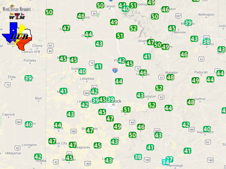
| Peak wind gusts observed by the West Texas Mesonet on Thursday, 20 March 2020. The peak sustained wind gusts on this day can be FOUND HERE. | |||||||||||
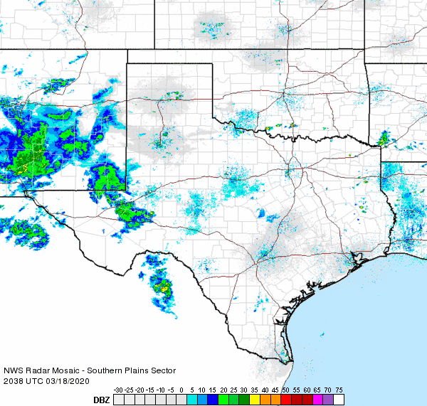
| More typical early spring weather, in the form of gusty and dry westerly winds, followed as the storm system that provided the rain in previous days lifted out to the north of the region on Thursday. Southwesterly winds of 30 to 40 mph, with gusts as high as 50 mph, where common Thursday afternoon. |
PRELIMINARY LOCAL STORM REPORT
NATIONAL WEATHER SERVICE LUBBOCK TX
1047 AM CDT TUE MAR 17 2020

..TIME...   ...EVENT...      ...CITY LOCATION...     ...LAT.LON...
..DATE...   ....MAG....      ..COUNTY LOCATION..ST.. ...SOURCE....
            ..REMARKS..

0855 AM     HAIL             5 W LEVELLAND           33.58N 102.45W
03/17/2020  M1.00 INCH       HOCKLEY            TX   TRAINED SPOTTER

            SPOTTER CONFIRMED 1" HAIL

0913 AM     HAIL             SMYER                   33.59N 102.16W
03/17/2020  E1.00 INCH       HOCKLEY            TX   BROADCAST MEDIA

0945 AM     HAIL             1 NE DOUD               33.56N 101.92W
03/17/2020  M1.00 INCH       LUBBOCK            TX   TRAINED SPOTTER

            OCCURRED AT MSF AND SLIDE

0947 AM     HAIL             3 ESE LUBBOCK SOUTH PLA 33.52N 101.87W
03/17/2020  M0.75 INCH       LUBBOCK            TX   TRAINED SPOTTER

            OCCURRED NEAR 77TH AND UNIVERSITY

0948 AM     HAIL             7 W LUBBOCK             33.58N 102.00W
03/17/2020  M0.75 INCH       LUBBOCK            TX   NWS EMPLOYEE

1045 AM     HAIL             RALLS                   33.68N 101.38W
03/17/2020  E1.00 INCH       CROSBY             TX   PUBLIC

