
Numerous severe thunderstorms are expected across a broad region from the Ohio Valley to the Mid-Atlantic and Northeast States today into tonight. Swaths of damaging wind gusts are expected and some tornadoes are possible. Bertha is expected to bring tropical storm conditions to portions of the Gulf Coast from the Florida Panhandle westward to southeastern Louisiana later today and Wednesday. Read More >
|
Widespread showers and thunderstorms visit West Texas |
|
 |
|
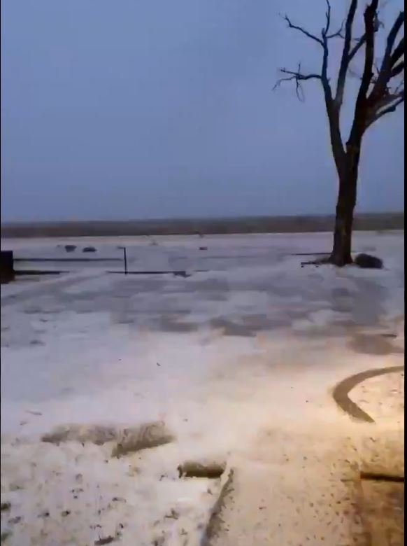
| Small hail covering the ground in Spade Sunday evening (24 January 2021). The image is courtesy of Javy Troche via Jacob Riley. | |
|
Chilly and moist air settled into the South Plains on Sunday (January 24th), complete with drizzle and fog and temperatures falling through the 40s. By early Sunday evening, temperatures were mostly in the upper 30s and lower 40s. |
|
 |
|
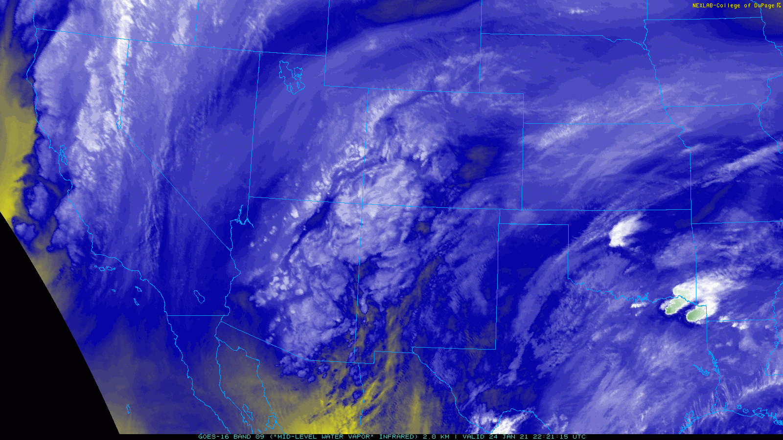
| Mid-level water vapor loop captured from GOES-16 on Sunday afternoon (24 January 2021) shows a large storm system approaching through the Desert Southwest. The animation is valid from 4:21 pm to 5:06 pm CST. | |
| Although these raw conditions certainly didn't feel very spring-like, rather mild and moist conditions were in place just to the south, over the Permian Basin and Big County. The warm and moist air was drawn northward up and over the cool air Sunday evening as a strong upper level storm system quickly approached out of the Desert Southwest. In response, showers and thunderstorms blossomed across the western South Plains early Sunday evening. | |
 |
|
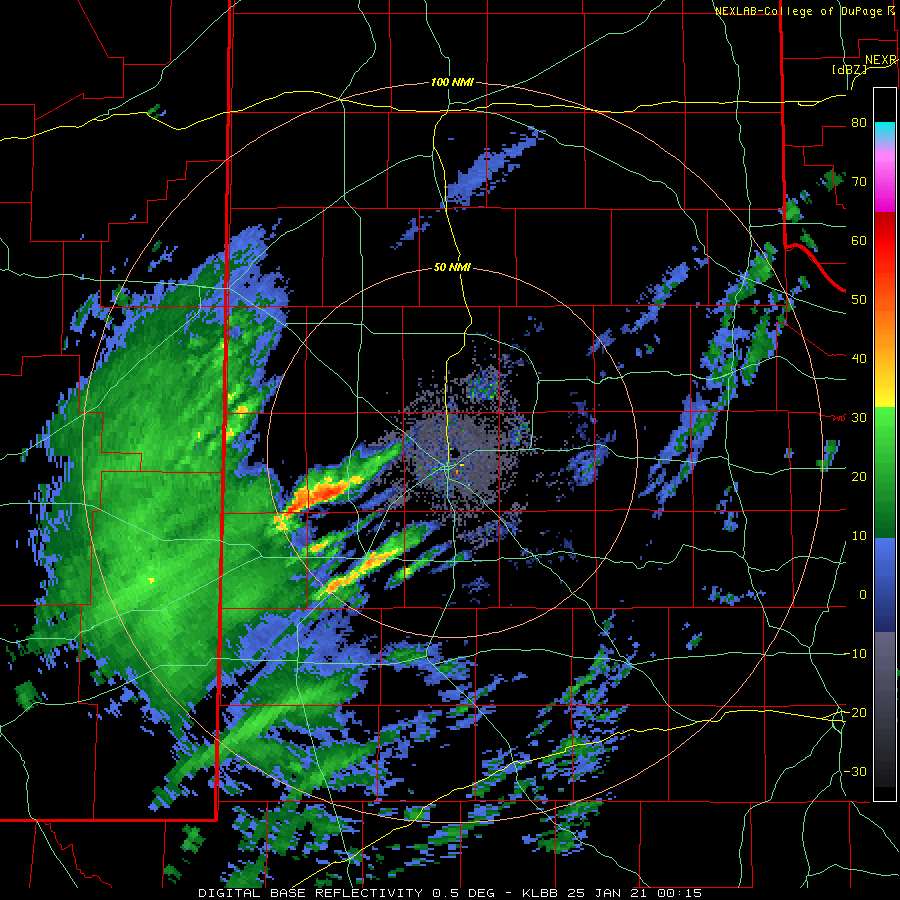
| Lubbock radar animation valid from 8:02 pm to 9:44 pm on Sunday (24 January 2021). | |
| The spring-like storms raced northeastward across the remainder of the South Plains and into the southern Texas Panhandle and Rolling Plains late Sunday evening, lingering into early Monday morning off the Caprock. The strongest of these storms dropped a lot of small hail, brief heavy rain and even generated gusty outflow winds. Although mostly sub-severe, a number of locations did receive pea sized hail, sometimes covering the ground completely. One storm did become severe, dropping hail in excess of golf ball size, as it tracked across southern and eastern portions of Lynn County. Unfortunately, the hail injured and killed many waterfowl that were wintering in the area, while also causing property damage. | |
 |
|
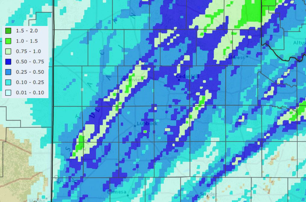
| 24-hour radar-estimated and bias-corrected rainfall ending at 2 pm on Monday (25 January 2021). | |
| The thundery evening brought welcome moisture to the South Plains region. Nearly everyone saw at least a little rain, with many spots recording a quarter to half inch of rain. A few lucky locations, in a couple of southwest-to-northeast swaths, measured totals near to slightly above an inch. | |
|
|
|
 |
|
| Rain totals measured by the NWS COOP Observers and the West Texas Mesonet for this late January event. | |
| Lubbock officially recorded 0.32 inches of rain on January 24th. This boosted the monthly and yearly total to exactly an inch. Although early in the year, this rainfall, in addition to the moisture from the snow a couple of weeks earlier, has Lubbock about a half inch above average for 2021. Childress officially measured 0.40 inches during these thunderstorms, and lifted their year total to near average. | |

