
Dangerous heat will expand from the Gulf Coast into the Southern Plains and Desert Southwest through week's end. Additional extreme heat impacting the Pacific Northwest will shift to the northern Plains by the weekend. Tropical Storm Bertha is expected to continue to impact portions of the northern Gulf Coast from the western Florida Panhandle to southeastern Louisiana through tonight. Read More >
|
Showers and t-storms bring rain, hail and damaging wind |
|||
 |
|||
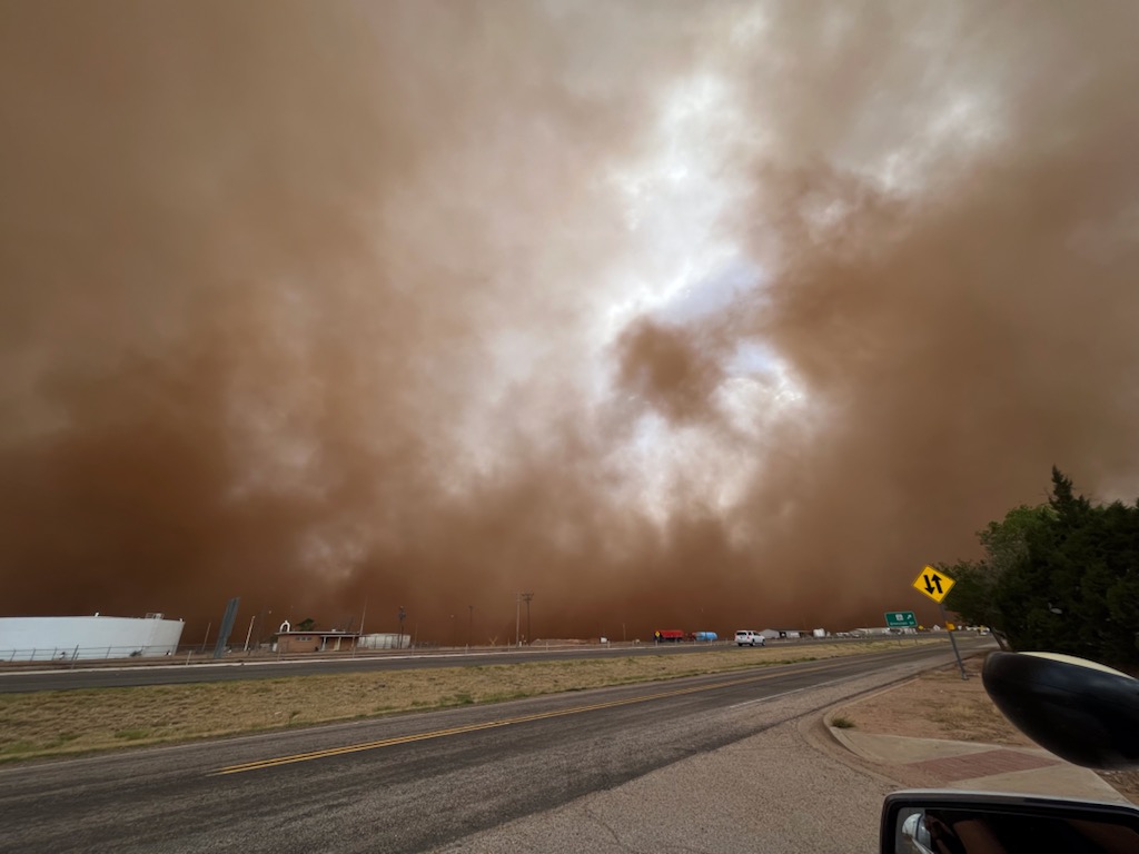
| Strong, dusty outflow approaching Slaton on Tuesday evening, 17 May 2022. The picture is courtesy of Trevor Barnes. | |||
|
Mid-May brought a couple of active days of weather to West Texas. The activity was sparked by a dryline and a couple of weak disturbances moving through the middle to upper atmosphere. |
|||
 |
|||
|
|||
|
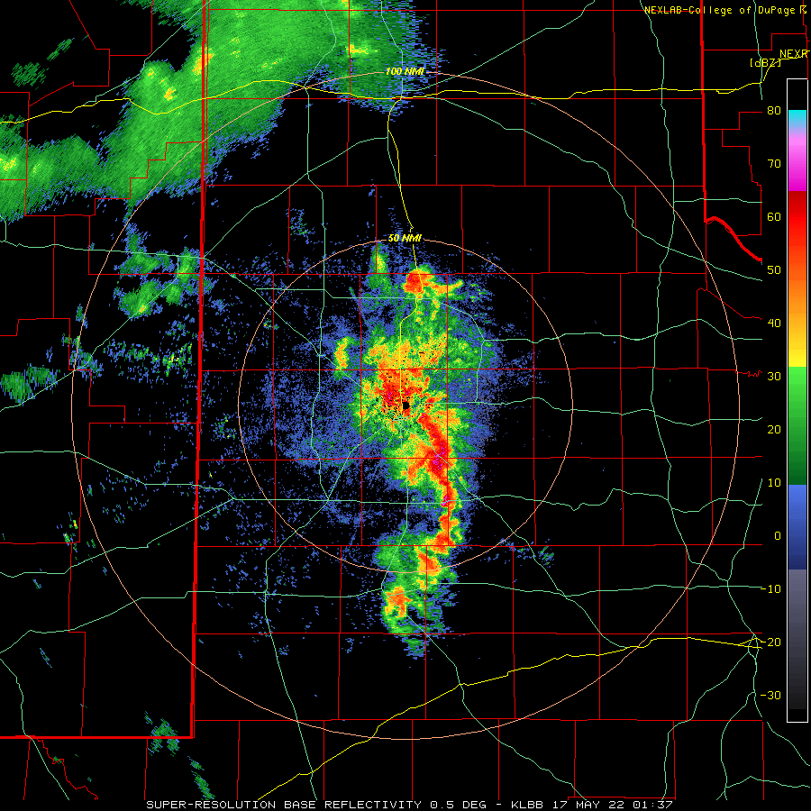
The most active day was Monday, May 16th, when moisture levels were higher and the upper level disturbance passed closer by. Strong heating, in combination with the moisture and disturbance, caused scattered thunderstorm to flourish over eastern New Mexico Monday afternoon. This activity developed eastward, organizing into a ragged line of thunderstorms as it moved across the South Plains, then into the Rolling Plains during the evening and overnight hours. |
|||
 |
|||
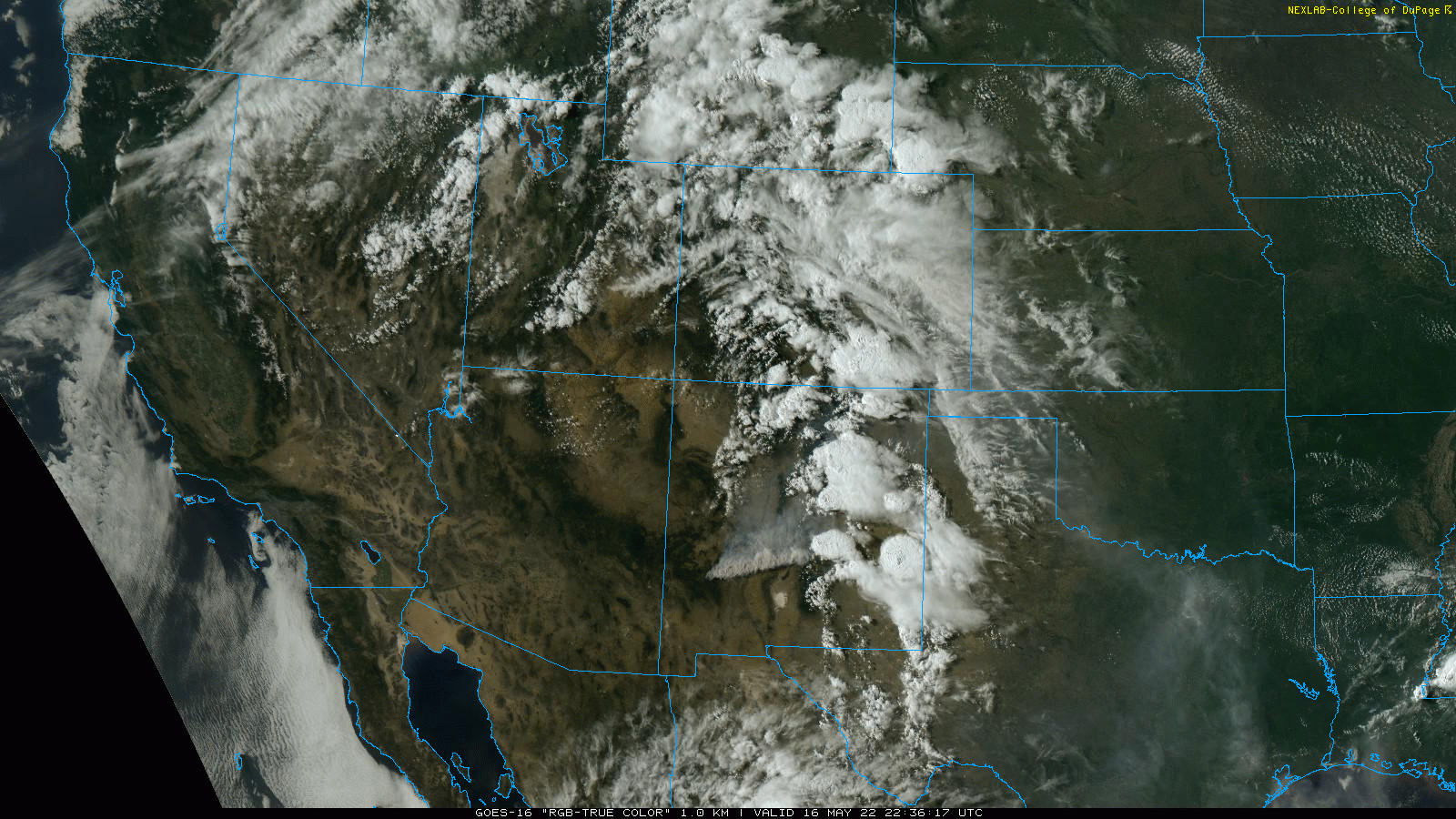
| Lubbock WSR-88D radar animation valid from 5:40 pm to 8:37 pm on 16 May 2022. Additional radar animation can be viewed at: 8:37 pm to 9:31 pm on the 16th; and 5:36 pm on the 16th to 6:23 am on the 17th. | |||
|
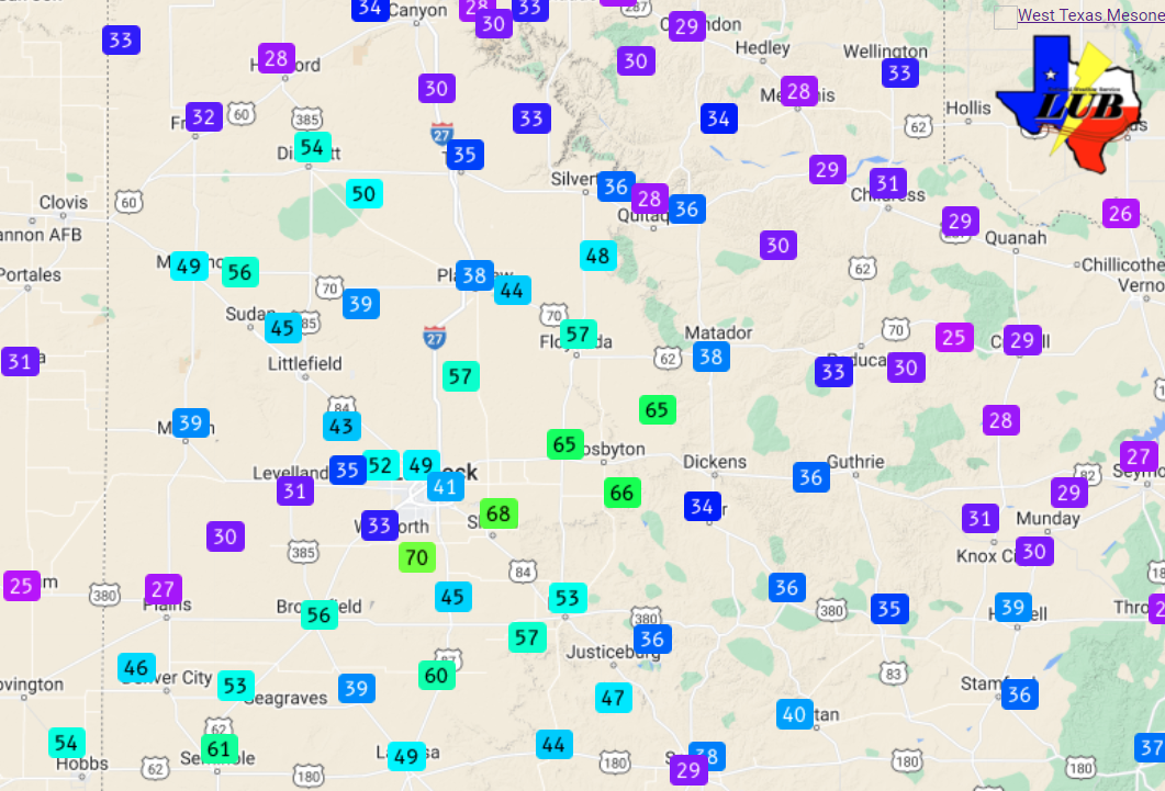
The thunderstorm produced widespread strong to severe winds as they accelerated eastward, along with blowing dust. The most intense winds were confined to a corridor from near Seminole and Brownfield east-northeastward through Slaton and Crosbyton, where gusts of 55 to 70 mph were common. |
|||
 |
|||
| Peak wind gusts measured by the West Texas Mesonet on 16 May 2022. | |||
|
Several locations also experienced small hail on the 16th, though the strong and dusty winds were much more widespread. The wind did knock out power in several locations. |
|||
 |
|||
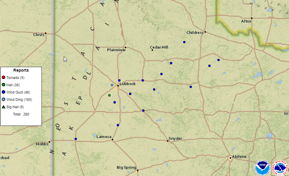
| Storm reports collected by the National Weather Service and displayed by the Storm Prediction Center for 16 May 2022. | |||
|
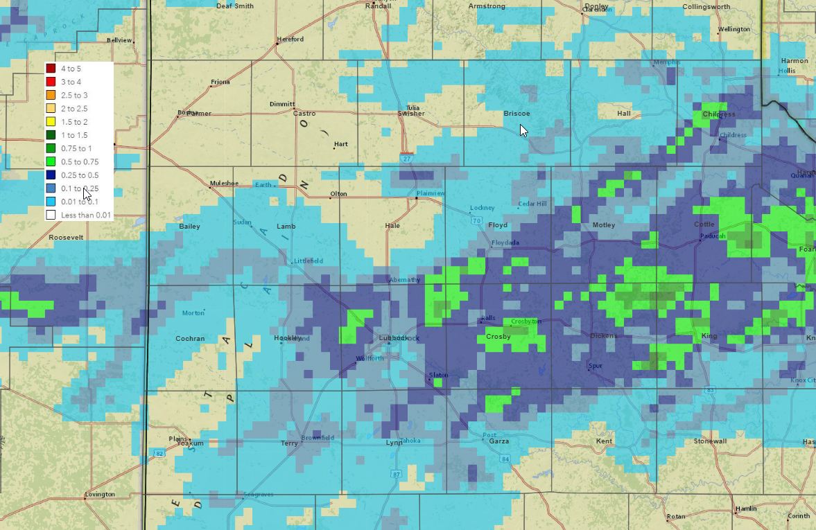
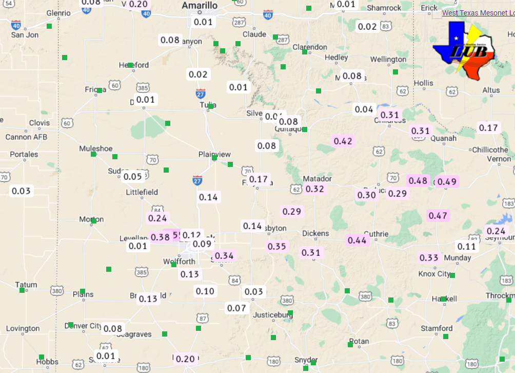
On the positive side of things, the evening and overnight activity provided much-needed rain for a good chunk of the South Plains and Rolling Plains. Unfortunately, rain totals weren't overly impressive, but many locations did record a quick tenth to third of an inch, with localized totals around a half inch or more. |
|||
 |
|||
| 24-hour radar-estimated and bias-corrected rainfall ending at 7 am on 17 May 2022. The rainfall measured by the West Texas Mesonet from 16-19 May 2022 can be VIEWED HERE. | |||
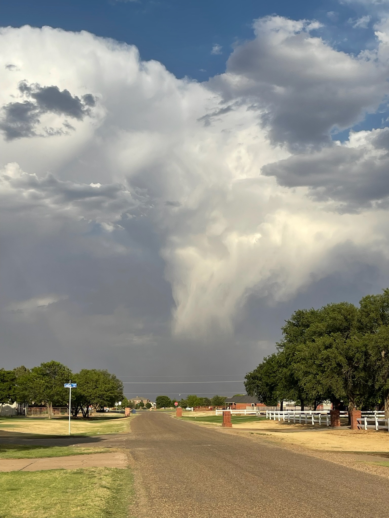
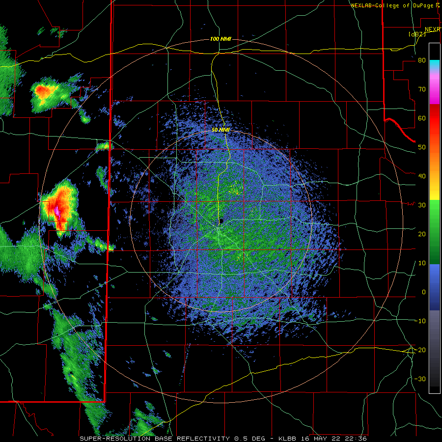
| The next evening brought additional showers and thunderstorms, though they were much more isolated than the previous day. In addition, low-level moisture was greatly limited in comparison to 24 hours earlier. | |||
 |
|||
| View of a high-based shower as it is approaching Slaton Tuesday evening (17 May 2022). The image is looking east and is courtesy of John Lipe. | |||
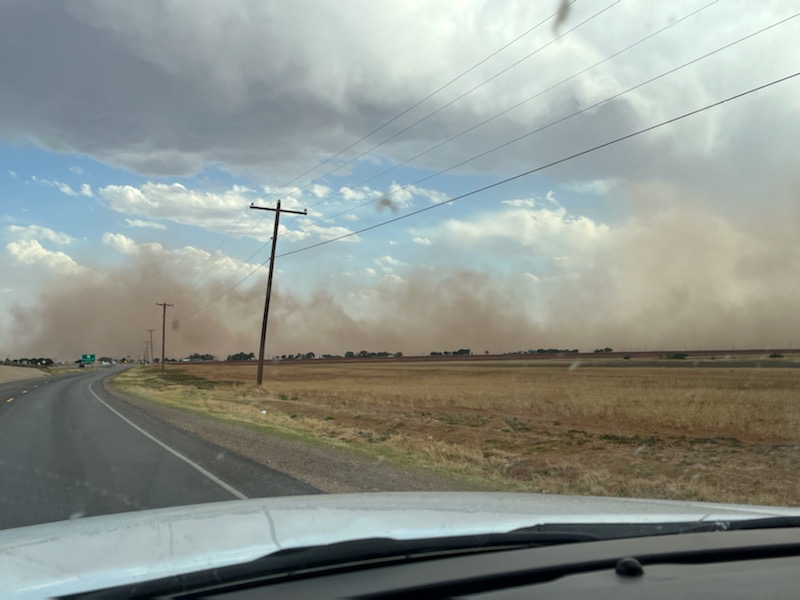
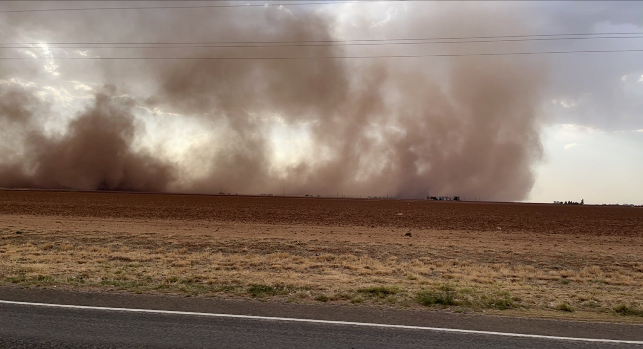
| The result was very high-based showers and thunderstorms Tuesday evening, efficient at generating strong to severe winds, blowing dust, but little to no rainfall. One of these high-based showers collapsed near Slaton, where a wind gust as high as 79 mph was measured by the West Texas Mesonet site on the northeast side of town. | |||
 |
 |
||
| Dust being lofted by strong winds near Slaton Tuesday evening (17 May 2022). The pictures are courtesy of Trevor Barnes. | |||
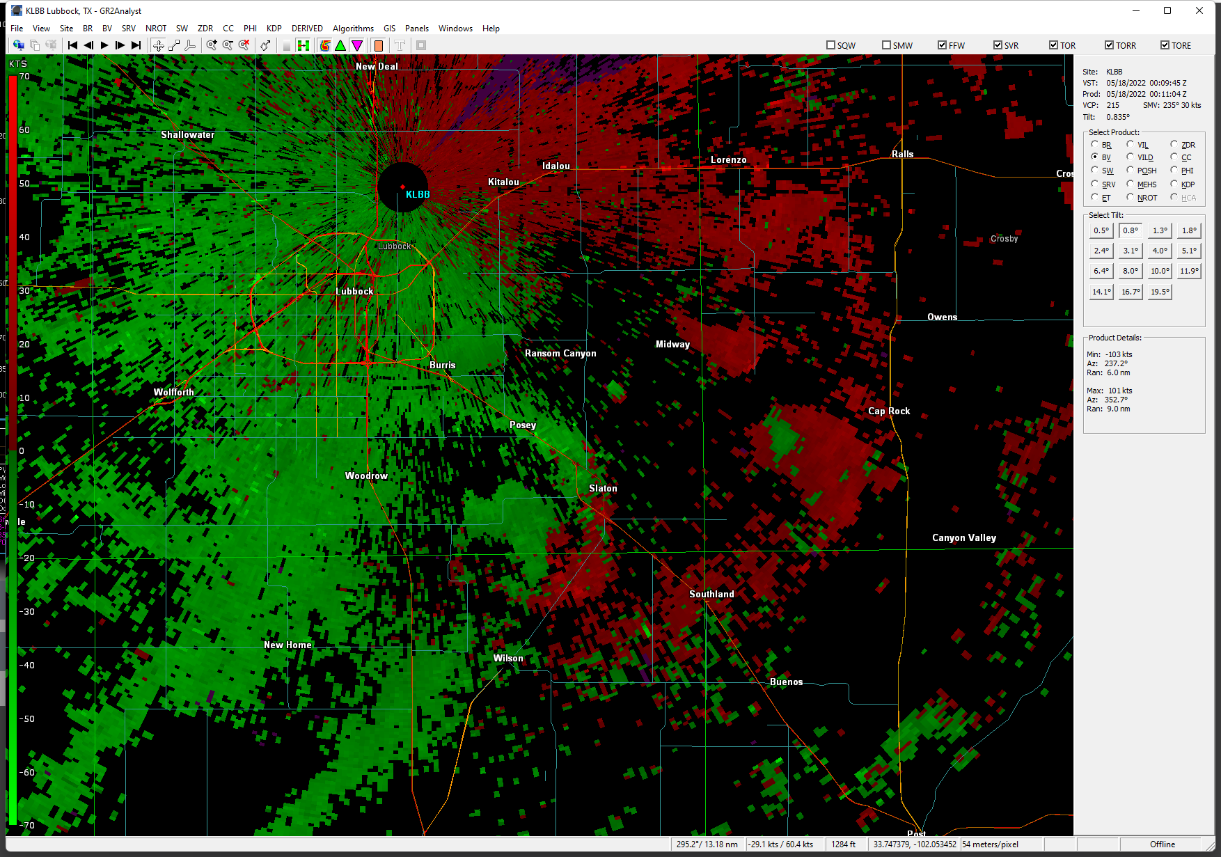
| The intense wind from the decaying shower lofted copious amounts of blowing dust as it approached and passed through Slaton. As can be inferred from the radar image below, very little to no rain actually made it to the ground, even though the robust winds did. | |||
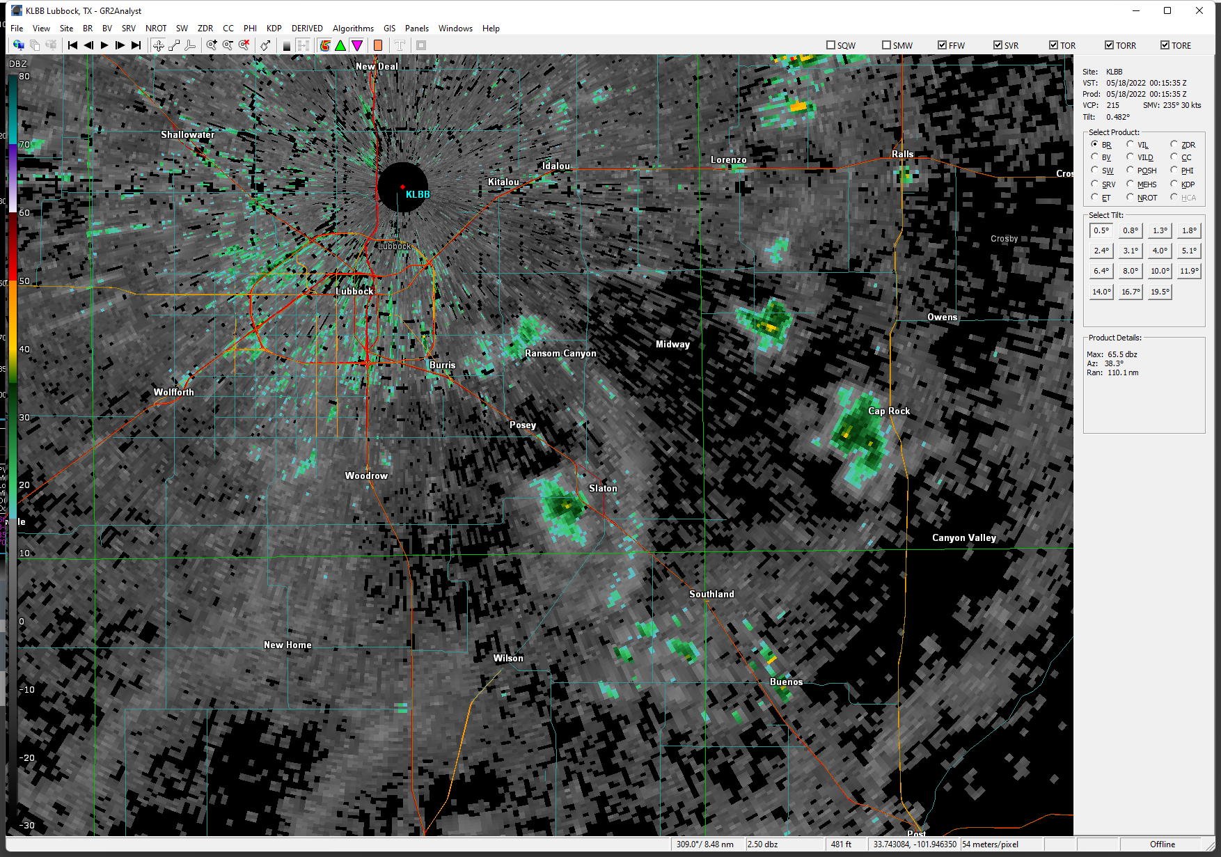 |
|||
|
Lubbock WSR-88D 0.8Ëš radar reflectivity image captured at 7:11 pm 17 May 2022. The radar velocity image observed at the same time came be VIEWED HERE. A radar animation valid from 2:00 pm on the 17th to 7:22 am on the 18th can be VIEWED HERE. |
|||
| Unfortunately, the intense winds did cause damage around Slaton. A portion of a roof was removed from a local business on the south side of town, as is shown below. | |||
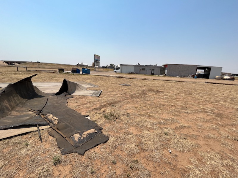 |
|||
| Roof damage sustained at Pitchforks & Smokerings BBQ in Slaton on 17 May 2022.The roofing material came from the building in the background. The image is courtesy of Trevor Barnes. | |||
|
The downburst winds also caused extensive tree damage throughout Slaton, and downed at least one road sign. |
|||
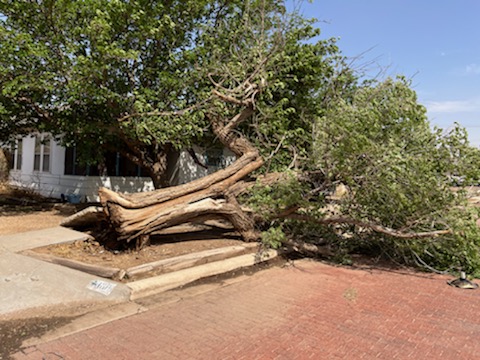 |
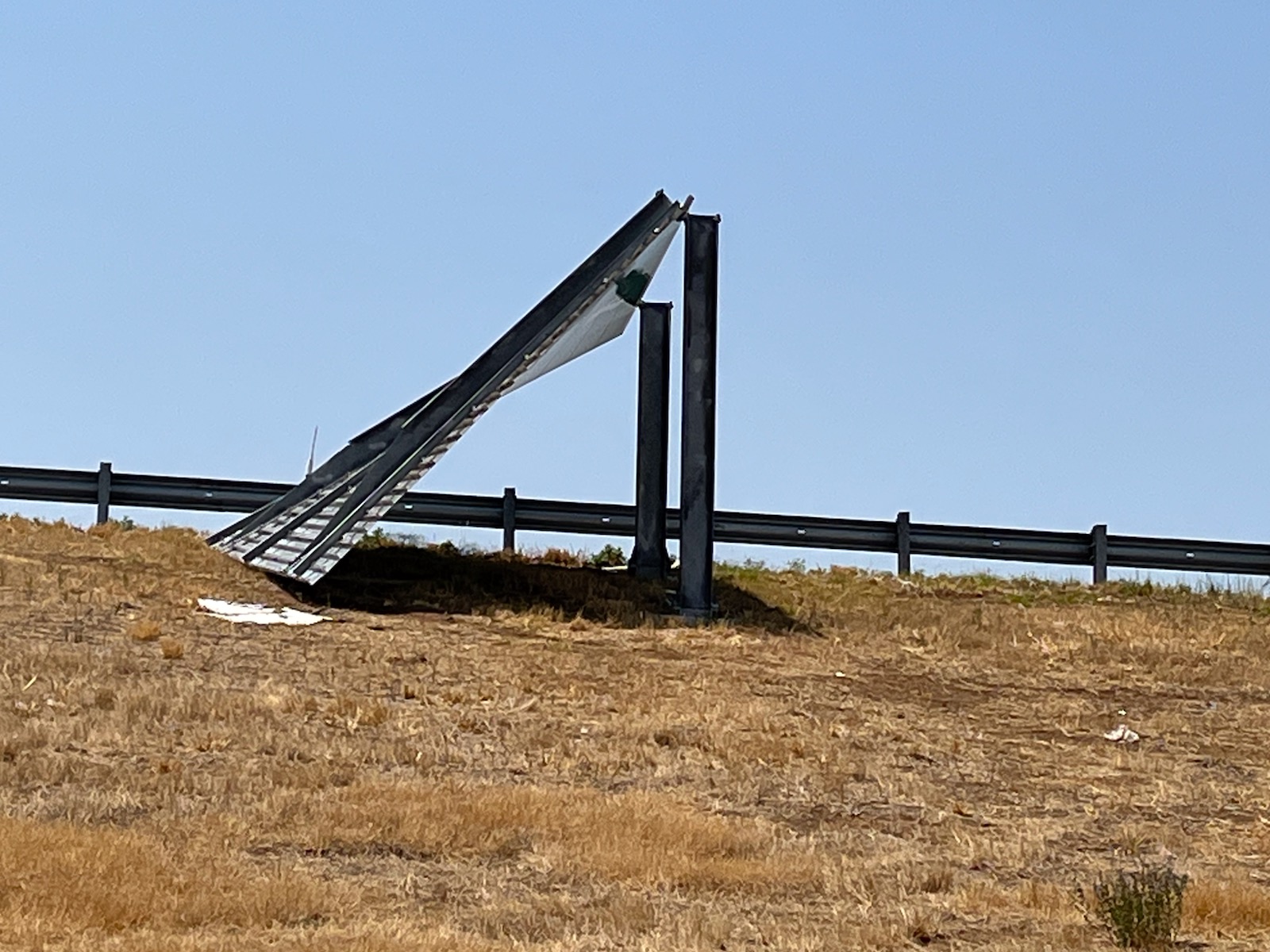 |
||
| Damage sustained in Slaton on 17 May 2022. The images are courtesy of Trevor Barnes. | |||
| The preliminary storm reports collected on these active mid-May days can be found below. | |||
PRELIMINARY LOCAL STORM REPORT...SUMMARY
NATIONAL WEATHER SERVICE LUBBOCK TX
1124 PM CDT MON MAY 16 2022

..TIME...   ...EVENT...      ...CITY LOCATION...     ...LAT.LON...
..DATE...   ....MAG....      ..COUNTY LOCATION..ST.. ...SOURCE....
            ..REMARKS..

0742 PM     TSTM WND GST     1 W O`DONNELL           32.97N 101.85W
05/16/2022  M58 MPH          LYNN               TX   MESONET

            WEST TEXAS MESONET

0811 PM     TSTM WND GST     NEW HOME                33.33N 101.91W
05/16/2022  M70 MPH          LYNN               TX   MESONET

            WEST TEXAS MESONET. 58 MPH SUSTAINED WIND ALSO
            RECORDED.

0818 PM     HAIL             5 S WOLFFORTH           33.44N 102.01W
05/16/2022  M1.00 INCH       LUBBOCK            TX   NWS EMPLOYEE

0831 PM     TSTM WND GST     6 NNE LUBBOCK           33.67N 101.82W
05/16/2022  M58 MPH          LUBBOCK            TX   ASOS

            VISIBILITY AS LOW AS 1 SM DUE TO HEAVY RAIN AND BLOWING
            DUST.

0833 PM     TSTM WND GST     2 NE SLATON             33.46N 101.62W
05/16/2022  M68 MPH          LUBBOCK            TX   MESONET

            WEST TEXAS MESONET. 53 MPH SUSTAINED WINDS ALSO
            RECORDED.

0833 PM     TSTM WND DMG     5 WNW LUBBOCK           33.60N 101.96W
05/16/2022                   LUBBOCK            TX   EMERGENCY MNGR

            EMERGENCY MANAGER REPORTS DOWNED POWER LINES IN THE
            5700 BLOCK OF 3RD ST.

0905 PM     TSTM WND GST     1 SE RALLS              33.67N 101.38W
05/16/2022  M65 MPH          CROSBY             TX   MESONET

            WEST TEXAS MESONET

0916 PM     TSTM WND GST     6 NW WHITE RIVER LAKE   33.53N 101.17W
05/16/2022  M66 MPH          CROSBY             TX   MESONET

            WEST TEXAS MESONET. GUST ALSO TO 59 MPH 9:15 MPH.

0920 PM     TSTM WND GST     3 NNW MCADOO            33.77N 101.03W
05/16/2022  M65 MPH          DICKENS            TX   MESONET

            WEST TEXAS MESONET. 59 MPH GUST ALSO AT 9:19 PM.

0937 PM     TSTM WND GST     1 NE POST               33.20N 101.37W
05/16/2022  M60 MPH          GARZA              TX   MESONET

            WEST TEXAS MESONET

0940 PM     TSTM WND GST     3 N ROARING SPRINGS     33.94N 100.85W
05/16/2022  M62 MPH          MOTLEY             TX   MESONET

            WEST TEXAS MESONET

1012 PM     TSTM WND GST     10 WSW GUTHRIE          33.57N 100.48W
05/16/2022  M60 MPH          KING               TX   MESONET

            WEST TEXAS MESONET

1020 PM     TSTM WND GST     1 S NORTHFIELD          34.27N 100.60W
05/16/2022  M61 MPH          MOTLEY             TX   MESONET

            WEST TEXAS MESONET

1032 PM     TSTM WND GST     2 SSE HACKBERRY         33.90N 100.13W
05/16/2022  M58 MPH          COTTLE             TX   MESONET

            WEST TEXAS MESONET

