
Dangerous and extreme heat will remain across portions of the central U.S. this week, persisting across the mid to lower Mississippi Valley, Gulf Coast, southern Plains and portions of Texas. A heat wave over the Southwest U.S. will peak this weekend. Heavy to excessive rainfall may produce flash flooding from the Delmarva Peninsula north into the Hudson Valley today and tonight. Read More >
|
Powerful winter storm brings widespread wind & blowing dust to West Texas |
|
 |
|
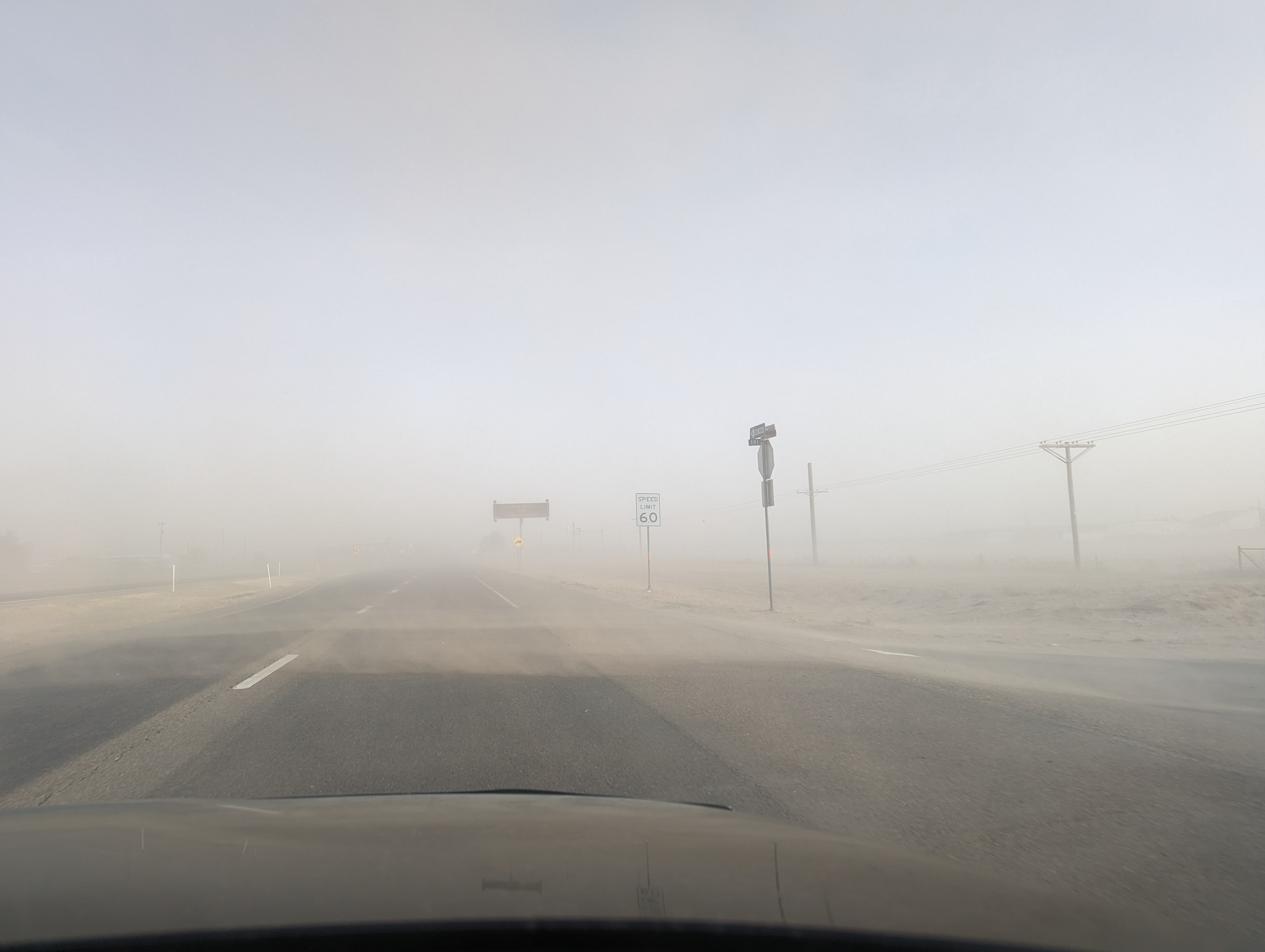
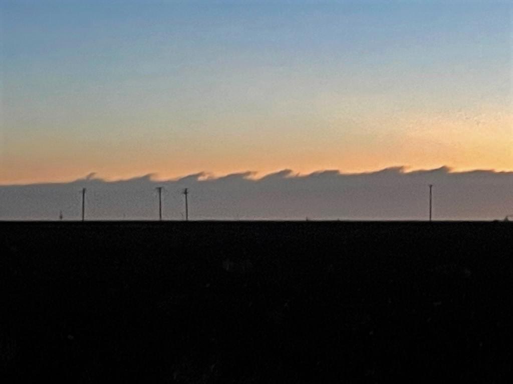
| Thick blowing dust blowing across Highway 84 immediately southeast of Muleshoe late Wednesday afternoon (22 February 2023). The image is courtesy Gary Skwira. | |
|
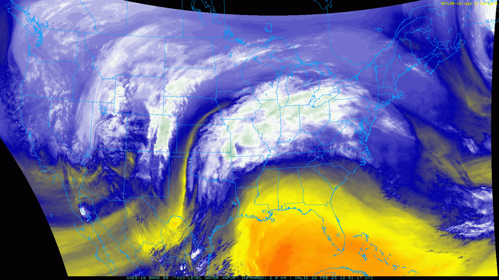
A large and intense winter storm tracking out of the western United States brought widespread impacts to the Rockies and adjacent High Plains in late February. Heavy snow was common from the Intermountain West into the Upper Midwest between February 21st and 23rd, while farther southeast it was warm enough for showers and thunderstorms. Regardless of where you found yourself, on the cold side or the warm side of the storm system, the entire region experienced a whole lot of wind. |
|
 |
|
| Water vapor satellite loop valid from 6:51 am to 4:21 pm on Wednesday (22 February 2023). | |
| Here in West Texas, breezy to windy conditions occurred well in advance of the system on Tuesday, though the worst of the wind held off until Wednesday. Between the two windy days, an embedded disturbance ahead of the primary storm system provided enough lift and moisture to generate scattered showers and even a few weak thunderstorms Tuesday evening/night. | |
 |
|
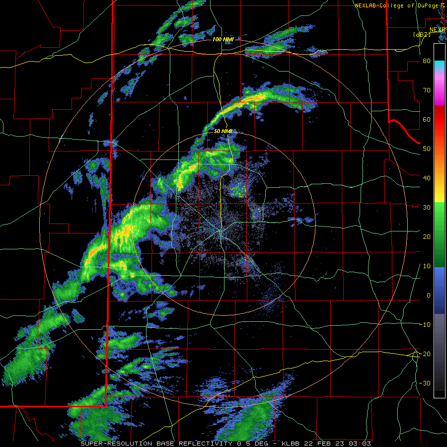
| Lubbock WSR-88D radar animation valid from 9:03 to 10:49 pm Tuesday evening (22 February). | |
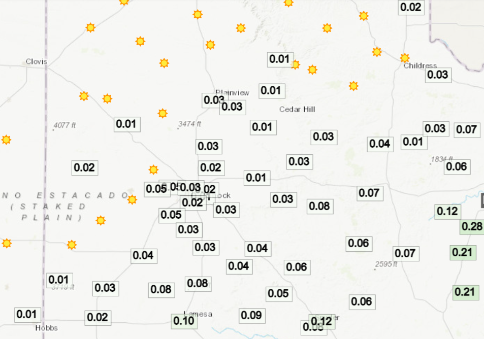
| The showers battled relatively dry low-levels, but were able to squeeze out a little light rain for most of the South Plains and Rolling Plains. Rain totals of a couple hundredths to around a tenth of an inch were common, with a few spots eeking out a bit more. The high-based showers did also enhance the wind, creating brief bursts of strong to severe gusts in places. | |
 |
|
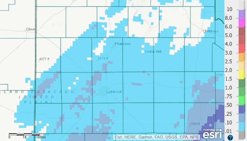
| 24-hour radar-estimated and bias-corrected precipitation ending at 6 am on Wednesday (22 February). The rain totals measured by the West Texas Mesonet for this event can be FOUND HERE. | |
| Any sense of moisture from the light overnight rain quickly faded away as very strong and dry westerly winds rapidly overspread West Texas early Wednesday. Unique clouds known as Kelvin-Helmholtz clouds (KH clouds), shown below, were spotted over the South Plains early Wednesday morning. KH clouds are indicative of very strong vertical wind shear, which was certainly the case on Wednesday. | |
 |
|
| Kelvin-Helmholtz clouds viewed to the east of Lubbock early Wednesday morning (22 February 2023). The picture is courtesy of the West Texas Mesonet. | |
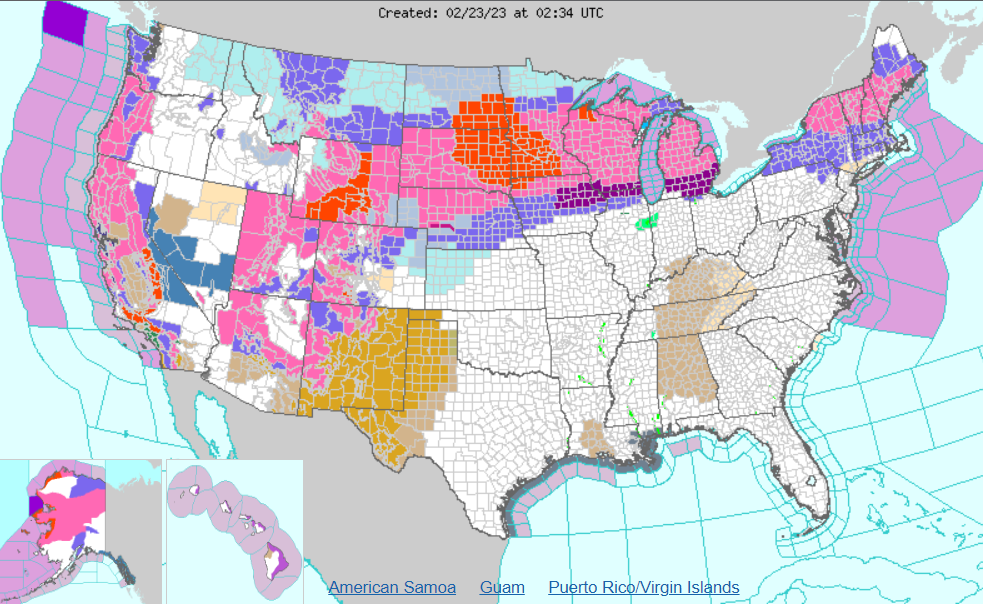
| The extent of the of impacts from the massive winter storm can be found below. In general, the brown colors represent high wind products while the purples, pinks and reds are winter weather products. | |
 |
|
| Watch, warning and advisory map valid for the entire United States Wednesday evening (22 February). | |
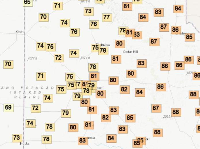
| The strong westerly downslope winds did provide warm conditions. Highs on Tuesday reached into the 70s and 80s, while even behind a Pacific cold front, temperatures still topped out in the 60s and 70s on Wednesday. | |
 |
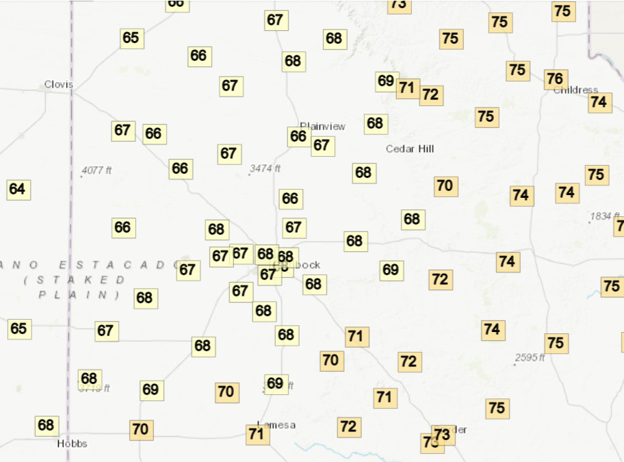 |
| High temperatures recorded by the West Texas Mesonet on Tuesday (left) and Wednesday (right). | |
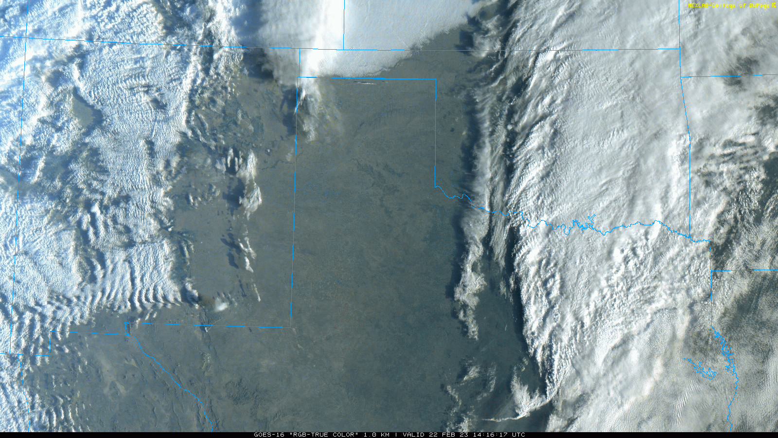
| Though the temperatures were rather pleasant for late February, the wind certainly was not, and this unpleasantness was further enhanced by the copious amounts of dust the wind lofted. The initial thrust of strong to severe wind gusts lifted an area of blowing dust over the southwestern South Plains around midday. This plume of dust was carried into southwestern Oklahoma by late afternoon, while additional and more widespread blowing dust enveloped most of West Texas and eastern New Mexico. The dust turned the sky an eerie brown/orange while dropping the visibility to 2 miles or lower in a number of locations. Localized very low visibility, under a quarter mile, did occur downwind of some open fields and other dust sources. | |
 |
|
| "RGB-True Color" satellite animation valid from 8:16 am to 5:56 pm on Wednesday (22 February). Several plumes of blowing dust are readily apparent. | |
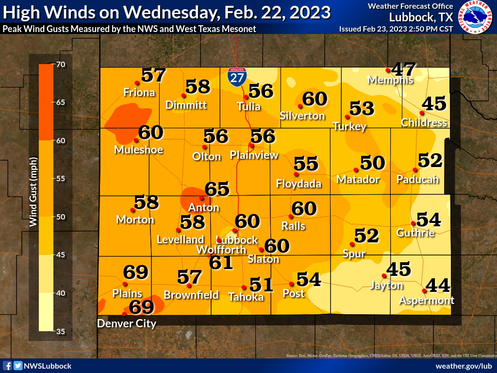
| Peak wind gusts of 50-60+ mph were common across the South Plains region, as the below map illustrates. A few sites recorded gusts of 65 mph or higher, including Anton, as well as Plains and Denver City which measured peak gusts of 69 mph! Thankfully the winds and dust gradually decreased through the evening hours as the storm system responsible pulled away from the region. | |
 |
|
| Peak wind gusts measured on Wednesday (22 February). The data are courtesy of the West Texas Mesonet and the National Weather Service. | |
|
Preliminary wind reports collected on February 22nd can be found below: |
|
PRELIMINARY LOCAL STORM REPORT...SUMMARY
NATIONAL WEATHER SERVICE LUBBOCK TX
906 PM CST WED FEB 22 2023

..TIME...   ...EVENT...      ...CITY LOCATION...     ...LAT.LON...
..DATE...   ....MAG....      ..COUNTY LOCATION..ST.. ...SOURCE....
            ..REMARKS..

1208 AM     NON-TSTM WND GST 7 ESE SILVERTON         34.45N 101.19W
02/22/2023  M60 MPH          BRISCOE            TX   MESONET

            WIND GUST ENHANCED BY APPROACHING SHOWER.

1255 AM     NON-TSTM WND GST 6 NNW IDALOU            33.73N 101.73W
02/22/2023  M58 MPH          LUBBOCK            TX   MESONET

            WIND GUST ENHANCED FROM DEPARTING SHOWER.

0934 AM     NON-TSTM WND GST LUBBOCK INT. AIRPORT    33.67N 101.82W
02/22/2023  M58 MPH          LUBBOCK            TX   ASOS

            ASOS STATION KLBB LUBBOCK.

1003 AM     NON-TSTM WND GST 6 WNW DENVER CITY       32.99N 102.94W
02/22/2023  M58 MPH          YOAKUM             TX   MESONET

            MESONET STATION 45 DENVER CITY 7W.

1026 AM     NON-TSTM WND GST 6 NNE LUBBOCK           33.67N 101.82W
02/22/2023  M60 MPH          LUBBOCK            TX   ASOS

            ASOS STATION KLBB PEAK GUST 240@60 MPH.

1048 AM     NON-TSTM WND GST 3 NNW PLAINS            33.23N 102.84W
02/22/2023  M67 MPH          YOAKUM             TX   MESONET

            MESONET STATION 17 PLAINS 3N. FIRST GUST
            BEGAN AT 1043AM.

1049 AM     NON-TSTM WND GST 5 NW WHITE RIVER LAKE   33.53N 101.17W
02/22/2023  M59 MPH          CROSBY             TX   MESONET

            MESONET STATION 27 WHITE RIVER LAKE 6NW.
            FIRST SEVERE GUST AT 1046AM WITH 58MPH.

1128 AM     NON-TSTM WND GST 8 SW SUNDOWN            33.39N 102.61W
02/22/2023  M58 MPH          COCHRAN            TX   MESONET

            MESONET STATION 29 SUNDOWN 8SW.

1239 PM     NON-TSTM WND GST 4 S LEVELLAND           33.53N 102.36W
02/22/2023  M59 MPH          HOCKLEY            TX   MESONET

            MESONET STATION 6 LEVELLAND 4S.

1244 PM     NON-TSTM WND GST 6 E ROPESVILLE          33.42N 102.05W
02/22/2023  M60 MPH          LUBBOCK            TX   MESONET

            MESONET STATION 47 WOLFFORTH 6 MI SW. FIRST
            SEVERE GUST 58MPH AT 12:31 PM.

0112 PM     NON-TSTM WND GST NEW HOME                33.33N 101.91W
02/22/2023  M61 MPH          LYNN               TX   MESONET

            MESONET STATION 100 NEW HOME/LYNN COUNTY.

0114 PM     NON-TSTM WND GST 6 SSW ANTON             33.73N 102.19W
02/22/2023  M58 MPH          HOCKLEY            TX   MESONET

            MESONET STATION 30 ANTON 6S.

0127 PM     NON-TSTM WND GST 2 NW REESE CENTER       33.61N 102.05W
02/22/2023  M58 MPH          LUBBOCK            TX   MESONET

            MESONET STATION 1 LUBBOCK (REESE) 12W.

0135 PM     NON-TSTM WND GST 2 SSW LEVELLAND         33.55N 102.37W
02/22/2023  M58 MPH          HOCKLEY            TX   AWOS

            AWOS KLLN LEVELLAND MUNICIPAL AIRPORT.

0138 PM     NON-TSTM WND GST 2 NE SLATON             33.46N 101.62W
02/22/2023  M60 MPH          LUBBOCK            TX   MESONET

            MESONET STATION SLATON 2NE.

0142 PM     NON-TSTM WND GST 4 SE DOWNTOWN LUBBOCK   33.54N 101.81W
02/22/2023  M59 MPH          LUBBOCK            TX   MESONET

            MESONET - LUBBOCK 4SE.

0206 PM     NON-TSTM WND GST 6 E NEW DEAL            33.73N 101.74W
02/22/2023  M58 MPH          LUBBOCK            TX   MESONET

            MESONET STATION 6 E OF NEW DEAL.

0233 PM     NON-TSTM WND GST 1 SE RALLS              33.67N 101.38W
02/22/2023  M60 MPH          CROSBY             TX   MESONET

            MESONET STATION RALLS 1SE. FIRST SEVERE GUST
            AT 2:21 PM.

0356 PM     NON-TSTM WND GST 2 SSW MULESHOE          34.20N 102.74W
02/22/2023  M58 MPH          BAILEY             TX   MESONET

            MEASURED BY THE TTU MESONET.

0523 PM     NON-TSTM WND GST 1 ENE MORTON            33.73N 102.74W
02/22/2023  M58 MPH          COCHRAN            TX   MESONET

            WEST TEXAS MESONET REPORT.

