
Numerous severe thunderstorms are expected across a broad region from the Ohio Valley to the Mid-Atlantic and Northeast States today into tonight. Swaths of damaging wind gusts are expected and some tornadoes are possible. Bertha is expected to bring tropical storm conditions to portions of the Gulf Coast from the Florida Panhandle westward to southeastern Louisiana later today and Wednesday. Read More >
|
Active weather to end March and start April 30 March - 1 April 2026 |
|
 |
|
|
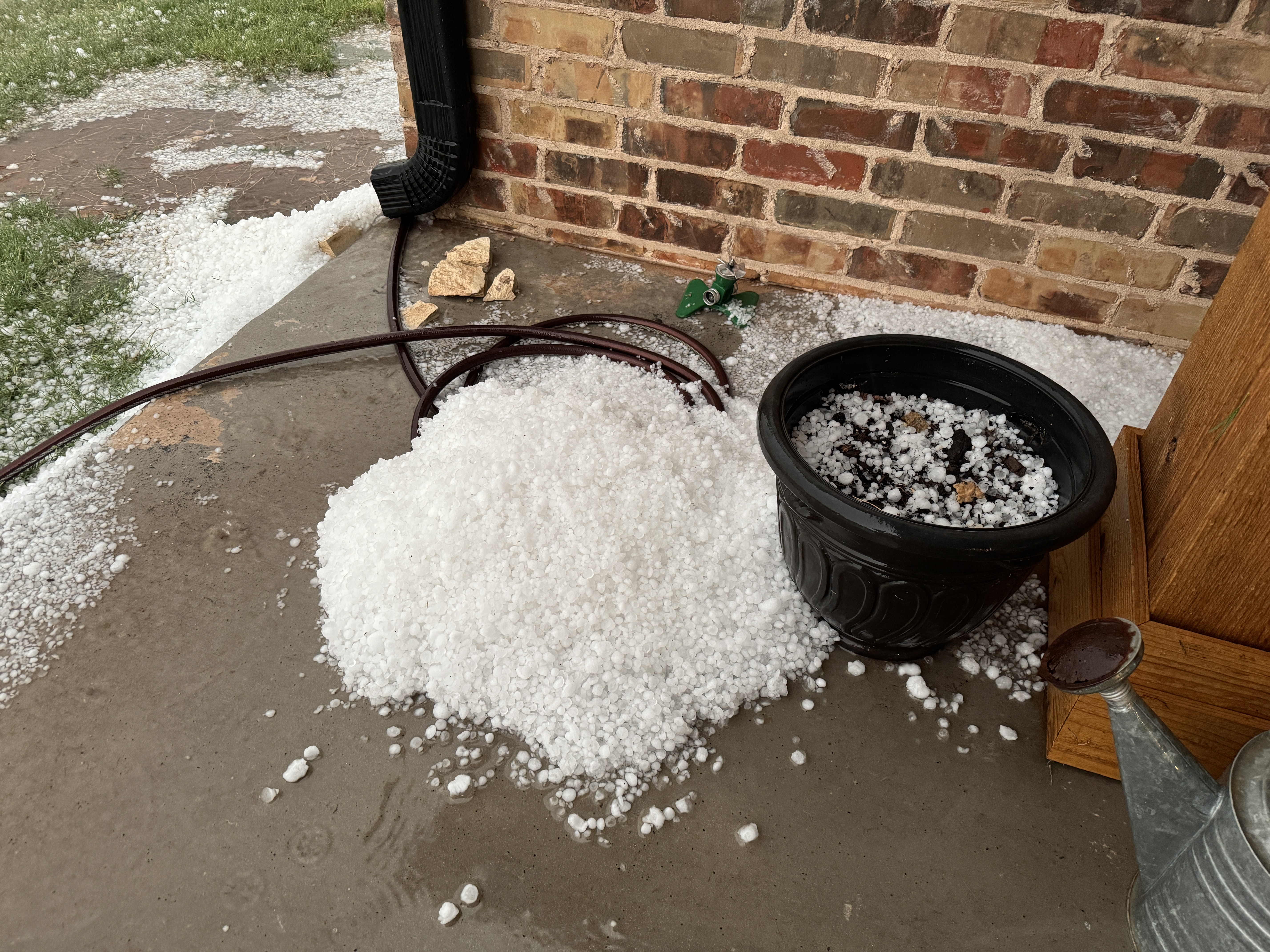
Hail piled up just north of Paducah on Tuesday evening (31 March 2026). The picture is courtesy of Dana Wright. An additional view of one of the larger hailstones can be SEEN HERE. |
|
|
Dry conditions were the rule through most of March, but that changed, at least for some, at the very end of the month. The reason for the change was the return of the dryline, in combination with sufficient moisture and forcing to trigger a few rounds of showers and thunderstorms. |
|
 |
|
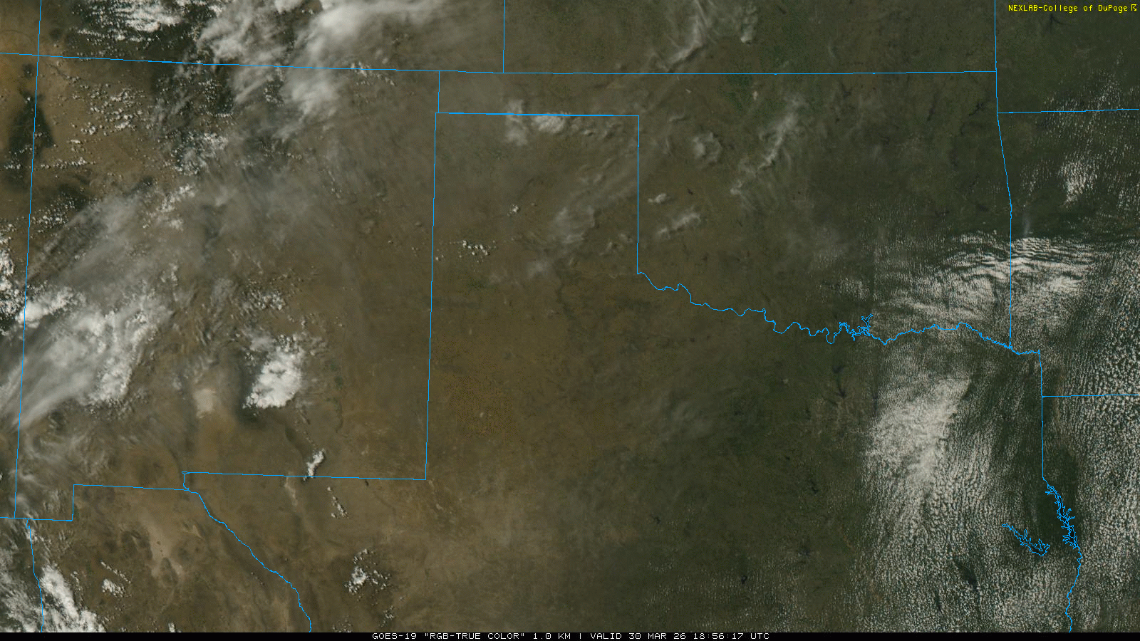
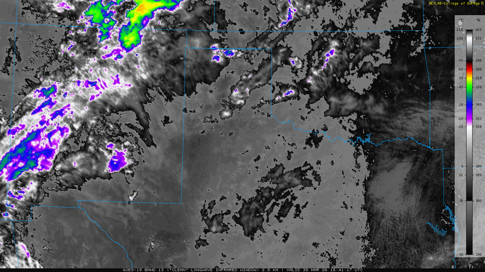
| "RGB-True Color" satellite loop valid from 1:51 pm to 8:11 pm on Monday (31 March 2026). An infrared satellite loop, valid from 1:41 pm to 8:56 pm on Monday, can be VIEWED HERE. | |
| Monday, March 30th, brought the first taste of springtime dryline activity. Low-level moisture along and east of the dryline wasn't overly robust on Tuesday, but proved sufficient to support scattered high-based shower and thunderstorm development by late afternoon. | |
 |
|
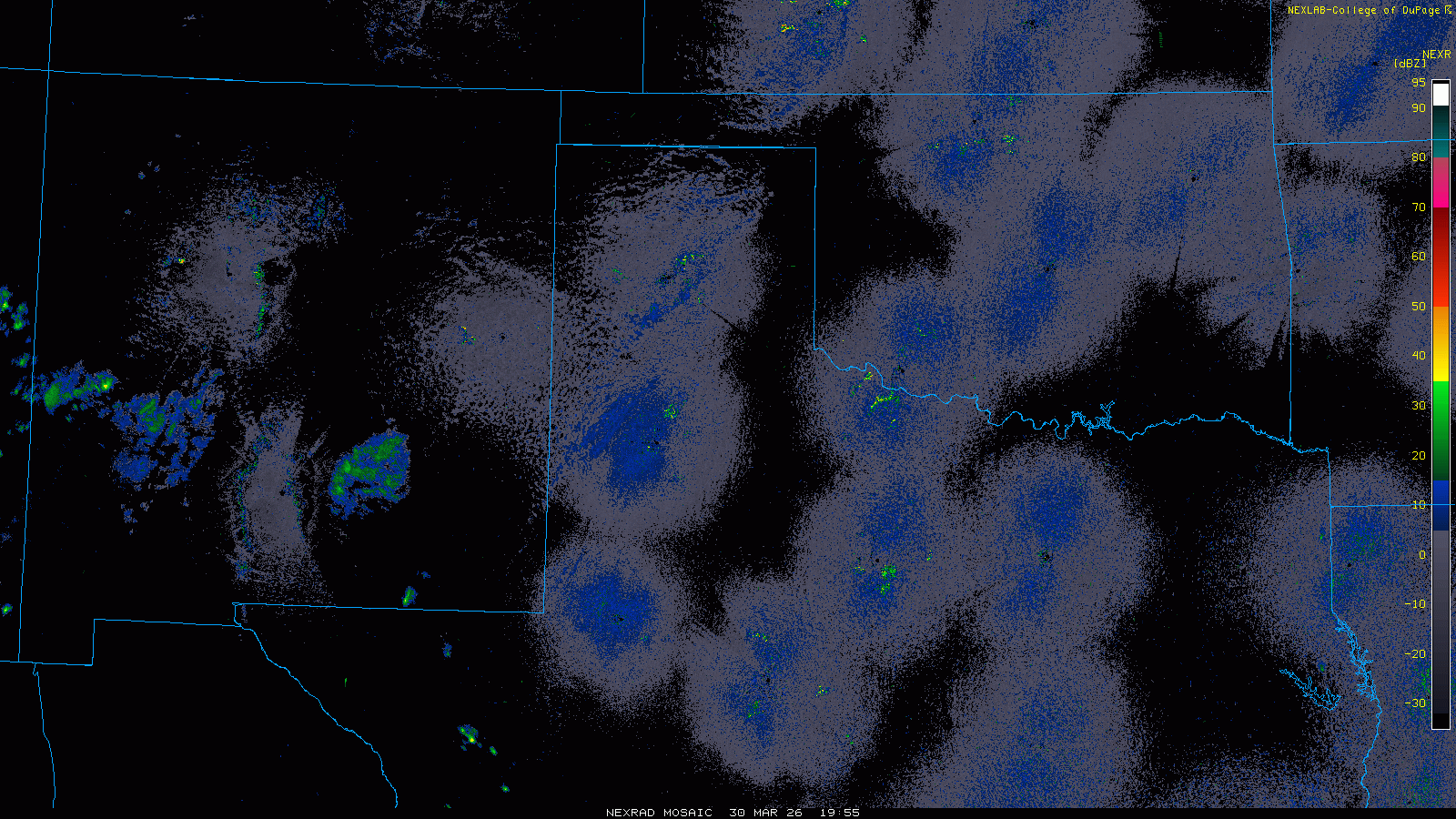
| Regional radar animation valid from 1:05 pm to 8:55 pm on Monday (31 March 2026). | |
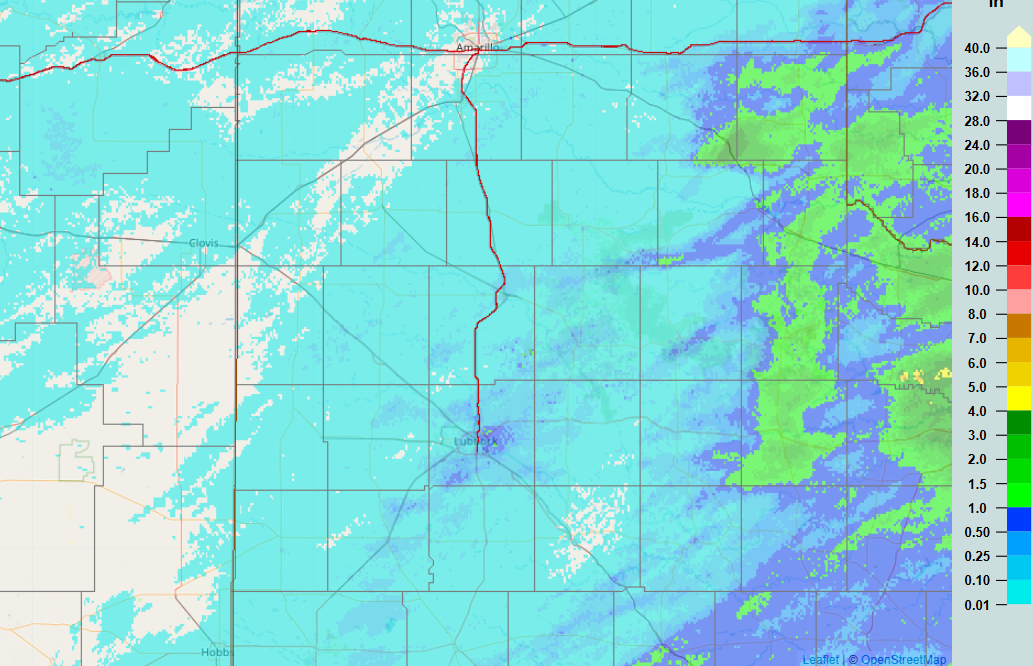
| The activity that formed near Lubbock didn't produce a lot of rain, as much of it evaporated before reaching the ground. Even so, many locations did measure a few hundredths to over a tenth of an inch of rain, as can be SEEN HERE. In addition to the rain, a few spots had small hail, and many locations experienced strong to severe wind gusts. A peak wind gust of 72 mph was measured by the West Texas Mesonet (WTM) near Shallowater as one of the high-based thunderstorms moved by. | |
 |
|
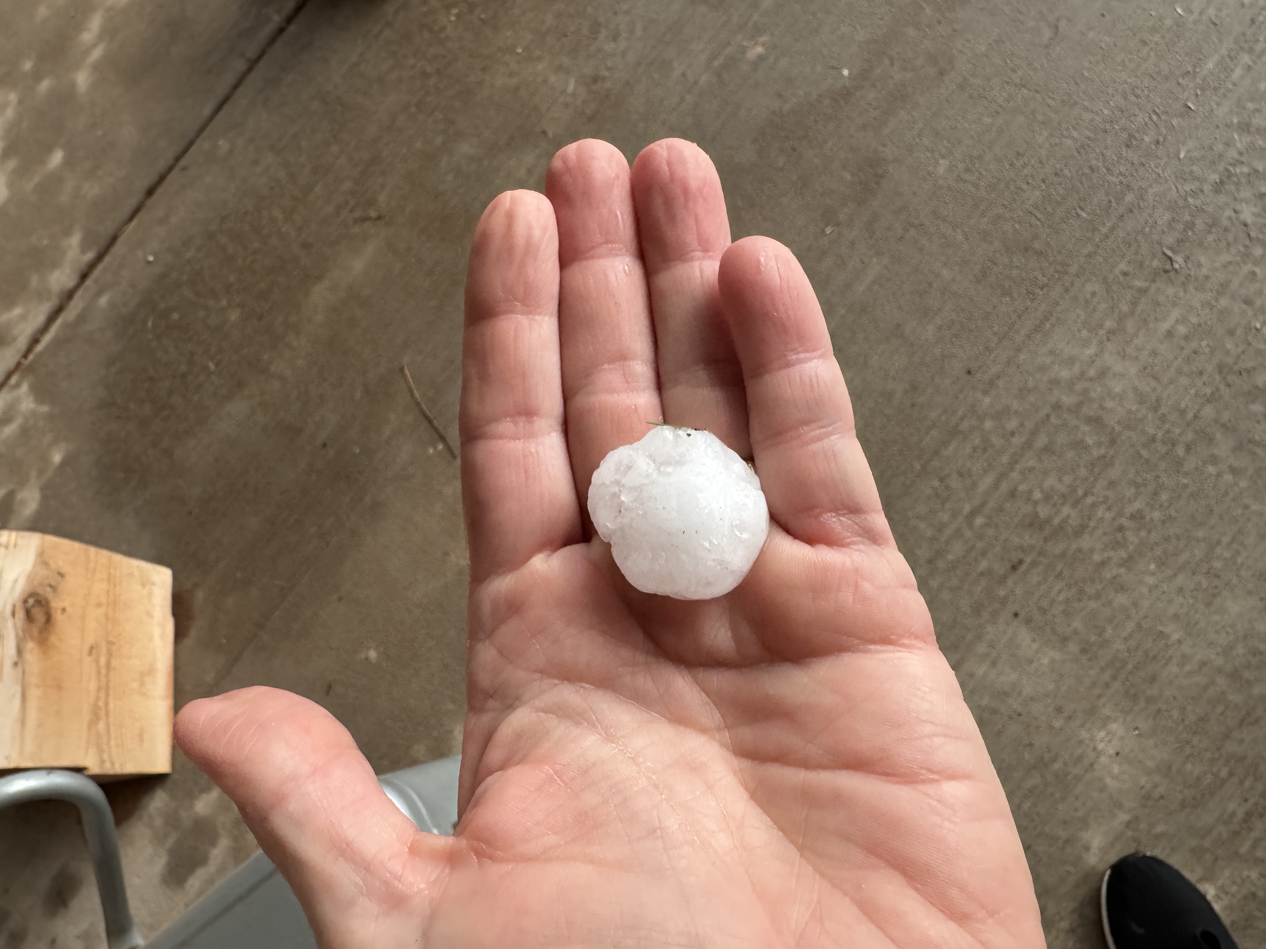
| Hail that fell in Memphis on Monday evening (31 March 2026). The picture is courtesy of Farrah Holcomb. | |
| The most significant storm of the day took shape farther north, over the southeast Texas Panhandle. This storm went on to produce brief heavy rain and hail as large as golf balls as it moved across Memphis Monday evening, before quickly fading after 9 pm. | |
 |
|
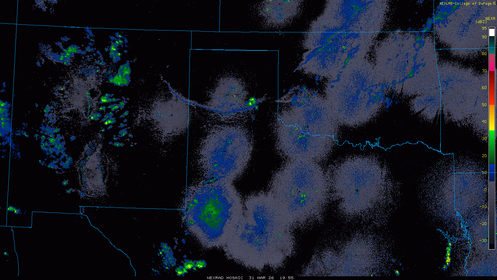
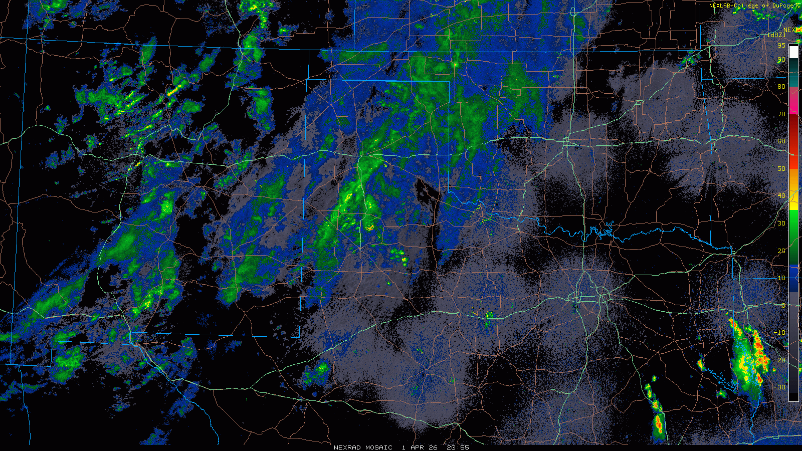
| Regional radar animation valid from 2:05 pm to 10:25 pm on Tuesday (31 March 2026). A close up loop from the Lubbock WSR-88D, valid from 4:39 pm to 10:29 pm on Tuesday, can be FOUND HERE. | |
| The following day (Tuesday, March 31st), brought more of the same. However, this time the dryline moved farther east, into the Rolling Plains, and was aided by a cold front that moved south out of the Texas Panhandle. The cold front and dryline intersection provided the focus for robust thunderstorm development. This activity formed over the southeast Texas Panhandle Tuesday afternoon and translated southward well into the Rolling Plains through the evening hours. Heavy rain, severe wind gusts and large hail accompanied the strongest storms. Hail as large as golf balls fell 5 miles southwest of Childress and a peak wind gust of 68 mph was measured by the WTM near Hackberry. | |
 |
|
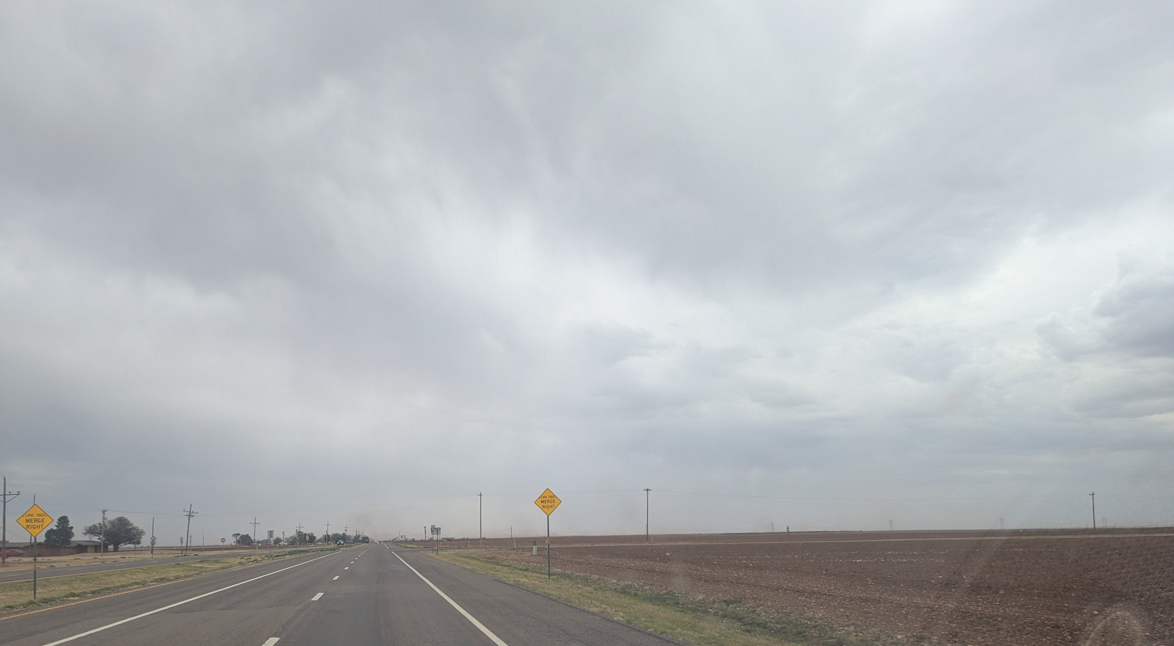
| Downburst, accompanied by dust and occasional sprinkles, north of Ralls on Wednesday afternoon (1 April 2026). | |
|
The next day (April Fools' Day) brought the third day in a row of impactful weather to parts of West Texas. This day a mid-upper level storm system emerging to our north carried increased mid-upper level moisture over the region while also providing large-scale lift. The result was more widespread shower and thunderstorm activity Wednesday afternoon and evening. |
|
 |
|
| Regional radar animation valid from 3:05 pm to 7:25 pm on Wednesday (1 April 2026). A close up loop from the Lubbock WSR-88D, valid from 4:59 pm to 7:16 pm on Wednesday, can be FOUND HERE. | |
| Initially, low-level moisture was scare and which limited the amount of rain reaching the ground over the South Plains. Many locations on the Caprock did receive a few sprinkles or brief light showers, but little to no measurable rainfall. Instead, strong to severe wind gusts were the main impact, with gusts of 40 to 60+ mph being common Wednesday afternoon and evening. A wind gust as high as 67 mph accompanied one of these "virga" showers as it move by the WTM near New Deal. | |
 |
|
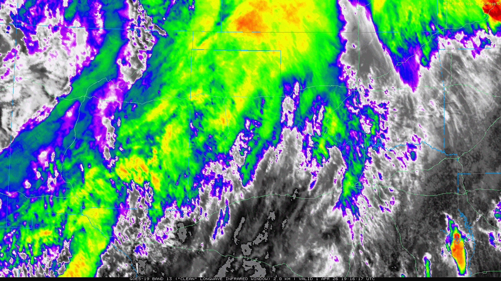
| Infrared satellite loop, valid from 2:16 pm to 7:26 pm, on Wednesday (1 April 2026). An "RGB-True Color" satellite animation, valid from 3:31 pm to 7:11 pm on Wednesday, can be VIEWED HERE. | |
|
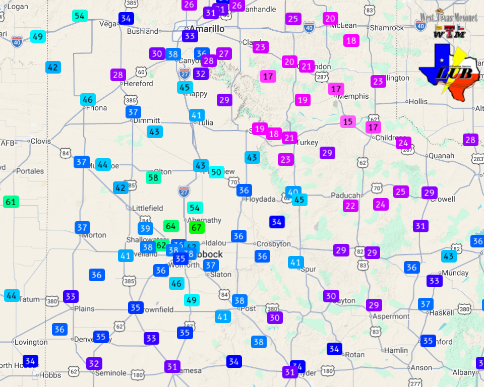
Once the lift reached the better low-level moisture and instability, thunderstorms erupted over the eastern Texas Panhandle and adjacent Rolling Plains. Several of these storms became severe as they raced east and northeastward, producing torrential rainfall, damaging wind gusts and swaths of hail. The WTM sites near Childress and Guthrie measured wind gusts of 71 mph and 72 mph, respectively. In addition, a couple of power lines were blown down in Aspermont. |
|
 |
|
| Peak wind gusts measured by the West Texas Mesonet through 5:10 pm on Wednesday (1 April 2026). | |
| Over the course of the 3-day stretch many locations over the South Plains region saw at least a little rain, though only trace amounts for many spots on the Caprock. However, farther east, meaningful rain, in excess of 1 inch, did fall over much of the southeast Texas Panhandle and eastern Rolling Plains. | |
 |
|
| 3-day radar-estimated and biased-corrected precipitation ending at 7 am on Thursday (2 April 2026). | |
| A list of the preliminary storm reports collected over this active stretch can be found below. | |
Preliminary Local Storm Report...Summary
National Weather Service Lubbock TX
854 PM CDT Mon Mar 30 2026

..TIME...   ...EVENT...      ...CITY LOCATION...     ...LAT.LON...
..DATE...   ....MAG....      ..COUNTY LOCATION..ST.. ...SOURCE....
            ..REMARKS..

0524 PM     Tstm Wnd Gst     4 NNE Shallowater       33.75N 101.97W
03/30/2026  M63 MPH          Lubbock            TX   Mesonet

            West Texas Mesonet.

0538 PM     Tstm Wnd Gst     4 NNE Shallowater       33.75N 101.97W
03/30/2026  M72 MPH          Lubbock            TX   Mesonet

            West Texas Mesonet.

0604 PM     Tstm Wnd Gst     1 NNW Lubbock Int. Airp 33.67N 101.82W
03/30/2026  M67 MPH          Lubbock            TX   ASOS

            One-mile visibility from blowing dust.

0705 PM     Tstm Wnd Gst     1 NE Memphis            34.74N 100.53W
03/30/2026  M60 MPH          Hall               TX   Mesonet

            West Texas Mesonet.

0720 PM     Tstm Wnd Gst     2 WSW Turkey            34.38N 100.93W
03/30/2026  M58 MPH          Hall               TX   Mesonet

            West Texas Mesonet.

0829 PM     Hail             Memphis                 34.73N 100.54W
03/30/2026  E1.50 Inch       Hall               TX   Law Enforcement

            Hall County Sheriff Office reported lots of
            ping pong ball sized hail in Memphis.

0836 PM     Hail             Memphis                 34.73N 100.54W
03/30/2026  E1.75 Inch       Hall               TX   Public

            Multiple phone calls of golf ball sized hail
            in Memphis, with lots of hail on the ground.

0718 PM     Tstm Wnd Gst     2 NNE Floydada          34.01N 101.33W
03/30/2026  M61 MPH          Floyd              TX   Mesonet

            West Texas Mesonet.

0752 PM     Tstm Wnd Gst     2 NNE Floydada          34.01N 101.33W
03/30/2026  M64 MPH          Floyd              TX   Mesonet

            West Texas Mesonet. Gusts occurred as storms
            were collapsing.

