
Flash flooding threatens areas from the Tennessee Valley to the Carolinas as storms repeat along a stalled front. Monsoonal storms may trigger flooding in the Southwest. Dangerous heat expands across the Desert Southwest, Plains, mid-Mississippi Valley and Southern Tier. Critical fire weather for interior Pacific Northwest. Cooler, drier air brings brief relief to the Great Lakes and Northeast. Read More >
|
Cold front triggers scattered severe thunderstorms |
|
 |
|
|
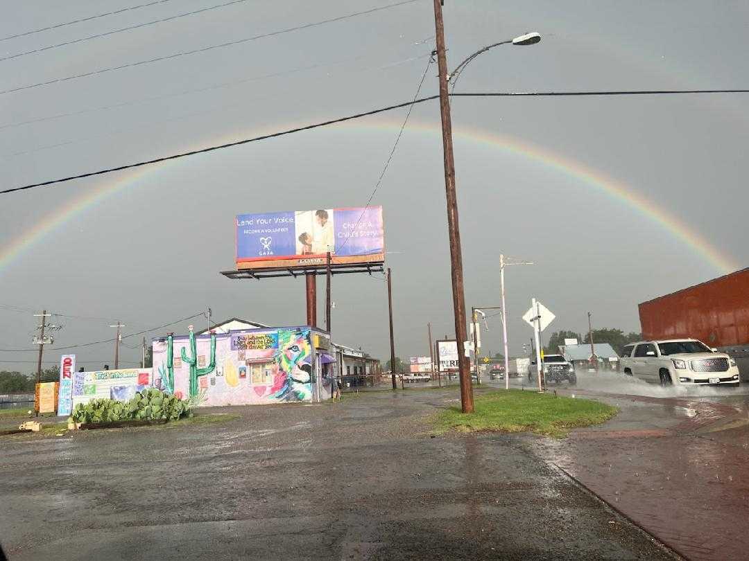
Rainbow and wet roadways in Childress Thursday evening (11 June 2026). The picture is courtesy of Farrah Holcomb. |
|
|
Following a scorching day, with many locations experiencing highs in the upper 90s and lower triple digits, a well "cold" front dipped into the region Thursday afternoon (11 June 2026). The front slowed to a crawl as it encountered the hot temperatures late Thursday, but it also provided the focus for thunderstorm development. Strong instability, a result of the heat and humidity ahead of the front, fueled the rapid development on scattered thunderstorms along the front Thursday evening. |
|
 |
|
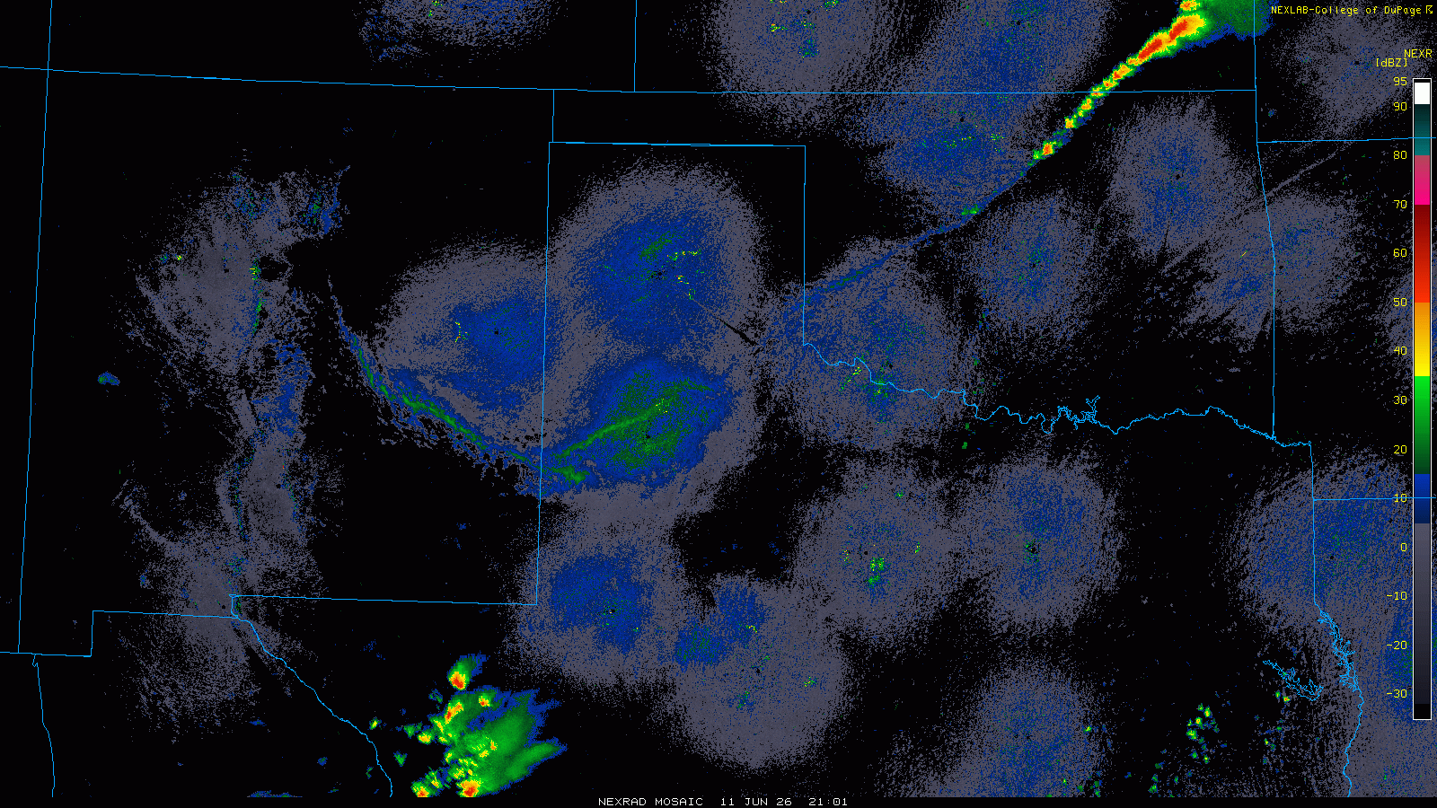
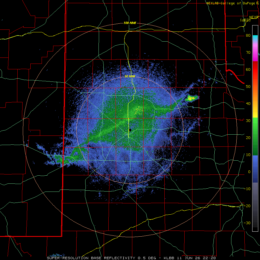
| Regional radar animation valid from 4:01 pm on Thursday to 2:01 am on Friday (11-12 June 2026). The Lubbock WSR-88D radar loop, valid from 5:23 pm on Thursday to 6:48 am on Friday, can be VIEWED HERE. | |
| Initially thunderstorms erupted over the southeast Texas Panhandle and northern Rolling Plains, where triple digit heat allowed clouds to break through a capping inversion. A dearth in wind throughout much of the depth of the atmosphere kept storms from moving very quickly. However, where storms did develop, they dumped heavy rain and produced strong outflow winds and pockets of hail. In Childress, hail as large a quarter size was reported, as well as street flooding. | |
 |
|
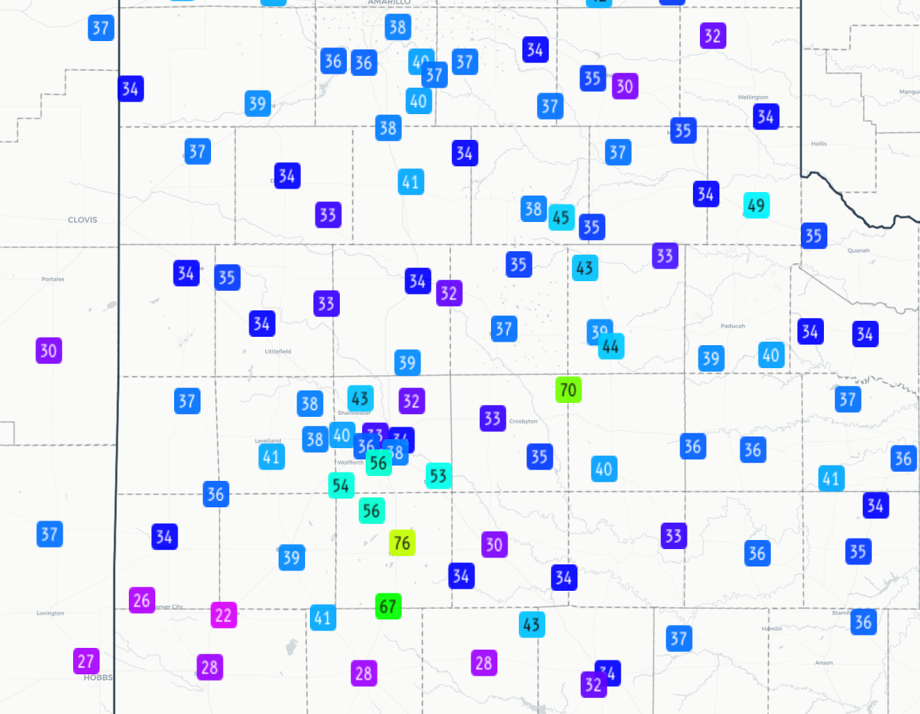
| Peak wind gusts measured by the West Texas Mesonet (WTM) on Thursday (11 June 2026). | |
| Additional thunderstorm development soon followed through the central South Plains Thursday evening, with quarter size hail and heavy rain observed in Levelland around 7:30 pm. Similar conditions also occurred southeast of Floydada about the same time with a separate storm. This storm went on to generate a 70 mph wind gust as it moved across the West Texas Mesonet (WTM) near McAdoo at 8:16 pm. | |
 |
|
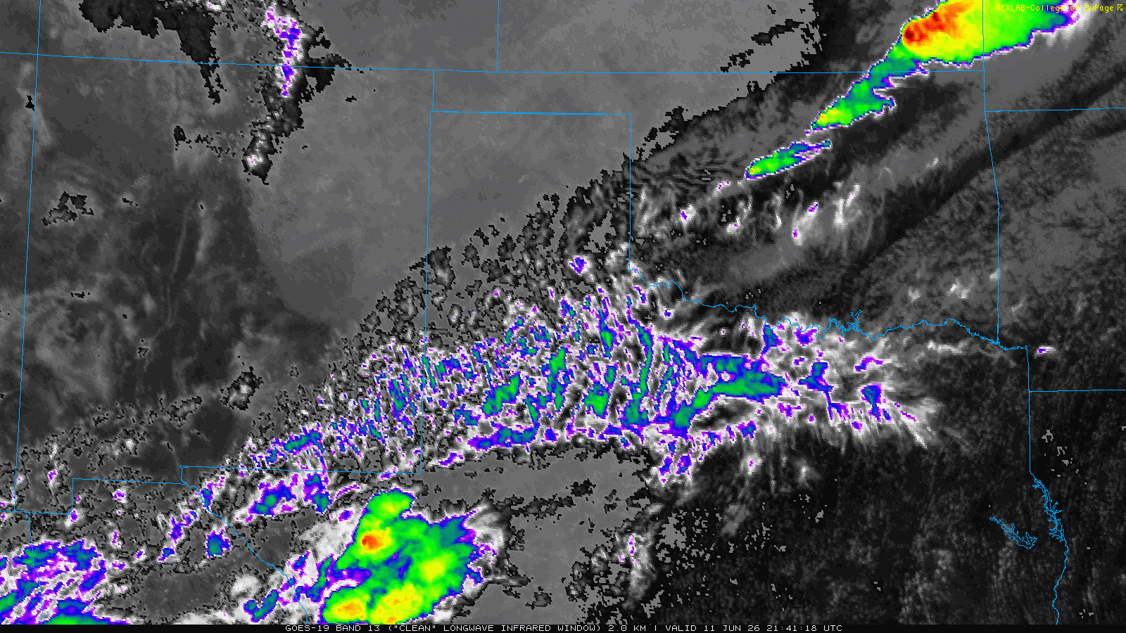
| Infrared satellite loop valid from 4:51 pm on Thursday to 3:01 am on Friday (11-12 June 2026). | |
| The thunderstorm activity then trended downward in both intensity and coverage for bit mid-evening. However, this didn't last, as multiple outflow boundaries collided over the central South Plains and led to explosive storm development near Lubbock late in the evening. This activity impacted the southeast side of the city of Lubbock, then marched southward, generating hail, damaging winds and torrential rainfall. | |
 |
 |
 |
|
| (upper level and bottom) Downed power poles near Tahoka Thursday night (11 June 2026), courtesy of Lyntegar Electric Cooperative. (upper right) Lingering hail in Tahoka Friday morning (12 June 2026), courtesy of Pam Elrod and Gary Jones. | |
| The south-central South Plains was particularly hard hit, including the community of Wilson, in and around Tahoka and O'Donnell. A peak gust of 76 mph was measured by the Tahoka WTM northeast of town at 11:19 pm, with the O'Donnell WTM recording a 68 mph gust at 11:46 pm. Unfortunately, the intense winds caused plenty of damage as they swept across the area late Thursday evening/night. | |
 |
|
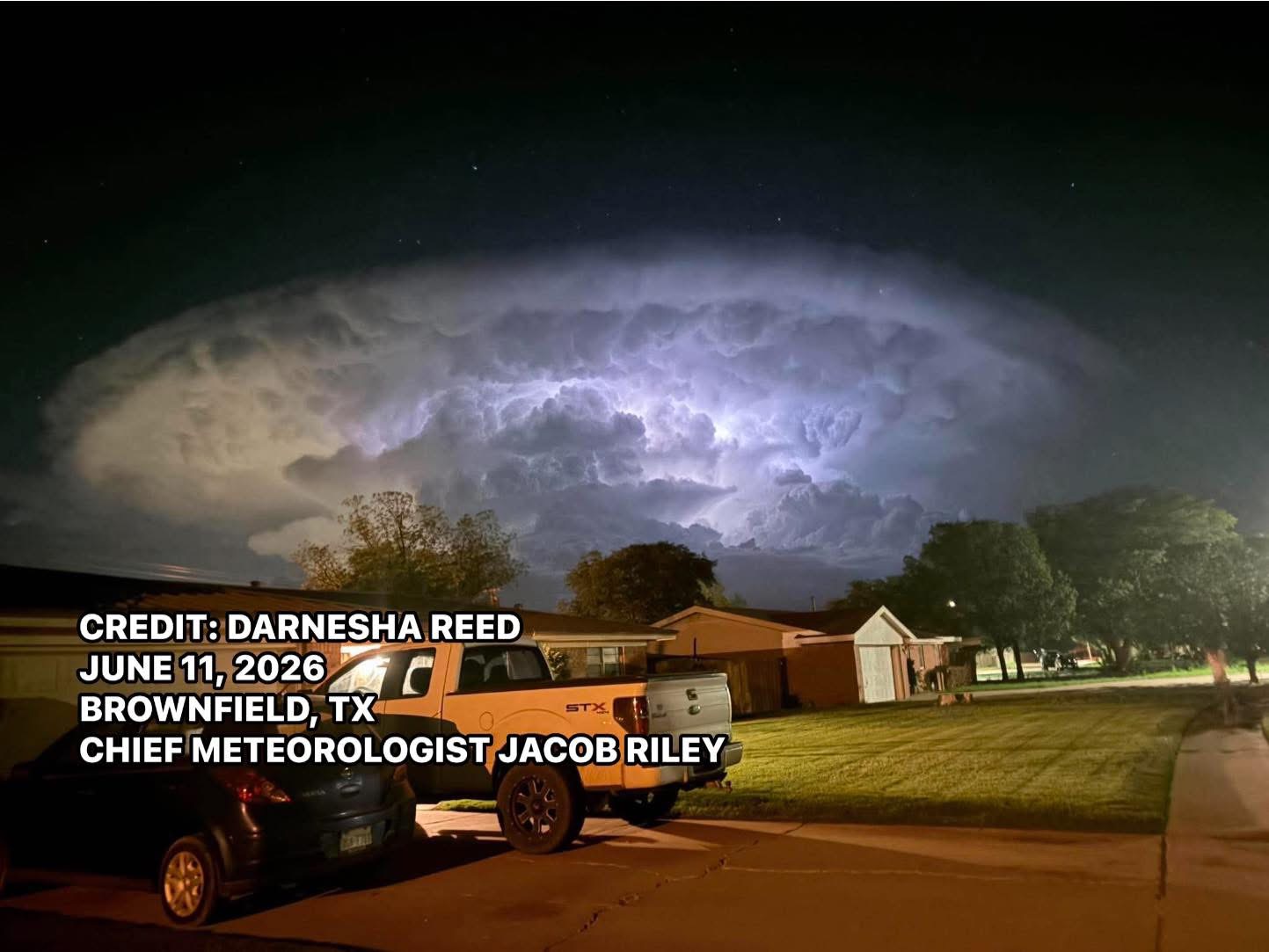
| Lightning illuminated thunderstorm approaching Tahoka, as seen from Brownfield, on Thursday night (11 June 2026). The picture is courtesy of Darnesha Reed, via Jacob Riley. | |
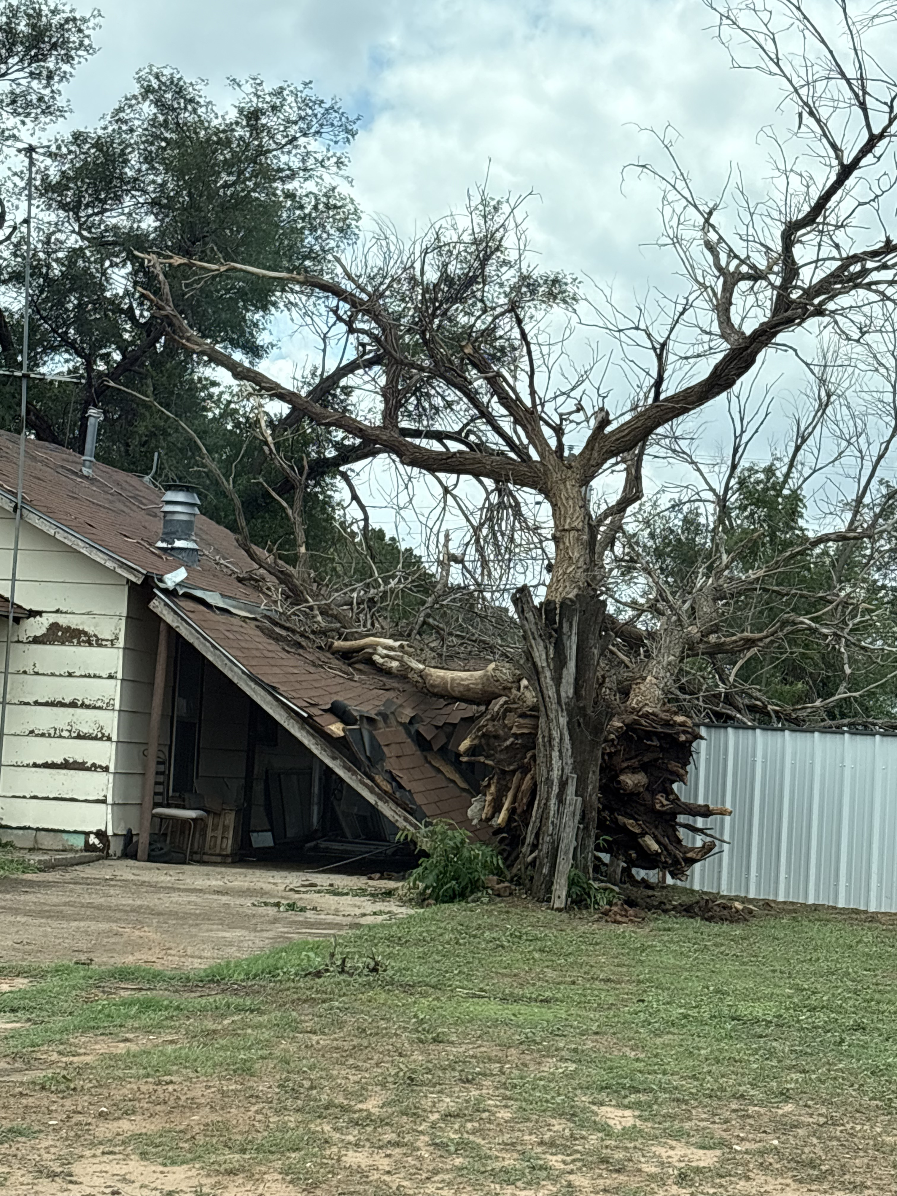
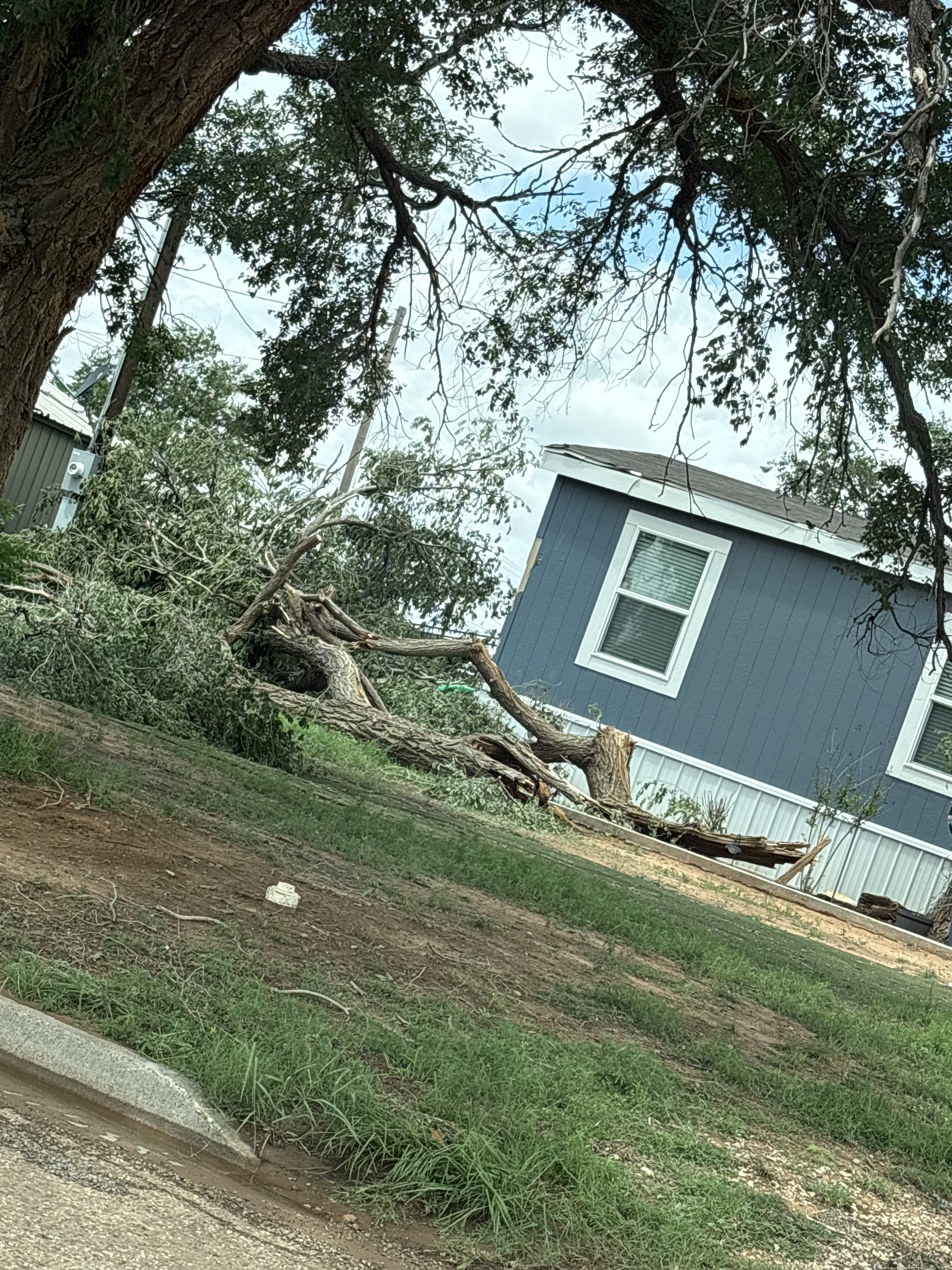
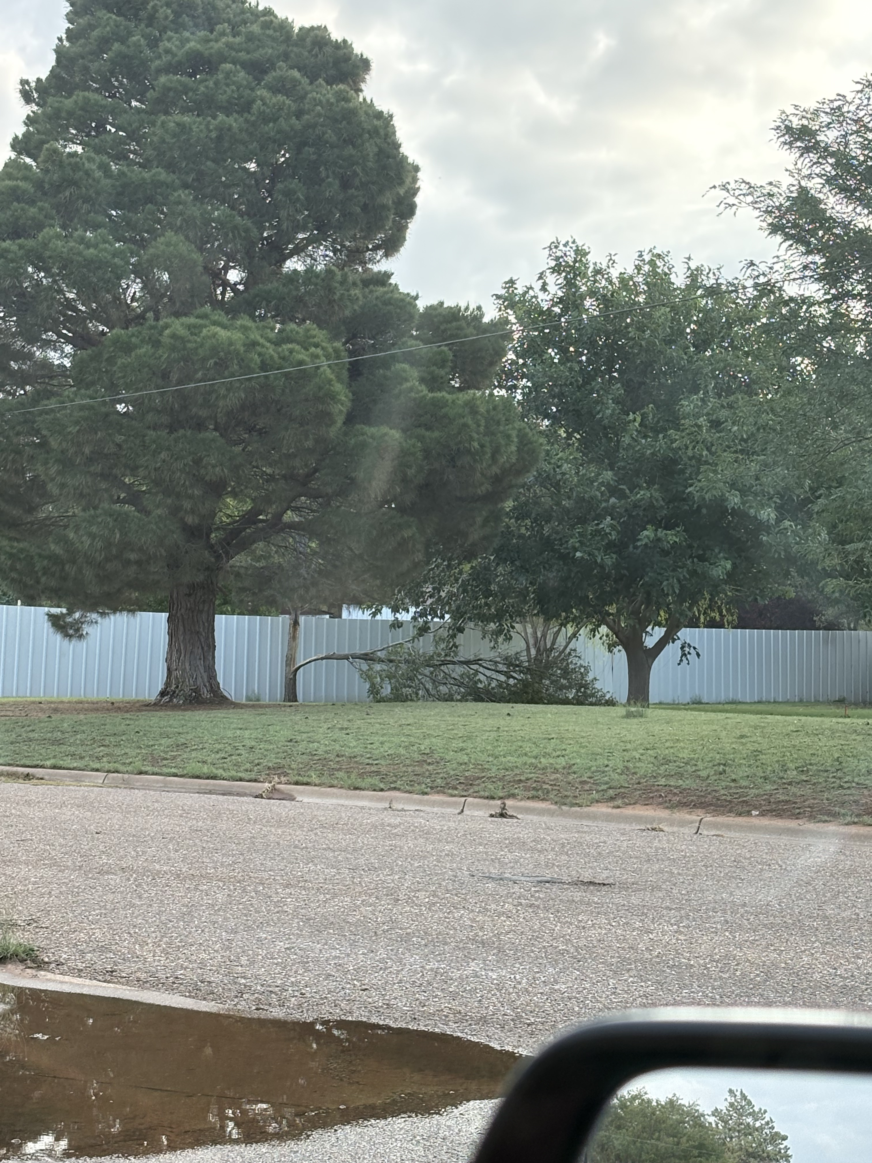
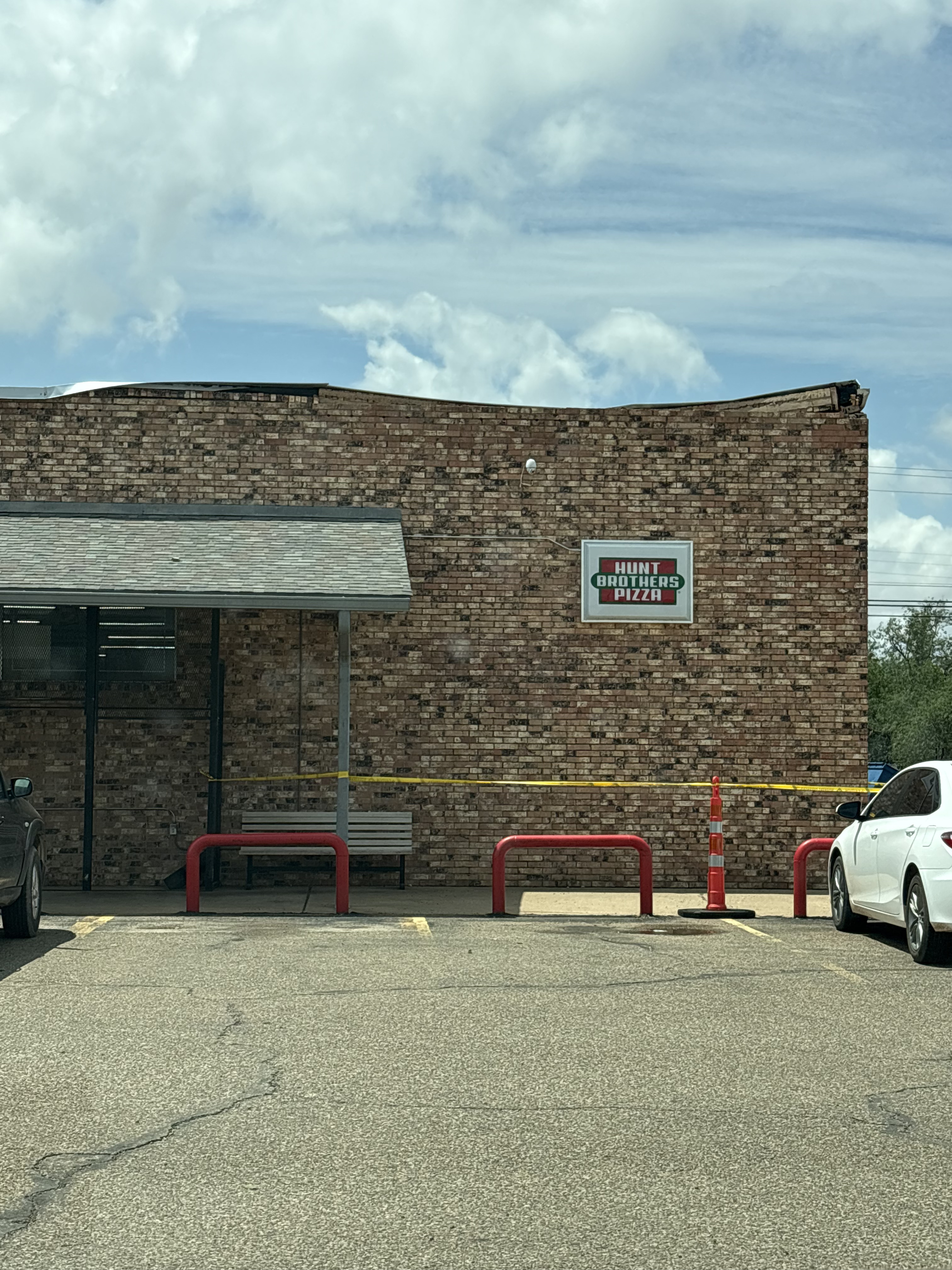
| The winds caused widespread tree damage in Tahoka, as well as roof damage to the grocery store in town. Several buildings were also damaged, primarily from tree limbs and other debris impacting them. The wind also downed power poles and led to power outages over the south-central South Plains. | |
 |
 |
 |
 |
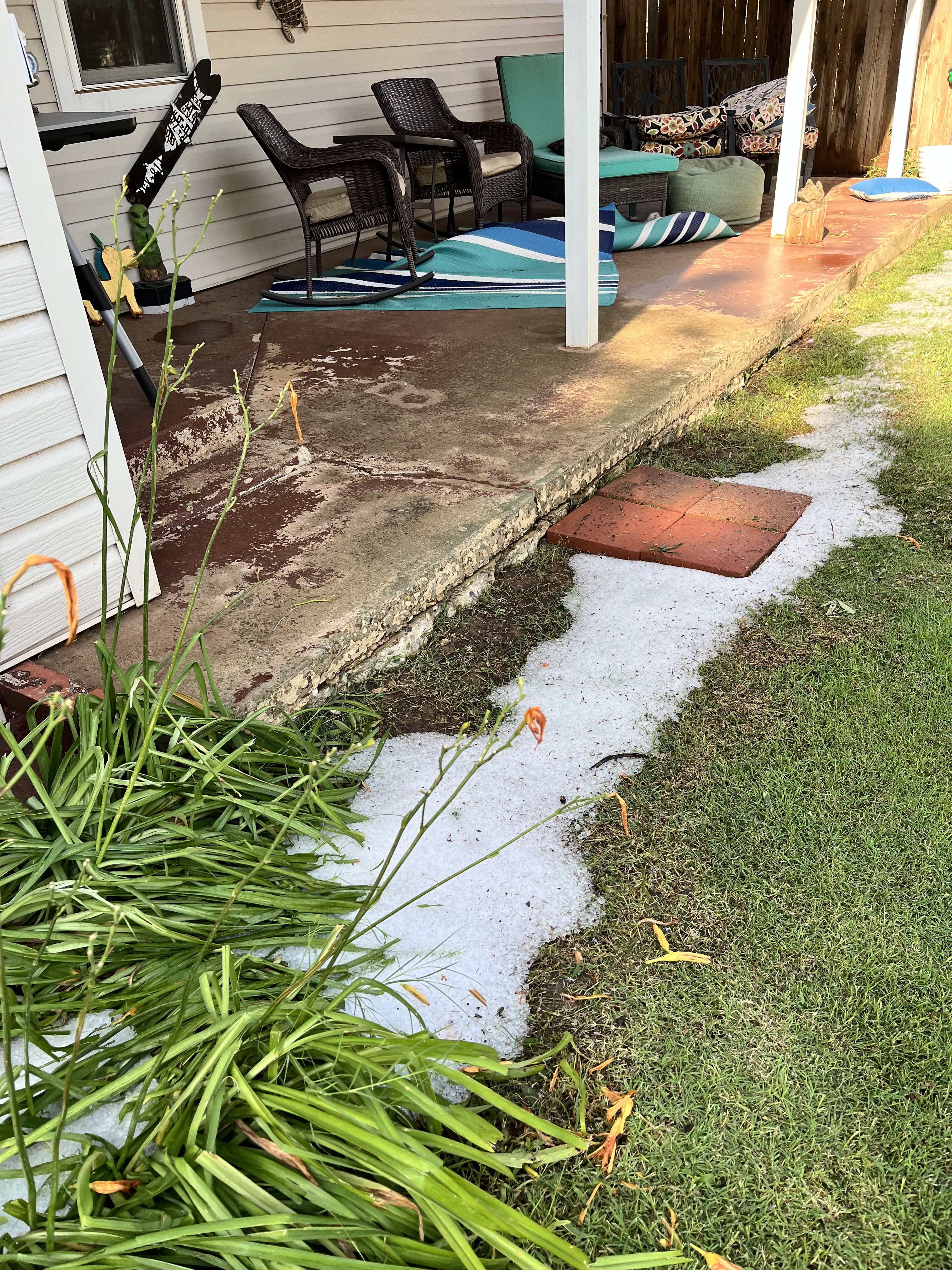
| Tree damage observed around Tahoka on Friday morning (12 June 2026). The pictures are courtesy of Pam Elrod. The intense downburst winds also damage the roof of the local grocery store, as can be SEEN HERE. | |
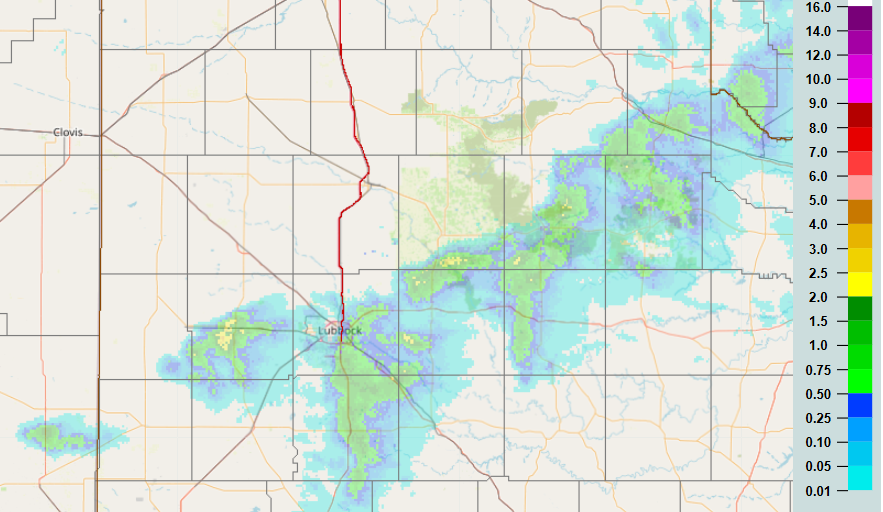
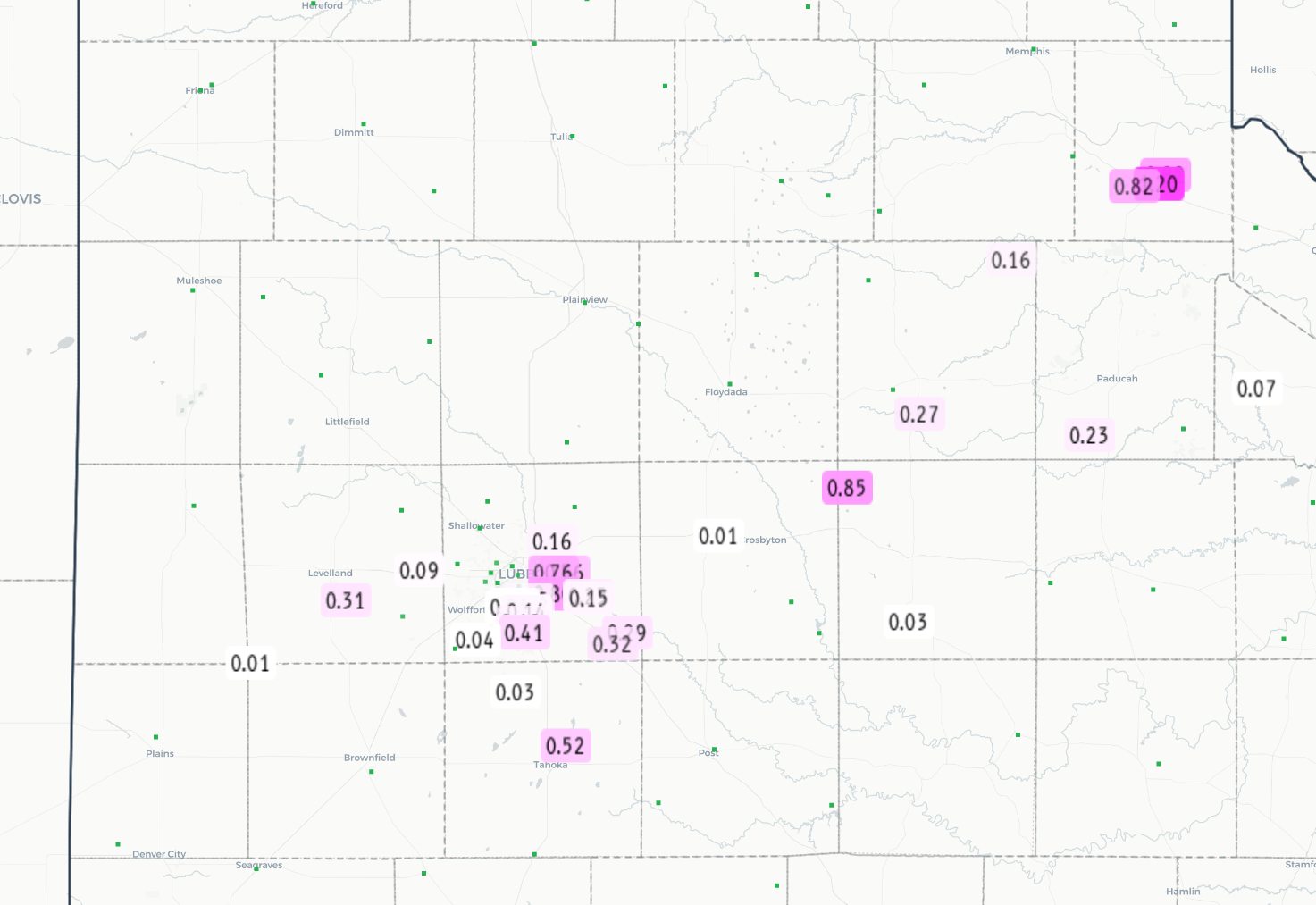
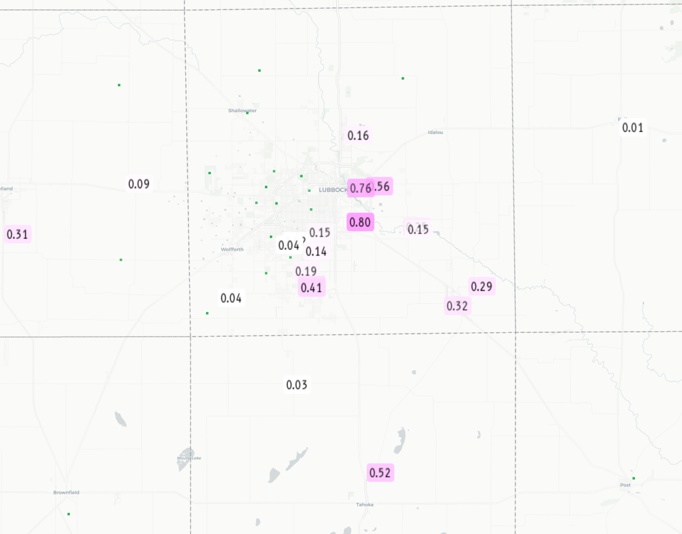
| On the positive side, the thunderstorms were efficient rain producers, bringing a quick half inch to inch plus for locations that managed to get directly under a storm. The rain-cooled air also knocked temperatures down into the 60s and lower 70s. Locations in and around Tahoka even briefly dipped into the 50s thanks to the intense thunderstorm. | |
 |
|
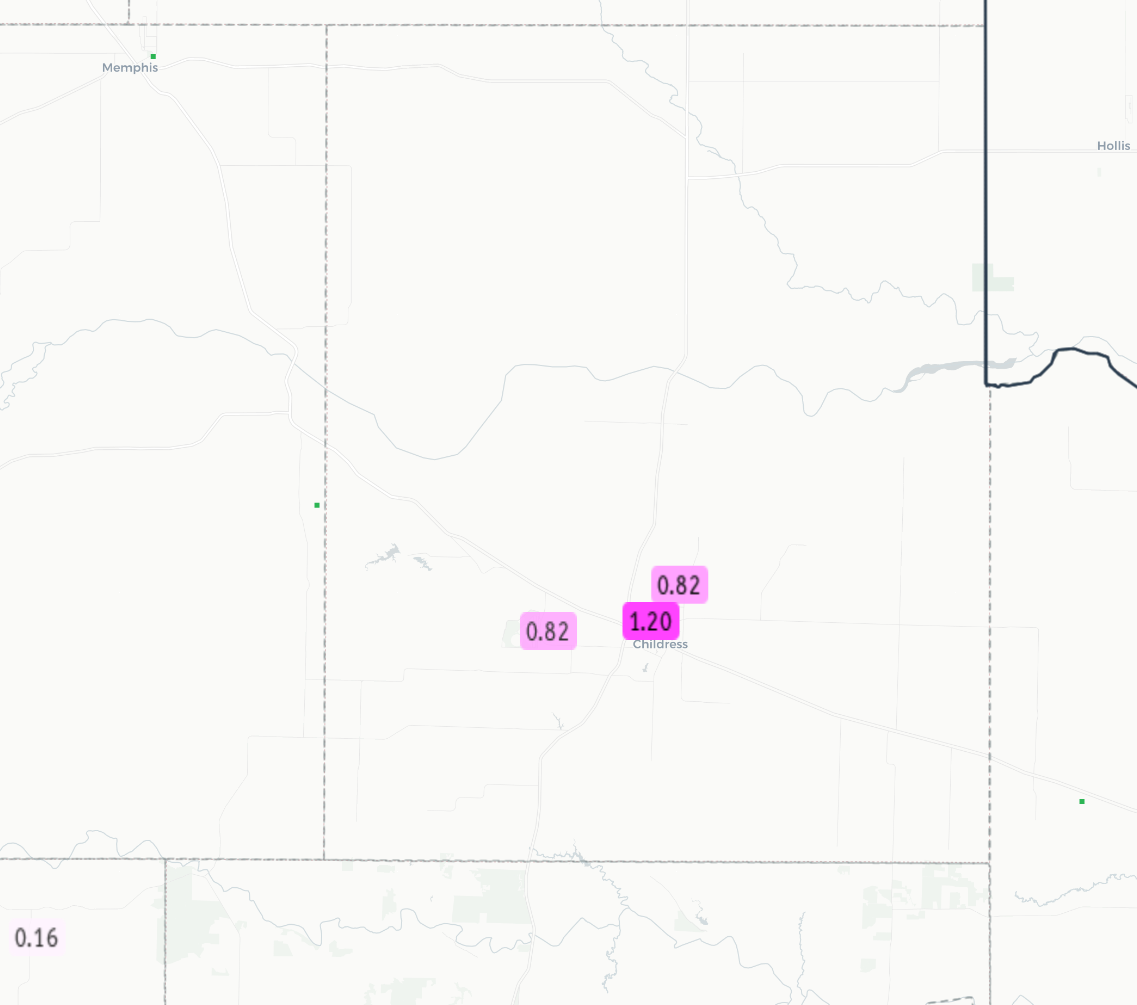
| 24-hour radar-estimated and bias-corrected rainfall (inches) ending at 7 am on Friday (12 June 2026). Measured 24-hour rainfall totals from the National Weather Service (NWS) and West Texas Mesonet (WTM), ending at 7 am on Friday, can be VIEWED HERE. Zoomed in views of the measured rainfall can be found at: Lubbock area and Childress area. | |
|
A list of the preliminary storm reports collected on this mid-June evening can be found below. |
|
Preliminary Local Storm Report...Summary
National Weather Service Lubbock TX
115 AM CDT Fri Jun 12 2026

..TIME...   ...EVENT...      ...CITY LOCATION...     ...LAT.LON...
..DATE...   ....MAG....      ..COUNTY LOCATION..ST.. ...SOURCE....
            ..REMARKS..

0658 PM     Hail             Childress               34.42N 100.20W
06/11/2026  E0.50 Inch       Childress          TX   Trained Spotter


0700 PM     Hail             Matador                 34.02N 100.82W
06/11/2026  M0.50 Inch       Motley             TX   CO-OP Observer


0703 PM     Landspout        6 NE Smyer              33.65N 102.10W
06/11/2026                   Hockley            TX   Public


0708 PM     Hail             1 S Matador             34.01N 100.82W
06/11/2026  E0.50 Inch       Motley             TX   Public

            Report from mPING: Half-inch (0.50 in.).

0712 PM     Hail             Childress               34.43N 100.20W
06/11/2026  E1.00 Inch       Childress          TX   Trained Spotter


0727 PM     Hail             2 NNW Levelland         33.60N 102.38W
06/11/2026  E1.00 Inch       Hockley            TX   Broadcast Media


0730 PM     Hail             9 SE Floydada           33.89N 101.23W
06/11/2026  M1.00 Inch       Floyd              TX   CO-OP Observer


0816 PM     Tstm Wnd Gst     3 NNW Mcadoo            33.77N 101.04W
06/11/2026  M70 MPH          Dickens            TX   Mesonet

            Measured by the TTU mesonet.

0855 PM     Flash Flood      1 N Levelland           33.59N 102.36W
06/11/2026                   Hockley            TX   Trained Spotter

            Water impeding traffic in Levelland on TX
            Highway 114.

1115 PM     Tstm Wnd Gst     3 NNE Tahoka            33.21N 101.78W
06/11/2026  M64 MPH          Lynn               TX   Mesonet

            Tahoka WTM.

1119 PM     Tstm Wnd Gst     3 NNE Tahoka            33.21N 101.78W
06/11/2026  M76 MPH          Lynn               TX   Mesonet

            Tahoka WTM.

1145 PM     Tstm Wnd Gst     1 N O`Donnell           32.98N 101.83W
06/11/2026  M64 MPH          Lynn               TX   Mesonet

            ODonnell WTM. Outflow wind gust.

1146 PM     Tstm Wnd Gst     1 N O`Donnell           32.98N 101.83W
06/11/2026  M68 MPH          Lynn               TX   Mesonet

            WTM.

