|
Intense heat sparks scattered strong to severe storms |
|
 |
|
|
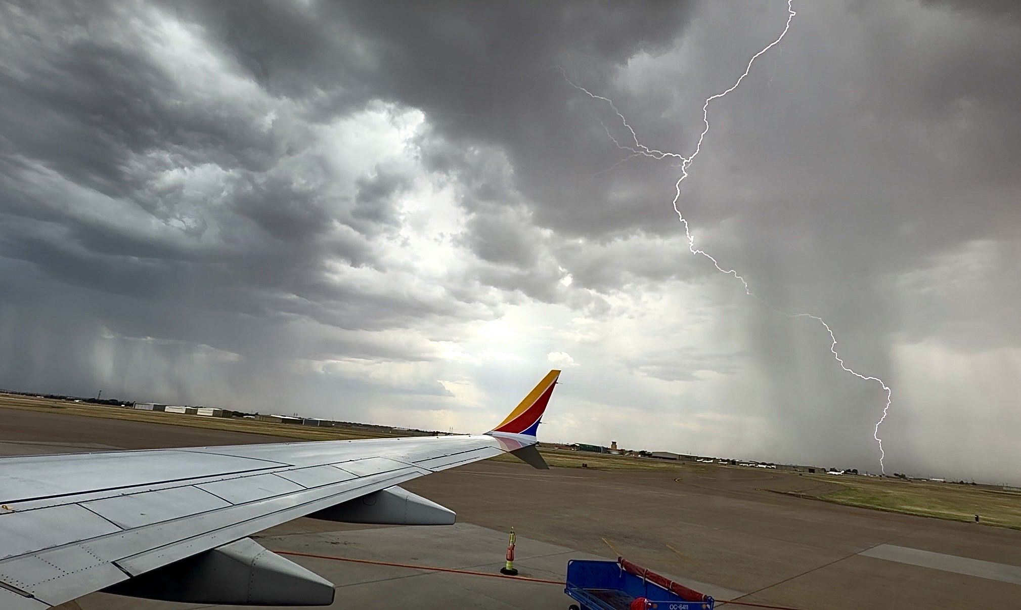
High-based thunderstorm at Lubbock International Airport on Thursday afternoon (13 August 2026). The picture is courtesy of Nelson Tucker. |
|
|
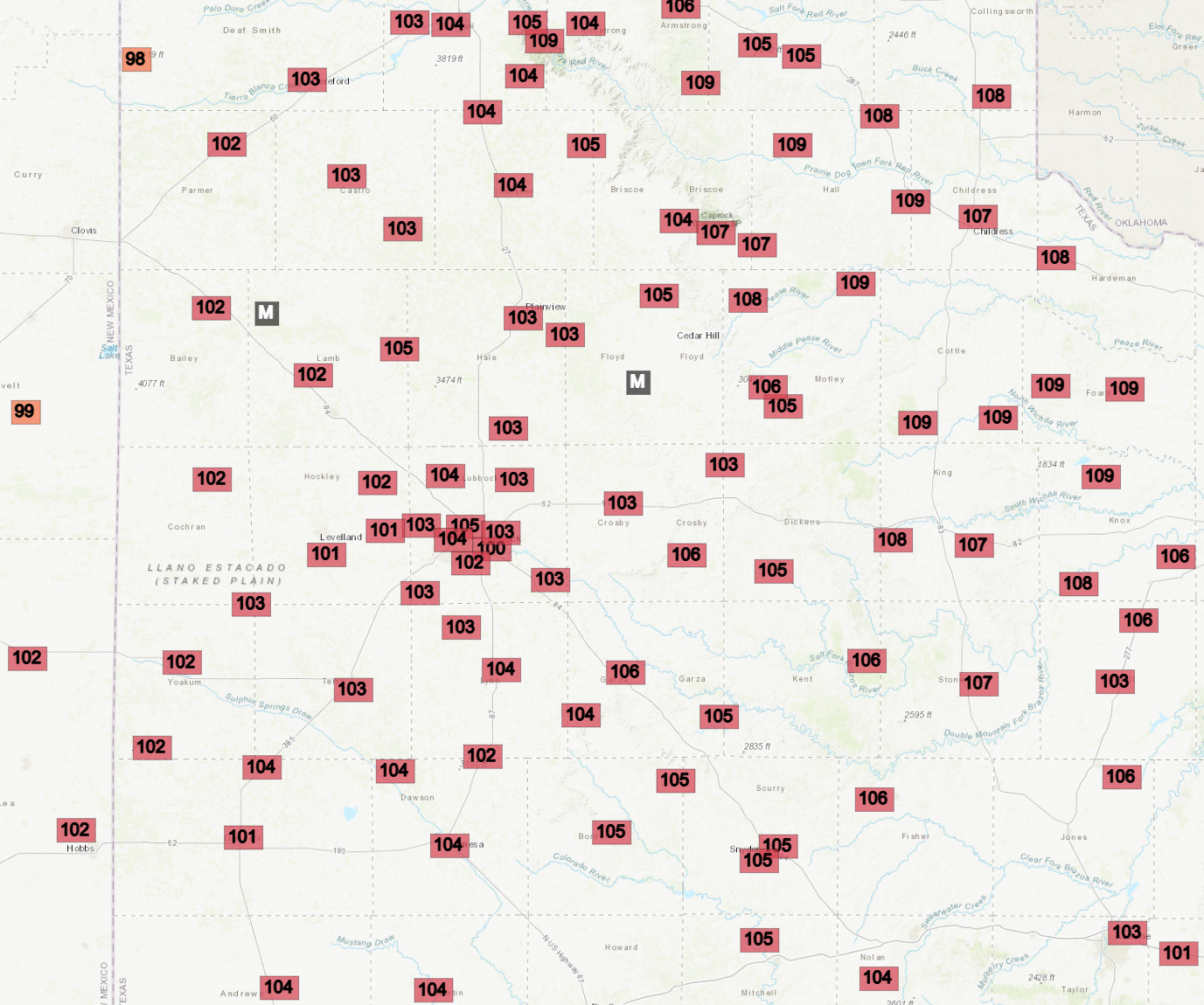
Thursday, August 13th, brought the heat, as temperatures soared into the triple digits. Locations on the Caprock generally topped out at 101 to 105 degrees, with spots off the Caprock as toasty as 109 degrees. Although the heat wasn't something new or unexpected for the southern High Plains, especially the second half of this summer, it was one of the hottest days to this point in the year. |
|
 |
|
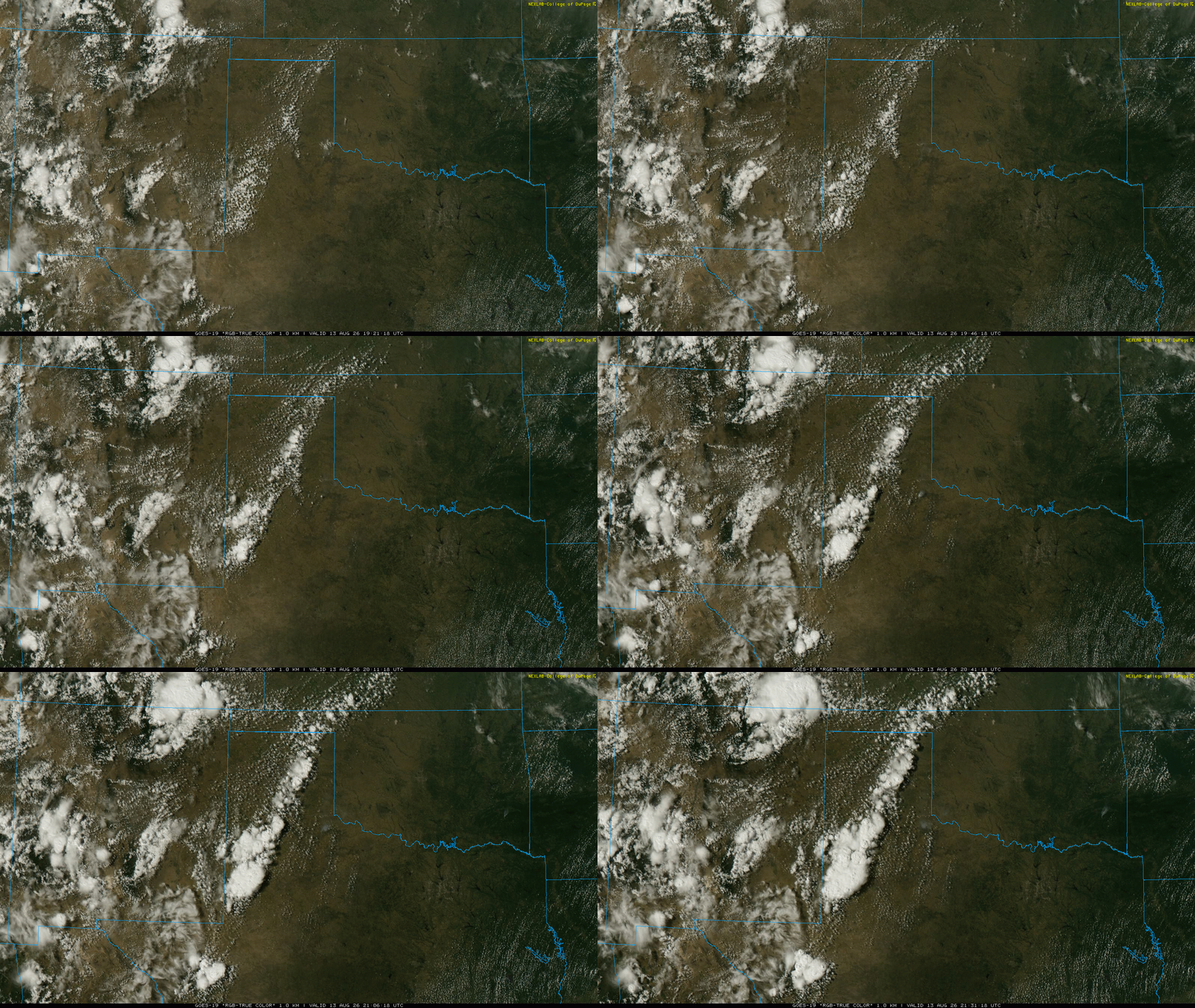
| "RGB-True-Color" satellite loop valid from 2:31 pm to 4:31 pm on Thursday (13 August 2026). | |
| In addition to the heat, a modest increase in moisture, particularly aloft, helped fuel the development of scattered high-based thunderstorms Thursday afternoon. | |
 |
|
| High temperatures measured by the West Texas Mesonet (WTM) on Thursday (13 August 2026). | |
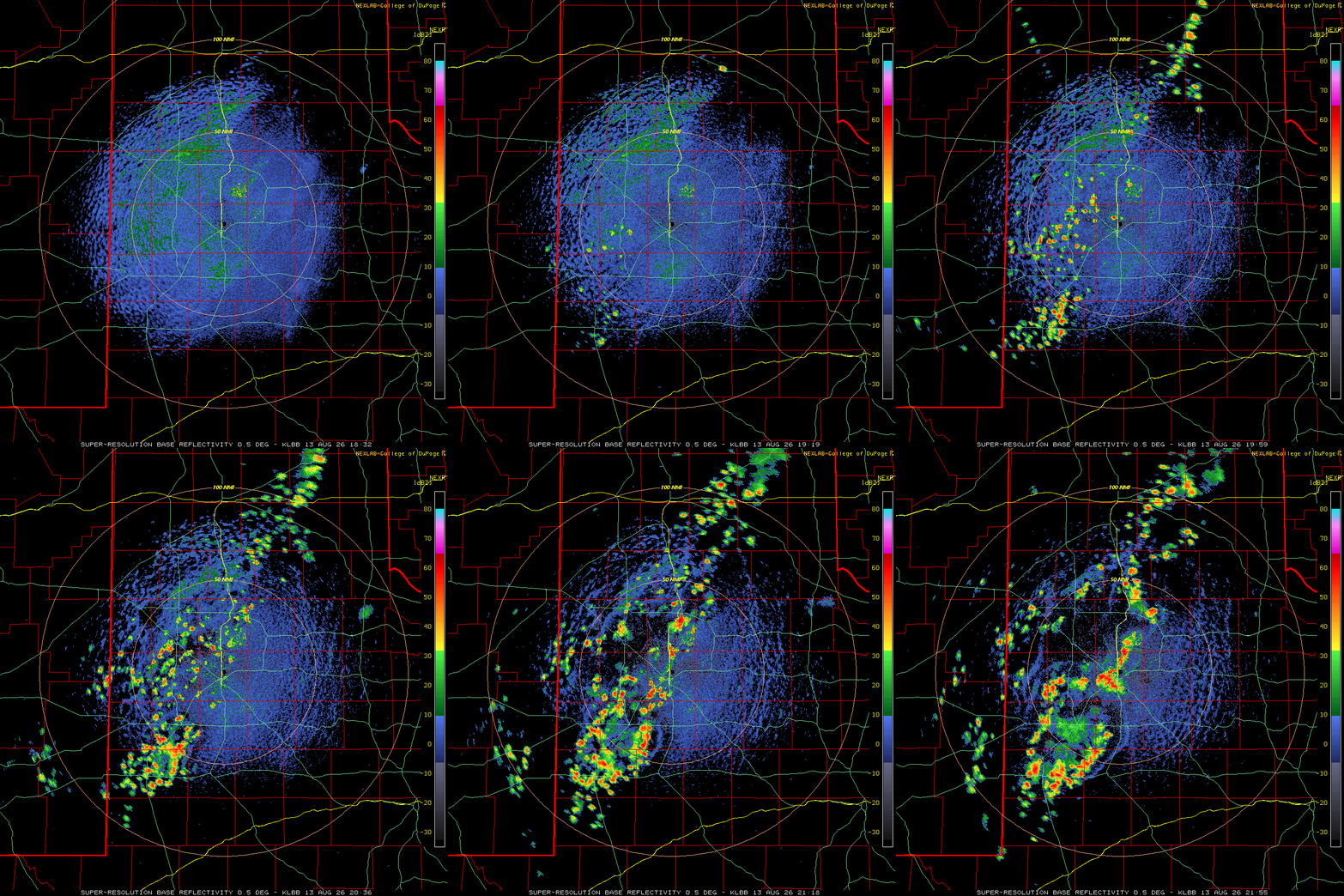
| The intense heat and increased moisture contributed to decent instability, at least by summer standards. After breaching the triple digits, a smattering of thunderstorm cells quickly developed across the western and central South Plains and the south-central Texas Panhandle. The hot and deeply mixed sub-cloud layer caused significant evaporation, which limited rainfall amounts and coverage and generated strong to severe downburst winds. | |
 |
|
| Lubbock WSR-88D animation valid from 1:32 pm to 4:55 pm on Thursday (13 August 2026). | |
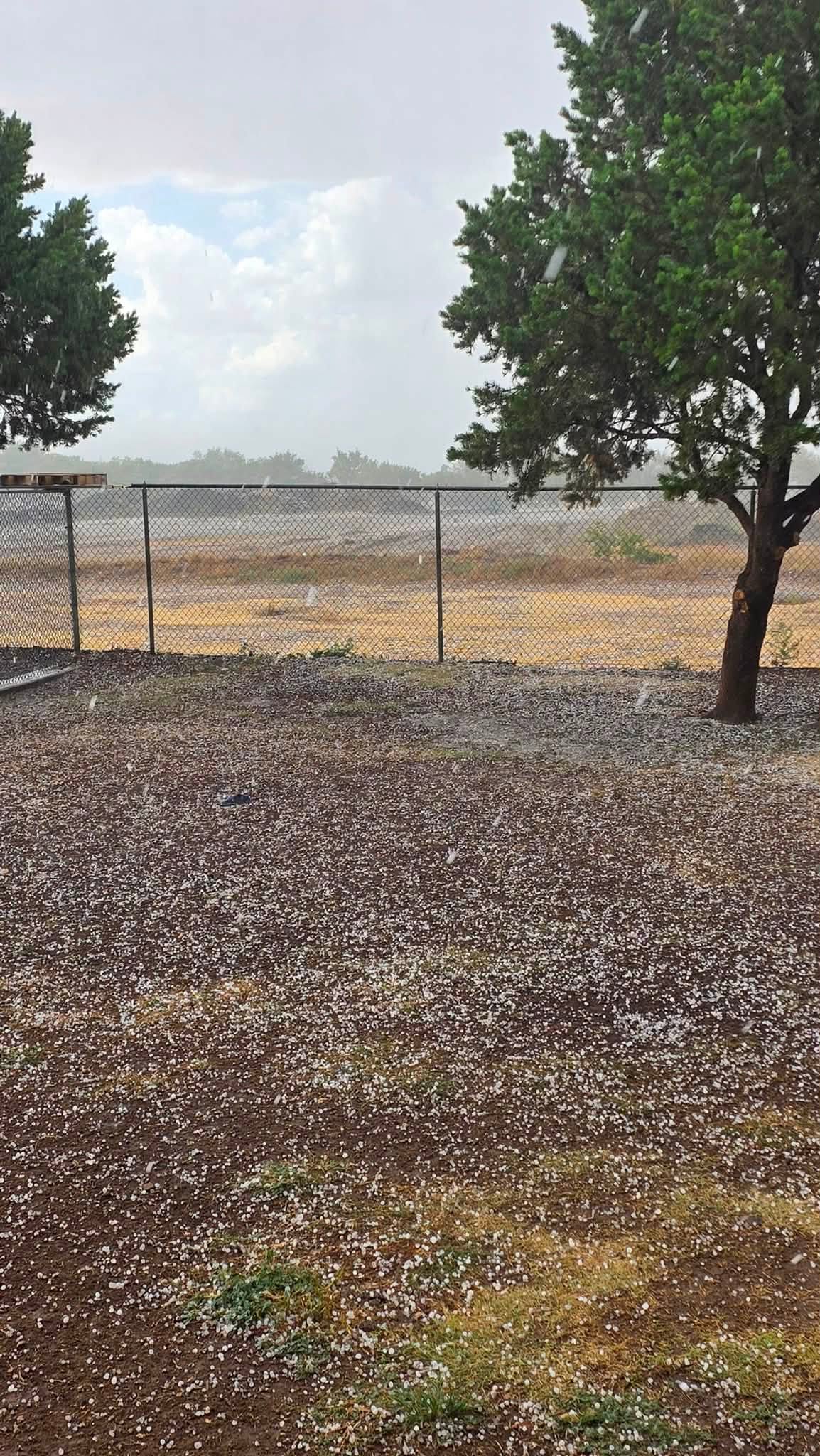
| Where the most intense cores formed, heavy downpours and even a few pockets of small hail made it to the ground despite the hot and relatively dry lower levels. Small hail was reported near Levelland, Plainview and Wolfforth, with strong to severe wind gusts reported in many of these same locations. | |
 |
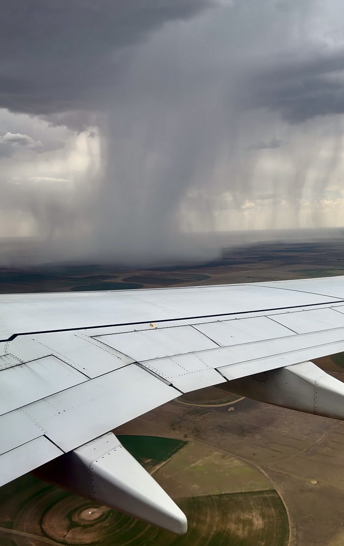 |
| (Left) Pea size-hail in Plainview on Thursday afternoon (13 August 2026). The image is courtesy of Joshua Harris via Jacob Riley. (Right) High-based thunderstorm over the South Plains Thursday afternoon (13 August 2026). The picture is courtesy of Nelson Tucker. | |
| A peak wind gust of 72 mph was measured by the West Texas Mesonet (WTM) on the south side of Plainview, while tree branches were downed by the wind a few miles south of Wolfforth. | |
 |
|
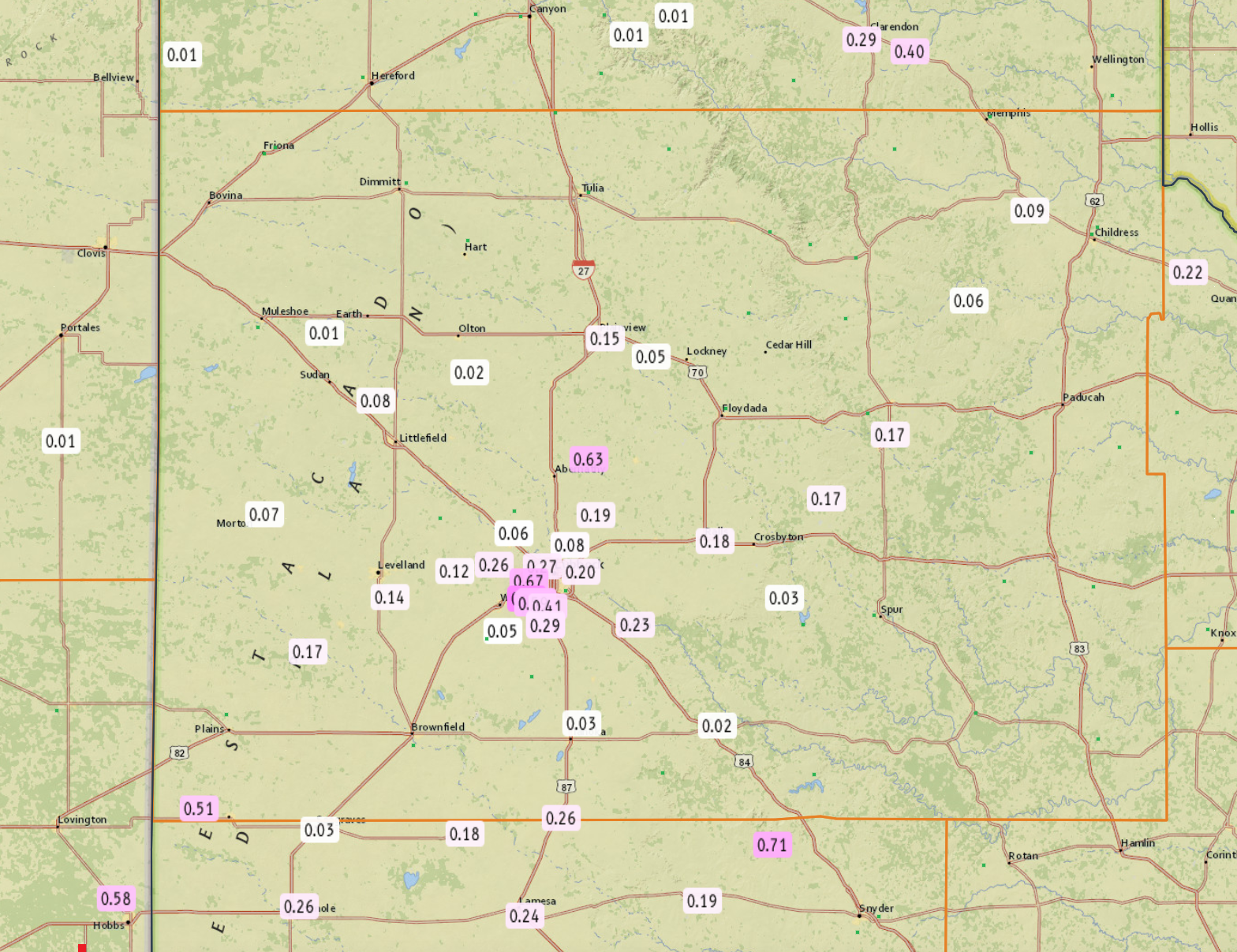
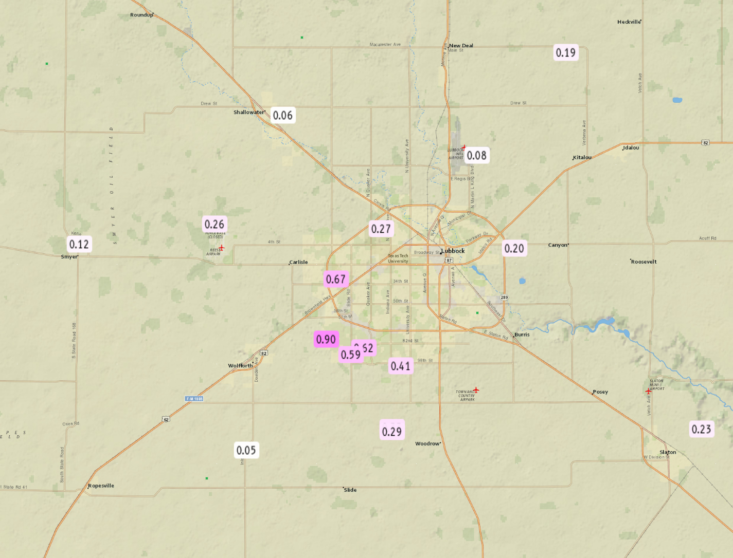
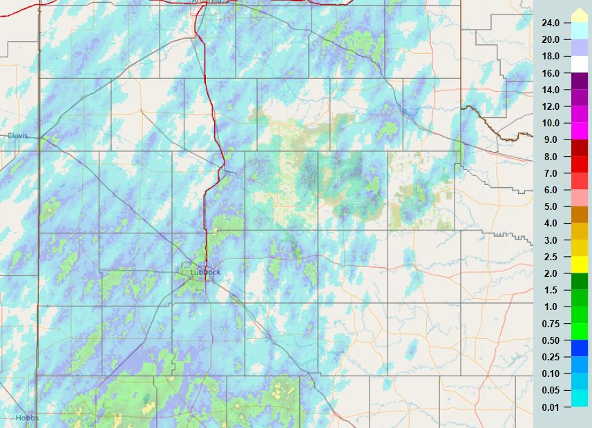
| 24-hour radar-estimated and bias-corrected rainfall (inches) ending at 8 am on Friday (14 August 2026). Measured rainfall, courtesy of the West Texas Mesonet (WTM) and National Weather Service (NWS), can be VIEWED HERE A closeup of the Lubbock area can be FOUND HERE. | |
|
On the positive side, several swaths of meaningful rainfall, in excess of a half inch, did occur. The southwest side of Lubbock was one winner, with rain totals measured as high as 0.90 inches near 82nd Street and Milwaukee Avenue. However, the heavier rain was localized, with many spots seeing little to no rain. Officially, the Lubbock Airport only recorded 0.01 inches of rain with this event despite pockets of heavy rain very nearby. A list of the preliminary storm reports collected on Aug 13th can be found below. |
|
Preliminary Local Storm Report...Summary
National Weather Service Lubbock TX
856 PM CDT Thu Aug 13 2026

..TIME...   ...EVENT...      ...CITY LOCATION...     ...LAT.LON...
..DATE...   ....MAG....      ..COUNTY LOCATION..ST.. ...SOURCE....
            ..REMARKS..

0400 PM     Hail             3 SSW Levelland         33.53N 102.38W
08/13/2026  E0.25 Inch       Hockley            TX   Public


0426 PM     Hail             Plainview               34.19N 101.72W
08/13/2026  E0.25 Inch       Hale               TX   Broadcast Media

            Light accumulations of pea size hail in
            Plainview.

0430 PM     Hail             6 E Wolfforth           33.51N 101.91W
08/13/2026  E0.50 Inch       Lubbock            TX   Public

            Report from mPING: Half-inch (0.50 in.).

0431 PM     Tstm Wnd Dmg     3 S Wolfforth           33.47N 102.00W
08/13/2026                   Lubbock            TX   Fire Dept/Rescue

            Tree branches down in vicinity of the
            intersection of FM1585 and FM179.

0420 PM     Tstm Wnd Gst     1 S Plainview           34.18N 101.71W
08/13/2026  M71 MPH          Hale               TX   Mesonet


0421 PM     Tstm Wnd Gst     1 S Plainview           34.18N 101.71W
08/13/2026  M72 MPH          Hale               TX   Mesonet


0447 PM     Tstm Wnd Gst     Reese Center            33.61N 102.05W
08/13/2026  M58 MPH          Lubbock            TX   Mesonet


0830 PM     Wildfire         2 NW Paducah            34.03N 100.33W
08/13/2026                   Cottle             TX   Park/Forest Srvc

            The Grass Burr Fire started on the morning
            of 8/13 just northwest of Paducah in Cottle
            County, and may have been ignited by
            lightning. As of 830 PM on the evening of
            8/13, fire size was an estimated 1500 acres
            with 75% containment.



 Follow us on X
 Follow us on Facebook
 Follow us on YouTube
 LUB RSS Feed