 |
| High Water Situations |
| To help the local community in times of high water, the National Weather Service is spreading the word about Turn Around Don't DrownTM. |
|
|
 |
Turn Around Don't DrownTM (Norfork Lake, Arkansas) |
 |
| |
 |
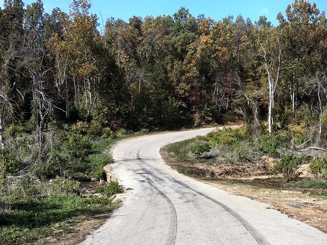
There are numerous roads in Arkansas that are susceptible to high water. One such road has a spot that runs near Norfork Lake about 8 miles northeast of Mountain Home (Baxter County). |
| In the picture: This is County Road 806, which is less than a quarter of a mile north of Norfork Lake (Baxter County). Click to enlarge. |
|
Water has flowed across this road (flash flooding) following periods of heavy rain. Also, this area is known to flood when lake levels reach about 562 feet. In this situation, the lake backs up over the road. Following torrential downpours and over 20 inches of rain in April and May of 2011, Lake Norfork reached the top of its flood pool at 580 feet. That put 18 feet of water over the road (yes, 18 feet)!
In the past, barricades were placed along the road as it became inundated by water. Motorists have been known to drive around the barricades. This is a dangerous practice, especially at night when it is tough to estimate the depth of the water.
|
|
On October 28, 2011...signs were posted in the area to warn people of the high water danger. It is hoped the signs will remind motorists to consider their safety before attempting to drive into the water and risk their lives.
|
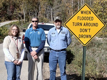 |
| In the picture: Baxter County Emergency Manager Jim Sierzchula (center) and Russel Duggins (right) of the Baxter County Road and Bridge Department stand next to a Turn Around Don't DrownTM sign along County Road 806 on 10/28/2011. They were accompanied by Tabitha Clarke (left), Senior Service Hydrologist at the National Weather Service in Little Rock. Click to enlarge. |
|
|
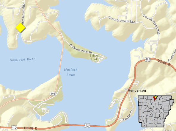
| In the picture: Map of Norfork Lake at County Road 806 (Baxter County), with high water sign placement in yellow. |
|
| |
|
Each year, more deaths occur due to flooding than from any other thunderstorm related event. More than half of all flood related deaths occur in automobiles that are swept downstream.
|
 |
Whether you are driving or walking, if you come to a flooded road, TURN AROUND DON'T DROWN. |
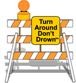
| In the picture: Barriers are there for a reason. Don't ignore the barriers! |
|
Turn Around Don't DrownTM (or TADD) is a National Weather Service campaign to warn people of the hazards of walking or driving a vehicle through flood waters. Several counties are adopting TADD signs and posting them at locations where flash flooding often leads to water over the roads.
These TADD Warning Signs are compliant with the Federal Highway Administration's regulations and can be produced and deployed as an official road sign. If your community would like more information on purchasing these signs, contact the Senior Service Hydrologist at the NWS Little Rock office. Civic groups may consider donating or raising money to give to their local community officials for purchase of these TADD signs.
|
|
|