National Weather Service United States Department of Commerce
Hazard Maps Activation Levels Send a Report
Graphical Hazardous Weather Outlook
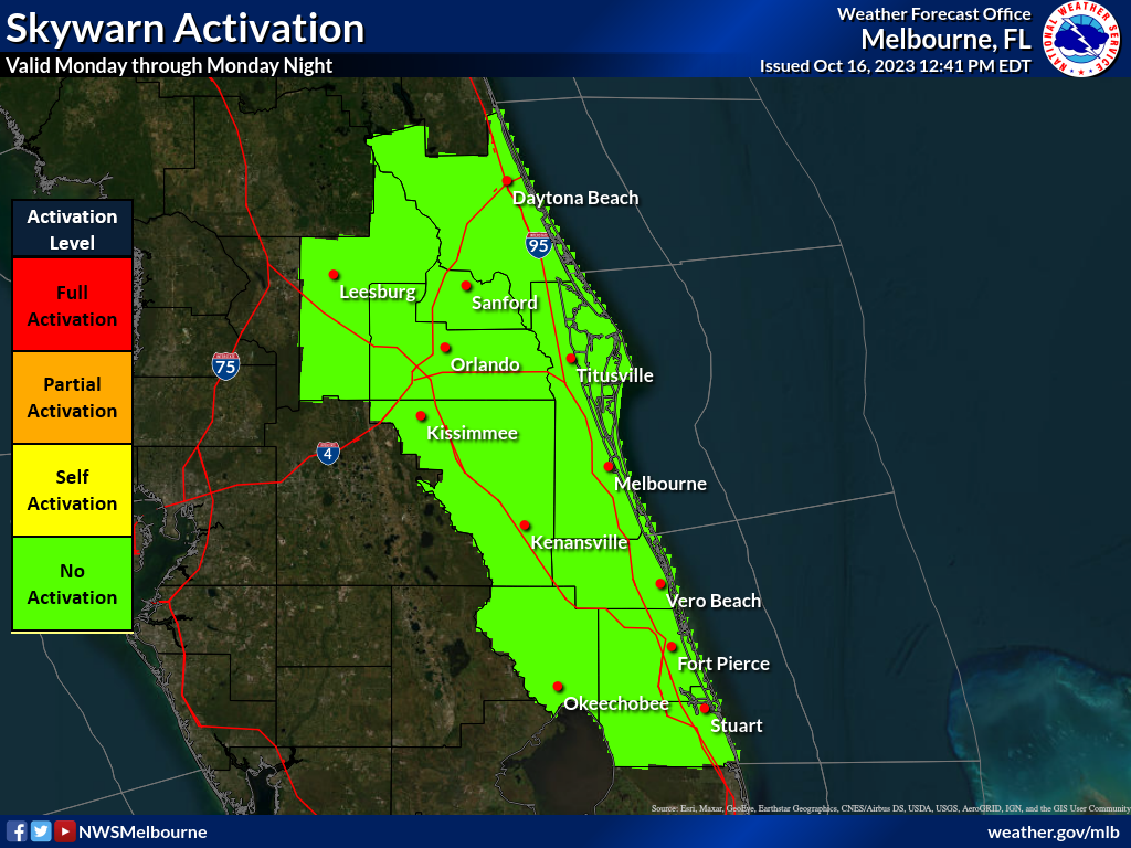
Skywarn Activation
skywarn map
FLUS42 KMLB 080925
HWOMLB

Hazardous Weather Outlook
National Weather Service Melbourne FL
525 AM EDT Wed May 8 2024

AMZ550-552-555-570-572-575-FLZ041-044>046-053-058-141-144-154-159-
164-247-254-259-264-347-447-547-647-747-090000-
Flagler Beach to Volusia-Brevard County Line 0-20 nm-Volusia-
Brevard County Line to Sebastian Inlet 0-20 nm-
Sebastian Inlet to Jupiter Inlet 0-20 nm-Flagler Beach to Volusia-
Brevard County Line 20-60 nm-Volusia-
Brevard County Line to Sebastian Inlet 20-60 nm-
Sebastian Inlet to Jupiter Inlet 20-60 nm-Inland Volusia-
Northern Lake-Orange-Seminole-Osceola-Okeechobee-Coastal Volusia-
Southern Lake-Coastal Indian River-Coastal Saint Lucie-
Coastal Martin-Inland Northern Brevard-Inland Indian River-
Inland Saint Lucie-Inland Martin-Mainland Northern Brevard-
Northern Brevard Barrier Islands-Inland Southern Brevard-
Mainland Southern Brevard-Southern Brevard Barrier Islands-
525 AM EDT Wed May 8 2024

THIS HAZARDOUS WEATHER OUTLOOK IS FOR EAST CENTRAL FLORIDA.

.DAY ONE...TODAY AND TONIGHT.

.THUNDERSTORM IMPACT...
Isolated thunderstorms are possible as a result of the sea breeze
collision this evening, mainly between 6pm-9pm across portions of
Volusia, Seminole, Orange and Osceola counties. The primary threat
will be occasional lightning strikes.

.EXCESSIVE HEAT IMPACT...
Peak heat indices are forecast to reach 99-101 across the interior
counties and inland portions of the coastal counties with mid 90s
along the coast. While these conditions are fairly common during
Florida summers and are below Heat Advisory criteria, most are 
not yet acclimated to the heat this season. For those exposed to 
the direct sun for extended periods, this heat can be dangerous to
anyone without proper hydration or access to adequate cooling 
breaks. 

.RIP CURRENT IMPACT...
A Moderate Risk of dangerous rip currents continues at all central
Florida Atlantic beaches. Always swim near a lifeguard, and never
swim alone.

.WIND AND SEA IMPACT...
South winds will increase 15 to 20 knots this evening over the 
open Atlantic. Small craft should exercise caution.

.FIRE WEATHER IMPACT...
A Moderate fire weather danger exists today for low humidity over
the interior, dropping between 35 and 40 percent. Along the 
coast, humidities will be higher but east to southeast winds will 
increase 15 to 20 mph with gusts up to 30 mph behind the sea 
breeze.

.DAYS TWO THROUGH SEVEN...THURSDAY THROUGH TUESDAY.
A Moderate risk of rip currents is expected to continue through
much of this week.

A Moderate to High fire danger will exist Thursday and Friday due
to hot temperatures, low humidity and increasing southwest winds.

Scattered lightning storms are possible Friday and Saturday mainly
during the afternoons as a frontal boundary sags into central 
Florida. A higher coverage of rain and storms may develop next 
week along a stalled frontal boundary.

.SPOTTER INFORMATION STATEMENT...
Spotter activation will not be needed today and tonight.

$$

Kelly