A heat wave over the Southwest will intensify this week, peaking and expanding into the Intermountain West and northern High Plains this weekend. Severe thunderstorms and heavy rainfall are expected over parts of the Upper Midwest to mid-Mississippi Valley today. Critical to extremely critical fire weather conditions from the Northwest and the northern Great Basin on Saturday and Sunday. Read More >
| National Weather Service | ||||||||||||||||||||||||||||||||||||||||||||||||||||||||||||||||||||||||||||||||||||||||||||||||||||||||||||||||||||||
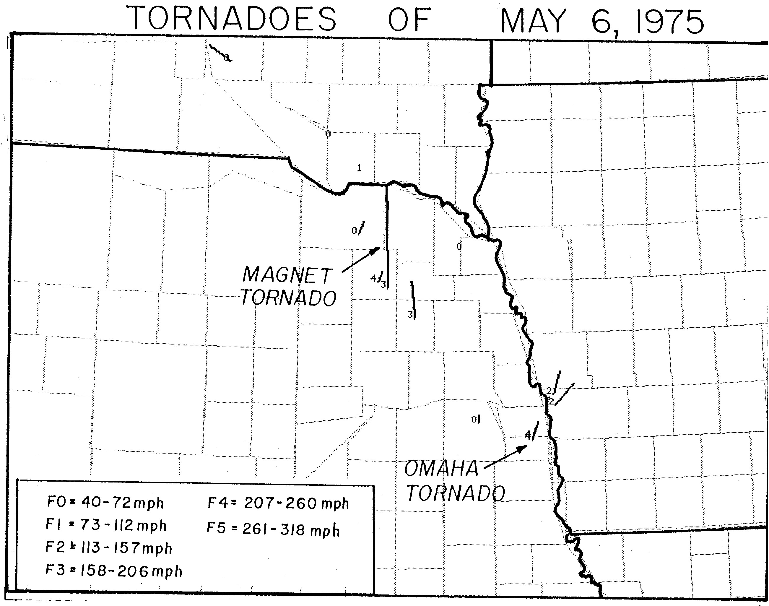
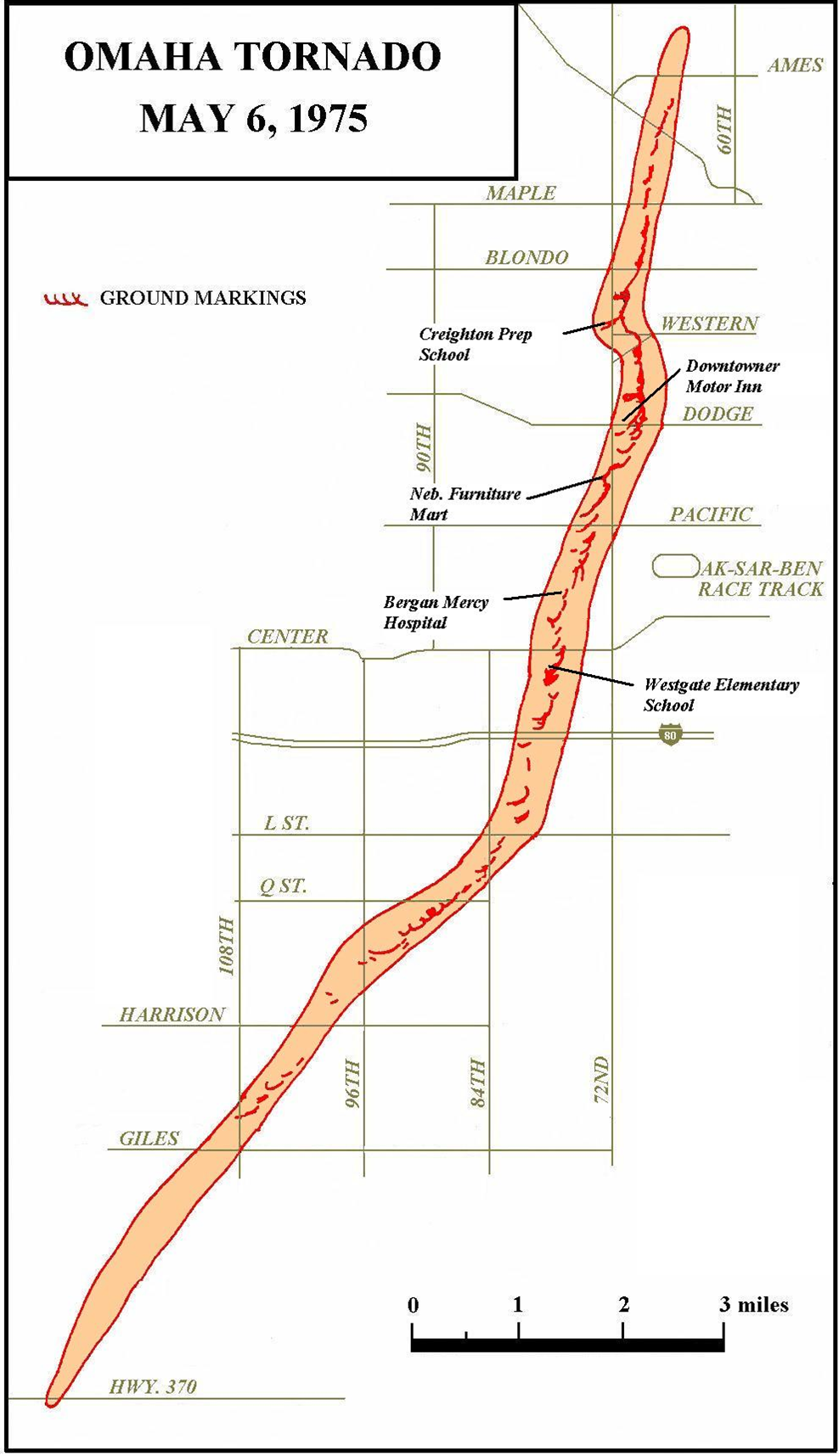
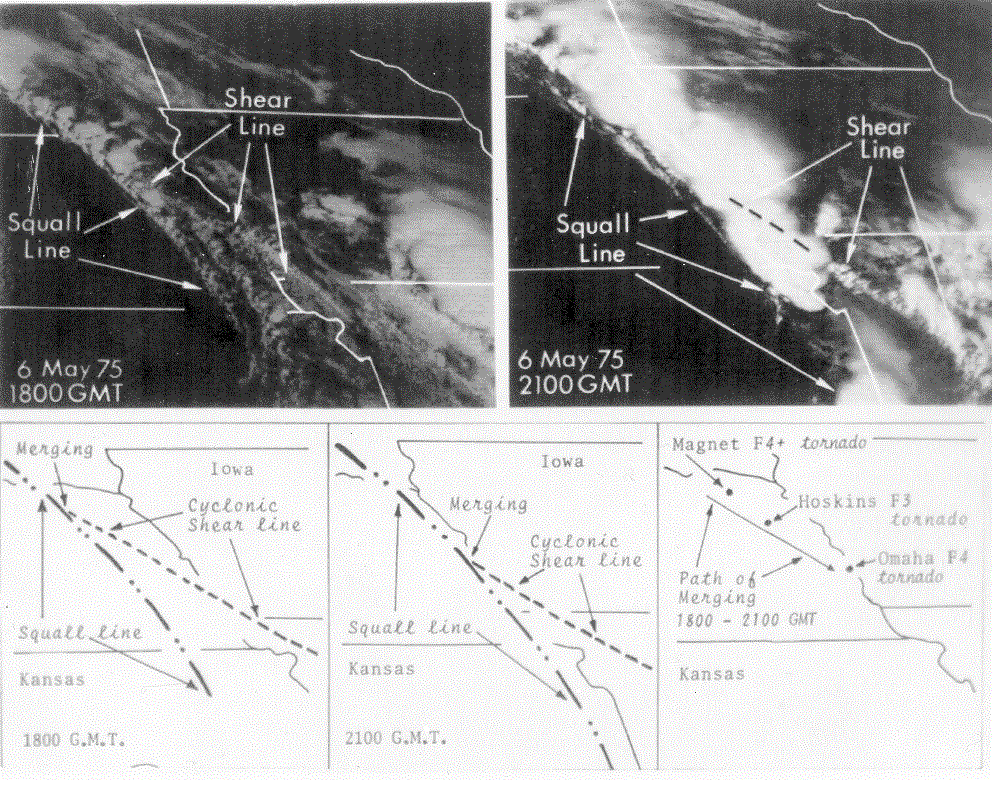
| MAY 6, 1975 OMAHA TORNADO | ||||||||||||||||||||||||||||||||||||||||||||||||||||||||||||||||||||||||||||||||||||||||||||||||||||||||||||||||||||||
 |
||||||||||||||||||||||||||||||||||||||||||||||||||||||||||||||||||||||||||||||||||||||||||||||||||||||||||||||||||||||
| This photo of the Omaha Tornado was taken near Aksarben (72nd and Mercy Rd.) by Bob Dunn | ||||||||||||||||||||||||||||||||||||||||||||||||||||||||||||||||||||||||||||||||||||||||||||||||||||||||||||||||||||||
Several Damage Photos - Click Here
|
||||||||||||||||||||||||||||||||||||||||||||||||||||||||||||||||||||||||||||||||||||||||||||||||||||||||||||||||||||||
|
|
||||||||||||||||||||||||||||||||||||||||||||||||||||||||||||||||||||||||||||||||||||||||||||||||||||||||||||||||||||||
|
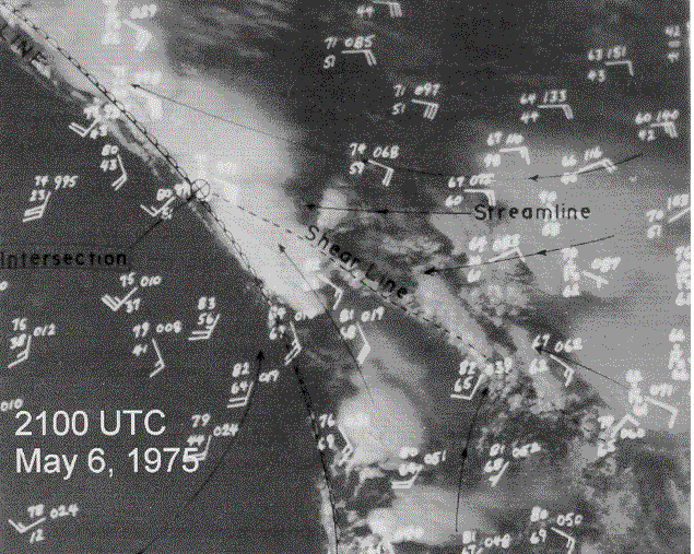
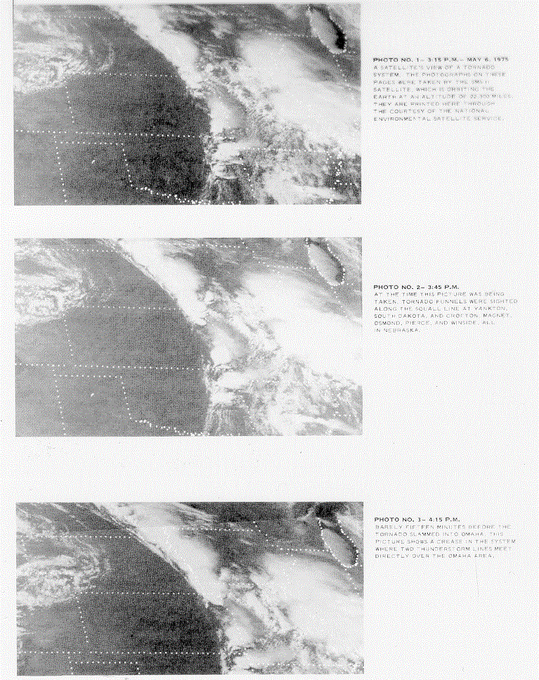
12:37 PM 1 PM - 2 PM 2:05 PM 3:15 PM 4:07 PM 4:09 PM 4:14 PM 4:29 PM 4:33 PM 4:34 PM - 4:43 PM 4:36 PM 4:38 PM 4:40 PM 4:42 PM - 4:49 PM 4:58 PM |
||||||||||||||||||||||||||||||||||||||||||||||||||||||||||||||||||||||||||||||||||||||||||||||||||||||||||||||||||||||
|
||||||||||||||||||||||||||||||||||||||||||||||||||||||||||||||||||||||||||||||||||||||||||||||||||||||||||||||||||||||
|
|
||||||||||||||||||||||||||||||||||||||||||||||||||||||||||||||||||||||||||||||||||||||||||||||||||||||||||||||||||||||
| STORM REPORT
Tornado touched down in northern Sarpy County just south of Omaha. Tornado moves north-northeast through residential and business areas of west central Omaha, lifting over the northern section of the city. Extensive damage to apartments, businesses, homes, schools, autos, trucks, and trees. At times damage area was a quarter mile wide. |
||||||||||||||||||||||||||||||||||||||||||||||||||||||||||||||||||||||||||||||||||||||||||||||||||||||||||||||||||||||
|
||||||||||||||||||||||||||||||||||||||||||||||||||||||||||||||||||||||||||||||||||||||||||||||||||||||||||||||||||||||
|
ADDITIONAL INFORMATION Damage estimates ranged from $250 million to $500 million. The number of homes destroyed was 287 with damage to 1400 others. The time of day aided in the warning process as a spotter saw the tornado in Sarpy County during the daylight hours and children were no longer in school. The NWS aided by REACT and Civil Defense systems provided good lead time for the residents of Douglas County. Three people did perish. An elderly woman died in her home and likely did not hear the warnings. A waitress was killed in a restaurant as she huddled with others in the restroom. A man was killed while seeking shelter at a gas station. |
||||||||||||||||||||||||||||||||||||||||||||||||||||||||||||||||||||||||||||||||||||||||||||||||||||||||||||||||||||||
|
||||||||||||||||||||||||||||||||||||||||||||||||||||||||||||||||||||||||||||||||||||||||||||||||||||||||||||||||||||||
|
|
||||||||||||||||||||||||||||||||||||||||||||||||||||||||||||||||||||||||||||||||||||||||||||||||||||||||||||||||||||||
|
||||||||||||||||||||||||||||||||||||||||||||||||||||||||||||||||||||||||||||||||||||||||||||||||||||||||||||||||||||||