Dangerous heat will expand from the Gulf Coast into the Southern Plains and Desert Southwest through week's end. Additional extreme heat impacting the Pacific Northwest will shift to the northern Plains by the weekend. Tropical Storm Bertha is expected to continue to impact portions of the northern Gulf Coast from the western Florida Panhandle to southeastern Louisiana through tonight. Read More >
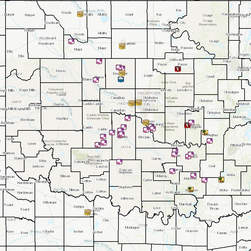
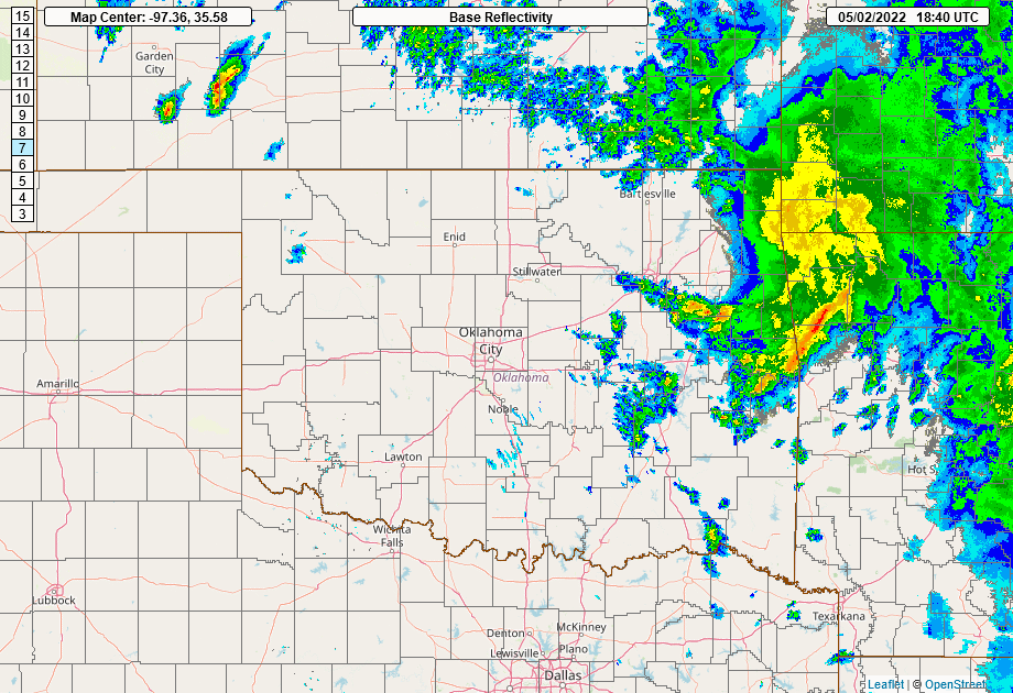
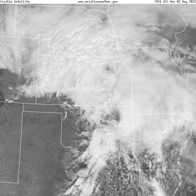
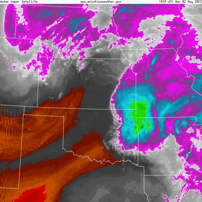
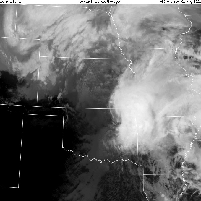
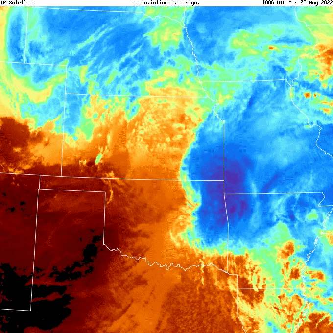
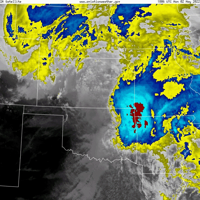
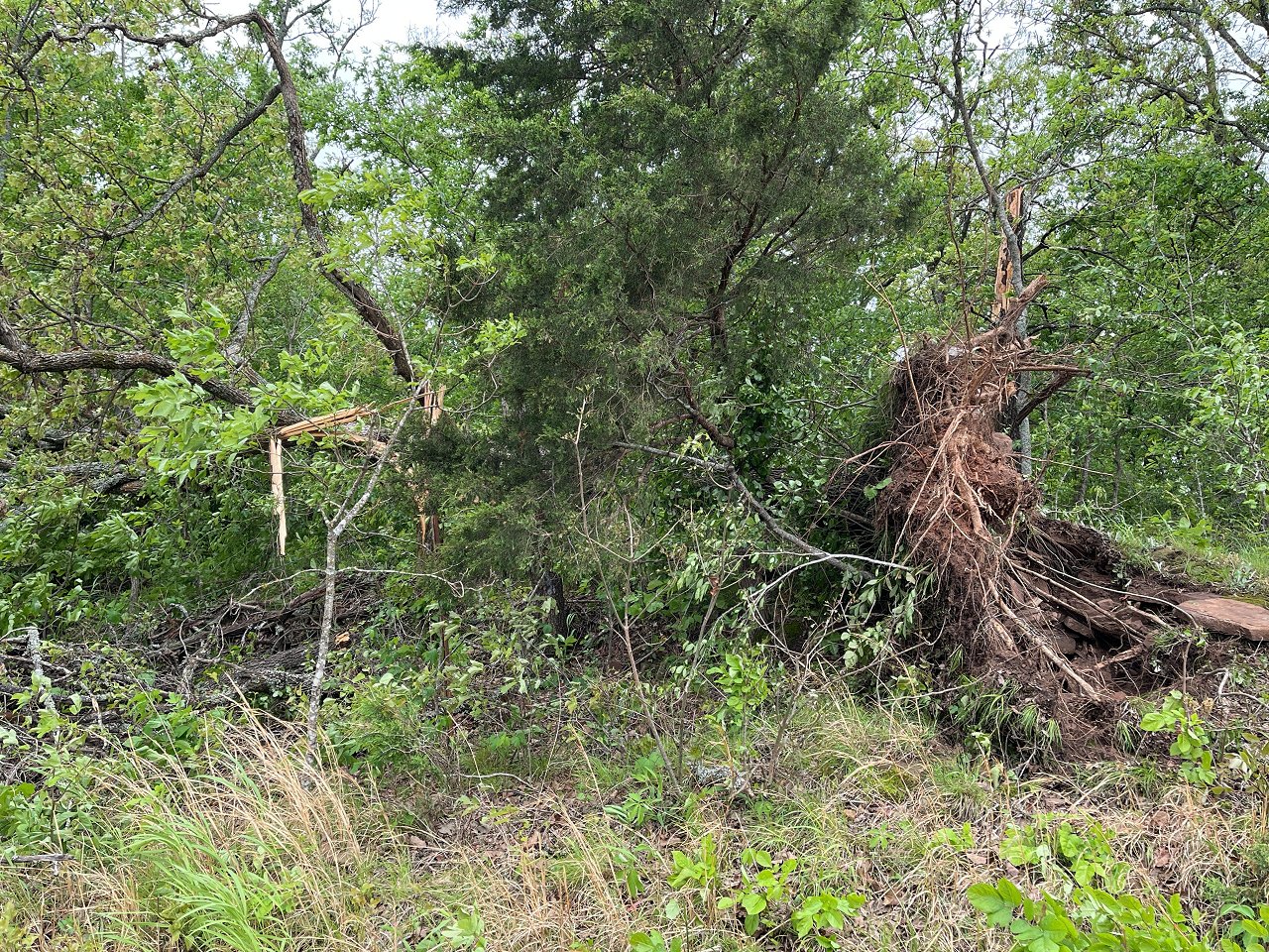
Numerous severe thunderstorms developed across portions of northern and central Oklahoma during the afternoon andevening of May 2, 2022. Storms developed along and just ahead of a fast-moving cold front. As such, storms tended to form into a line quickly after initiation. Still, a pair of semi-discrete supercells persisted across central and north central Oklahoma during the late afternoon into early evening. Given cold temperatures aloft (associated with the main upper-level system), large hail was the main severe hazard type observed with these storms during this event, though a few tornadoes and sporadic wind damage also occurred across the NWS Norman warning area.
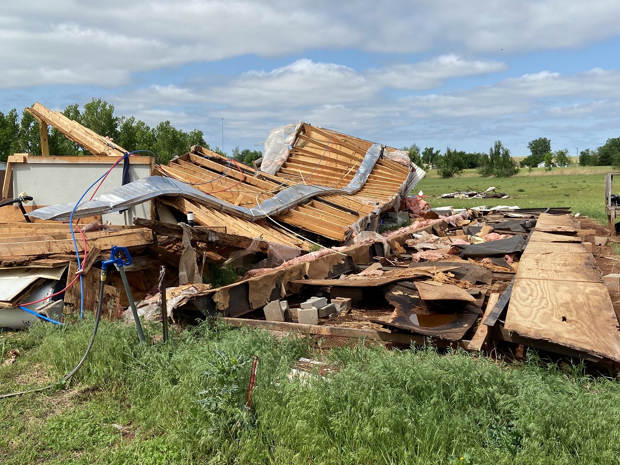
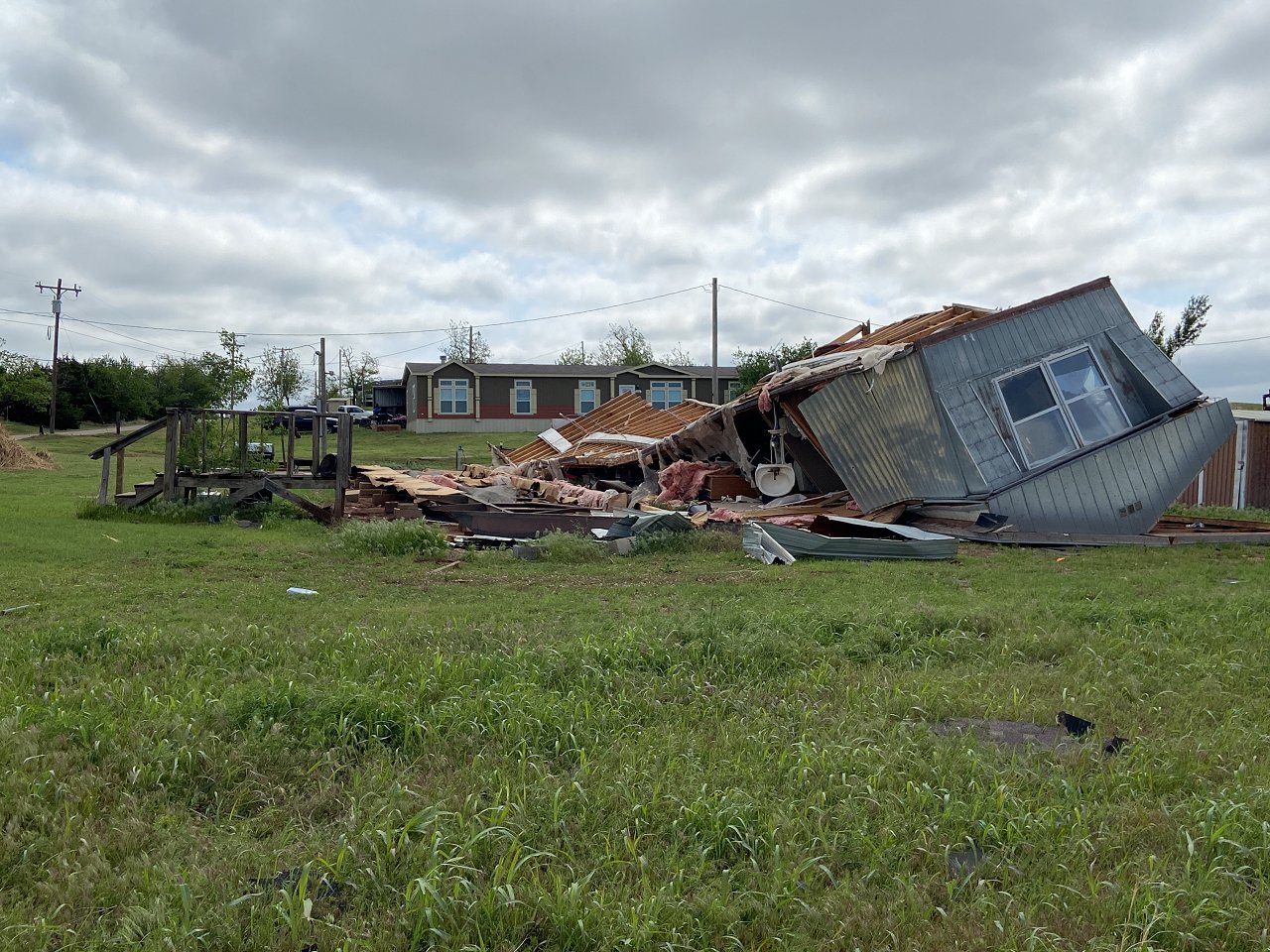
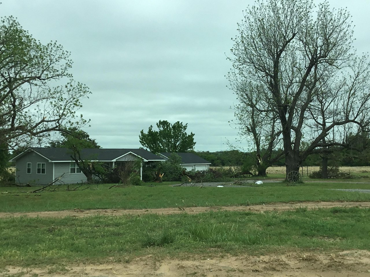
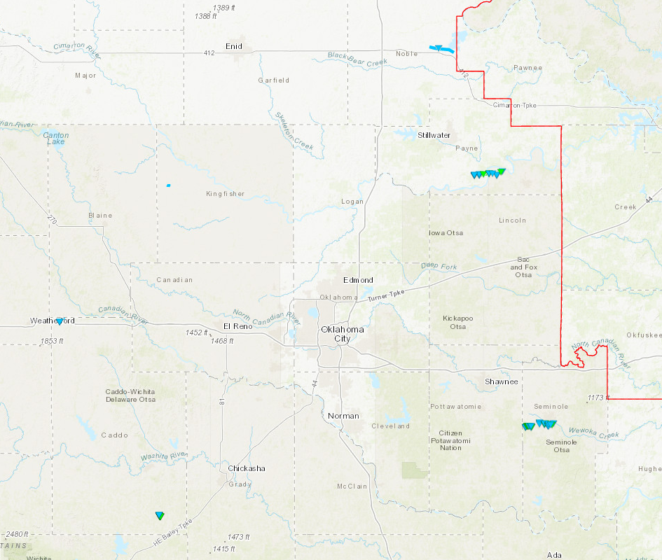
The pair of semi-discrete supercells that traveled across central into north central Oklahoma both became weakly tornadic. The first storm tracked across northern Blaine and Kingfisher counties producing a few brief and weak tornadoes near the town of Loyal, OK. An additional supercell thunderstorm tracked along the U.S. Interstate Highway I-44 corridor from northern Comanche County to Seminole County, OK. The first tornado from this storm significantly damaged a mobile home near the town of Cyril, OK in Caddo County. An additional tornado occurred as the parent supercell began to merge with an expansive quasi-linear convective system (QLCS) along the cold front. This EF-1 tornado moved just south of Seminole, OK, where similar areas would be affected by a significant tornado two days later on May 4, 2022. Additional (weak) tornadoes occurred with the QLCS across Noble and Payne counties.
| Tornadoes by Intensity | |||||||
|---|---|---|---|---|---|---|---|
| EFU | EF0 | EF1 | EF2 | EF3 | EF4 | EF5 | Total |
| 0 | 4 | 4 | 0 | 0 | 0 | 0 | 8 |
| Tornado Number |
Date | Time (CST) |
Length of Path (miles) |
Width of Path (yards) |
F-Scale | Killed | Injured | County | Location |
|---|---|---|---|---|---|---|---|---|---|
| 1 | 05/02/2022 | 1513-1514 | 0.6 | 80 | EF0 | 0 | 0 | Kingfisher | 2.5 W Loyal |
| 2 | 05/02/2022 | 1522-1526 | 0.9 | 80 | EF0 | 0 | 0 | Kingfisher | 2 WSW - 2 WNW Loyal |
| 3 | 05/02/2022 | 1536-1538 | 1.6 | 10 | EF0 | 0 | 0 | Caddo | 1.2 SW - 0.7 E Hydro |
| 4 | 05/02/2022 | 1613-1614 | 0.5 | 240 | EF1 | 0 | 0 | Caddo | 1.5 N - 1 NNE Cyril |
| 5 | 05/02/2022 | 1618-1633 | 5.6 | 1400 | EF1 | 0 | 0 | Le Flore | 3.6 ENE Howe - 1.9 NNE Monroe |
| 6 | 05/02/2022 | 1657-1659 | 1.4 | 150 | EFU | 0 | 0 | Noble | 4 NNE - 5 NE Sumner |
| 7 | 05/02/2022 | 1726-1733 | 7 | 500 | EF1 | 0 | 0 | Payne | 3 WSW - 3 E Ripley |
| 8 | 05/02/2022 | 1852-1910 | 6 | 700 | EF1 | 0 | 0 | Seminole | 3 ESE Harjo - 2 SE Seminole |