Welcome to the NWS Norman Office Information page. This web page contains information about what we do here at our office, the history of the office, who works here, frequently asked questions, information about tours, and our social media sources via the Internet including X, Facebook (Meta), and YouTube. A StoryMap that gives an overview of NWS Norman weather forecast office is now available. |
The National Weather Service Forecast Office in Norman is located at 120 David L. Boren Boulevard in the National Weather Center building, which opened in August 2006. This is located on the South Research Campus of the University of Oklahoma. The building is also along the north side of Highway 9, which runs west to east along the south side of the city of Norman.
 |
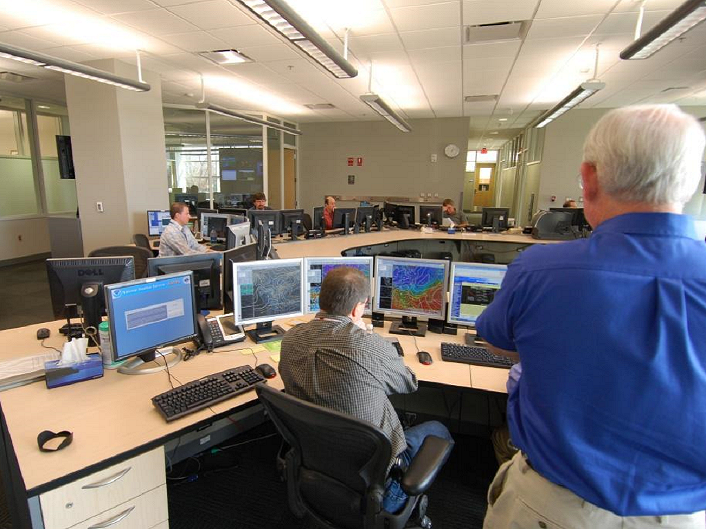 |
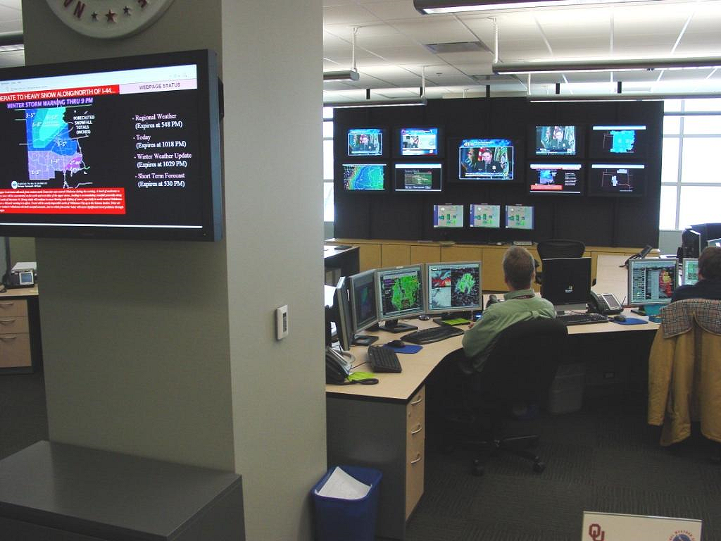
All of the forecasts, watches, warnings, and advisories get produced in the operations area, shown in the pictures above. The operations area is staffed on a 24 hour, 7 days-a-week basis, every day of the year. At least two people are always on duty. In the picture on the left, you can see the Situational Awareness Display (SAD) in the background. The SAD is a grid of multiple television screens that monitor local television stations, the latest weather data, any warnings issued by the NWS Norman or surrounding offices, and the NWS Norman web page. All of the computer workstations where the forecasters work face the Situational Awareness Display. Eight workstations are available in the Operations area. During normal operations in quiet weather, as few as two or three of these may be occupied at any given time. However, during severe weather operations, most or all of the workstations will likely be used.
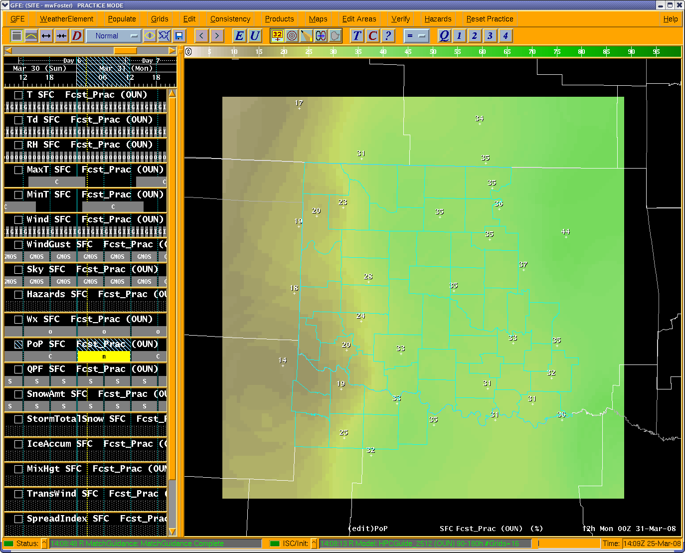
At the Norman Forecast Office, we issue 7-day forecasts for 48 counties in Oklahoma and 8 counties in Western North Texas. In order to produce these forecasts, the forecasters utilize the Advanced Weather Integrated Processing System (AWIPS) to analyze the latest weather data and computer model forecasts. Also, they use the Graphical Forecast Editor (GFE) to create gridded forecasts of dozens of weather variables for the entire 7-day period. An example of a GFE grid is pictured below. Finally, forecasters also create graphical depictions of the biggest weather stories over the next few days.
 |
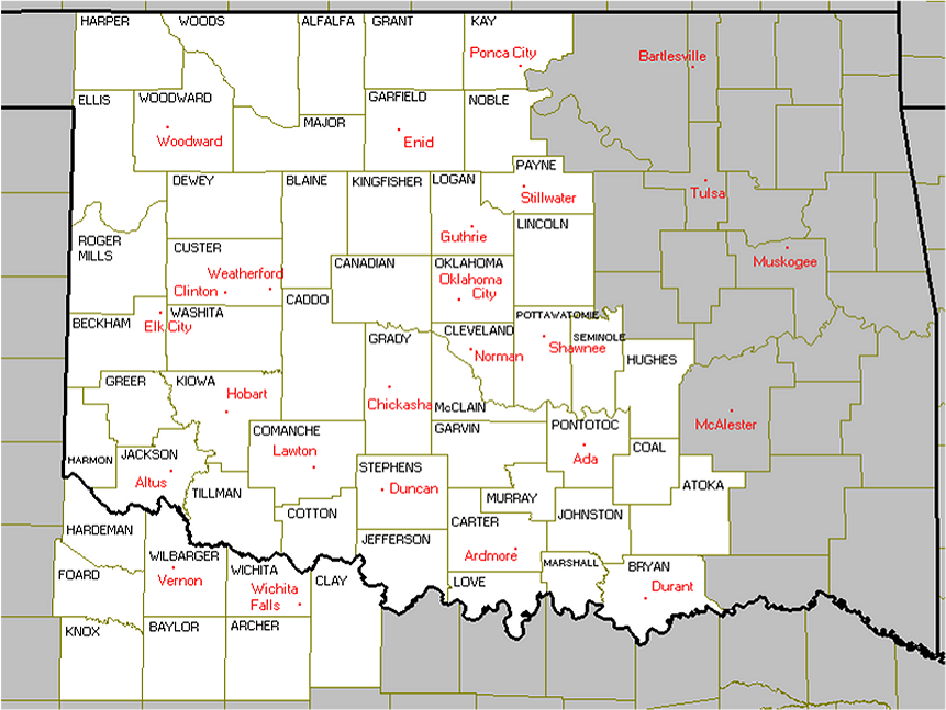 |
In addition to the regular 7-day forecast, the forecasters on duty monitor the need for watches, warnings and advisories around the clock. All watches, warnings and advisories for the 56 counties in the NWS Norman area are issued from the operations area (shown in the first set of pictures). The only exceptions are Severe Thunderstorm Watches and Tornado Watches, which are issued by the Storm Prediction Center (SPC). However, in the National Weather Center Building, the SPC and NWS Norman offices are located right next to each other.
Finally, we also produce aviation and fire weather forecasts. The aviation forecasts are called Terminal Aerodrome Forecasts (TAFs). The NWS Norman produces TAFs for 9 airports around the area: Oklahoma City, Norman, Woodward, Ponca City, Clinton-Sherman, Stillwater, Lawton, and Wichita Falls. The fire weather forecasts are produced based on the grids in the Graphical Forecast Editor, and are issued as a special product.
At the NWS Norman we also maintain various equipment and records. There are three WSR-88D radars in our county warning area: near Vance Air Force Base around Enid, near Frederick, Oklahoma (also near the Altus Air Force Base), and near Twin Lakes, Oklahoma. Technicians at the Air Force bases maintain the two radars near the Air Force bases. Our electronic technicians maintain the Twin Lakes radar, as well as a handful of observation sites around the area.
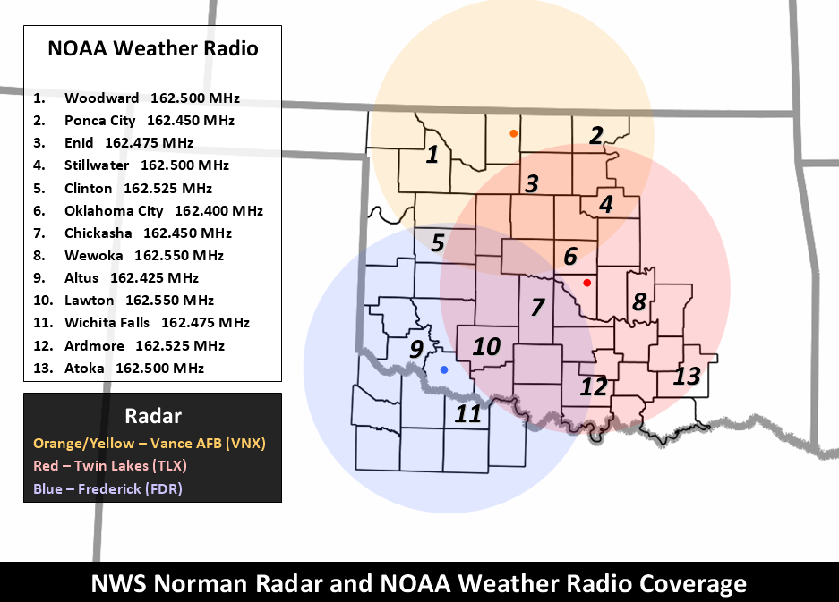
We broadcast our forecasts, watches, warnings, and advisories over NOAA Weather Radio towers, located at different places around the area. NOAA Weather Radio is always available, 24 hours a day, 365 days a year. The broadcast schedule consists of messages which are repeated every three to five minutes and are routinely revised to provide up-to-date information.
We maintain climate data and records for various observation sites around the area, as well as for cooperative observer sites around the area. The three official climate locations that we serve are Oklahoma City and Lawton, Oklahoma and Wichita Falls, Texas. This includes records and averages for temperatures and precipitation, along with a few other meteorological variables. We also log storm reports, snowfall totals, etc.
Finally, we also keep records and provide forecasts for various rivers around the area. River forecasts are routinely produced by River Forecast Centers, but they can be tweaked and readjusted here at our office. We keep data on river crest information, and historic crests at each of the river gage locations. Additionally, we make sure the gages are functioning properly and report issues to the USGS, USACE, OWRB and other owners of river equipment. We occasionally travel to several NWS river sites to perform maintenance.
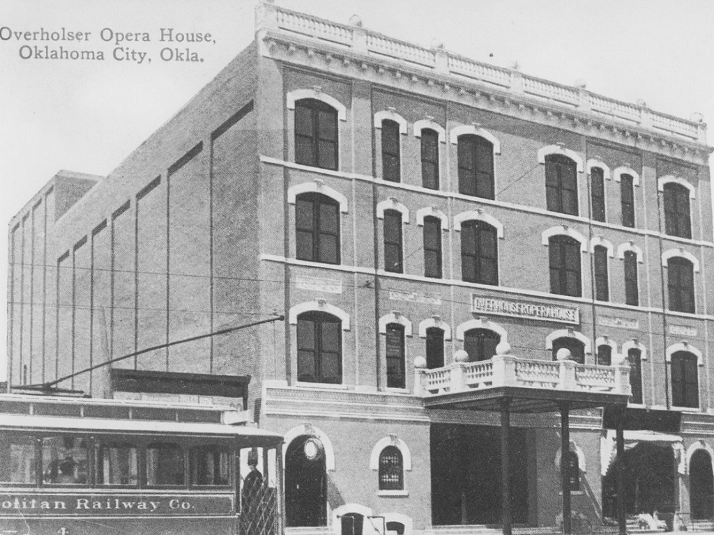
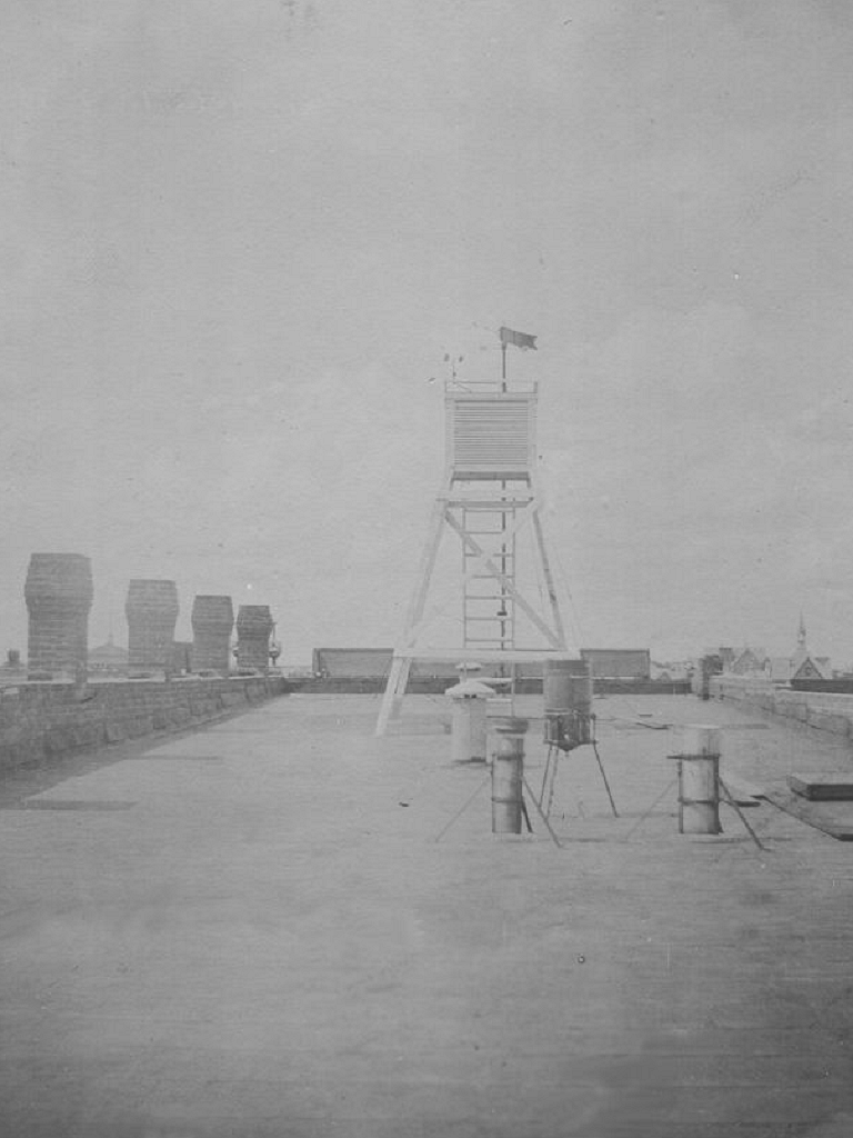
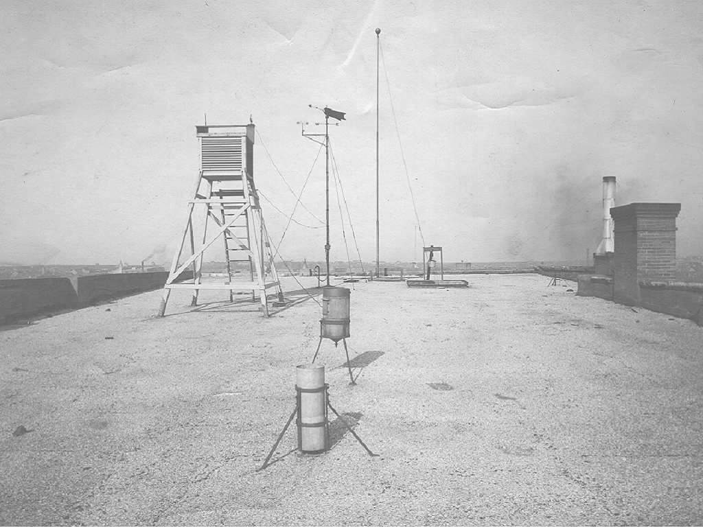
The National Weather Service essentially began on October 1, 1890 when Congress passed an act creating the U.S. Weather Bureau underneath the Department of Agriculture. A Weather Bureau office began operating in Oklahoma City at the Overholser Opera House on November 1, 1890. This opera house was located on the southeast corner of the intersection of Robinson and Grand. Eventually, Grand became known as Sheridan Avenue, and the Overholser Opera House became known as the Orpheum Theater, long after the Weather Bureau had moved. This theater was eventually demolished in 1964, and now the Cox Convention Center is situated in that location.
 |
 |
 |
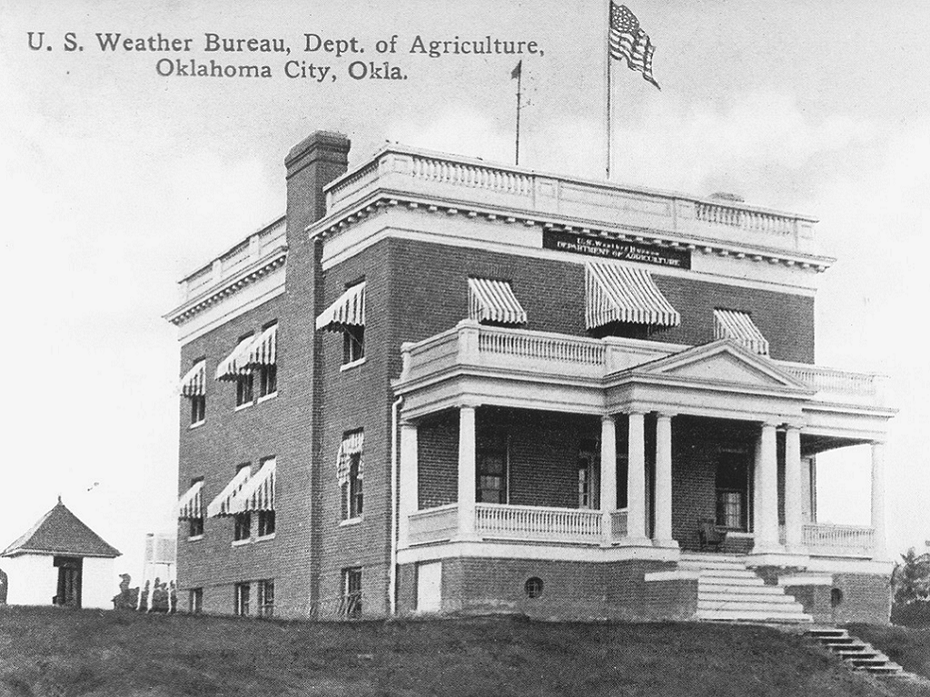
After the Overholser Opera House, the Weather Bureau office in Oklahoma City moved to the Culbertson Building, which was located on the southeast corner of Broadway and Grand in Oklahoma City, just down the street from the old office. The new office began officially operating there on July 1, 1902. The Weather Bureau office only lasted in the Culbertson Building until January 16, 1906. The reason for the move was a brand new Weather Bureau Observatory, built at 1923 Classen Boulevard in Oklahoma City. This weather observatory was one of a special new class of 47 observatories being built across the United States.
 |
 |
 |
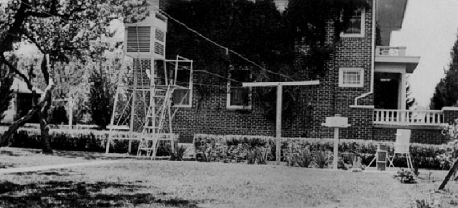
Back in the days of the Weather Bureau Observatory, it served as both an observatory, and a residence for the Section Chief. This is evident in the picture below, which shows a clothesline hanging from the temperature shelter to the building on the south lawn. The office on Classen Boulevard was north of downtown Oklahoma City, in a fairly residential area. The building still exists to this day.
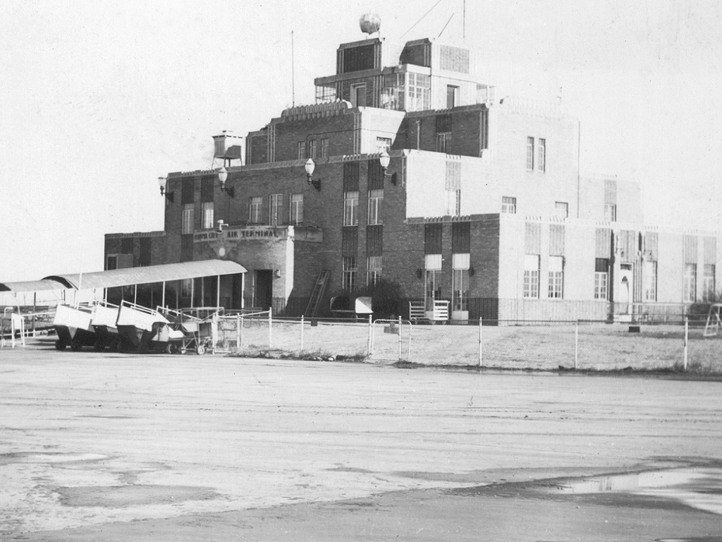
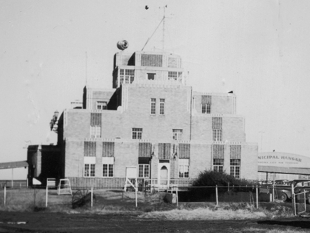
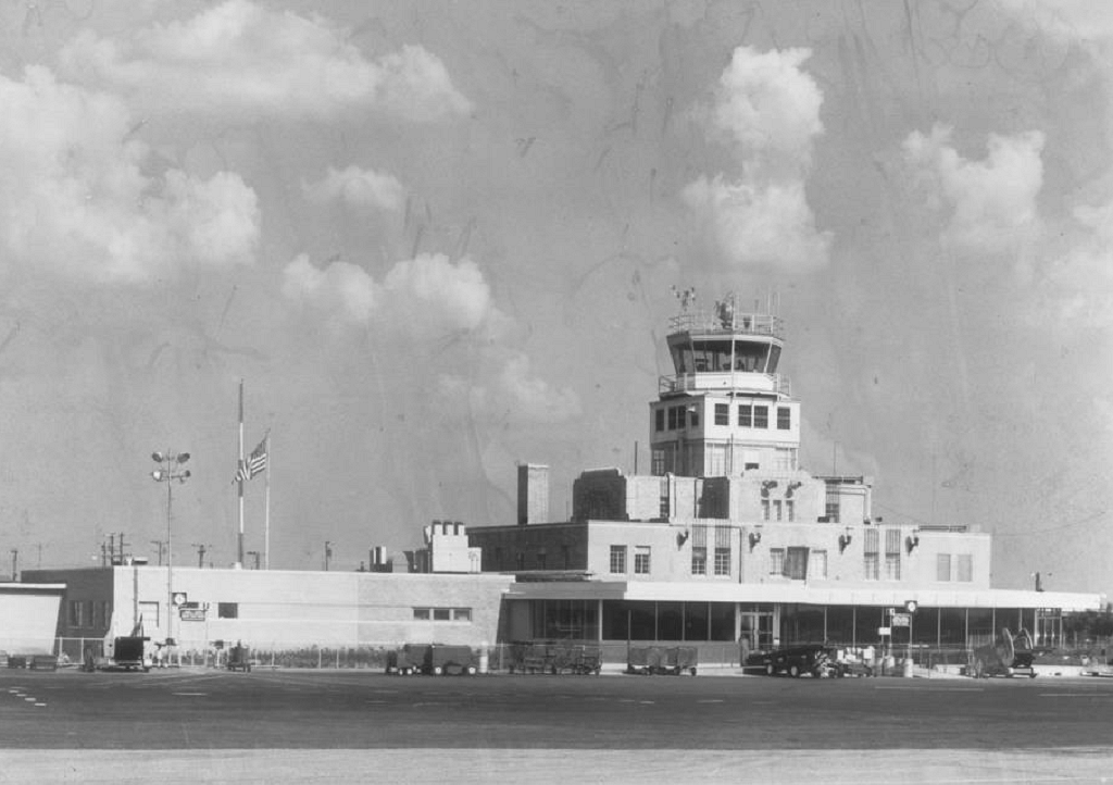
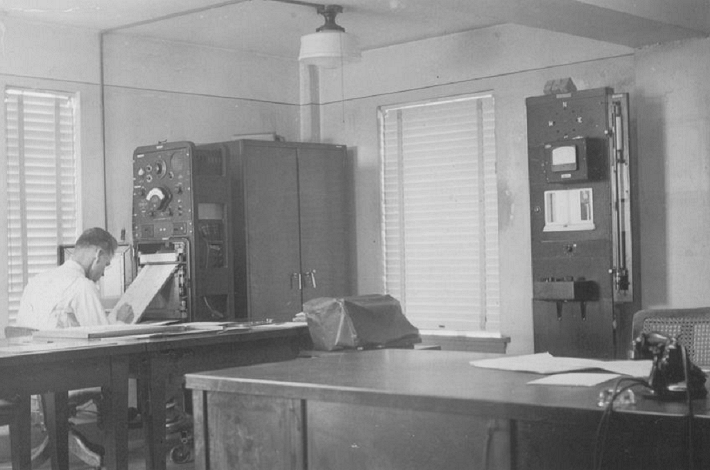
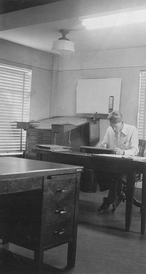
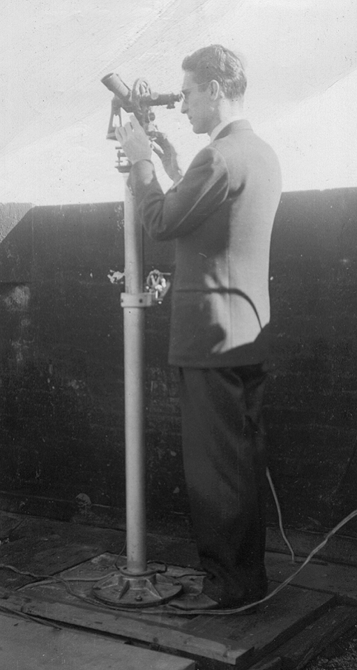
In 1932, a Weather Bureau office opened up at Will Rogers Airport on the southwest side of Oklahoma City. This office officially opened on April 2, 1932 and began the gradual transition away from the Weather Bureau Observatory on Classen Boulevard. The new office was located in the Administration Building at Will Rogers Field. Initially observations remained at the Weather Bureau Observatory, but by 1951 the number of observations taken there were substantially reduced. Below are a series of pictures from the Administration Building at Will Rogers Airport.
 |
 |
 |
 |
 |
 |
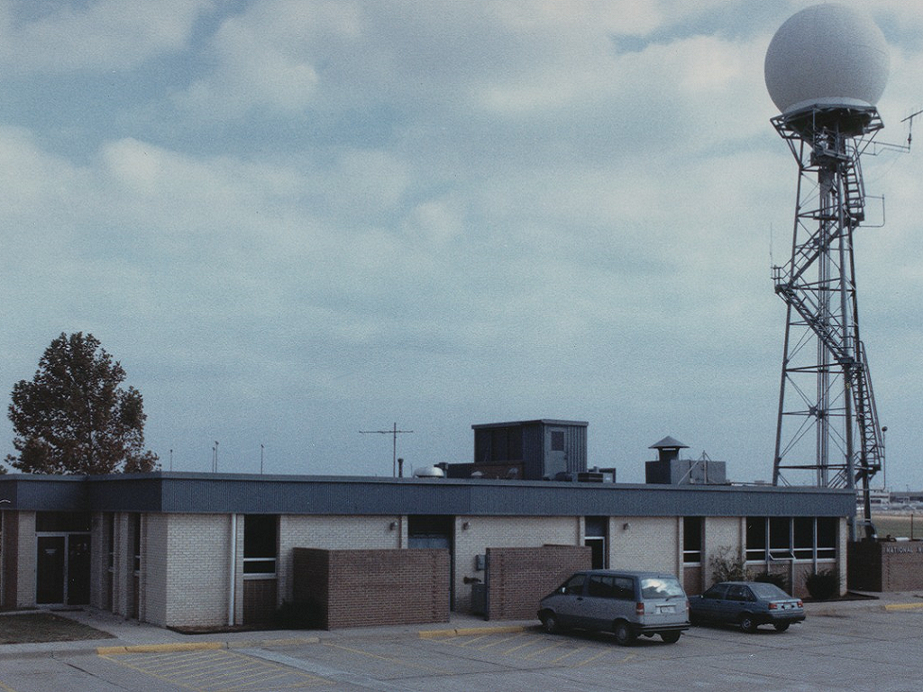
The office was located at Will Rogers Airport in some fashion until January 26, 1987. A new Weather Bureau Building was built at the airport to just house the Weather Bureau Office. The Weather Bureau office relocated there on October 22, 1965. In 1970, the U.S. Weather Bureau had been renamed the National Weather Service. Below is a picture of this new building that was constructed at the airport.
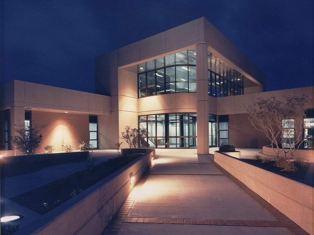
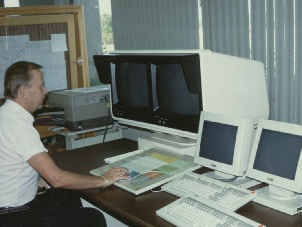
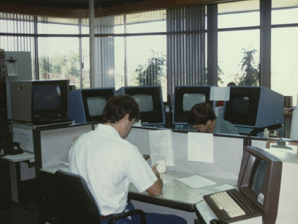
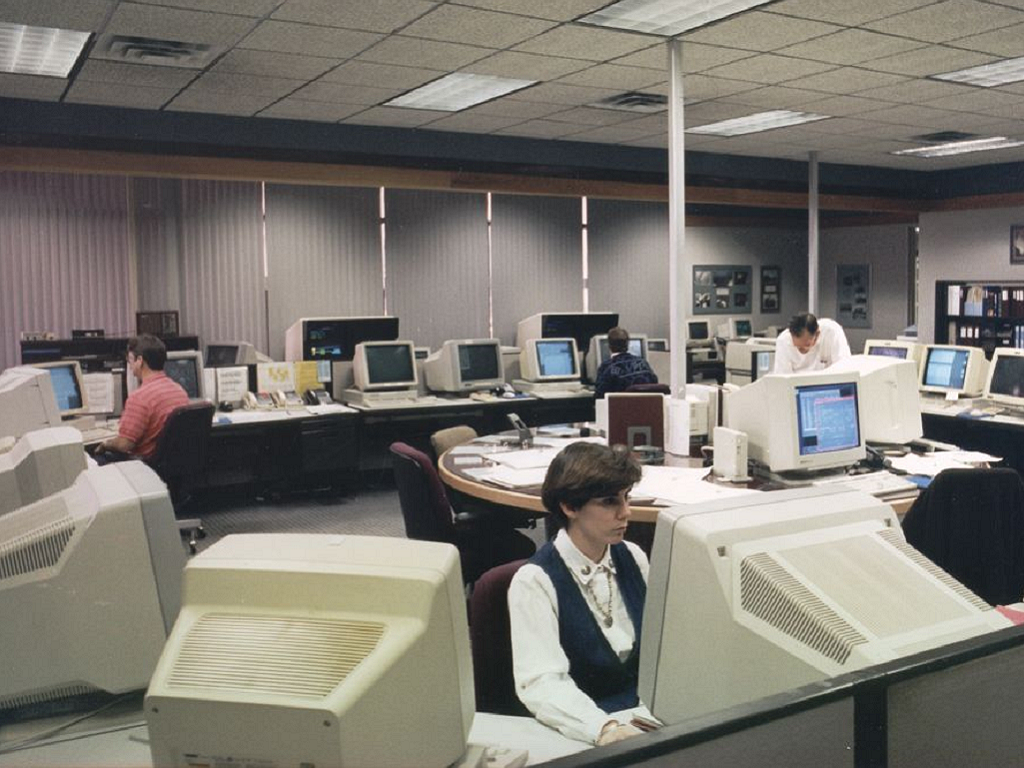
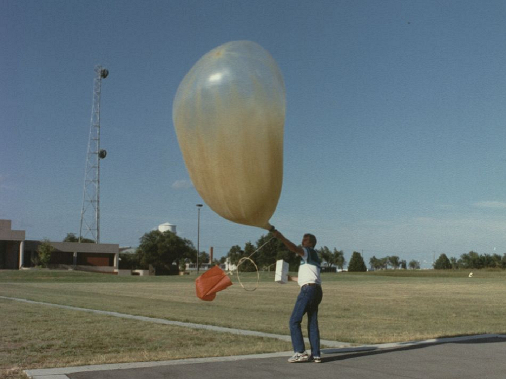
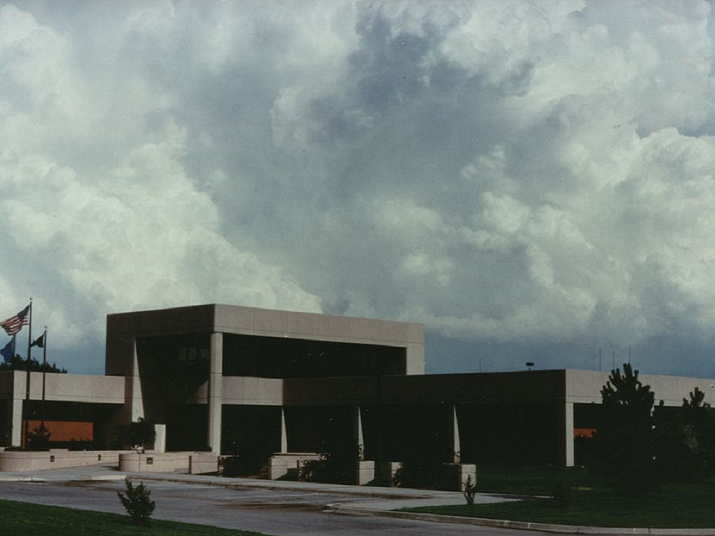
On January 27, 1987, the National Weather Service office in Oklahoma City relocated to Norman, Oklahoma. It was located at Max Westheimer Airport in a building built specifically for the NWS office. By 1997, the Storm Prediction Center (SPC, previously named the Severe Local Storm Warning Center and located in Kansas City) had moved to Norman and was co-located with the National Weather Service office there. The National Severe Storms Laboratory (NSSL) was also in the building. This building at Max Westheimer, and also located on what is sometimes referred to as the "north campus of the University of Oklahoma", is pictured below along with other pictures of the office.
 |
 |
 |
 |
 |
 |
On August 7, 2006, the National Weather Service Forecast Office began the move to a new building on the University of Oklahoma's South Research Campus in Norman, Oklahoma. The office began operations in the new building on August 10, 2006. The "National Weather Center" is located along Highway 9 on the south side of Norman. The Storm Prediction Center and National Severe Storms Laboratory also moved to the new National Weather Center that summer. For more details, you can visit the page with information on our current office.
Through the years that it was in place, the Weather Bureau and National Weather Service Forecast Office in Norman/Oklahoma City has had to forecast and respond to some significant weather events, and has been a part of some major weather stories. A few of these weather stories grabbed national, or even international, headlines. Below is a bullet point list of a few of the major weather stories from November 1, 1890 to present day.
Here is a collection of frequently asked questions, and their answers, on a wide variety of topics - from climate, to employment, to severe weather, to website issues. If you have a question that isn't addressed here, email our webmaster.
Jump to:
For certain Oklahoma and north Texas sites, you can find detailed daily/monthly data in our CF6 (formerly "F6") Preliminary Monthly Climate Data section (follow the instructions on the page to get a CF6 for the location and month you want). For Oklahoma, you may wish to contact the Oklahoma Climatological Survey. Most OCS data, and our CF6 data for Oklahoma City and Wichita Falls date back to the mid-1990s. Other CF6 sites date back to the summer of 2001. Please visit our Climate Section for more information.
It depends entirely on the type of request. Generally, the more recent the data, the easier it is to look up, unless it's for a Cooperative site or a primary climate station (Oklahoma City and Wichita Falls, in our area). When you send or phone in your request, be sure to include the location, time, and weather elements you need the information for. It doesn't hurt to specify which units you want, either, especially when requesting pressure information. Please be as specific as possible, since weather elements can take many varied forms (for example, "pressure" can be interpreted as sea-level pressure, sea-level pressure corrected for temperature, or simply the uncorrected station pressure).
We cannot provide weather information suitable forcourt cases. The National Centers for Environmental Information is the national repository for climate records. Alternatively, the Oklahoma Mesonet is available if you need data from Oklahoma. Expert testimony may be obtained from private meteorologists.
Usually, one of the best sources of information is the NWS office which has forecast responsibility for the storm's location. For example, the NWS office in Paducah KY has a section of their Web site dedicated to the spectacular Tri-State Tornado of 1925. See a map of the NWS offices and links to their Web sites.
For the NWSFO Norman area of responsibility, please visit our various Climate Information pages. Daily temperature, precipitation, and wind records are in the Monthly Weather Summaries. The Oklahoma Climate Survey provides very detailed climate information for all of Oklahoma (for large requests, fees may apply). Similar information is available for Texas residents from the Office of the State Climatologist for Texas (OSC). The Southern Regional Climate Center also provides climate information for Oklahoma, Texas, and other states in the southern United States. Finally, the National Climatic Data Center provides both free and for-fee services.
After a rather long search of the Internet, I found nothing on-line. (If anyone reading this knows of a site with a map of lightning frequency, please let me know!) There is a printed publication, Thunderstorms and Lightning... The Underrated Killers, which is a preparedness guide from NOAA, FEMA, and the American Red Cross. Inside is a map of "thunderstorm days" across the contiguous United States. This is somewhat different than the number of lightning storms, in that there could be several storms in one day at the same location. The publication is available from the National Weather Service Office nearest you.
Certain cycles do occur in climate, and in weather in general. Most are irregular and do not contribute to long-term forecasting very reliably. The Climate Prediction Center provides a lot of good information on this topic.
There is some good educational information at the NOAA and NSSL (National Severe Storms Laboratory) websites.
We are not currently aware of any. (If there are any such camps, we would appreciate hearing about them! - An e-mail contact link is at the bottom of this page.)
No. When we receive e-mail questions that look like they are straight out of a textbook or class assignment, we normally will not answer them.
The American Meteorological Society has published a guide to careers in atmospheric research and applied meteorology that answers a lot of questions about the profession, including what meteorologists earn, where they work, and what kind of education is needed.
"How do I get a job in the National Weather Service?".
Generally, you would want to emphasize math and science, especially physics, in high school. You should also become very familiar with using a computer, and learn concepts of computer programming. Technical writing classes would also help when you get into the college-level courses. If you plan to attend the University of Oklahoma, check out their School of Meteorology.
Some colleges and universities have specialties that may be of value to you. For example, the University of Oklahoma is well-known for its role in research into severe weather. Coastal campuses often specialize in marine meteorology, while some in the southern states emphasize tropical meteorology. Similarly, if your interest is winter weather, the northern states often have good programs for that aspect of meteorology. Probably the best way to handle this decision is to determine which colleges and universities are affordable, and in locations where you would like to live for several years - then visit their Web sites and call their counselors. You might also want to contact the employer you will want to work for (National Weather Service, private meteorology companies, airlines, etc.), and find out which colleges/universities appeal to the person who will do the hiring.
Possibly, but openings are quite limited. The entry-level position is a "meteorologist intern" (paid, full-time, rotating-shift schedule). Applications for the meteorologist intern position must be made as described in How do I get a job in the National Weather Service?). Volunteer positions are available at many NWS offices, usually including the Norman Forecast Office. Those positions are usually filled by juniors or seniors in the Meteorology Department at the University of Oklahoma.
Please contact us if you are really interested.
First, you should meet the current standards for NWS Meteorologists positions.
When a job opening (vacancy) occurs within the National Weather Service, a vacancy announcement is published with specific information on the job opening, duties, pay and location. A list of current job openings can be found at the USA Jobs website. You can enter the 'series number' of the job you're interested in (the series number is 1340 for meteorologist and 1341 for meteorologist technician). For entry-level (intern) positions, look for jobs with a grade listed as 'GS-5/' or 'GS-7/'. A list of all vacancy announcements within NOAA (the National Oceanic and Atmospheric Administration) is also available. This list includes not only meteorology positions, but other job opportunities available in NOAA, and is updated daily. In either list, the associated link will describe the vacancy announcement in full, including requirements to apply for a particular position. Other opportunities are available within the National Weather Service for electronics technicians, hydrologists, computer programmers, and research meteorologists.
The meteorologist positions use the Federal government's General Schedule (GS) Federal salary table. In general, entry-level meteorology positions are as a "Meteorologist Intern" (GS level 5/7/9/11). Meteorologists entering the National Weather Service usually start at GS-5 (at this writing, in 2014, $27,705/yr., plus locality pay - a minimum of about 13%) or GS-7 ($34,319/yr., plus locality pay) depending on education and experience (see the General Schedule (GS) pay scale for up-to-date information), including charts showing locality pay adjustments. Interns can advance to GS-11. The intern position allows meteorologists to become acquainted with the products and processes of the NWS. Later, General Forecaster (GS-9/11/12, and, at a few locations, GS-13), and Senior Forecaster (GS-13 and, at a few locations, GS-14) positions are available. Other research, science, management and supervisory positions (GS-13, 14 or 15, and some ES - Executive Schedule) are also available after an appropriate length of service.
Most meteorologists in the NWS work at a forecast office (see map). Since these offices are in operation continuously, meteorologists typically work some type of shift rotation. Usually, the rotation involves about a week on each of three main shifts. Overtime work is often required during severe weather events. Meteorologists in other types of offices may work a standard workweek or have other types of schedules to meet their staffing needs. Contact the specific office(s) where you wish to work for more information.
In Oklahoma:
Alfalfa, Atoka, Beckham, Blaine, Bryan, Caddo, Canadian, Carter, Cleveland, Coal, Comanche, Cotton, Custer, Dewey, Ellis, Garfield, Garvin, Grady, Grant, Greer, Harmon, Harper, Hughes, Jackson, Jefferson, Johnston, Kay, Kingfisher, Kiowa, Lincoln, Logan, Love, Mcclain, Major, Marshall, Murray, Noble, Oklahoma, Payne, Pontotoc, Pottawatomie, Roger Mills, Seminole, Stephens, Tillman, Washita, Woods, Woodward
In Texas:
Archer, Baylor, Clay, Foard, Hardeman, Knox, Wichita, Wilbarger
(See Map.)
Because our e-mail is not checked daily, we cannot answer specific short-term forecast requests through e-mail. There are many locations on the Internet that contain the official National Weather Service forecasts. For weather forecasts issued by the NWS Norman or other NWS offices, simply go to any NWS Forecast Office's main page (such as ours), near the upper-left corner, and enter the city, state (or Zip code) for which you want a forecast, then click "Go".
Long-range forecasts tend to be very vague, and do not usually help much for planning outdoor activities. Unfortunately, the atmosphere is far too complex to allow us to forecast rain, storms, etc., more than a few days in advance. Please check out the climate data available for the location of concern for an advance idea of your chances of getting wet, cold, or otherwise inconvenienced.
The NWS Meteorological Development Laboratory office has a list of most of the acronyms that the NWS uses, and the Tulsa OK office has a handy glossary of weather terms. Site identifier information is available from the NWS Data Management website.
It depends. If the forecaster is sure there will be "measurable" precipitation (0.01 inches of rain or its frozen equivalent), the probability of precipitation ("PoP") corresponds to the amount of coverage that is expected in the forecast area. This forecast area may be a county, a group of counties, or some equivalent geographic area, and is specified in the Zone Forecast, Area Forecast, and Detailed Forecast. In other cases, the PoP is an approximation derived from a combination of the likelihood that precipitation will occur, and how much area it is likely to affect. For example, if a forecaster is 40% sure that rain will occur, and expects it to cover 70% of the forecast area, the PoP will probably be 30%. At this time, PoPs in official forecasts are always for the given 12-hour period ("today," "tonight," etc.), or what remains of it.
Computer models also produce a PoP. In their case, the probability of precipitation is for a given point location, and represents the likelihood that "measurable" precipitation will occur at that point in the given time period.
If the information concerns our forecast area, yes. Otherwise, we would prefer that you contact the NWS office that serves your area (see our map of NWS offices), or the area you are researching. This is especially true if you are requesting safety pamphlets or other national publications that are available from all NWS offices. Another source of information, nationwide, is the National Centers for Environmental Information. They can also be reached by phone or e-mail. See their contact page for more information.
Maybe. E-mail requests are checked most days, and often answered promptly. If your request requires research, then response time may be several days or even a couple of weeks. We do not have full-time e-mail response personnel, and other office duties take priority, which can result in significant delays.
Most of the time, it is because you entered an invalid e-mail address. We do not (yet) have the ability to warn you about that ahead of time. Occasionally, software or computer problems cause e-mails to be lost in transit. Regardless of the reason, if you have not received a response from us within a week or two, please contact us again. The only messages we normally do not reply to are spam, frivolous messages, "keep up the good work" messages, and thank-you replies.
We are located in the National Weather Center (NWC), and tours are organized by the NWC. Please see the NWC tour information page for more information.
No. The NSSL office is also in the NWC, but is a different organization and has a different mission. Our mission is to issue forecasts and warnings for our forecast area, which covers parts of Oklahoma and Texas. The NSSL is a research center and works to further our knowledge of, and ability to predict, severe local storms.
No. The SPC is adjacent to our office in the NWC, but has a different mission. Our office issues forecasts and warnings for much of Oklahoma and a small part of Texas. The SPC issues severe thunderstorm and tornado watches, plus various outlooks, for the entire country, excluding Alaska and Hawaii.
Our severe storm spotting glossary is dedicated to terms related to severe weather and storm spotting. Our neighbors at the NWS Tulsa office have a general-purpose weather glossary, and the NWS (national level) has similar glossary.
Sunrise/sunset (and moonrise/moonset) information is available from the U.S. Naval Observatory.
Please see the NOAA Weather Radio All Hazards website and your radio manual. If you have further questions, please write, e-mail, or phone the NWS office that serves your area (see this map to find the right office).
Different people have different weather information needs. A general recommendation is to include the county you are in, plus one or two nearby counties, particularly those to the northwest, west, and southwest. If you plan to use the radio for road trips, you can save money by buying a non-SAME radio, which will alert for all watches and warnings transmitted from the nearest NWR station.
FIPS (Federal Information Processing Standard) or SAME (Specific Area Message Encoding) codes are the same. They are six-digit numbers that represent all, or part of, a county, independent city, or parish. The second and third digits represent the state (for example, 40 = Oklahoma); the fourth through sixth digits represent the county/city/parish (for example, 109 = Oklahoma County in Oklahoma), and the first digit identifies what section of that county, city, or parish is being described. That digit is usually a zero, which means "all" the area defined by the other five digits.
Several people have written or phoned with this complaint with the added comment that they turned the radio's alert feature off. We really don't want you to do that! The purpose of the WR-SAME technology was to help prevent this from happening.
If your radio alarms for distant warnings, one of two things has probably happened. Either you purchased a radio that is not SAME-compatible (if you can't program county codes into it, it's not SAME-compatible) or your radio is not programmed for the right counties. Check to ensure that the "FIPS Code" list contains only the code for the county you are in, and perhaps one or two nearby counties. Also be sure that any "wild card" entries are removed (for example, "999999" is often used as an "all counties" indicator).
Other possible explanations (which are much less common) include a miscoded warning or a defective radio.
This page provides information about special-needs NOAA weather radios. The information is intended to assist those who are deaf or hard-of-hearing.
If the photos are copyrighted (those photos are labeled as such), you will need to get written permission from the copyright holder. Otherwise, you can use the photo without express permission, provided that you give credit to the source of the picture, usually the National Weather Service.
Our site has a few tornado and winter storm pictures in our Weather Events list. It includes major tornado and winter storm events in Oklahoma and north Texas. For a much larger collection of general weather photography, see the NOAA Photo Library.
Please feel free to post it to your own ISP (Internet Service Provider), then send us a link. The Webmaster can make the decision whether to include it or not at that point. If you don't have an ISP, please try to make the image as small as possible, while still preserving the main subject(s), then e-mail it to us with your request for submission. Again, the Webmaster can then decide whether or not to display a larger version of the image.
First, determine which office serves the area where the event occurred, by finding the location on a map of forecast/warning areas. For our forecast area, you can find ways to submit a report by going to the Introduction to Storm Observation and Reporting web page and choosing the "Reporting Severe Weather" tab. For other offices, visit their website and look for a link to submit a storm report. You can also try phoning the office, but most offices stop answering the public telephone in the evening. If you cannot contact the NWS directly, you may contact your local law-enforcement agency and ask them to relay the report to the National Weather Service. For other after-the-fact reports, you can e-mail the Webmaster of that office's Web site with the following information:
Storm spotters are a vital link in the NWS warning process. Dr. Keith Brewster (University of Oklahoma) has written a paper: "Getting Started in Tornado and Thunderstorm Spotting." The NWS Office in Norman offers spotter training at various locations around Oklahoma and the western part of north Texas in the late winter and early spring. A list of dates for these meetings will be posted on our home page as plans are finalized. If you do not live in our office's forecast area, other NWS offices also offer spotter training. Check with the NWS office nearest you. On-line spotter training is becoming an increasingly popular alternative to attending a class. On-line classes are often included among the entries in the spotter training schedules.
From the Storm Prediction Center's FAQ: "Very few people make a living as storm chasers. The vast majority of people who chase storms do so as a hobby in their spare time, often at a cost of hundreds or thousands of dollars a year. To become a professional storm chaser, you must be able to consistently acquire and successfully market your storm photographs and video. You may also develop enough skill to have others pay to ride along with you on chases. However, it takes many years to become a safe and successful storm chaser, and the market for storm chase pictures/video and tours is quite competitive. The best way to approach storm chasing is to ride along with more experienced chasers for a few years, and practice severe storm forecasting at every opportunity."
The NWS does not encourage "pursuit" of potentially lethal weather since its mission is the protection of life and property. However, researchers at the National Severe Storms Laboratory occasionally send storm chasers into the field in an organized, scientific effort to study severe thunderstorms and tornadoes (like VORTEX2). Chasers involved in these projects are NSSL employees, University of Oklahoma students, or collaborating scientists. Nearly all of the meteorologists at NSSL have advanced scientific degrees. The NSSL cannot accept volunteers to participate in their field projects due to government regulations and legal liability issues.
The best source of additional information on storm chasing is the Storm Track web page. Their FAQ has more information on safety, financial concerns, chase tours, ethics, strategies, etc.
The NWS does not encourage anyone to pursue dangerous storms for any reason other than promoting public safety (spotting) and official research. However, joining one of the professional tour groups is probably safer than going out yourself without appropriate training. A good place to find information on storm chasing is the Storm Track website.
The NWS does not currently provide e-mailed warnings, mostly due to problems with timeliness. We prefer that you use NOAA Weather Radio instead. If you really want e-mailed warnings, you can check with the various private weather companies and media outlets. If you are interested in warnings in other parts of the country, you can see the NWS's current map (which auto-updates periodically), and you can obtain a text list (which also auto-updates) from the College of DuPage.
The National Weather Service does not offer such services directly at this time, but there are many sources that can provide you with a variety of weather information via your phone or smart phone. Note that this field is evolving rapidly, so rapid changes in the availability of various alert services are likely in the near future.
We have recent reports for the NWSFO Norman forecast area, and the SPC has a nationwide listing, complete with color maps. The NWS does not provide a personal e-mail service for severe weather reports. You may want to check with one of the many private services to see if they do.
Counties are outlined in many map publications, such as road atlases, state highway maps, etc. The free maps provided by the state travel information centers are especially good, since those are often the maps used by the NWS when issuing warnings. For the Norman office, at least, references to cities not on the Oklahoma or Texas state highway maps are very rare, and counties are reasonably well-marked on both state maps. Also, we have a less-detailed map of our warning area. A few retail stores sell inexpensive magetized county-outline maps that can be attached to a refrigerator or other large metal appliance.
Please see the amateur radio page in our SKYWARN section of our Web site for the ham radio network in our forecast area.
We have a Storm Spotter Resource Center available on our Web site. There are links from it to other resources, too. If you are serious about becoming a spotter, please check out the "How do I become a storm spotter?" question in this section.
You can find information regarding this subject in the FEMA safe room resources web page.
FEMA has another excellent source of safety information on their Are You Ready? page.
The NWS distributes several pamphlets on storm safety, including hurricane, tornado, lightning, and winter storm preparedness - and a few specifically for children. Contact the NWS Forecast Office that serves your area for more information.
Myth: "Tornadoes don't cross rivers." Although some landforms may influence the distribution of tornadoes, rivers do not have any clear effect on them. The great Tri-State tornado of 1925, the deadliest tornado ever recorded, crossed both the Mississippi and the Wabash Rivers.
Myth: "Open windows in your house to equalize pressure." Do not do this! Your house will not "explode" due to a tornado passing over it, and taking time to open windows merely reduces your ability to seek safe shelter in time.
Myth: "Get to (or away from) the southwest corner of the building for safety." Of course, the safest place to be is in an underground storm shelter, or a reinforced above-ground storm shelter. If neither is available, then the safest place in a building is in a small, reinforced room (such as a bathroom or closet) near the center of the building, on the lowest floor (preferably below ground).
Myth: "Tornadoes skip." Sometimes, the damage path of a tornado will result in demolition of several buildings, followed by several lightly damaged, followed by several more demolished. This gives the impression that the tornado "skipped" over the less-damaged structures. There are several possible explanations for this. One is that the surviving buildings were simply better-constructed. Also possible is that the orientation of the buildings resulted in varying degrees of vulnerability to the winds of the tornado. Finally, small eddies in the tornado's circulation can add or detract from the overall flow in the tornado's circulation. Longer breaks in a tornado's path suggest that more than one tornado was involved. Supercell thunderstorms go through cycles of tornado formation and decay. One supercell storm may generate several tornadoes during its own life cycle. For an example, see the map of the May 3, 1999 tornado outbreak across central Oklahoma.
Myth: "Mobile homes attract tornadoes." This myth probably came from the tendency of tornadoes to demolish mobile homes while leaving nearby structures only slightly damaged. Mobile homes can be severely damaged even by weak tornadoes, which tend to cause only minor damage to most other kinds of dwellings. If the mobile home is not tied down, it is vulnerable even to the winds of a not-quite severe thunderstorm, since such a building can be flipped over by winds around 50 mph.
There are several excellent Web sites for general information on tornadoes. Try these:
Storm Prediction Center: Tornado FAQ
National Severe Storms Laboratory: NSSL Weather Research and NSSL Tornado FAQ
Federal Emergency Management Agency: Tornadoes
NOAA: NOAA Tornado FAQ and NOAA Tornado Links
The Storm Prediction Center has a nice F-scale chart. (Note that the "F-scale" has been revised, and the new version, the "EF-scale," is now in use.)
Thirteen, as of 2021. See this page for details. It is important to remember that the (E)F-scale is somewhat subjective, which can lead to some disagreement between experts as to the true rating of a given storm. Also, most of these tornadoes were given ratings long after they occurred, based on surviving reports of the storm-related damage.
No. See the "Fast Facts" tab and then the FAQ section of the May 3, 1999 event web page detailed explanation.
According to the NSSL mobile radar (then referred to as "Doppler on Wheels", yes. Those winds were measured several hundred feet above the ground, however, and speeds at the surface were probably somewhat lower, due partly to friction.
Please see the answer to this question in the SPC's FAQ.
People have described the sound of a tornado in many different ways, often depending on the intensity of the storm in question. Sometimes, it sounds like the rumble of a passing freight train; occasionally it is described as being like the whine of a jet engine as power is applied to it. People in shelters sometimes describe the sound of their house being destroyed as similar to the sound of large hail pounding on the roof.
Many weather links are included in the University of Michigan's UM Weather. Pointers to find more obscure meteorological data can be found in the Meteorology section of faqs.org.
Please see the answers to lightning questions in the Climate and Weather History section.
We have moved the GraphiCast display to our main page. It should appear near the top of the page. A few of the features (such as multiple radar links) have not been retained, and a few features (such as multiple thumbnails of active graphics) are less convenient. However, improvements include better-looking graphics, animations (mainly of radar images), and captions for each graphic.
Yes. Please click the Webmaster link, found at the bottom of most pages on our site and send us an e-mail. It would help us a lot if you would include the address of the page with the bad link, the text of the bad link itself, and, if you know what it is, the corrected link address.
The weather observation has not been available for a long time (a day or two) for some reason. The most likely causes include equipment failure and communication failure. These, in turn, may be caused by severe weather (ice storms, high winds, etc.) or by accident (such as a cut power cable or communications line). The amount of time between the failure and restoration to service varies according to the magnitude of the cause of the failure and the site's maintainer. Sites maintained by this office are: Gage, Woodward, Stillwater, Ponca City, Guthrie, Wiley Post (OK City), Will Rogers (OK City), Clinton, Hobart, Frederick, Lawton, and Wichita Falls. Repairs at these sites are generally complete within a few days, except for the most catastrophic failures. Other sites use less-expensive (and less-reliable) equipment, and are typically owned by the state or local community. These owners may not be able to respond quickly to equipment failures. In extreme cases, many months may pass before repairs are made. These less expensive observing sites may also report incorrect weather conditions at times (snow is occasionally reported when rain is occurring, for example), even when otherwise functioning normally.
Please do send us a correction for anything that is clearly in error. Please also be tactful when you write - we work very hard to make this an informative and correct Web site.
Not at this time. The best resources for school closings would be from your local school district or local media sources.
Not exactly. The Wind Chill Index (WCI) is designed to tell you how cold you should feel, based solely on the current wind speed and air temperature. For example, if the current temperature is -22 °F (-30 °C), and the wind speed is 35 mph (15.6 m/s or 56 km/h), the WCI is equivalent to -58 °F (-50 °C). This is supposed to be the equivalent of walking at 3 mph (1.3 m/s or 4.8 km/h) in calm air at the WCI temperature. Several variables that affect how you really feel were approximated and incorporated into the formula as constants. Such things as surface wind speeds that vary significantly from the official measurements (usually due to sheltering effects of trees and buildings), skin that is already cold, and wind-breaking effects of certain clothing articles can cause the "real" wind chill to differ from the WCI. Still, the WCI is a reasonable approximation. Note that the above discussion has been updated (Dec. 18, 2002) to describe the new WCI
Okay, so far, no one has actually asked us this question, but it seemed like a likely candidate for the FAQ when the change took place. The wind chill formula was revised in 2001 to attempt to make the Wind Chill Index (WCI) more representative of reality. The previous formula gave values that were generally considered to be too cold. For details, please see the NWS webpage on this subject.
No, not unless the actual air temperature is also below freezing.
It is different than the effects on humans. Until detailed research can be done, the exact effects are too complex to determine. Please also see the other answers to questions on wind chill in this section.
You can normally view the current wind chill equivalent temperature simply by going to any NWS home page (such as ours), and supplying a city, state (or Zip code) in the box in the upper left, and clicking "Go". If the temperature is 50 °F (10 °C) or colder, and there is at least a light breeze, the wind chill equivalent temperature should be listed. You can also see the wind chill values in Oklahoma on the Oklahoma Mesonet website.
Information regarding tours of the National Weather Center, including the NWS Norman forecast office, can be found at:
https://www.ou.edu/nwc/visit/tours
Social Media
Our social media sources via the Internet include Facebook (Meta), X, and YouTube.
Facebook (Meta)
https://www.facebook.com/NWSNorman
X
https://twitter.com/NWSNorman
YouTube
https://www.youtube.com/user/NWSNorman