Blacksburg, VA
Weather Forecast Office
Overview
|
A cool wedge was in place along and east of the Blue Ridge. During the morning areas to the west and south saw sunshine and an increase in instability throughout the day. The remnant wedge front was oriented east to west along the NC/VA border and provided a focus for thunderstorms. Strong shear helped storm organization and led to strong updrafts with hail up to the size of golf balls occurring.. |
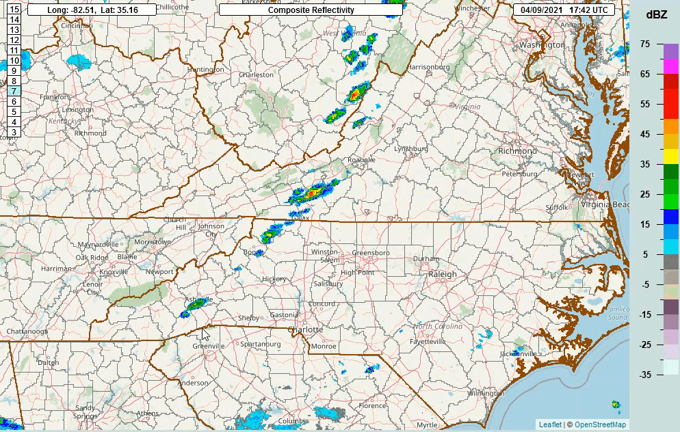 Radar loop of hail producing storms over southern VA into NC April 9th. |
 |
 |
 |
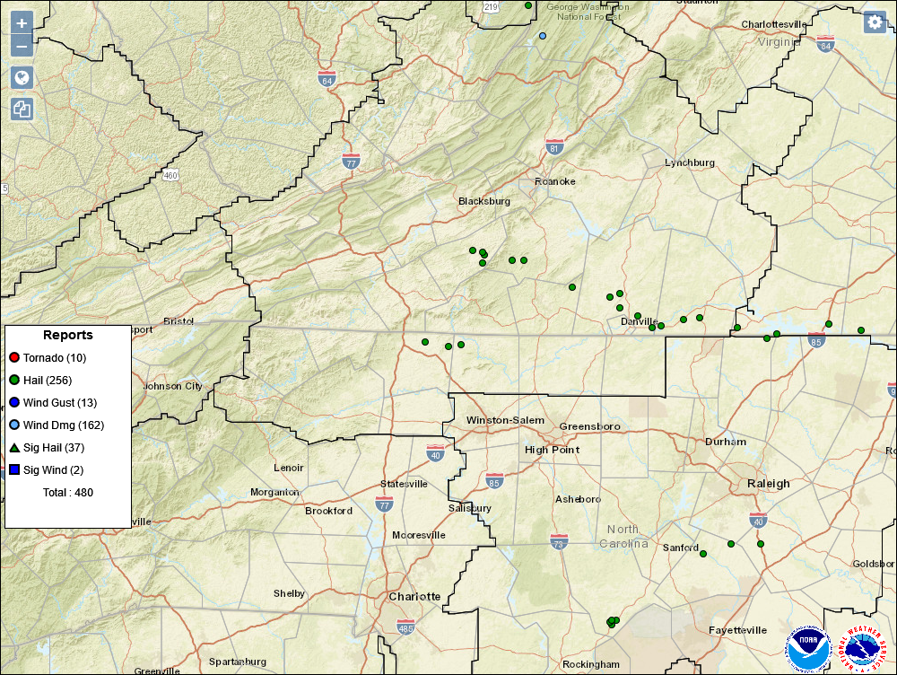
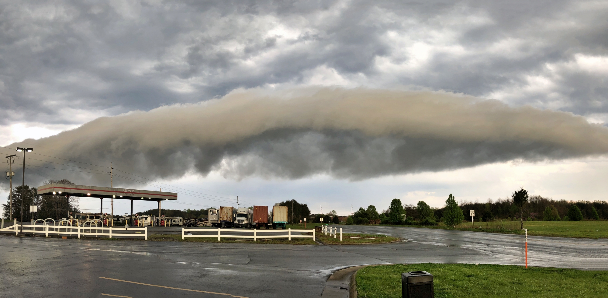
| Storm reports from April 9th, 2021 | Arcus/Roll Cloud in Martinsville, VA April 9th (credit Chris White) |
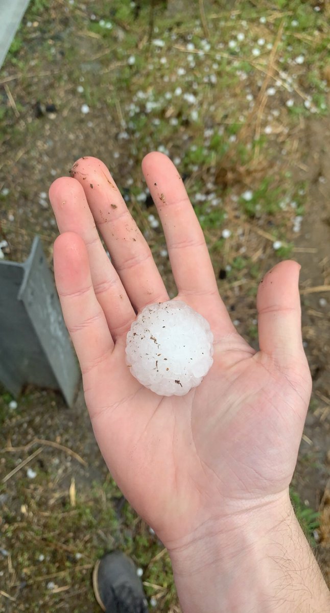
Large hail along U.S. 58 near Danville/South Boston, VA (credit: Trained Spotter) |
 |
Media use of NWS Web News Stories is encouraged! Please acknowledge the NWS as the source of any news information accessed from this site. |
|
Current Hazards
Severe Weather
Winter Weather
Flooding
Local Storm Reports
Drought Conditions
Current Conditions
Air Quality
Observations List
Observations Map
Upper Air Soundings
Forecasts
Bufkit Data
Fire Weather
Spot Forecasts
Air Quality Forecast
National Graphical Forecast
Aviation Forecasts
Hydrology
River Observations (Map)
River Forecasts (Map)
Current and Past Streamflow
Excessive Rainfall Outlooks
Experimental Long-Range Flood Risk
Climate/Past Weather
Climate Information
CoCoRaHS
Precipitation Estimate (Click Enabled)
Snow and Ice Information (Click Snow and Ice)
Past Events
Weather Extremes / Top 10s
Citizens Weather Observing Program (CWOP)
Tropical Cyclone Reports
US Dept of Commerce
National Oceanic and Atmospheric Administration
National Weather Service
Blacksburg, VA
1750 Forecast Drive
Blacksburg, VA 24060
540-553-8900
Comments? Questions? Please Contact Us.

