Blacksburg, VA
Weather Forecast Office
|
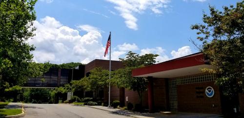
National Weather Service office in Blacksburg, VA |
| For directions to our office, please e-mail us. |
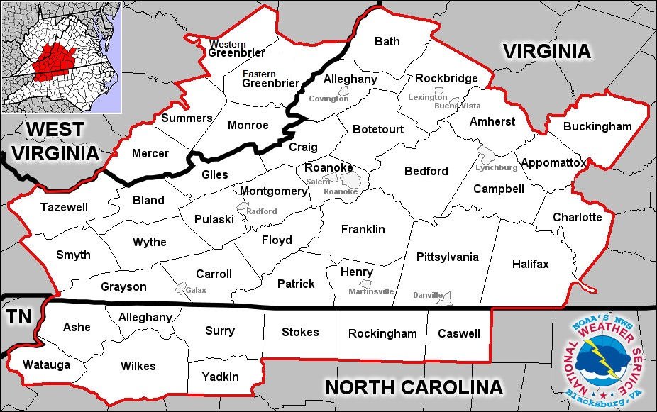
| Blacksburg is located in southwest Virginia, approximately 40 miles southwest of Roanoke. Our County Warning Area covers 40 counties including parts of southeast West Virginia, southwest Virginia, and northwest North Carolina. We are responsible for monitoring weather and river conditions in these counties and issuing appropriate warnings, statements, long and short term forecasts, and aviation forecasts. |
| To accomplish our mission we make use of the latest technology for detection and communication. Our Doppler radar is located in Floyd County. We operate six NOAA Weather Radio transmitters located in Roanoke, VA, Lynchburg, VA, Halifax, VA, Hinton, WV, Jefferson, NC, and Wytheville, VA. We are also one of the approximately 75 upper air sites in the U.S. releasing weather balloons twice daily. |
| The region we cover encompasses a diverse population and diverse geography. Larger cities in our area are Roanoke, Lynchburg, and Danville, VA, Lewisburg and Bluefield, WV, and Boone and Reidsville, NC. Our area extends from the Appalachian and Blue Ridge mountains on the west side to the flatter topography of the Piedmont on the east. Our Hydrologic Service Area covers parts of 5 major river basins and the threat of flash flooding is high throughout the year. |
Current Hazards
Severe Weather
Winter Weather
Flooding
Local Storm Reports
Drought Conditions
Heat
Current Conditions
Air Quality
Observations List
Observations Map
Upper Air Soundings
Forecasts
Bufkit Data
Fire Weather
Spot Forecasts
Air Quality Forecast
National Graphical Forecast
Aviation Forecasts
Hydrology
River Observations (Map)
River Forecasts (Map)
Current and Past Streamflow
Excessive Rainfall Outlooks
Experimental Long-Range Flood Risk
Climate/Past Weather
Climate Information
CoCoRaHS
Precipitation Estimate (Click Enabled)
Snow and Ice Information (Click Snow and Ice)
Past Events
Weather Extremes / Top 10s
Citizens Weather Observing Program (CWOP)
Tropical Cyclone Reports

US Dept of Commerce
National Oceanic and Atmospheric Administration
National Weather Service
Blacksburg, VA
1750 Forecast Drive
Blacksburg, VA 24060
540-553-8900
Comments? Questions? Please Contact Us.


 Radar
Radar Current Weather
 Rivers & Lakes
 Satellite
 Forecast Maps
 Hour by Hour Forecast
 Tropical Weather
 Graphical Hazards
 Weather Briefing Page
 Forecast Discussion
 Text Products
 Climate Plots
 Submit A Storm Report
 Fire Weather
 Drought
 Recreation Forecast
 NOAA Weather Radio
 Aviation
 Follow us on X
 Follow us on Facebook
 Follow us on YouTube
 RNK RSS Feed