Tonight will be warm and humid. Low temperatures will range in the low to mid 70s across the region, with south winds expected between 5 and 15 MPH. Skies will remain mostly clear through midnight, followed by scattered low clouds moving in by Wednesday morning
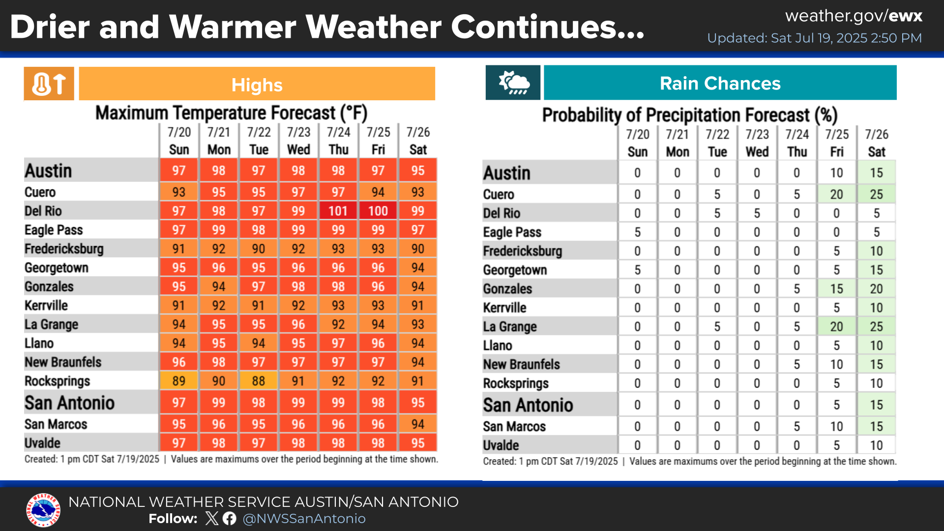
Seasonably hot and mainly rain-free conditions will persist through the end of July and into the beginning of August. A major heat risk is possible this weekend into early next week. Maximum temperatures are forecast to reach up to 103°F in some areas, with maximum heat indices climbing as high as 114°F. Remember to stay hydrated and practice heat safety.


 Austin/San Antonio Radar
 Weather Map
 Satellite Imagery
 Del Rio Radar
 Digital Forecast Map
 Tropical Outlook
 Drought Status
 Air Quality
 Fire Weather Forecasts
 Observed Rainfall
 Observed Temperatures
 Daily Climate Graphs