
A slow moving front will produce a threat for heavy rainfall and severe weather from the southwest into the western High Plains through the weekend. Heavy rainfall and isolated flash flooding and gusty winds will be possible this weekend into early next week in portions of southern Florida. Coastal flooding impacts remain possible through the weekend along the Southeast and Mid-Atlantic coasts Read More >
| Overview | ||||||||||||||||||||||||||||||||||||||||||||
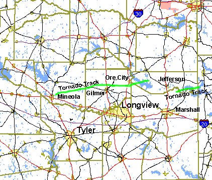
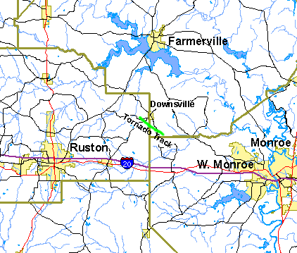
| Severe thunderstorms brought tornadoes to portions of East Texas during the night of May 6th, 2003, and the early morning hours of May 7th. Tornadoes also developed in North Central Louisiana during the early morning of May 7th. Below is a summary of the tornadoes that were confirmed by National Weather Service officials. | ||||||||||||||||||||||||||||||||||||||||||||
|
TOTAL TORNADO COUNT = 4
|
||||||||||||||||||||||||||||||||||||||||||||
|
Tornado Table
Graphics
|
||||||||||||||||||||||||||||||||||||||||||||
| Back to Top | ||||||||||||||||||||||||||||||||||||||||||||



 Follow us on X
 Follow us on Facebook
 Follow us on YouTube
 SHV RSS Feed