Wildfire smoke continues to impact air quality from the Great Lakes region into New England and the Mid-Atlantic today with widespread Air Quality Alerts in effect. Severe thunderstorms are expected across portions of the Ohio Valley and Lower Great Lakes into the Mid-Atlantic and Northeast, this afternoon into the evening. Monsoonal thunderstorms may bring areas of flooding to the Southwest. Read More >
Shreveport, LA
Weather Forecast Office
|
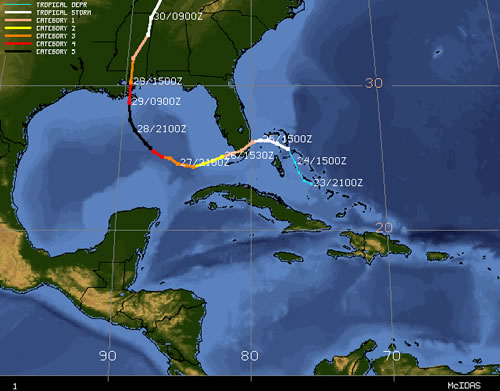
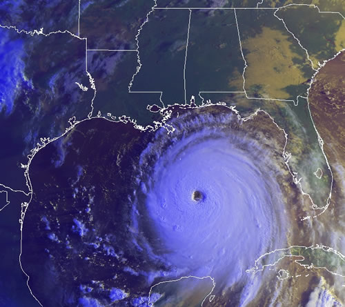
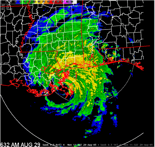
Click here for more information on Hurricane Katrina from the National Hurricane Center. Click here for an interactive map of Hurricane Katrina's track. |
|||||||||||||
|
|||||||||||||
Current Hazards
Local
National
Outlooks
Submit Storm Report
Hazards Outlook
Radar Imagery
Nationwide
Shreveport, LA (SHV) Standard Radar
Fort Polk, LA (POE) Standard Radar
Forecasts
Local Forecast Info
Forecast Discussion
Graphical Forecasts
Tropical Weather
Fire Weather
Aviation Weather
Recreation Forecasts
Climate and Past Weather
Local Observed Reports
Climate Prediction
Local Data/Records
Storm Event Database
Past Events
Tropical Cyclone Reports
US Dept of Commerce
National Oceanic and Atmospheric Administration
National Weather Service
Shreveport, LA
5655 Hollywood Ave.
Shreveport, LA 71109
318-631-3669
Comments? Questions? Please Contact Us.