Scattered strong to severe thunderstorms may pose a risk for damaging wind gusts over the Carolinas, southeast Virginia, and the Tennessee Valley Sunday afternoon then the northern Plains from late afternoon into Sunday night. Monsoonal thunderstorms may cause locally considerable flash, urban, and small stream flooding in the Southwest U.S. the next few days. Read More >
| Overview | ||||||||||||||||||||||||||||||||||||||||||||||||||||||||||||||||||||||||||||||||||||||||
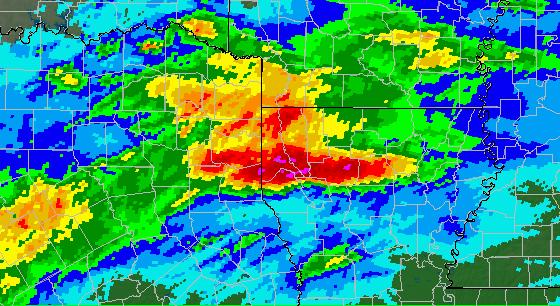
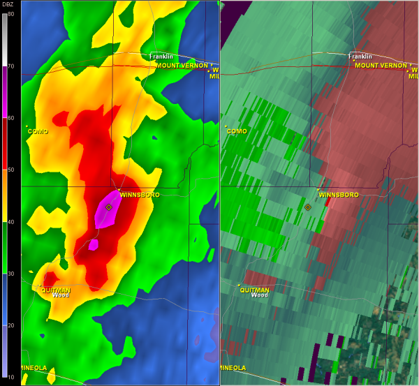
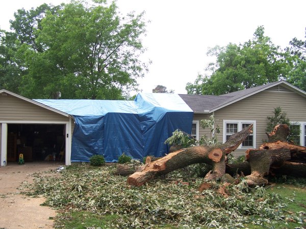
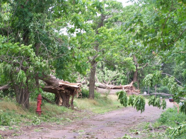
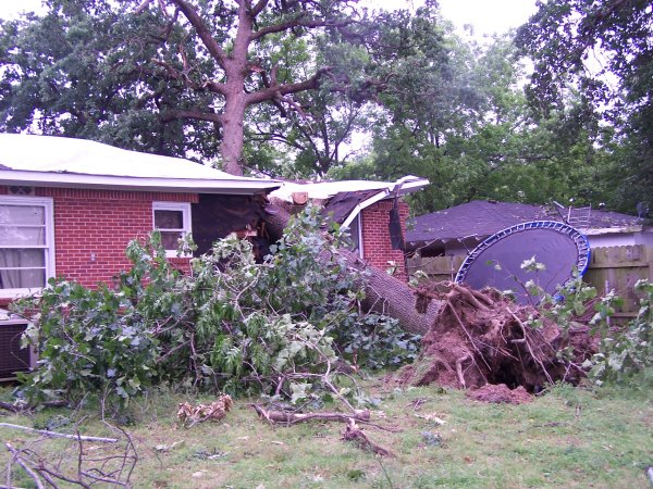
| A severe weather event unfolded across the Four State Region on May 14th-15th, 2008. Straight-line winds, a tornado, and flooding occurred. A significant straight-line wind event with wind speeds of 90 to 100 mph, and an EF1 tornado with winds of 95 to 105 mph occurred in Winnsboro, TX, in Wood and Franklin Counties between 12:50am and 1:00am CDT on Thursday, May 15th. | ||||||||||||||||||||||||||||||||||||||||||||||||||||||||||||||||||||||||||||||||||||||||
|
TOTAL TORNADO COUNT = 1
|
||||||||||||||||||||||||||||||||||||||||||||||||||||||||||||||||||||||||||||||||||||||||
|
Tornado Table
Flooding
Graphics & Photos
Tornado Map


|
||||||||||||||||||||||||||||||||||||||||||||||||||||||||||||||||||||||||||||||||||||||||
| Back to Top | ||||||||||||||||||||||||||||||||||||||||||||||||||||||||||||||||||||||||||||||||||||||||