Thunderstorms with severe wind gusts and hail will be possible today across parts of the central Plains, and from the Missouri Valley into the upper Mississippi Valley. Heavy rain associated with the thunderstorms may also produce flash/urban flooding. Critical fire weather conditions expected in the Great Basin and interior Northwest. Dangerous heat continues across the Southwest and Southeast. Read More >
| Overview | ||||||||||||||||||||||||||||||||||||||||
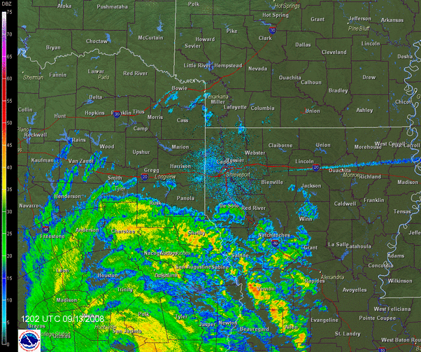
| Shortly after 2:00am CDT, on Saturday, September 13th, 2008, Hurricane Ike made landfall near Galveston, Texas, as a very broad Category 2 hurricane, and quickly moved north. By late afternoon, Ike was following a path which would take its center very near the cities of Tyler, Mount Pleasant,and De Kalb in Northeast Texas, and to De Queen, Arkansas, before racing northeast to the Great Lakes Region. While strong winds around the center of the storm were wreaking havoc for locations west of the Red River, several tornadoes developed in the feeder bands for portions of Central and North Central Louisiana. Nearly every county or parish in the Shreveport National Weather Service forecast region reported some damage from the storm. The most severe damage occurred in Angelina, Nacogdoches, Rusk, Cherokee, and Smith Counties of East Central Texas. Hundreds of buildings were damaged and thousands of trees were downed across the region because of the storm. Many locations across Northeast Texas, Northwest Louisiana, and Southwest Arkansas lost power and telecommunications as Ike moved through. While these services were restored for some as soon as the following day, a few locations were without these utilities for nearly a week after the storm's passage. Some of the highest wind gusts observed from Hurricane Ike are listed below. |
||||||||||||||||||||||||||||||||||||||||
|
||||||||||||||||||||||||||||||||||||||||
| Ike's rapid northward movement had one benefit. Most of the Shreveport NWS forecast region managed to avoid inland flooding problems, which are typical with most tropical systems. The heaviest rains were confined to totals of around 4 inches, most of which fell in portions of East Central and Northeast Texas, which went relatively unscathed during the passage of Tropical Storm Gustav across Northwest Louisiana the week prior. Download the Hurricane Ike Post-Tropical Cyclone Report for a more complete assessment of observed weather conditions and reported damage from this storm. |
||||||||||||||||||||||||||||||||||||||||
|
Graphics
Tornado Track Map


|
||||||||||||||||||||||||||||||||||||||||
| Back to Top | ||||||||||||||||||||||||||||||||||||||||