National Weather Service United States Department of Commerce

Major Winter Storm in the North-Central U.S.; Severe Weather from the Mid-South to Ohio Valley

A major winter storm will bring a swath of heavy snowfall, strong winds, blizzard conditions and freezing rain to the Northern Plains into the Great Lakes region. A line of storms will be capable of producing widespread damaging winds, tornadoes, and some large hail from the Mid-south to the Ohio Valley and the Southeast. Critical fire weather concerns shift to the southern Rockies and Plains. Read More >

Overview
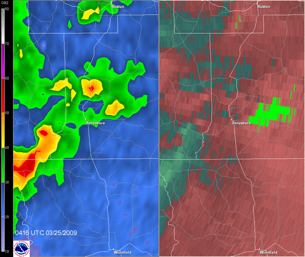
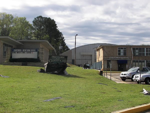
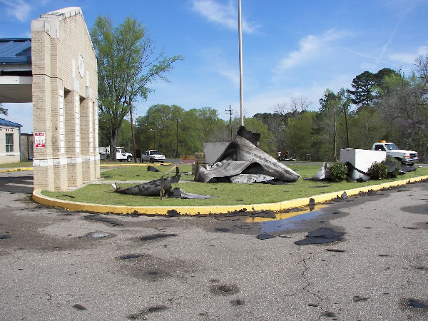
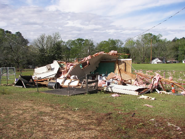
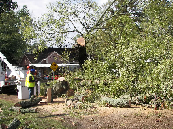
A storm survey was completely in the town of Jonesboro in Jackson Parish to assess damage that occurred late in the evening on Tuesday, March 24th, 2009.

TOTAL TORNADO COUNT = 1

EF1 = 1
 
TOR. # LOCATION RATING PEAK WIND START TIME END TIME LENGTH/
WIDTH
FATALITIES/
INJURIES
REMARKS
#1 Jonesboro, Jackson Parish, LA EF1 85-90 mph 11:10pm CDT 11:15pm CDT 1 mile/
80 yards
None The tornado initially touched down about 1 mile west-northwest of Jonesboro. Damage consisted of roof damage to Jonesboro-Hodge High School. In addition, several windows were broken during the storm. Several trees along the storm track were snapped or uprooted.
Radar loop
Radar imagery of the storm. Imagery on the left is of storm reflectivity, and imagery on the right is of storm relative motion.
Roof damage to a home
A few homes near the location where the tornado touched down received roof damage.
 
Damage to Jonesboro-Hodge High School
Jonesboro-Hodge High School was damaged during the storm.
 
Damage to Jonesboro-Hodge High School
Jonesboro-Hodge High School received extensive roof damage during the storm.
         
Damage near Jonesboro-Hodge High School
This auxiliary building near the Jonesboro High School football stadium was destroyed by the tornado.
 
Tree snapped by the tornado
This large hardwood tree was snapped during the tornado.
Click here to download the survey KMZ file.
This survey data is preliminary and subject to change as more information becomes available.  Road accessibility and inconsistencies between mapping and GPS software may limit the accuracy of the tracks plotted on this map. Line widths are not representative of actual tornado widths.  The information plotted on this map is intended for general reference use only.

For official post-storm information, use 
Storm Data from the National Centers for Environmental Information.
 
Back to Top