| TOR. # |
START POINT |
END
POINT |
RATING |
PEAK WIND |
START TIME |
END TIME |
LENGTH/
WIDTH |
FATALITIES/
INJURIES |
REMARKS |
| #1 |
3 miles N of Geneva, Sabine County, TX |
4 miles N of Geneva, Sabine County, TX |
EF1 |
95-105 mph |
4:26pm CST |
4:32pm CST |
0.25 mile/
150 yards |
None |
The tornado began along FM 330 toppling and uprooting several large trees. One home had minor roof damage along with most of its shingles stripped off, while another had its outside storage shed destroyed. |
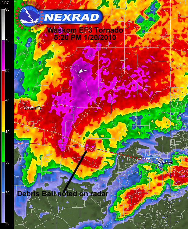
| #2 |
5 miles SW of Waskom, Harrison County, TX |
2 miles SSW of Blanchard, Caddo Parish, LA |
EF3 |
150-160 mph |
5:18pm CST |
5:59pm CST |
15.5 miles/
0.75 miles |
None |
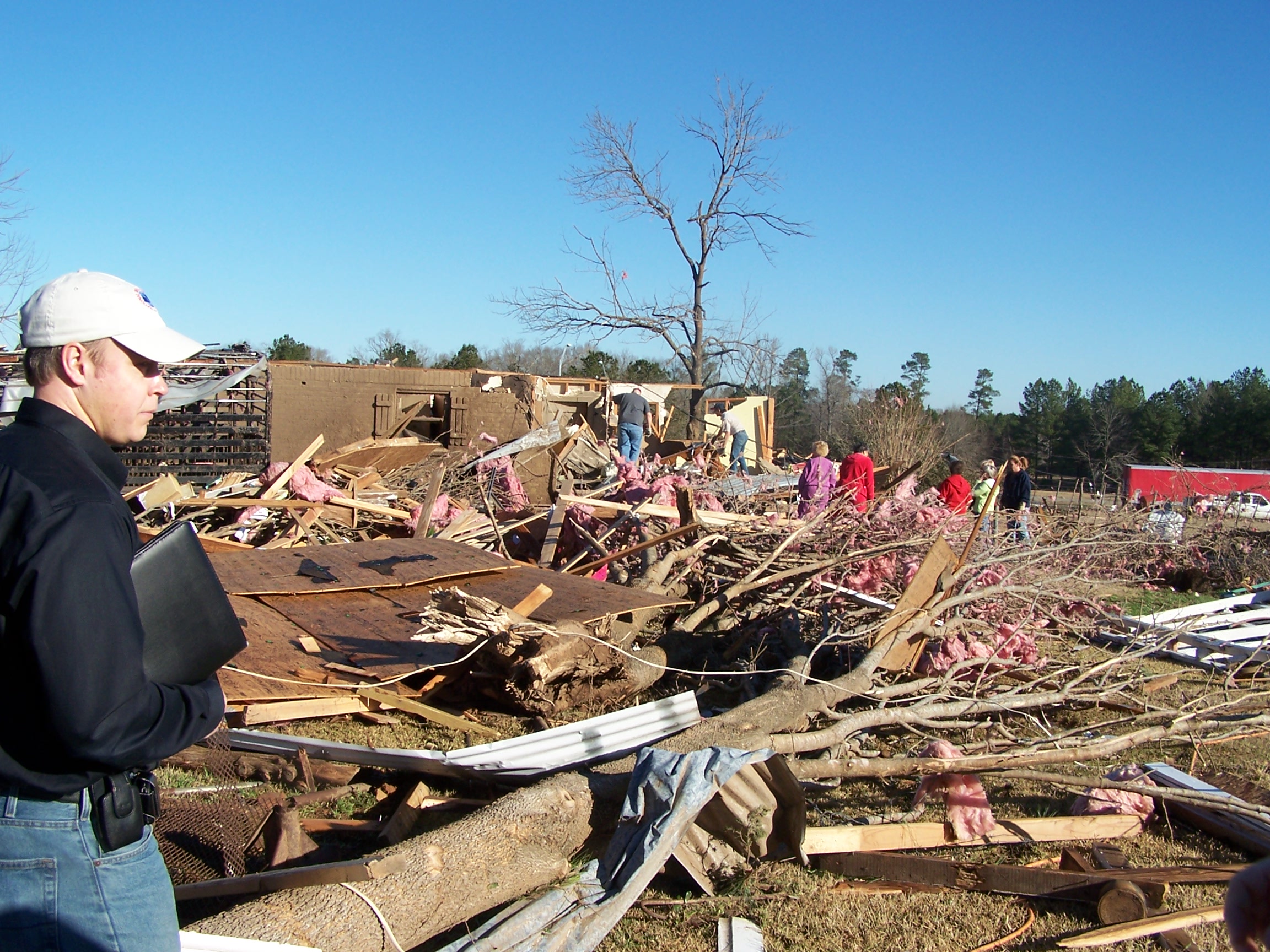
The tornado began in a wooded area west of Ireland Williams Road and quickly intensified as it approached Interstate 20 near Mile Marker 628, where two businesses were destroyed on both the south and north service roads. One of the businesses was a metal building and the other was a mobile home.
One home was completely destroyed with only a few interior walls remaining. A second home sustained major damage to the roof and carport. Debris was scattered across Interstate 20 and Hwy 80. Several other homes were damage farther east along both sides of the service road. Many trees were snapped and uprooted in the area. Some were snapped close to the ground.
The tornado continued northeast crossing Bellview Road and into Jonesville, TX, where a grocery store roof was peeled back and walls were blown out of a large warehouse. Some metal buildings were also damaged north of Jonesville along FM 134. The tornado tracked east across a wooded area snapping and uprooting trees as it crossed FM 9 and headed east into Caddo Parish in Louisiana.
The tornado weakened but continued east crossing Greenwood Mooringsport Road, where several trees were uprooted. It continued east over portions of western Cross Lake before lifting southwest of Blanchard, LA. |
| #3 |
5 miles WSW of Posey Road Exit on I-49, Natchitoches Parish, LA |
1 mile east of I-49. |
EF0 |
70-75 mph |
5:48pm CST |
6:06pm CST |
5 miles/
150 yards |
None |
This tornado began along Posey Road about 5 miles west of the Posey Road exit on Interstate 49. It traveled northeast across I-49. Large trees were toppled or uprooted, several trees had their tops snapped off, and numerous limbs were broken off along the path. |
| #4 |
2 miles E of Noonday, Smith County, TX |
4 miles S of Tyler, Smith County, TX |
EF0 |
65-70 mph |
6:58pm CST |
7:00pm CST |
1.5 miles/
75 yards |
None |
This tornado began in a subdivision along Southern Trace Circle where shingles were peeled off several homes and a trampoline was thrown up onto a home. Several fences were also blown down. The tornado continued east onto Walnut Hill Drive where sporadic tree damage was observed as well as minor damage to several homes along the street. |
| #5 |
2 miles NNW of Whitehouse, Smith County, TX |
2.5 miles N of Whitehouse, Smith County, TX |
EF1 |
85-90 mph |
7:09pm CST |
7:10pm CST |
0.5 mile/
75 yards |
None |
The tornado briefly touched down near the intersection of Oscar Burkett Road and Joye Lane (CR 2192). A small metal garage was damage where a couple of the walls were blown out. A large pine tree was snapped along CR 2192 close to the ground. Several large limbs were snapped out of a cedar tree as well as other trees in the path. Farther northeast on the north side of CR 2192, a small barn was destroyed and tin roof panels were peeled from another building. |
| #6 |
Harleton, Harrison County, TX |
1 mile NE of Harleton, Harrison County, TX |
EF1 |
95-105 mph |
7:44pm CST |
7:46pm CST |
0.5 mile/
50 yards |
None |
This tornado began along Central Avenue uprooting trees and causing minor damage to awnings on homes along the street. The tornado traveled northeast and uprooted more trees and caused minor roof and structural damage to two brick buildings and one metal building along Hwy 154. The tornado lifted just after crossing Hwy 154. |