Dangerous, record-breaking heat will intensify across most of the central and eastern U.S this week. Heat indices will likely exceed 100 degrees. Severe thunderstorms are forecast from parts of the central High Plains into the Upper Midwest, and across parts of the Northeast. Critical fire weather conditions will continue across portions of the Four Corners and Great Basin. Read More >
| Overview | ||||||||||||||||||||||||||||||||||||||||||||||||||||||||||||||||||||||||||||||||||||||||||||||||||||||||||||||||||||||||||||||
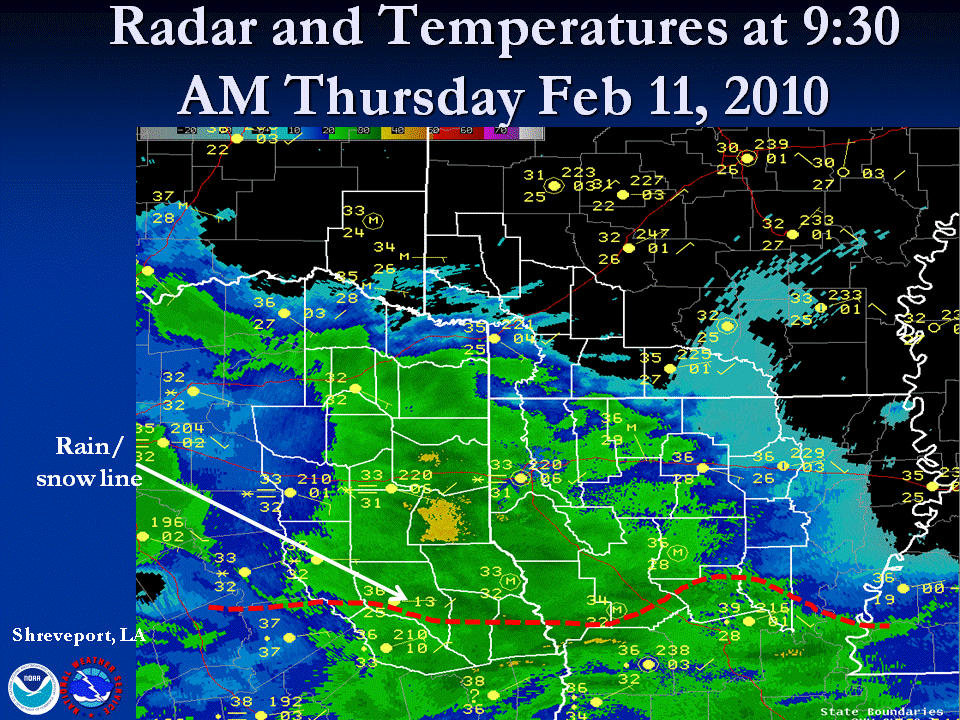
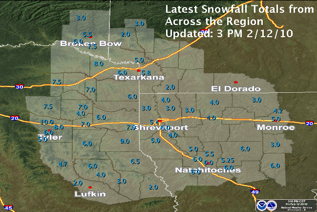
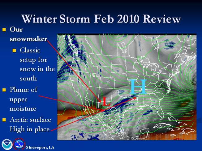
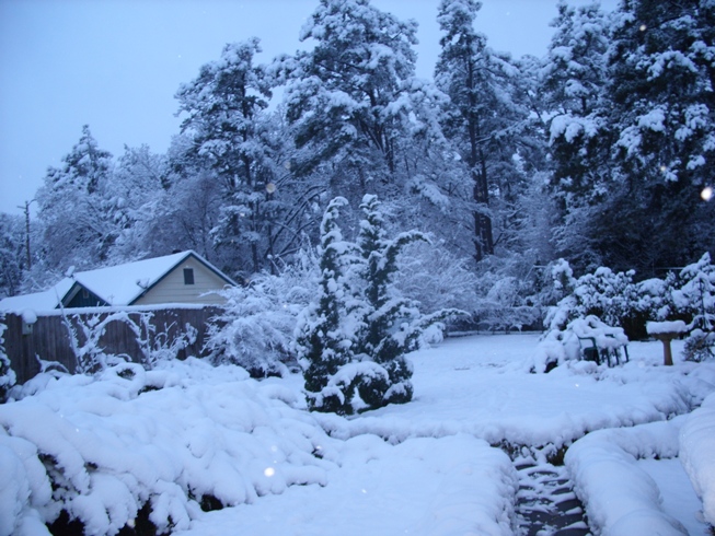
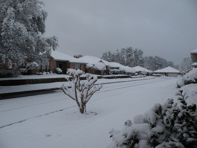
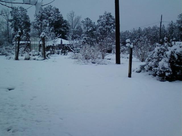
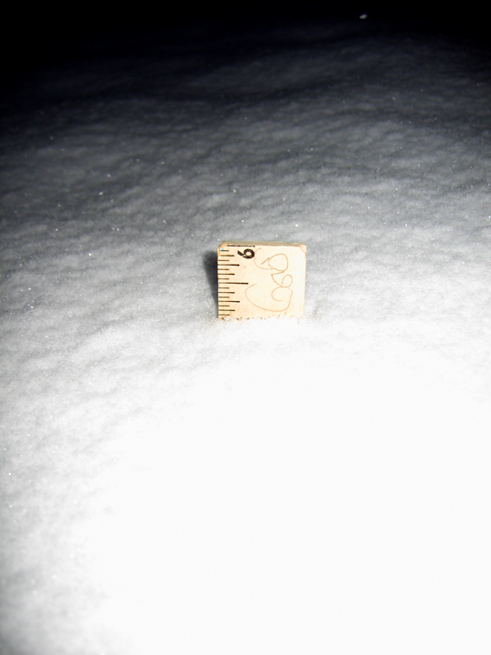
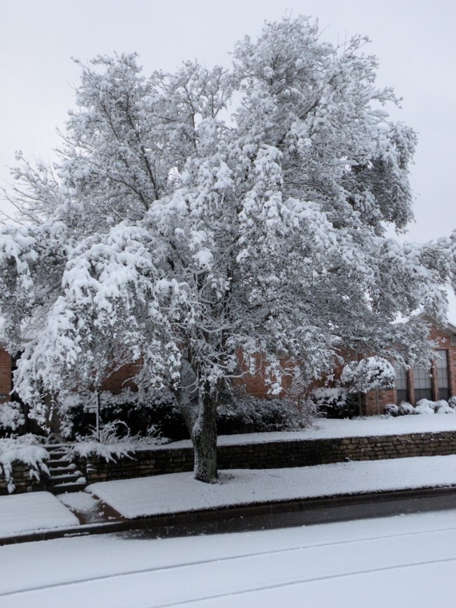
| A significant winter storm affected all of the Four State Region, which began in the pre-dawn hours of Thursday, February 11th, 2010. An arctic high pressure had built into the region during the early portion of the week ahead of a potent upper level disturbance, which moved across the southwestern states tapping a large plume of subtropical moisture. As the upper disturbance moved closer to our region, the moisture was lifted up and over the cold arctic air already in place. Light snow began to fall across areas west of Interstate 49 before sunrise Thursday and the intensities increased throughout the day mainly north of a Jacksonville, TX, to Natchitoches, LA, line. As the upper disturbance moved closer, snowfall rates increased to as much as 1 to 2 inches per hour in some locations. During the evening hours on Thursday and lasting into the early morning hours of Friday, the rain, which had been falling across portions of Deep East Texas eventually changed over to all Snow during the early morning hours Friday. When the storm ended early Friday, much of the area had received 4 to as much as 9 inches of heavy wet snow. Numerous schools and businesses were closed and many roads were closed due to snow and slush covering them. Also, due to the weight of the snow, numerous trees were downed on power lines causing power outages to nearly 100,000 people across the region. This storm ranks 7th all time in total snowfall in Shreveport since records began in 1871, with 5.4 inches being recorded. This was also the most snow the Shreveport-Bossier Metro Area has seen since December 16th, 1983, when 5.4 inches of snow was recorded. |
||||||||||||||||||||||||||||||||||||||||||||||||||||||||||||||||||||||||||||||||||||||||||||||||||||||||||||||||||||||||||||||
|
||||||||||||||||||||||||||||||||||||||||||||||||||||||||||||||||||||||||||||||||||||||||||||||||||||||||||||||||||||||||||||||
|
||||||||||||||||||||||||||||||||||||||||||||||||||||||||||||||||||||||||||||||||||||||||||||||||||||||||||||||||||||||||||||||
|
||||||||||||||||||||||||||||||||||||||||||||||||||||||||||||||||||||||||||||||||||||||||||||||||||||||||||||||||||||||||||||||
|
||||||||||||||||||||||||||||||||||||||||||||||||||||||||||||||||||||||||||||||||||||||||||||||||||||||||||||||||||||||||||||||
|
||||||||||||||||||||||||||||||||||||||||||||||||||||||||||||||||||||||||||||||||||||||||||||||||||||||||||||||||||||||||||||||