Severe Thunderstorms; Excessive Rainfall; Dangerous Heat; Air Quality Concerns
Canadian wildfire smoke will push into the Midwest, worsening air quality. A frontal system brings severe storms from the Northern Plains to the Mid‑Atlantic the next few days. Heavy Gulf Coast rain is possible as we closely monitor tropical development, while monsoonal storms persist in the Southwest with heavy rainfall. Hazardous heat expands from the Plains into the Lower Mississippi Valley.
Read More >
LOADING...
Shreveport, LA
Weather Forecast Office
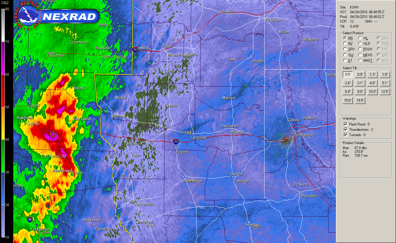
April 23-24, 2010: Tornadoes in East Texas and Southwest Arkansas
A severe weather event unfolded during the evening of April 23, 2010, and continued into the morning of April 24. Damage survey teams from the National Weather Service in Shreveport confirmed five tornadoes occurred with this event.
TOTAL TORNADO COUNT = 5
EF0 = 5
Tornado Table
Graphics & Photos
TOR. #
START POINT
END
POINT
RATING
PEAK WIND
START TIME
END TIME
LENGTH/
WIDTH
FATALITIES/
INJURIES
REMARKS
APRIL 23, 2010
#1
5 miles WSW of Atlanta, Cass County, TX
1 mile S of Atlanta, Cass County, TX
EF0
65 mph
7:34pm
7:41pm
5 miles/
50 yards
None
This tornado began along Highway 59, where it damage several large trees. It moved east-northeast where it snapped or uprooted several more trees before lifting near FM 251 about one mile south of Atlanta.
#2
1 mile W of Queen City, Cass County, TX
Fouke, Miller County, AR
EF0
80 mph
7:41pm
8:10pm
18 miles/
100 yards
None
This tornado began along Highway 96, where it uprooted a large tree. It moved into Queen City and caused damage to several large tree limbs and branches and caused moderate damage to the roof of a building. The tornado moved east-northeast, crossing into Southwest Arkansas. Several large tree limbs and branches were downed along Miller County Roads 152 and 24. The tornado entered Fouke, AR, and snapped several large trees in a nearby field and caused property damage when it blew a large tree limb onto the bed of a truck and into the corner of a house. The tornado lifted as it exited Fouke.
APRIL 24, 2010
#3
5 miles NNE of Quitman, Wood County, TX
5 miles NE of Quitman, Wood County, TX
EF0
65 mph
2:33am
2:35am
0.75 miles/
70 yards
None
This tornado began along CR 4919, where it uprooted several large trees. The tornado continued east and damaged several trees along CR 4925. A tree was uprooted along CR 4930 before the tornado lifted.
#4
1.5 miles S of Winnsboro, Wood County, TX
5 miles E of Winnsboro, Wood County, TX
EF0
75 mph
2:45am
2:49am
5.5 miles/
70 yards
None
This tornado began along FM 321, where it knocked down numerous trees. It continued northeast crossing Hwy 11, where it destroyed a metal hay barn. Portions of the barn were blown up to 100 yards from their source. The tornado proceeded east along Hwy 11 for another 2 miles before lifting causing additional damage to several trees along the road.
#5
7 miles W of Marion, Union Parish, LA
6 miles W of Marion, Union Parish, LA
EF0
65 mph
6:57am
6:58am
0.5 miles/
75 yards
None
This tornado began along Game Reserve Road, knocking down a few trees along the road and in the forest nearby. No structural damage was observed.
Radar loop of the classic comma head mesocyclone that tracked across portions of East Texas causing two tornadoes in Wood County and numerous wind damage reports across the area. The storm tracked across East Texas between 2am and 4am.
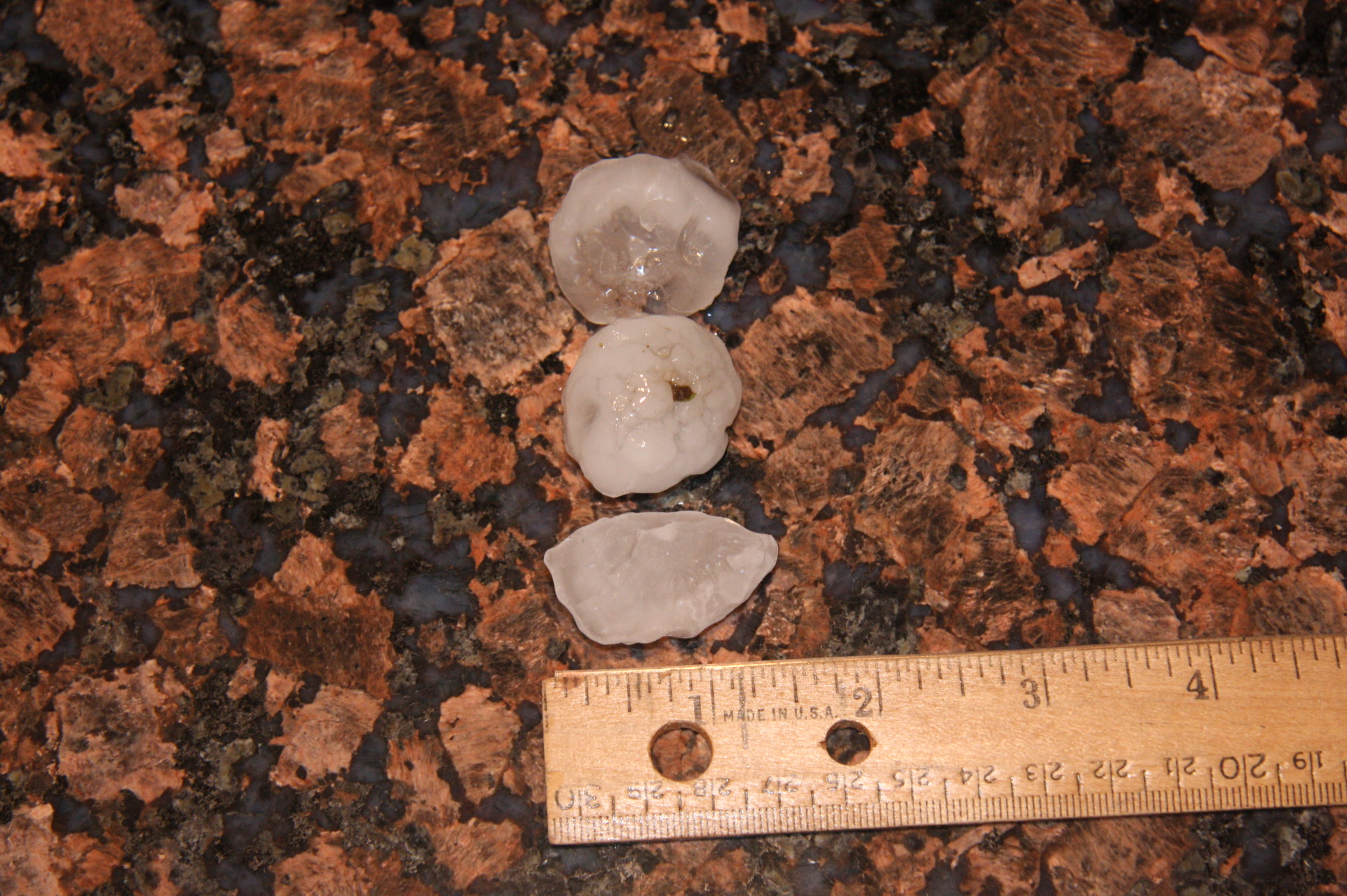
This photo is courtesy of Bill McFadden at Pecan Bend Farm in south Shreveport, where quarter-sized to half dollar-sized hail fell on the morning of April 24th.