Canadian wildfire smoke will push into the Midwest, worsening air quality. A frontal system brings severe storms from the Northern Plains to the Mid‑Atlantic the next few days. Heavy Gulf Coast rain is possible as we closely monitor tropical development, while monsoonal storms persist in the Southwest with heavy rainfall. Hazardous heat expands from the Plains into the Lower Mississippi Valley. Read More >
| Overview | |||||||||||||||||||||||||||||||||||||||||||||||||||||||||||||||||||||||||||||||||||||
|
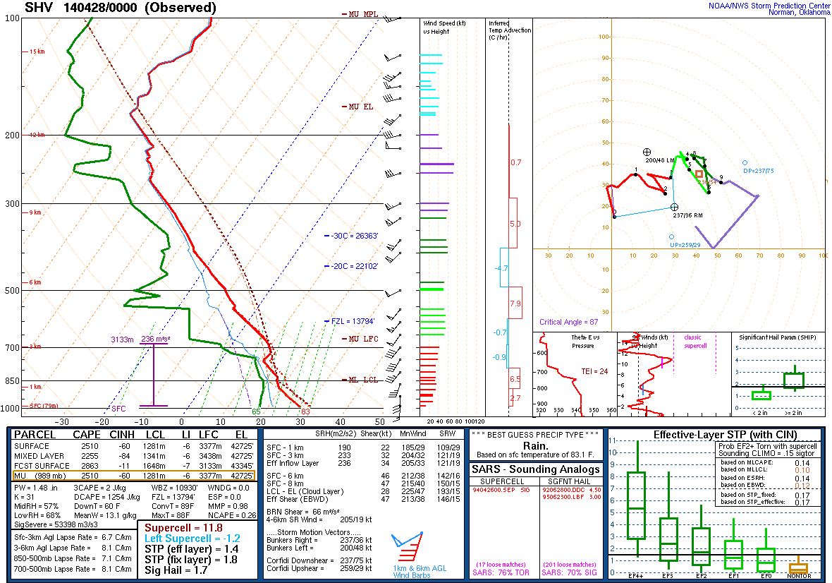
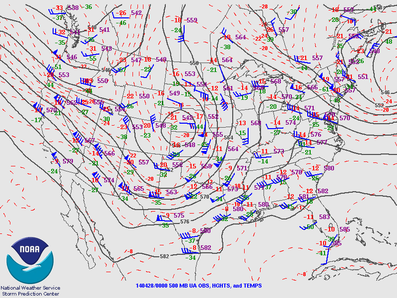
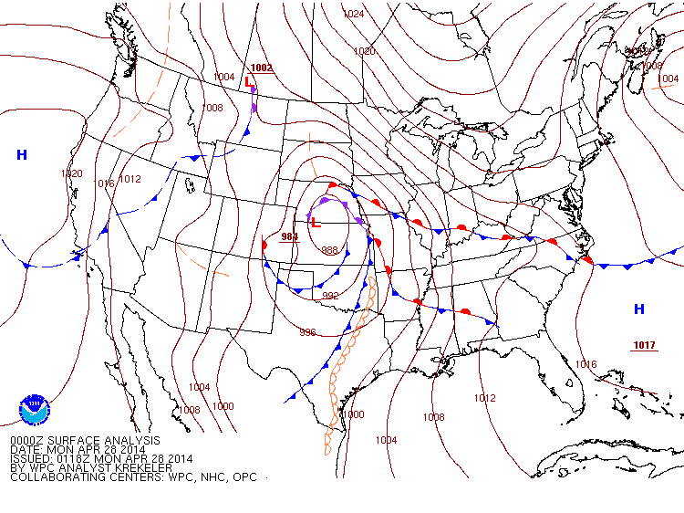
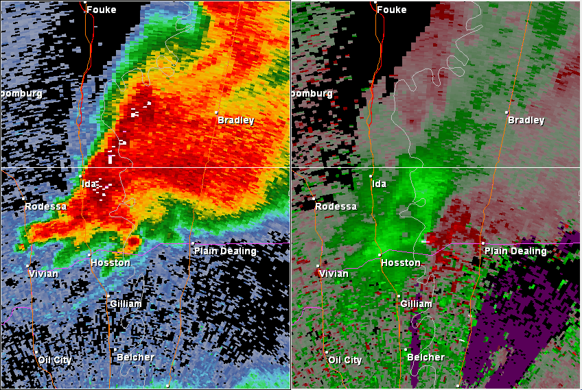
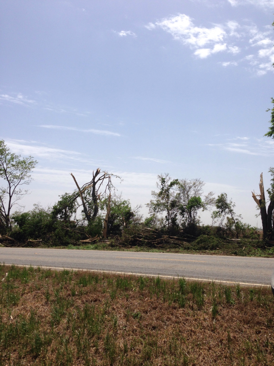
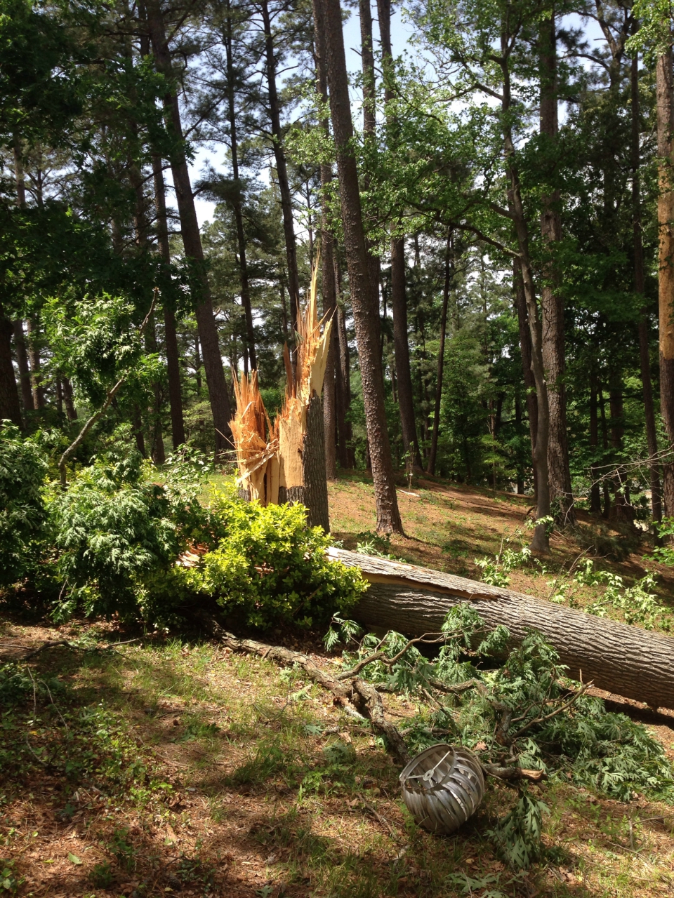
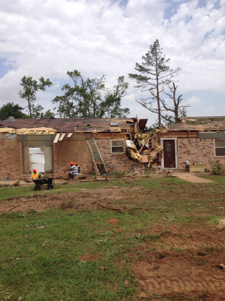
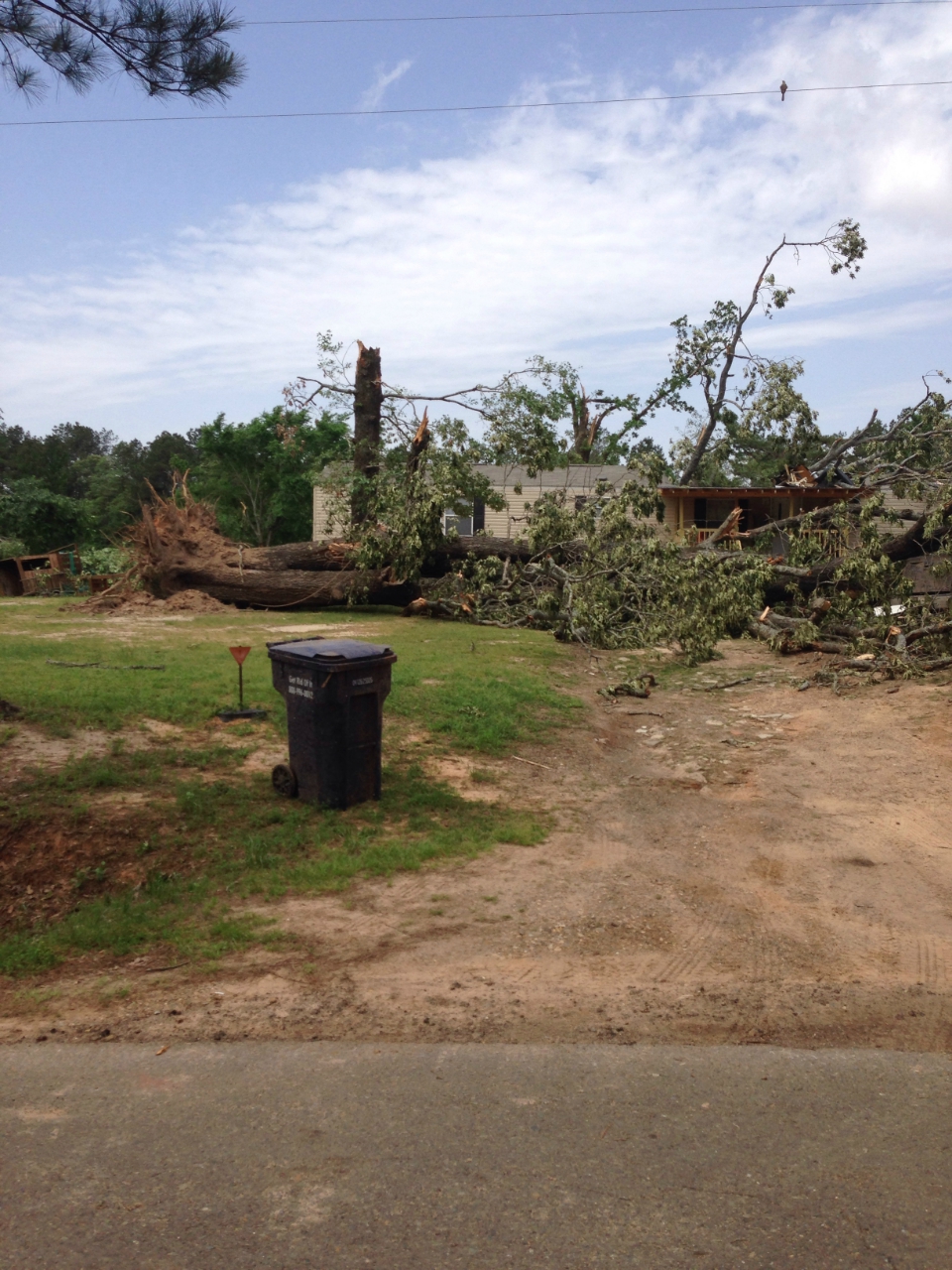
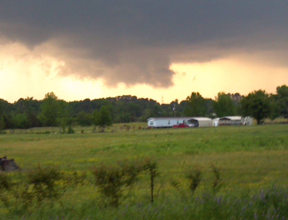
A multi-day severe weather event unfolded across a large portion of the United States near the end of April 2014. Severe weather occurred from the Central Plains, into the Southeast, and eventually affected the Mid-Atlantic States. Several rounds of severe thunderstorms developed across the Four State Region beginning late on April 27, 2014, before storms finally moved east of the area during the evening of April 28, 2014. The first thunderstorm developed during the late afternoon of April 27 across North Texas. This storm moved northeast and eventually produced quarter-size hail during the early evening hours in McCurtain County in Southeast Oklahoma. Additional thunderstorms developed later in the night and moved east-northeast across East Texas and into Western Louisiana and Southern Arkansas. One of these storms produced hail ranging in size from golf balls (1.75" in diameter), to tennis balls (2.50" in diameter), to softballs (4.50" in diameter). The report of softball-sized hail near Atlanta, TX, in Cass County, was confirmed via a picture sent to local media. Very large hail from this storm was reported along its track from Alba, TX, in Wood County to Atlanta. Another one of these overnight thunderstorms strengthened as it moved into Extreme Northwest Louisiana during the early morning hours of April 28. Damage from a damage from a suspected tornado was reported west of Plain Dealing, LA, in Bossier Parish. Once the sun came up, a survey team from the National Weather Service office in Shreveport investigated the damage. The team determined that a tornado began in Caddo Parish, in the town of Hosston, LA, and ended near where the damage was reported west of Plain Dealing. This tornado was rated EF2 based on damage to a house west of Plain Dealing. Additional damage was reported farther south in Panola and Rusk Counties in East Texas. A second survey team was deployed to investigate these reports. The team determined that the damage was caused by straight-line winds. |
|||||||||||||||||||||||||||||||||||||||||||||||||||||||||||||||||||||||||||||||||||||
|
TOTAL TORNADO COUNT = 1
|
|||||||||||||||||||||||||||||||||||||||||||||||||||||||||||||||||||||||||||||||||||||
|
Tornado Table
Graphics
Photos
Damage Map
Coming soon |
|||||||||||||||||||||||||||||||||||||||||||||||||||||||||||||||||||||||||||||||||||||